408 - HISTORY OF AUGLAIZE COUNTY
CHAPTER XIII.
OTHER TOWNSHIPS OF THE COUNTY.
Clay township on the south line of Auglaize county (town 6, south of range 7 east) covers thirty sections numbering from 1 to 30, running five sections from north to south and six from east to west, and is thus but thirty square miles in extent. The township is crossed by the Toledo & Ohio Central railway, which enters at Santa Fe in the northeast quarter of section 25 (in the southeast corner of the township) and passes out in the northwest quarter of section 7 and on to Wapakoneta, crossing the old Detroit, Toledo & Ironton railway (the present Ford railway) in the southeast corner of section 8. This latter road traverses the township from north to south, entering at' the village of St. Johns on the northern line of the township in the northwest quarter of section 5. Other villages or railway stations in the township are Geyer, in the northwest quarter of section 21 on the Ford road, a mile southeast of that road's crossing with the T. & O. C. ; Gutman, in the southwest quarter of section 15, on the T. & O. C., a mile northeast of Geyer station, and Santa Fe, on the east line of the county in the northeast quarter of section 25, on the T. & O. C., a part of the latter hamlet lying in the neighboring county of Logan. Clay township is bounded on the north by Union township, on the east by Goshen township and Logan county, on the south by Shelby county and on the west by Pusheta township, and is amply drained by Blackhoof creek, Wolf creek, Pedlers run and the main branch of Pusheta creek and their tributaries, supplemented by an adequate system of ditches. The old Lewistown Indian reservation takes in parts of sections 25, 26, 27 and 28 in the southeast part of the township, and the Wapakoneta Indian reservation cut through sections 19, 20, 21
HISTORY OF AUGLAIZE COUNTY - 409
and part of section 22 on the south and down through sections 3, 10, 15 and 22 from the north, the Indian lands thus having embraced one-half of the present territory of the township in the days before its civil organization. It was there, at the present site of the pleasant village of St. Johns that old Chief Blackhoof spent his last days amid the hills and dales he loved so well, and it also was within the present bounds of this township, in the immediate vicinity of the Blackhoof lodge, on what later came to be known as the Bitler farm, that Chief Wayweleapy (Willipie) had his lodge at the time he and his people ceded their lands to the Government in 1831 and in the next year took their departure from their old hunting grounds here forever. These picturesque hills now provide an apparently inexhaustible source of gravel for the needs of the community and in the gravel pits thus uncovered it not infrequently happens that grim relics of the days of Indian occupancy are uncovered in the form of skeletons of the red men who were buried there in the days now long gone.
Prior to the erection of Auglaize county in 1848 Clay township was attached to Allen county for civil purposes and it attained its own civil status two years after the Indians had left this region, a sufficient number of settlers having come in by that time to give force to their petition for the formation of a new township, it having been a part of Union township before this time. According to the journal of the board of commissioners for Allen county this action was taken on December 1, 1834, the journal as of that date setting forth that "a petition was then presented to have original Town 6, south of Range 7 east, made the limits of their township and said township to be designated and made known by the name of Clay. Petition granted and bonds given and advertisements written for an election to be held at James H. Coleman's for township officers on the 20th inst." James H. Coleman had entered his land in section 6, the northwest corner of this township, in 1833, the year following the departure of the Indians and the year
410 - HISTORY OF AUGLAIZE COUNTY
prior to the presentation of this petition. He and Thomas Beer and John Rogers served as judges of this first township election and Richard Henry and Joel Bayliff as clerks. Besides these there were six other voters participating in the election, David Vonblaricom, William Hinton, Thomas Reed, Byrd Richardson, William Copeland and Samuel Bechdolt, and the following officers were elected: Township trustees, John Rogers, David Vonblaricom and Thomas Beer; clerk, Richard Henry; treasurer, Joel Bayliff; constable, Thomas Beer; fence viewers, James H. Coleman, Thomas Reed and Thomas Beer; overseers of the poor, William Copeland and Samuel Bechdolt—as many offices to fill as there were voters to exercise the suffrage. Originally this township (" original town 6") included its normal lower tier of sections, but with the readjustment of county lines that presently began to take place in northwestern Ohio it lost this tier to Shelby county, and thus now has but thirty sections instead of its original thirty-six.
ST. JOHNS AND OTHER VILLAGES.
In the spring following this election, April 29, 1835, Daniel and Elizabeth Bitler and John and Mary Rogers created a town site on the north line of the township in section 5, the site of the old Blackhoof village, and as a compromise of the respective preferences the two couples held in the matter of a name for the new town named it St. Johns. The Bitlers had come in here from Franklin county in 1834 and Daniel Bitler had opened a store and blacksmith shop on the site of the old Indian village and presently also erected an inn, thus having become the first business man in the village. John Rogers was a New Yorker by birth but had been transplanted to Ohio soil when he was fourteen years of age by the coming of his parents to this state, and he grew to manhood and was married in Richland county. He and his wife came over here into the new lands in the fall of 1833, the year following the departure of the Indians, and settled in the old
HISTORY OF AUGLAIZE COUNTY - 411
Blackhoof village, Mr. Rogers—as noted above—being elected one of the township trustees in the election of the following year. He afterward served as justice of the peace in and for Clay township and lived to a ripe old age, his death occurring in the spring of 1880, he then being eighty years of age. These pioneers no doubt had a deep consciousness of the natural beauty of their town site, for St. Johns is one of the most picturesquely situated villages in this section of the state and its hills and dales when clothed in their native forests must have been a delight to the eye.
The original plat of the Bitler-Rogers village of St. Johns (or St. Johns Town, as the plat has it) was filed in the office of the recorder of Allen county on April 29, 1835, and sets out the boundaries of a tract of thirty-two lots bounded on the north by Washington street, on the east by Walnut, on the south by Spring and on the west by Mulberry, and bisected north and south by Lima street and east and west by Center street. Extensions later were made to the east, over toward the creek to which the settlers by common consent gave the name of Blackhoof, and the village gradually grew in importance as a rural social and commercial center. The Methodists effected an organization there in the year in which the village was platted and church and school were given deep consideration from the first. When the railroad came some impetus was given to the growth of the village and the extension of the grain shipping facilities was greatly appreciated. The town has two grain elevators and the proper complement of stores to meet the community demands. Its location on the Wapakoneta-Bellefontaine highway, paved with cement, places it on the line of the heavy tourist travel along this road and the picturesque situation of the village, nestling amid its hills, attracts the admiring attention of all who pass that way. The census report for 1920 gives St. Johns a population of 355.
The other railway stations in Clay township have proved convenient shipping points and local commercial centers, but have not attained much growth. The 1920 census gives Geyer
412 - HISTORY OF AUGLAIZE COUNTY
a population of 140. This place was platted by George Geyer on September 20, 1893, following the coming of the railroad, and was named by him Geyer City, the plat showing a tract of thirty-six lots divided midway north and south by the railroad—the present Ford road. Mr. Geyer had entered the farm on which he platted his townsite in 1840. The hamlet has a grain elevator and is a very convenient trading center for the people living in that vicinity.
The census of 1920 gives the hamlet of Gutman, on the T. & O. C. railway in this township, a population of seventy-seven. This convenient trading center grew up around the grain elevator and store that the Gutman brothers started on their farm following the coming of the railroad twenty years and more ago. The village of Santa Fe, on this same railroad, in the extreme southeastern corner of the township, and extending over into Logan county, was laid out on the Deloss pike by Reuben Conner in pioneer days and profited somewhat by the later coming of the railroad, but has not attained much !growth. The original plat ;of this hamlet shows some peculiarity of lay out, the same covering a tract of fourteen parcels of land of varying dimensions, ranging from twenty-three-hundredths of an acre to one and forty-eight-hundredths of an acre. It has a grain elevator and the necessary complement of stores to meet local demands upon it as a trading center.
THE PIONEERS OF CLAY TOWNSHIP.
Concerning the days of settlement here, an interesting little sidelight is carried in the following from the Sutton review (1880), bearing on the conditions which confronted the pioneers : "The territory comprised within the township was of a low, swampy character, except along the line of the deposit ridge which crosses the northwest corner, reaching its highest and most broken point at St. Johns. Judging by the topography, there was little to encourage settlement save the richness of the soil, which is unsurpassed in the county. Still,
HISTORY OF AUGLAIZE COUNTY - 413
a rich soil under water and heavy timber presented obstacles which necessity alone was courageous enough to meet and overcome ; for the writer has been told by an honored pioneer that, on his arrival here, the lack of $10 was all that caused him to remain." To this it may be added that this no doubt was true of many a settler who would have turned and gone back to the old home upon coming over here into the new lands and finding conditions as they were if he had not exhausted his resources in making the attempt to gain a home in the wilderness and thus was compelled to stick and see it through simply because he did not have money enough to make the trip back. But time rewarded him and the rich and improved lands of this county now bespeak his honor.
When Auglaize county was erected in 1848 there were the following landowners in Clay township, according to the tax duplicate for that year: Jacob Allenbach, Amos Arthur, Daniel Apple, Joseph Allenbach, Henry Bey, John Burlean, William Brackney, Sr., William Brackney, Jr., Peter Bennett, William Bitler, Richard and H. R. Baily, Daniel and Henry Bitler, Joel and Margaret Bayliff, D. W. Barber, Charles Boden, Abraham and Rebecca Bilger, James Ball, F. K. and Joseph Bush, John Bierlain, John Bailey, Joel Babcock, Mathias Burkhart, Casper Bodenbender, Peter and Samuel Beckdolt, George Bishop, Simeon Biggs, G. W. Bodkin, Henry Baughman, M. A. Bradley, J. H. Coleman, James H. Coleman, Jr., Henry Coleman, Abner, James and Jeremiah Copeland, William C. Campbell, Eli Costle, Joseph, Madison, Amos and William Copeland, S. S. Coleman, John Copeland, David Caldwell, Henry Crowell, William Collison, William Counsellor, Jacob Chambers, Elizabeth Cloverstine, John Corder, John Collier, James Coleman, H. B. Curtis, Hamilton Davison, Jeptha and Samuel Dunlap, Otho Danderlin, Leonard Evilseizer, George Elsas, Henry Ever- sole, Bartlett Ellrod, James Ellison, David Eversole, Benjamin Furrow, Philip Fetters, Joseph Flick, Valentine Flegel, John Foreman, William F. Frankeberger, Benjamin Faler, Resin Franks, Conrad Fry, Blazy Fisher, Ozias Falk-
414 - HISTORY OF AUGLAIZE COUNTY
ner, George Fisher, Philip Gross, Michael and Nicholas Gross and Nicholas Gross, Jr., Kaitzel Godpey, Joseph Graham, William Gunter, John Gray, George Geier, Mathias Glaser, Jacob Griffin, Richard and Willard Gunn, Joseph Gibson, Daniel Guseman, Charles Hankerson, Christopher Hohn, Lewis Helmlinger, William Hinton, David and Richard Henry, David B. Helmer, Frederick Hohn, Cynthia Harrod, Aaron Hartley, William Hamilton, William Harbst, Wilhelm Harbst, Hiram Howe, John H. F. Josting, Joseph King, M. Kinstley, Christopher Kramer, Leonard Kinstley, Zelpha Kinstley, John G. Kraus, James H. Lusk, George Linder, John Lockhard, Philip Leininger, Jonathan McCoy, John McNoble, Jr., William Miller, Martha F. Mays, John Moore, G. H. Martin, Arthur McHugh, Uri Mix, Jacob Michael, John Moore, J. D. Mefford, Elizabeth Miller, George Mink, David McKnight, Charles Martin, Doctor+, McMillin, Samuel McHarry, James Manning, William Milnor, John Nippgar, Catherine Neal, John Northrop, Michael Nipgen, George Newman, Enos and Thomas Oxley, Isaac Pownall, Philip Phenegan, Philip Pulfer, Albred Purcell, James Pownall, Jesse Pence, Peter Roth, D. Rostorfer, George M. Ripple, John Rogers, George Ripley, Barbara Rock, Charles Reed, Jacob Rock, George Runkle, Robert Reed, Thomas Reed, Hugh T. Rinehart, David Reed, William Rock, William B. Speers, John Stull, Michael and Blazy Seiter, Jacob Snider, D. A. Schneider, George Snider, Abraham Skillman, William Staley, Ansel Sateal, John Lemon, William Spence, Joseph Schlicting, Davis Trumbo, John Tomlin, Gerhard Thusticher, Adam Vegar, John Watt, Stephen Werling, John Wiss, William Welchance, Jacob Whetstone, John Weimert, John Wagner, Joseph Wright, Andrew Walk, Joseph Wilson, Stephen Worling, Leonard Werst, Philip Wiltermule, Andrew Wagner, John Walk, Henry Yost and Michael Zwiebel.
In that portion of the town of St. Johns lying in Clay township there were at that time the following lot owners: Henry Baughman, William Brackney, Daniel Bitler, Sr., Daniel Bitler, Jr., Benjamin and John Corder, Jacob Flegel,
HISTORY OF AUGLAIZE COUNTY - 415
L. G. Moorehead, John Rogers, J. M. Shaw, D. A. Schneider and Benjamin Vantress.
GERMAN TOWNSHIP AND NEW BREMEN.
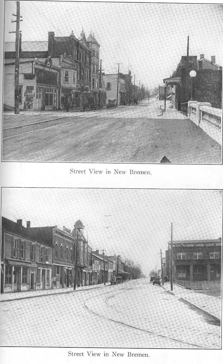
German township, so named on account of the nativity of the dominant element of its early settlers, a racial dominance which still is maintained, is the northern half of township 7 south, range 4 east, its sections numbering from 1 to 18, three miles north and south and six miles east and west, and thus covers eighteen square miles of surface, one of the richest agricultural sections of the county. This township originally included all of the above congressional township and so continued until in 1858, when by mutual consent a division was made and the lower half of the township was given a separate civil status under the name of Jackson township. Most of the land in this township was included in the canal donation and it was quickly taken up when the tide of emigration set in up this way in the early '30s, following the departure of the Indians from this section of the state. The township is bounded on the north by St. Marys township, on the east by Shelby county, on the south by Jackson township, which it formerly included, and on the west by Mercer county. Here rise the south branches of the St. Marys river, forming the headwaters of that stream, which drains most all but the west tier of townships, these latter being drained into the Wabash, with some drainage to the south into the Miami. These tributaries with a complete system of ditches afford ample drainage to the lands of the township. Near the geographical center of the township, in sections 10, 11, 14 and 15, is the town of New Bremen, the site of numerous thriving industrial concerns. The township is crossed from north to south by the St. Marys-Minster division of the Lake Erie & Western railway and by a similar division of the Western Ohio electric line, as well as by the Miami & Erie canal, all these passing through New Bremen.
416 - HISTORY OF AUGLAIZE COUNTY
Township 6, south of range 7 east (German township), formerly was a part of Darke county and when Mercer county was given its civil status in 1824 was annexed to this latter county and so remained until the time of the erection of Auglaize county in 1848 when it became a part of this county. It retained its original proportions until in 1858, when Jackson township was set off, this action taking the lower half of the township. The first settlers of this township were "squatters" who followed along up the Miami to the head- ' waters of this stream at old Ft. Loramie, hunters and trappers whose adventurous life fit in well with that of the Indians who then inhabited this region and who as adventurers or traders found plenty of activity along the line of the portage between Loramies and St. Marys, this portage following the old Wayne Military trail up through the township, which trail in due time became somewhat further dignified by the name of the Piqua and St. Marys road, which later became the line of survey for the Miami & Erie canal through this county. After the treaty at St. Marys in 1818 and the opening of lands hereabout to settlement in 1820, there were some inquiries at the land office at Piqua concerning lands for settlement this far north, but the wild state of the country and the continued presence of large numbers of Indians on the Wapakoneta reservation did not offer much encouragement to settlers and there was no practical movement made toward settlement until after the departure of the Indians in 1832.
THE COMING OF THE BREMEN COMPANY.
It was in the following year (1833) that the interesting colonization plan of the Bremen Company, one of the numerous colonization societies organized at Cincinnati for the purpose of taking care of the land needs of German immigrants who at that time were coming to America in large numbers following the unsuccessful revolution of 1832, resulted in the settlement of the colony of Germans at Bremen (now New
HISTORY OF AUGLAIZE COUNTY - 417
Bremen). It is narrated that originally there were thirty- three members of this company, Germans who had gone to Cincinnati upon their arrival in this country in 1832, and that they organized as the Bremen Company, in honor of the city from which they had come. These land seekers, prominent among whom were Frederick Henry Schroeder, A. F. Windeler, Philip Reis, Christian Carrmann, F. Steiner, F. Neiter and J. B. Mesloh, appointed Schroeder and Windeler to "spy out the land" with a view to the selection of a suitable place of settlement. These two men proceeded on up the Miami valley, having in mind a location some place in Ohio, and even took a turn over into the new lands section of Indiana, and then hearing good word concerning the portage strip up here on the "divide" examined the site at what is just about the summit of the divide between St. Marys and Loramies and decided there to "pitch their tents" along the line of the old military trail. They reported to the land office at Piqua and make entry to a tract of ten acres covering the site of their proposed colony, paying for the same $1 an acre, and Windeler went back to Cincinnati to report.
Schroeder secured the services of Robert Grant, surveyor of Mercer county (these lands at that time lying in Mercer county) and had the town site platted in his name as agent for the Bremen Company, this plat being recorded on June 11, 1833. The original town site, to which the name of Bremen was given, consisted of 102 lots, each 66 by 300 feet, with a reservation on the west edge of the plat for "public square and church yard," "with a stone planted on the northeast corner of the same " Under the terms of the company's agreement each member of the colony was to receive one lot, the apportionment to be made by "lot" in order to obviate any difficulty on account of supposed differences of value, and the remaining lots were to be sold at $25 each. It is narrated that immediately upon Windeler's return to Cincinnati with his report that a town site had been selected six members of the association returned with him to Bremen and that they were fourteen days in making the trip.
(26)
418 - HISTORY OF AUGLAIZE COUNTY
Meanwhile Schroeder had secured the erection of a log cabin twelve by fourteen feet in dimensions for the initial shelter of the new colony and when the first detachment of this group of homeseekers arrived on the scene the tract was cleared and other cabins erected for the reception of the families who in due time followed the leaders of the colony and all hands buckled down to the task of making the wilderness habitable. And it was thus that New Bremen had its beginning. Simultaneously with this colonization movement a similar colony was being organized at Minster, in this same township (of which further mention is made under the head of Jackson township) and German township thus early became one of the most populous and progressive centers of what later came to be organized as Auglaize county.
DIFFICULTIES OF THE PIONEERS.
An older chronicle relating to the beginning of the Bremen colony has it that "the houses were covered with clapboards and left so open on the sides that the deer are said to have approached them and attempted to eat straw from the improvised beds through the openings between the logs. It is also related that on one occasion while Mohrman was hewing one end of a log a fox approached and stole a chicken which had hopped on the other end of the log. Here, as in other new settlements, much difficulty was experienced in obtaining supplies, as they were only to be secured at a distance of twenty-three miles [From this statement it seems apparent that these new settlers preferred Piqua as a trading point to the nearer towns of St. Marys and Wapakoneta, both of which by this time had become pretty well established trading centers and the former of which at that time was the county seat of Mercer county.—Ed.] Even in the matter of flour, the settlers were sometimes compelled to the use of the home-made grater. [Note—Christian Benner's mill at that time was in operation at St. Marys, less than ten miles away; the old Quaker mill at Wapakoneta still was in inter-
HISTORY OF AUGLAIZE COUNTY - 419
mittent operation, and it is quite likely that the old mill at Loramies also then was in operation.— Ed.] In 1833 new immigrants arrived and a building was erected at a cost of $40 to supply the place of both church and school. These settlers were all Protestants, whose first minister was the Rev. L. H. Meyer. During the summer of 1833 several families arrived from Bavaria, among whom were Maurer, Paul and Braun.
"Thus the settlement had grown until the arrival of Charles Boesel, who found thirty-five families within a radius of five miles. There were at that time but six houses within the limits of the village. So insignificant was the place that Mr. Boesel stopped to inquire of a woodchopper the distance to Bremen and was told that he then was in the town. The surroundings were so unpromising that he decided to go to Ft. Wayne. After a period of nineteen months he returned and found very material progress had been made, among which were separate buildings for church and school. Even at this time some of the farmers became discouraged by having their crops eaten by deer and other animals. The community was still almost isolated, as it had little facility for communication. In support of this it may be related that a man named George Garver walked to Piqua, a distance of twenty-three miles, and returned the same day, carrying a No. 7 plow the whole distance from Piqua." Charles Boesel, above referred to and who may be regarded as the real promoter of the business life of New Bremen in pioneer days, started his store there in 1836 and was ever thereafter a leader in commercial activities at that point. He was a Bavarian by birth and was eighteen years of age when he came to this country in 1832. During the Polk administration he was appointed postmaster at New Bremen and held that office for nine years, the postoffice being carried on in his store, and also served for two terms as a commissioner for Mercer county. Upon the completion of the canal in 1845 he erected a warehouse at New Bremen and enlarged his business to include grain shipping and pork packing, his ware-
420 - HISTORY OF AUGLAIZE COUNTY
house being used as a packing plant during the winter months when the canal was closed to navigation, and during the middle '50s he also served as one of the superintendents of the canal, acting under the State board of public works. During the Civil war period he was Auglaize county's representative in the State legislature and for four years during the '70s he served as State senator from this district. In 1866 he started a private bank at New Bremen and the Boesel interests continue largely represented along that line at that point today.
GRADUAL DEVELOPMENT OF THE TOWN.
It was in 1835 that the name of the town of Bremen was changed to that of New Bremen. This was upon the establishment of the postoffice there, when it was found that there was another Bremen postoffice in the State and hence a new name was given. After canal activities had secured for the town a general expansion along commercial and industrial lines, the trend was to the east side of the canal and in the spring of 1853, Ch. Ellerman platted an addition to the original plat of the town, to which he gave the name of Ober Bremen, and it is said that there persists to this day considerable of the spirit of rivalry that sprang up between the two Bremens, with only the canal between, though the old time warmth of that spirit, which found expression in something more than mere commercial rivalry, has long since cooled and the old time line between East Side and West Side which was observed in town elections in years gone by has long been obliterated. The town was incorporated for civil purposes in 1837 and G. Klefoth was the first mayor elected. Ellerman's Ober Bremen plat was a tract east of the canal beginning at the lock at the old Koop & Tangeman mill site and including Canal street, Cherry street, Main street (the old St. Marys and Piqua road) and Walnut street, north and south, and Wine, Front, High, Pearl and South streets, east and west. Since then the corporation line of
HISTORY OF AUGLAIZE COUNTY - 421
New Bremen has been extended by successive additions until now it covers the southeast quarter of section 10, one- fourth of the southwest quarter of same, about one-fourth of the southwest quarter of section 11, one-fourth of the northwest quarter of section 14, the greater part of the east half of section 15 and one-fourth of the northwest quarter of this latter section. At Lock 2 (once known as New Paris), just northeast of town, there formerly was a busy warehouse and packing house, a mill and a store, the site giving promise during the height of canal activities of becoming an important supplemental center, but with the passing of canal traffic its dream of expansion ended, though the mill and store still are maintained.
The general industrial development of New Bremen has been a gradual and steady growth, beginning with the erection there of J. H. Kuenning's horse-power grist mill in 1835, expanding with the opening of the canal ten years later and greatly accelerated by the coming of the railroad in 1877, further transportation advantages being acquired with the building of the trolley line in 1905. During the days of canal activity New Bremen was said to have been one of the most active points for the pork packing industry outside of Toledo in the state of Ohio, and many there recall the winter days when the streets would be filled with wagons loaded with hogs brought in from all directions to the packing plants, where they would be dressed and stored for shipment when the canal would be reopened for traffic with the passing of the ice. Formerly and for many years there was a brewery there whose products were widely and favorably known. The present industries include the flour mill and the woolen mill along the canal in the center of the town, a furniture factory which specializes in the manufacture of library tables, a tool and general machine manufacturing plant whose specialty is corrugating machinery, a lumber and finishing mill whose specialty is built-in interiors, two broom factories whose products are in wide demand, a truck hoist and body plant, a plant for the assembling of steel bridge work and one of the
422 - HISTORY OF AUGLAIZE COUNTY
most extensive sawmills still operating in this part of the state. The commercial interests of the town are well organized and are ample for the needs of the town, the population of which, according to the census of 1920, is 1,502. There are two newspapers in the town, the Sum and the Stern des Westlichen Ohio; four church organizations, a local grange of the Patrons of Husbandry, a post of the American Legion, a troop of Boy Scouts, a lodge of the Independent Order of Odd Fellows and of the Daughters of Rebekah, a lodge of the Knights of Pythias and of the Pythian Sisters and a camp of Woodmen.
There are two banks in New Bremen, both outgrowths of the old Boesel bank started in 1866 by Charles Boesel and to which reference has been made above. This bank was reorganized on May 11, 1885, as Boesel Bros. & Co., bankers— Jacob Boesel, president; Julius Boesel, cashier, and Charles Boesel, Jr., (Henry ;G. Schmidt and William C. Schmidt. In 1905 there was organized the First National Bank of New Bremen, which, according to the current bankers directory, is capitalized at $50,000 and reports resources in excess of $689,000, with deposits of $571,250 and surplus and profits aggregating $32,632. The officers of this bank are J. H. Grothaus, president; C. V. Huenke and August Isern vice presidents, and H. F. Bienz, cashier. Three years later, in 1908, the old Boesel bank was renamed the First City Bank of New Bremen. According to the bankers directory this latter bank, which is capitalized at $10,000, has resources in excess of $590,000 and deposits aggregating $568,730. Adolph Boesel is president of the City Bank and G. A. Kuenning is the cashier.
As has been set out elsewhere, the scourge of cholera which swept up along the line of the canal during the early days of the operation of that waterway took a terrible toll among the citizens of German township in the late '40s and early '50s and it is related than no fewer than 150 persons in this township died from the dread disease. It was about this time that considerable excitement was created in the New Bremen
HISTORY OF AUGLAIZE COUNTY - 423
neighborhood by the word that a colony of freed negroes was to be established on lands bought by Connecticut parties over in the Carthagena neighborhood west of the village. The way the story goes "the free negroes arrived at Cincinnati in midsummer (1848) and were transported by canal boats as far as New Bremen, where the citizens prevented their landing. Every adult male citizen in the village served on the picket line for two days, at the end of which time the boats returned to Cincinnati with their 400 passengers. After their return to the city they separated into parties and settled in Shelby, Miami and Warren counties." There formerly were a few families of negroes on small farms over west of New Bremen, but none ever got a foothold in the village. The lands that had been bought for the freed slaves in Mercer county were years afterward in litigation and it was long before title eventually was quieted.
EARLY LANDOWNERS OF ORIGINAL TOWNSHIP.
The tax duplicate for 1848, the year in which Auglaize county was erected, shows that at that time there were the following landowners in German township, though it must be borne in mind that what is now Jackson township was included in German township at that time, the separation not taking place until by an act of commissioners of 1858 Jackson township was given its separate civic identity: John G. Ankenman, George Aldhoff, B. H. Ahdelmeyer, John B. Albers, Bernard Arms, Christian Ankenman, Johannes Antoni, D. C. L. Ahlers, Bernard Bussing, Jacob Baker, Frederick Bambauer, Frederick Brambrink, Casper H. Bocrath, J. Bussing, Henry Black, John F. Bosche, E. H. Burgman, Henry Brandewie, Anton Brandewie, Henry Barhorst, B. H. Borgman, H. G. Borgenbrock, William Berner, John H. Berner, H. H. Berner, Charles Brunes, C. H. Baker, Christian Boesel, Charles Boesel, Bernard Brune, B. H. Busse, A. H. Brugeman, Frederick Blase, Henry Brochamp, John D. Bucker, William Beckman, Adolph Buhl-
424 - HISTORY OF AUGLAIZE COUNTY
man, Mary Buhlman, C. L. Buhlman, J. F. Beckman, John H. Bord, John B. Behrnes, _____ Brunsmith, Joseph Bissing, Francis Barkman, Francis Bushman, Henry Beckman, H. H. Bausman, John H. Bromlage, E. Brown & Sons, John Breitenour, Henry H. Bosche, Francis Buschman, Frederick Baker, _____ Bornhorst, Bosch, Tangeman & Koop, John M. Drees, C. S. Dusterkotter, Henry A. Deeters, J. H. Dickman, Bernard Danneman, Henry Dammeyer, F. H. Dickman, H. H. Duhme, Henry Danerberg, Henry Dorson, G. H. Dwenger, Augustus Dorson, Gottleib Dryer, ______ Dickman (heirs), Adelheid Clement, Henry Eneking, John F. Eneking, John H. Eneking, Joseph Eneking, G. H. Elerman, B. H. Flashkamp, J. H. Fornholt, H. H. Fornholt, J. B. Frederick, Feltman & Co., John M. Funk, John H. Feltman, G. H. Feltman, Clemens Freeling, B. H. Freeling, Albert Freeling, Nicholas Fullenkamp, J. F. Fannaman, Michael Fishback, John B. Fosche, Everhard Flickey, William Fluke, Clemens Frilling, Peter Geib, Catherine Garbrink, Andrew Garbrink, N. J. Goldshat, Christian Graber, H. H. Gille, John W. Gorman, Luckman Gerhard, Andrew Gast, Peter Gast, Charles Gospohl, Henry
Grieshoff, Herman Gerker, H. H. Gunkenmeyer, _____ Gorman, Mathias Gerker, H. A. Glasey, _____ Gordier, J. B. Helbush, John C. Holdman, George Hershfeld, Clement Hershfeld, B. W. Huckereider, J. Huckereider, Henry Heitkamp, John Heitkamp, Diederick Hinders, Henry Heinefelt, Henry Helmsink, J. H. Honebeck, Henry Hallet, Charles Hershfelt, J. H. Hosman, Arana Hernfeld, Diederick Hone, Charles Heseker, Bernard Heilers, H. H. Hengens, Frederick Isen, J. C. W. Karman, Paulus Kummet, Gerhard H. Kizer, G. Kizer, Henry Kalverlage, Theodore Kizer, Jared Kelsey, G. H. Knost, Jacob Koppel, A. Kramer, ____ Keitham, H. H. Klute, Frederick Keitham, Henry Klebecker, Gerhard Klepforth, B. H. Koop, William Kammann, Henry Keller, M. D., G. W., M. J. and F. L. Koop, Gerhard Knost, F. W. Klockenbrick, H. H. Kinney, H. R. Kruse, Henry Knopke, J. B. Kokenga, Frederick Kuhlman, John
HISTORY OF AUGLAIZE COUNTY - 425
Kemper, Joseph Kissing, B. H. Koster, Christian Kramer, John B. Leining, B. H. Lohman, Philip Lange, D. G. Lamb, Albert Lemkuhl, Henry A. Lears, Charles A. Lingleback, H. H. Lamping, Henry Lemermuhl, Andrew Leipard, G. W. Luckman, John H. Lagers, John D. Lohman, Bernard Lem- kohl, H. H. Landware, Francis Lange, C. W. Langhorst, Frederick Meyer, Henry Meyer, John B. Mesloh, H. F. Muker, Jacob Metz, Hamilton Major, Henry W. Meyer, B. H. Mohr- man, G. Mohrman, Jacob Mour, Charles Mour, George Mour, Frederick Miller, J. J. Meyer, D. Menkhouse, Henry Muhle, Lewis Meyer, B. Meyer, John W. Menke, Bernard Meyer, Henry Muiers, John H. Meyer, John C. Mohrman, Joseph Meysing, Jacob Metz, Gotlieb Neitert, John Neiter, G. H. Neiter, John W. Neuman, Henry Neismeyer, Stephen Northoff, B. H. Neiberg, John L. Neiswenger, Chas. Neitrich, B. Oilman, Gerhard Osterfelt, John C. Oberwitte, H. H. Oberwitte, Peter Opdike, John A. Osterloh, Theodore Oldiges, B. H. Ostendorf, John H. Pelzer, Adam Paul, John H. Paul, John Paul, F. L. Pohlman, Bernard Planke, H. H. Pansher, Bernard Panning, J. R. Pulsdorfer, Henry Paul, H. H. Quartman, William Ruther, George M. Runager, J. B. Klein Runebaum, Henry Rolfees, Henry Rodekoe, C. H. Richten, Clement Rolfees, H. H. Rump, Oren Rump, Philip Rothous, Frederick Rumping, J. H. Runebaum, Joseph Rolfees, John B. Schmeising, John H. Steinman, E. C. H. L. Sutton, Diederick Schroader, B. F. Schroader, Bernard Schulte, Theresa Stallo, John F. Smith, H. G. Severink, J. J. Thurman, Bernard Sprock, John Sternley, Frederick Selmer, Henry Sunderman, Herman Sunderman, William Sunderman, Henry Schemiller, Isaac Statler, Peter Schneider, J. C. Sumner, F. A. Stube, John H. Schemel, Henry Steinmeyer, Henry Stollman, Rudolph Sagers, Frederick Sollman, William Sol'man, J. H. Schemiller, H. W. Schowa, Casper Severing, H. H. Stueve, H. Stuckenberger, J. H. Stuckenberger, Gerhard Schilmiller, J. H. Schulter, Herman Stallo, William Scholling, H. H. Stewing, William Sunderland, Henry Schulte, _____ Schlepper, Henry Schulter,
426 - HISTORY OF AUGLAIZE COUNTY
Joseph Suerman, Bernard Smock, John W. Schelling, Peter Staub, John R. Tanke, John H. Timmerman, J. G. Tangeman, H. H. Tangeman, J. J. Taubius, William Tonius, Bernard Tape, John H. Taubling, C. F. Totgenhorst, J. H. Timmerman, H. H. Trankamp, H. F. Teaman, B. Thngeman, Bernard J. Tape, Henry Uphaus, H. H. Vornholt, F. H. Vogelsang, William Vockle, J. H. Vocke, H. Vocke, John H, Vanderheer, Joseph H. Vante, Peter VanWiddlesworth, Henry A Wehrman, A. H. Wehrman, Frederick Wehrman, William Wittie, Christopher Wittie, J. F. Wiseman, J. R. Werbling, J. H. Wellman, E. H. Welcher, E. H. Weichman, Adam Wenner, Francis Windhorst, Henry Wendell, William Wendell, John G. Waterman, H. F. Wellman, John Wippenhorst, Francis Weiner, H. H. Walters, H. H. Westjohann, Herman W. Witthoff, Charles Wittenbrink, J. H. H. Zeigenbush
In what is known on the original plat as the town of Bremen in this township, but which, when the postoffice there was established, took on the name of New Bremen, there were at the time the county was organized the following lot owners : C. L. Albers, Francis Abler, Christopher Brockhoft, J. F. Bosche, William Bechman, Charles Boesel, John B. Behrens, J. F. Bosche & Co., H. H. Bosche, Frederick Dubling, Henry Dannerberg, F. H. Dickman, John Eller- man, B. H. Flaskamp, John W. Fulling, Andrew Garbrick, G. H. Neheman, B. H. Huckerider, William A. Haverman, H. H. Kellerman, John C. Kuenzel, Michael Kuenzel, Frederick Kohlhorst, Gerhard Kleforth, H. H. Klute, J. H. Knost, Koop, Bosche & Koop, Margaret D. Koop, Margaret Justina Koop, Frederick Koop, Georgiana W. Koop, William Koop, H. H. Keitham, William Kamman, William Kuneman, Herman Klenke, Frederick Karrman, Victor Lambrink, H. H. Lamping, John C. Mohrman, P. G. Mourer, John Merker, H. N. Meyer, Sarah M. Meyer, B. H. Mohrman, G. H. Mohrman, B. F. Murker, William Mines, Henry Moller, Charles Nieter, J. C. Oberwitte, Peter Opdike, Henry Quillhorst, Jacob Rice, Christian Smith, William Schrawe, C. H. Schnelle, H. G.
HISTORY OF AUGLAIZE COUNTY - 427
Studheite, Charles Smith, J. V. D. Schnelle, Frederick Schulenberg, Frederick Seimer, Henry Schulenberg, Diederick, Schroeder, 'John Schulte, Henry Schulte, B. F. Schroeder, L. Sulter, Henry Tapp, August Teaman, Christian Totgenhorst, William Vockle, John H. Wellman, Frederick Wehrman, B. H. Weicher, William Wittie, Christopher Witte, Arnold Weideman, Henry Weicher, W. Wubberling, John W. Weinegar.
In the town of Minster, in what then was a part of German township, but which now is in Jackson township, there were the following lot owners at the time the county was organized: B. H Ahldemeyer, Albert Albers, John W. Boging, Charles Berting, B. H. Berner, J. H. Burgen, E. H. Busche, H. H. Busche, B. H. Borgman, Francis Bushman, J. H. Busse, Antone Berting, Lucas Clement, J. H. Dickman, C. H. Dickman, John M. Drees, H. H. Droop, Francis Fort- man, J. B. Frederick, John Flickenstein, J. H. Feltman, Henry Frerat, Joseph Garvels, H. E. Gospohl, John H. Goss- man, Casper Goer, Lewis Hute, Antone Haverback, J. H. Harkenhoff, B. Handorp, (B. Hanke, Heckfort, F. Holtzgrover, S. Hinders, Theodore Hute, John Jensens, Henry Kalverlage, C. & B. Kruse, Engle Kramer, Anton Kramer, B. Kramer, B. H. Kramer, Joseph Klein, Henry Knappe, H. Knostman, Henry Klein, B. A. Kooper, John B. Leining, John Luke, Charles Lau, G. H. Luckman, G. H. Lemmermuhl, Francis Lange,. Lange & Bruner, Frederick Horse, B. Manke, Frederick Meyer, John W. Menke, Bernard H. Neinburg, H. Neinburg, William Oldiges, E. M. Phelps, G. H. Paul, N. Pohlman, James M. Pilliott, John M. Pelster, H. H. Quartman, Herman Rehling, Henry Rehling, J. F. Roenkohl, Henry Rothway, 0. C. Road, J. W. Riley, John Rees, John H. Schemmel, John Schemmel, Francis Sprehe, John H. Steinman, Ferdinand Stunteback, Lewis Stallo, H. F. Steinback, Henry Steinback, E. H. Schemmel, Theresa Stallo, H. H. Stueve, F. F. Steinback, G. C. Smith, William Scholling, Henry Schlater, H. Tangeman, J. J. Tobias, H. H. Treaskamp, G. H. Tangeman, H. Taubling,
428 - HISTORY OF AUGLAIZE COUNTY
Henry B. Kotter, J. H. Vocke, Henry Willoh, John B. Willoh, Bernard Waggeman, F. Witterer, _____ Westbrook, John H. Willoh, B. A. Wendell, C. Willoh, Jacob Zimmer and Henry Zumbruik.
In the settlement then known as Amsterdam, in German township, but which long since lost its place on the map, there were the following lot owners listed at the time the county was organized : Richard Ames, Henry Beckman, Bernard Brewster, William Berner, William Buhlman, L. D. Dowty, the Widow Goker, J. H. Gosman, H. H. Helm, Frederick Teem, Franklin Linzee, G. H. Neiman, E. M. Phelps, H. Quelhorst, Samuel Ruckman and Frederick Snuck. There also were the following lot owners at the townsite of Mohrmansville, in this township, at that time : J. P. Friedenburger, Andrew Garbrick, Jacob Morvelius, Herman Moster and B. F. Schroeder. In this township at that time four physicians were listed for special license taxation, namely: E. A. VonBesler, J. P. Schmieder, William A. Haverman and B. H. Nieberg.
GOSHEN TOWNSHIP AND NEW HAMPSHIRE VILLAGE.
Goshen township, situated in the southeastern part of the county, is bounded on the north by Wayne township, on the east by Hardin county, on the south by Logan county and on the west by Union and Clay townships. It is made up of the south half of sections 25, 26, 27, 28, 29 and 30 and all of sections 31, 32, 33 and 34 and those parts of sections 35 and 36 lying outside the Virginia military lands in township 5, range 8 east, and those parts of sections 2 and 11 lying outside of the military lands and all of sections 3, 4, 5, and 6 and the upper half of sections 7, 8, 9 and 10 of township 6, same range, all comprising approximately eighteen square miles The township is drained by the Muchinippe and Willow branch toward the Miami river and by Wallace Fork toward the Sciota, these two rivers thus having their headwaters in this watershed. About one-fourth of the surface of
HISTORY OF AUGLAIZE COUNTY - 429
this township originally was prairie or black muck and a review written in the late '70s said that "it is only a few years since it was covered with water and only good for duck shooting." However, the settlers about that time began to waken to the need of systematic drainage and Muchinippe creek was dredged to afford a better outlet, with the result that land which theretofore had been considered all but worthless was found to be as good as any in the county. There is little visible evidence now that any of the lands in this township ever were regarded as "worthless." The township is crossed by the Ohio Electric railway (former D. I. & I.), from Defiance to Springfield, which enters from the north in section 29, passes through the village of New Hampshire, about the center of the township, and on out in section 9. The old Wapakoneta and Belle Center pike, now paved with cement to New Hampshire and thence south and east along the embankment of Indian Lake (otherwise known as the Lewistown reservoir) and on to Bellefontaine, is in striking contrast to the makeshifts for roads the pioneers of that region were compelled to put up with. The Sciota River ditch, the straightening of the Muchinippe and the construction of the big Willow branch and the Wallace Fork ditches back in the '70s were the beginning of the days of better things agriculturally for this township and the admirable farm plants which in every direction now dot the township bespeak the wisdom of the promoters of these drainage projects.
FORMERLY PART OF WAYNE TOWNSHIP.
Goshen township formerly was a part of Wayne township, at that time attached to Allen county, and so continued until set off to itself on petition of landowners there late in the year 1836, four years after the departure of the Indians. The action along this line is set out in the records of the board of county commissioners for Allen county as of December 5, 1836, as follows : "Bazle Day then presented a petition for a new township to be struck off of Wayne town-
430 - HISTORY OF AUGLAIZE COUNTY
ship, beginning at the northwest corner of the northwest quarter of section 30, in town 5, south of range 8 east; thence east to the county line between Allen and Hardin counties, thence south to Logan county line, thence west with said line to the northwest corner of Logan county, thence south to the northeast corner of Shelby county, thence west to the southwest corner of section 31 in town 6, south of range 8 east, thence north to the place of beginning. The commissioners being satisfied that legal notice had been given for the alteration, or for a new township to be struck off, granted the same petition, and the bounds of township to be described in the petition, and said township to be designated and known by No. 16, named Goshen. And that the electors of said township hold an election for township officers at Eli E. Corson's on Saturday, the 17th of December. Advertisements written and sent by Basle Day."
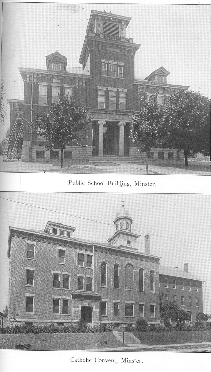
The "Bazle" Day, here referred to and whose name is found spelled variously Basle, Basle and Basil (the latter probably being correct), had entered his land in section 33 of this township, along Willow branch in the New Hampshire neighborhood, in 1832, the year the Indians took their departure, and early became one of the leaders of this community. Immediately following the erection of this township, John Kindle, who had entered his land here in 1836, platted a town site just east of Muchinippe creek on what then was known as the Fink road, laying out a regular tract of forty-three lots, gave to this plat the name of New Hampshire, in honor of his native state, and filed the same in the office of the recorder of Allen county on March 4, 1837. This village, lying about the center of the township, became the social center for the new township and so continued, the only village in the township. It was without rail connection until the coming of the Ohio Electric traction line about fifteen years ago. The town has a grain elevator and the usual complement of stores for the trading needs of the neighborhood, and has a modern and well equipped public school building, a picture of which is presented in this work.
HISTORY OF AUGLAIZE COUNTY - 431
LARGEST FARM IN AUGLAIZE COUNTY.
In this township, over in the Military lands section along the eastern line of this county, is the largest farm in Auglaize county and one of the largest farms in northwestern Ohio, the great Manchester farm, which has become widely recognized as a model of agricultural management and further and fitting details concerning which are set out elsewhere in this work. J. H. Manchester, owner of this farm, was twelve years of age when his father settled there in 1865, taking over a tract of 500 acres of unimproved land, which he proceeded to develop and to which he added until at the time of his death he was the owner of 1,000 acres, to which his son has since added until now the Manchester place takes in nearly double that area. Concerning the extensive farming operations carried on in this township, a review written twenty years or more ago, observed that "the great landed estates in the prairie are unsurpassed in picturesque beauty and fertility by any other locality in northern Ohio. * * * The great prairie and its drainage streams, in the former geological period, formed one of the five gaps in the dividing ridge of Ohio, through which the waters of the glacial sea flowed to the south. The great volume of water that flowed through the gap carried vast numbers of icebergs, loaded with great quantities of debris which was deposited as the bergs melted, forming gravel ridges along the line of the ocean current. There are evidences that there were ice gorges at the opening of the ice gap in the north and the bergs scraped and tore up the Erie clay at the bottom of the channel through the prairie. This prairie is also the source of two important rivers of the state, the Sciota and the Great Miami. The Sciota drains the greater part of the east prairie, while Muchinippe creek, head of the Miami, has been deepened and widened until it resembles a small river and drains the western prairie and adjacent territory."
432 - HISTORY OF AUGLAIZE COUNTY
AN OLDEN PICTURE OF NEW HAMPSHIRE.
A crayon sketch of what apparently was the chief corner in the village of New Hampshire fifty years ago reveals the two-story log hotel conducted there at that time by William Gullet. Alongside the hotel, which carries a signpost bearing the legend: "Wm. Gullet, Hotel," there is a somewhat pretentious looking frame barn. At the rear of the hotel appears the well-sweep. An apparent guest of the house is seen seated on the unprotected "stoop" of the hotel, another is seated on a fence which encloses the barnlot adjoining the house, while two others are leaning against the fence, all apparently engaged in deep conversation. A traveler is approaching the hostelry on horseback and a party of four are driving spiritedly past the place in a light spring wagon behind two prancing horses. Two women are standing at the doorway of the hotel and two men are standing in the middle of the street shaking hands. The hotel is twelve logs in height, with two doors and two windows opening from the ground floor and two windows from the second story front and the same number from the second story side, with but one window in the first floor side.
A plat of New Hampshire drawn in the late '70s reveals that William Gullet was the owner of three-fourths of the block between Washington and Market streets and Main and Marion streets and that his hotel occupied the southwest corner of this block, while immediately across the street south, at the northwest corner of Main and Market streets, stood the Exchange Hotel and store of J. J. Hutchinson. It is related that the first merchants in the village were Hiram and Orin North, brothers, who later erected a mill. Hutchinson's store was established not long afterward. Both the Baptists and the Methodists effected organizations here in pioneer days. Professor Williamson's review has it that "no village in the county has attended more earnestly to the cause of education than the citizens of New Hampshire and the community immediately surrounding it." It was about
HISTORY OF AUGLAIZE COUNTY - 433
1890 that this community interest in schools thereabout led to the erection of a township high school in the village.
PIONEERS OF GOSHEN TOWNSHIP.
When Auglaize county was erected in 1848 there were the following landowners in Goshen township, according to the tax duplicate for that year: William E. Aylesworth, Henry Borton, William Black, Daniel Black, A. S. Bennett, Salmon, Sampson, Samuel and Washington Buffenberger, C. F. Beebe, Benjamin Bidwell, R. P. Bodwell, James Cramer, John Conley, Eli Carson, Ephraim Caldwell, Samuel Canada, J. J. Caswell, John Damon, Alanson Earl, John Graham, Marcus Garrett, Asa Gray, John Gilroy, Joseph Hipple, Gilbert Hurley, Solomon Hanks, Nathaniel Hunter, Jacob Harrod, Sarah A. Hutchinson, Percifer F. Hucheson, Thomas Irwin, John F. Krouskop, Henry King, James Kelley, John Kindle, Joseph Klim, William Lewis, Robert Murray, Robert L. G. Means, Ebenezer Miles, William Marquis, Milton McLean, John McLean, Jonathan and Samuel Morecraft, Elias Miller, Nicholas Martz, John and William North, Francis and John J. Nichol', Thomas Patterson, Aaron Richardson, Edwin Stone, Christian, Philip and Sarah Smith, John W. Thomas, James Thomas, Sr., Sarah Wink- ley, Joseph F. Witham, Michael Waggant, George P. Williams and John Zaner.
In the Virginia military lands tract in this township there were at that time the following landowners: Green Thomas and others, the Mad River & Lake Erie Railroad Company, Valentine Peers, L. Somers, James Taylor and Wallace & Taylor, while in the town of New Hampshire in the same township there were then listed for taxation the following lot owners: Henry Barton, Matilda Blanchard, James Cramer, Elias Cline, Basil Day, John Gilroy, John Heindle, Solomon Hanks, Joseph Hippie, Nicholas Judy, R. L. G. Means, Samuel Morecraft and Adam Richardson.
434 - HISTORY OF AUGLAIZE COUNTY
JACKSON TOWNSHIP AND MINSTER TOWN.
The history of Jackson township is contemporaneous with that of German township (q. v.) until the year 1858, when the lower half of township 7 south, range 4 east, was by act of the commissioners and by the mutual consent and desire of the inhabitants of the township set off as a separate civil entity, and Jackson township thus appears for the first time on the tax duplicate of Auglaize county as of the following year, 1859, it thus having had its own local organization when the Civil war broke out. The names of the landowners in this township at the time Auglaize county was erected in 1848 therefore must be sought in the list of such names presented as of German township, as will be noted prefatory to the presentation of that list in that part of this story relating to the latter township above.
The initial act of the board of county commissioners covering this separation is set out in the journal of the board under date of Wednesday morning, December 8, 1858, where it is recorded that "the board took up a petition signed by 134 householders residing in the southern part of German township, praying for the erection of a new township to be composed of that part of German township lying south of the section line between sections 13 and 24, 14 and 23, 15 and 22, 16 and 21, 17 and 20 and 18 and 19, and laid the same over till the next quarterly meeting of the board." Then as of date March 7, 1859, there is this notation: "The board then took up the petition of sundry householders of German township for the creation of a new township to be composed of the southern part of German township and after some time spent in the consideration of the same the board adjourned till tomorrow morning at seven o'clock."
Two days later the matter was given final consideration, as shown by the following minute of the proceedings held on Wednesday, March 9 (1859) : "The board again took up the petition of citizens of German township for the creation of a new township and being satisfied that said petition is
HISTORY OF AUGLAIZE COUNTY - 435
signed by a majority of the householders residing within the boundary of said proposed change and that the notice required by law has been given, order that a new township be created out of the present township of German to be bounded as follows, to-wit : Beginning at the northeast corner of section 24, township 7 south, range 4 east, running thence west on the section line to the northwest corner of section 19, same township and range ; thence south on the line dividing between Auglaize and Mercer counties to the old Indian boundary line; thence in a southeasterly course with said boundary line to the east line of section 7, township 8 south, range 4 east; thence north with said section line to the northeast corner of section 6, same township and range ; thence east with the line between the counties of Shelby and Auglaize to the southeast corner of section 36, township 7 south, range 4 east; thence north with the section line to the place of beginning And it is further ordered that said new township be known and designated by the name of Jackson."
BOUNDS OF THE TOWNSHIP.
Jackson township comprises sections 19 to 36, the south half of the original congressional township 7 south, range 4 east, and all of section 6 and all but a thin "wedge" of the north half of section 7 of township 8 south, range 4 east, which makes a "handle" at the southwest corner of the civil township. About one-half a square mile lying in sections 35 and 36 of this township is covered by the waters of the Loramie reservoir, which extends up from Shelby county almost to the southern edge of the town of Minster and offers to the people of that section of the county delightful privileges for summer resorting and fishing. This township occupies the very summit of the "divide" which separates the waters north and south through this section of Ohio and the northern part of the township thus is drained into Lake Erie and the southern half into the Mississippi. To the natural drainage of the township an adequate system of ditches has been added
436 - HISTORY OF AUGLAIZE COUNTY
and no part of the county is better drained than this, the landowners there long ago having made the most of the unusual natural advantages possessed by reason of this region's situation on the summit of the great watershed.
The township is bounded on the north by German township, on the east by Shelby county, on the south by Shelby and Darke counties and on the west by Mercer county. The town corporation of Minster, the only town in the township, covers a little more than a square mile lying in sections 26, 27, 34 and 35, with subdivisions extending on all sides, with the Miami & Erie canal cutting through the town north and south and on out into Shelby county one-half mile south of the corporation line. The St. Marys-Minster division of the Lake Erie & Western railway has its southern terminus at Minster, as also has the St. Marys-Minster division of the Western Ohio electric railway. This latter road 'formerly ran its cars to Loramie, a couple of miles south in Shelby county, but some time ago discontinued that service, connections with the traction cars now being made by motor bus equipped to travel on the rails of the road. During the height of natural gas and oil activities hereabout, this part of the county profited largely by the considerable number of heavily productive wells brought in there.
MINSTER-OLD STALLO TOWN.
The town of Minster, the social and commercial center of Jackson township, dates from the coming of the Stall) colony of German immigrants up here from Cincinnati n the year 1833, contemporaneous with the Bremen colony which settled in that same year just three miles farther north. These lands at that time were a part of Mercer county an: had been favorably investigated by Francis Joseph Stallo, wealthy Cincinnati man, who became the leader in the organization of his fellow countrymen and homeseekers who had gathered at Cincinnati upon coming to this country and who authorized him to purchase a tract of land equivalent to one
HISTORY OF AUGLAIZE COUNTY - 437
mile square, or 640 acres, and lay out thereon a town site, the company obligating itself to provide the funds for the entry of the land and the expenses incident to the laying out of the town. The fund thus created was entrusted to Stallo, who was authorized to enter the land in his own name, to select the town site and have the same platted into 144 lots, each of these lots to represent one share in the company. These plans were formulated during the summer of 1832 and Stallo immediately thereafter came north and at the land office at Piqua on September 8, 1832, entered the northeast quarter of section 34, the northwest quarter of section 35, the southeast quarter of section 27 and the southwest quarter of section 26 of township 7 south, range 4 east. He then reported back to his associates and a plat of this mile square was drawn up and lots cast for the apportionment of the lots to the members of the company, the drawer of each share to pay a ratable proportion of the expense to Stallo, who was to make and execute a deed in favor of each purchaser. It was this mutual plan that has given to the original plat of the town its unique character. The mile square was divided into 144 lots ranging east and west from Main street, the central north and south street, with Fourth street as the central east and west street, these lots being given index numbers from 1 to 144 and then divided into ten parts or lots, lettered respectively from a to j off of Main street on either side. It was estimated by the company that the price of each share in this company would be $8.50, and on April 14, 1833, the members of the company got together at Cincinnati and drew their respective allotments in accordance with this plan.
Minster will be celebrating its centennial in another ten years and one of its most highly prized exhibits on that occasion undoubtedly will be the carefully preserved original draft of the town plat "laid out from (sic) F. J. Stallo" in 1833 and which now is in the possession of C. H. Dickman, of Minster, who for years has had it in his charge. Mr. Dickman was born in a log cabin at the northwest corner of Main and Fifth streets, within one square of the immediate center
438 - HISTORY OF AUGLAIZE COUNTY
of the town plat. In this cabin, one of the first to be erected in the village, it is said the first mass was celebrated when a mission church organization was effected there following the settlement of the colony. That cabin happily is still standing and is regarded as an equally priceless relic of pioneer days. Long ago it was worked over as to its interior and was given a sheathing of weatherboards, a new roof and other treatment to convert it into what now has the appearance of an ordinary cottage of that type, but the old logs are there underneath their covering and when centennial time comes no doubt still will be there to be pointed out to the descendants of the colonists who settled there in the wilderness one hundred years ago. The original draft of the town plat is on a prepared paper) made up of superimposed sheets which give the appearance of vellum and apparently was drawn by the hand of a well skilled draftsman, who in ornamental letters headed his plat " Stallow's Town." Just how he came to make a misspell in the name of the townsite owner is not known, probably a phonetic error. From all other evidence Stallo never spelled his name with a w in it, as all other records carry the name without the w. This ancient document so well cared for by Mr. Dickman bears notation on the back as having been recorded in the office of recorder Riley of Mercer county on June 11, 1833.
PROVISIONS FOR PUBLIC SQUARES.
The original mile square of the town of Minster was provided with plots for "court house" and "market place" on Zweibruken street flanking Fourth street, the former of which, in the absence of the court house which the projectors of the town evidently hoped might come, is now prettily parked and in the center of which has been erected a substantial stone memorial bearing on a bronze plate the names of the young men from Jackson township who rendered service during the World war. The market place plot many years ago was used for the purpose intended and one of the first platform scales
HISTORY OF AUGLAIZE COUNTY - 439
set up in this region stood there. Later, however, it was parked and is now filled with trees of noble growth. When the city erected its waterworks plant the south end of this plot was utilized as the site for the erection of the great water tank which now stands there. Just two squares to the east on Switzer street flanking Fourth street on either side other public plots were designated as sites for church and school. These, however, were so low and swampy when it came time to erect church and school that the present church and school square on Fifth street was selected for that purpose and there is general agreement now that the change was well made.
The plat was remarkable for its systematic uniformity and regularity. The east and west streets were numbered from First street to Seventh street and the north and south streets were named Ohio, Frieburg, Frankfort, Hanover, Zweibruken, Main, Switzer, Oldenburg, Vienna, Berlin and Paris, these numbered streets some years ago being changed by order of council to Clay, Washington, Jackson, Jefferson, Monroe, Madison, Roman and Adams, though to the older residents the olden nomenclature seems more familiar. When the canal came it cut through a little to the west of the center of the tier of blocks between Frieburg and Frankfort streets and of course very materially changed the course of commercial and industrial development that had begun to make itself manifest, the canal becoming a distinct line of demarkation between an East Side and a West Side, and business buildings and warehouses took their course accordingly. There are many of these old canal buildings remaining in the town and give a picturesqueness to the scene quite reminiscent of the older days. In the spring of 1838, five years after Stallo's Town was laid out, William Benner platted a tract of twenty acres on his farm on what is referred to on the old maps as the Amsterdam road, east and west through Minster, as a town site and called it Amsterdam, evidently in the hope that a town would there grow up, but the place never secured a permanent place on the map.
440 - HISTORY OF AUGLAIZE COUNTY
Francis J. Stallo did not live to participate in the fruition of his ambition as a town builder. He died a few months after the town site had been created and the colony established and as he held title to the land and had not executed deeds to the several lot owners and members of the company in interest there was considerable confusion in effecting title. For the purpose of securing title to purchasers of these lots a bill in chancery was filed in 1836 in the common pleas court of Mercer county, then sitting at St. Marys, by John Zimmer, B. J. Feldman, John H. Pelster, Joseph Surman and others, representing the shareholders, against John M. Stallo, Lewis Stallo, Mary Ann Stallo, Theodore Stallo and Theresa Stallo, heirs of Francis J. Stallo, to determine the rights of the shareholders. It then is narrated that "the defendants, the legal heirs of said Stallo, being infants, appeared by their guardian ad lit em, when it was ordered by the court that the defendants as they became of age should severally, convey to said owners or original purchasers their respective lots of shares, and in their failure to do so within six months after attaining their majority, this decree is to operate as a conveyance." And thus individual title eventually was perfected.
HOW MINSTER GOT ITS NAME.
For some time after Stallo died the town continued to be known by its original name of Stallo 's Town and it is said that the guide post at the intersection of the two highways bore the name in letters that the wayfarer could not mistake. One day, the tradition goes, the sign post was knocked over by a runaway team and was not replaced. About that time there sprang up a growing sentiment in favor of a change of name to Muenster, in honor of the old country town so dear to the memories of many of the residents of Stallo's Town, and by common consent the name was so changed, gradually coming to be Anglicised into the name of Minster, which was made the postoffice and which it was bearing officially at the time Auglaize county was erected in 1848. In
HISTORY OF AUGLAIZE COUNTY - 441
1837 certain changes were made in the survey of the original plat in order to effect a widening of some of the streets which gave promise of becoming commercially important, and still later the county commissioners added nine feet to the width of First and Seventh streets, the north and south bounds of the plat, making these roadways sixty feet in width. When the canal came along Francis Sprehe built a frame grist mill at the point where the canal feeder up from the Loramie reservoir crossed Fifth street, and this was properly the beginning of the industrial development of the place.
During the cholera scourge which swept up along the course of the canal in the late '40s and early '50s, the Minster settlement was especially hard hit An older chronicle has it that "the people died so rapidly that immediate burial could not be given them. Theodore Dickman, then a lad of fourteen years, remembers counting twenty-six coffins setting around in the hazel bushes in the cemetery south of town awaiting interment. Joseph Bussing, from three miles west of Minster, and a number of assistants came once a week and buried the accumulation of caskets. They buried them in deep trenches four tiers deep. * * * A remarkable feature of the epidemic was that its prevalence was confined to the village and township east of the canal. No case was reported west of that waterway."
COMMERCIAL AND INDUSTRIAL DEVELOPMENT.
The 1920 census gives Minster a population of 1,538, From the days when it was but a cross roads town on the Piqua and St. Marys road and the Amsterdam road it has developed into a city of considerable industrial importance. The dominant feature of the town is the great St. Augustine's Catholic church, one of the most imposing bits of church architecture in northwestern Ohio and which with the neighboring parish house and convent makes one of the most notable church plants in this section of the state. It is said that there are not half a dozen Protestants in the town of Minster and
442 - HISTORY OF AUGLAIZE COUNTY
this ecclesiastical ratio obtains pretty generally throughout Jackson township, St. Augustine's parish covering practically the whole township, with the exception of St. Joseph's parish in the Egypt neighborhood in the western part of the township.
During canal days Minster was widely known as a shipping point for grain and also as a pork-packing center. The brewery that was established there many years ago put out a product that attained a good deal more than local distribution and its old familiar label was widely known. It is still in operation, carrying the old label on a "soft" drink of the time. Its hydraulic mill was equally widely known for the quality of its flour, its brick and tile kilns and its tannery were busy and in the days before the big timber was exhausted its sawmills were constantly busy. The town has had a newspaper since the middle '70s and the Post, which also maintains an excellent job-printing plant, is a competent spokesman for the community An old established creamery has for many years made Minster an important dairy center, and there is a machine shop there, whose specialty is drill presses and such like heavy machinery, that is one of the largest single employers of labor in the county. Besides the flour mill there is a box factory, a well equipped branch of a nationally known cigar factory and minor industries, while the commercial interests of the town are amply represented. The town has one bank, the Minster State Bank, organized in 1914, the president of which is J. W. Eiting ; vice-president, 0. E. Dunan ; cashier, August Schunk, and assistant cashier, J. T. Haverbeck. This bank is capitalized at $25,000 and according to the current bankers directory has resources in excess of $450,000, with surplus and profits amounting to $33,060 and deposits aggregating $437,660.
Traditionally, Jackson township is a "rock-ribbed" Democratic township. For years, it is said, no Republican votes were cast in the township. Then, the story goes, one year the election judges found a Republican ballot in the ballot box. They were astonished, of course. Nothing like
HISTORY OF AUGLAIZE COUNTY - 443
this had ever happened before. They did not know of any Republicans in the township and therefore came to the conclusion that someone had cast the ballot by accident and threw it out. The next year, so the tale goes, two Republican ballots were found. Supposing this was a case simply of two accidents instead of one, the judges threw both of these out. The next year three ballots were treated in the same fashion, but when in the following year four ballots were found, it was decided that there hardly could have been four identical "mistakes" on the part of well meaning but careless Democrats and the ballots were counted, even as Republican ballots ever since have been counted.
LOGAN TOWNSHIP AND THE VILLAGE OF BUCKLAND.
Logan civil township on the northern border of Auglaize county covers twenty-six and one-half square miles of land surface, taking in sections 19 to 36 of congressional township 4 south, range 5 east, and sections 1 to 6 and one-half of sections 7 to 12 of township 5, with the village of Buckland on the Auglaize river and the Lake Erie & Western railroad on the south edge of the township in sections 10 and 11. The river enters the township in section 11 of the lower township, winds northerly and out in section 22 of the upper township. It was along this river at the bend in section 26 that the mile-square reservation was set off to the heirs of Logan, "the good Indian" and faithful friend and ally of General Harrison's soldiers during the War of 1812, at the time of the treaty at the foot of the Rapids of the Maumee, September 29, 1817. Among the numerous individual reservations created under the terms of Art. 8 of this treaty that clause relating to Chief Logan stipulated a reservation "to the children of the late Shawnee chief, Captain Logan (or Spamagelabe), who fell in the service of the United States during the late war, one section of land, to contain 640 acres, on the east side of the Great Auglaize river, adjoining the upper line of the grant of ten miles at Wapaghkonnetta and the
444 - HISTORY OF AUGLAIZE COUNTY
said river," and it is in further honor to this gallant Indian ally of the American arms in this country's second war for independence that Logan township bears its name.
THE STORY OF CAPTAIN LOGAN.
From the older chronicles and histories of the days of Indian occupancy it is learned that Captain Logan, as he came to be known to his white friends and whose Shawnee name is set out above in the quotation from the treaty which honored his memory, was born in the Mad river country and it is said that his mother was a sister of Tecumseh and The Prophet. He was about twelve or fourteen years of age when, along with the famed Grenadier Squaw and others, he was taken prisoner by Col. Benjamin Logan at the Macochee village, in what is now Logan county, in the campaign against the Indians in that region in 1786. It is narrated that the troops were brought to such a frenzy by the engagement that it was with much difficulty that the officers were able to save the life of the Indian lad. Gen. William Lytle, who participated in the engagement, wrote concerning the incident that "a young man by the name of Curner had been to one of the springs to drink. He discovered the young savage by my side and came running toward us. The young Indian supposed he was advancing to kill him. As I turned around, in the twinkling of an eye he let fly an arrow at Curner, for he was armed with a bow. I had just time to catch his arm as he discharged the arrow. It passed through Curner's dress and grazed his side. The jerk I gave his arm undoubtedly prevented his killing Currier on the spot. I took away his arrows and sternly reprimanded him." It is further narrated that General Logan took the boy home with him and sent him to school until "he acquired considerable education, when he gave him his liberty and his own name." And it was thus that Spamagelabe, a nephew of Tecumseh, came to the ways of civilization and to bear a white man's name.
HISTORY OF AUGLAIZE COUNTY - 445
Elsewhere in this work there are further details concerning Logan's friendliness to the whites after he became a chief of his tribe, for he rejoined the Shawnees, who had been dispersed on the Mad river and had settled among their friends at the Wapakoneta village, and became by reason of his schooling a power among them. It is fitting, however, here in the story of the township which bears his name, to set out the details regarding the death of this brave and gallant man. The story has it that General Harrison, while at Ft. Defiance in November, 1812, directed Logan to take a small party of his tribe and reconnoiter the country in the direction of the rapids of the Maumee. The chief and his scouts met a body of the enemy and were compelled to make a hasty retreat before superior numbers, being so closely pursued that they were obliged to separate. Logan, Captain Johnny and Brighthorn succeeded in making their way to General Winchester's command, and presently Logan had an interview with General Harrison concerning his escape. On this occasion General Perkins, commander of the Kentucky troops, without the slightest ground for such an accusation, charged Logan with treachery and giving intelligence to the enemy. Indignant at the unjust accusation, Logan resolved to distinguish himself in such a manner as would leave no doubt of his loyalty to the United States.
Some days later, on the 22d, Logan proceeded down the Maumee in company with Captain Johnny and Brighthorn, their route being on the north side of the river. They had proceeded about ten miles when they were surprised by a party of six Indians and a white of the name of Elliott, the eldest son of Colonel Elliott of infamous memory, this scouting party being in charge of Chief Winamac, the fiery Pottawattomie who a year before in the absence of Tecumseh in the South had precipitated the battle of the Tippecanoe, in which General Harrison forever shattered Tecumseh's hopes of effecting an Indian confederation. Logan made no resistance to capture, but with admirable diplomacy extended his hand to Winamac, who was an old friend, and told him that
446 - HISTORY OF AUGLAIZE COUNTY
he was going to the Rapids to give information to the British. Not wholly satisfied with this explanation, Winamac disarmed Logan and his companions, but after the party had proceeded some miles farther on the journey Logan had so fully impressed Winamac with his apparent sincerity that the latter restored their arms to the captives.
While they were marching Logan succeeded in communicating to his companions, Captain Johnny and Brighthorn, his plan of escape and in the evening when preparations for camp were being made and Winamac's party was off guard Logan gave the signal of attack. At the first fire two of the enemy fell dead and another was mortally wounded, this first fire removing both Winamac and Elliott. At the second fire a young Ottawa chief fell dead and another of the enemy was mortally wounded. By this time Brighthorn had received a bullet wound in his thigh and Logan received a ball just below the breast bone, which ranged downward and lodged under the skin of his back. Desperately wounded as he was, Logan ordered a retreat and he and Brighthorn seizing two of the horses of the enemy made for Winchester's camp, twenty miles away, arriving there during the night. Captain Johnny, after taking the scalp of the Ottawa chief, also retreated in safety and reached camp early in the morning. Logan lived for two days after reaching camp and was buried with the honors of war within the inclosure of Ft. Winchester. The chronicle of the incident has it that "no one more deeply regretted the fatal catastrophe than the author of the charge against Logan's integrity." Major Hardin wrote that "his death caused sorrow as generally and sincerely displayed as I have ever witnessed in the army," and with cause, for his services had been so important that the British had offered a reward of $150 for his scalp.
"The Indian name of Captain Logan is usually written Spemica Lawba,' and translated 'High Horn,' but it occurs in other forms," says Jacob Piatt Dunn, of the Indiana Historical Society, who is regarded as an authority on Indian nomenclature. "The first word is the Shawnee spum-muk,'
HISTORY OF AUGLAIZE COUNTY - 447
which also means 'above' or 'on top.' This confusion of vowel sounds is very common in Indian names and is very natural, for the spelling is phonetic and it is often impossible to determine the short vowels."
AN INDIANA CITY NAMED FOR LOGAN.
Mr. Dunn's story, "The Service of Logan," has it that "in the spring of 1828 there gathered informally at the site of Logansport (Ind.) a little knot of early settlers, and others interested; to select a name for the new town which had just been surveyed. General Tipton, who admired classic titles, proposed an alleged Latin compound said to mean 'Mouth of the Eel,' which was the name commonly given to the place at the time by the whites Another proposed Kene-pe-cuma-qua—the common form of the Miami name of Eel river and of their old town at the mouth of that stream. Others proposed various names and finally Hugh B. McKeen, a son- in-law of Barron, the Indian interpreter who had formerly been in the Indian tribe at Ft. Wayne, proposed the name of Logan, in commemoration of this friend of the whites. The suggestion pleased Colonel Duret, who proposed that `port' be added to round it out, and by common consent the name was adopted And so there was given a monument more lasting than stone or bronze to this Indian soldier who died for the people against whom he had fought as a child."
Not long after the treaty of Greenville Logan had married a Shawnee woman who had been taken prisoner by Colonel Hardin in 1789 and who was living in the Hardin household at the time of the treaty. After his marriage Logan had formed a strong attachment to Colonel Hardin and upon his arrival at Ft. Winchester, knowing that he had received his death wound, he sent for Hardin and requested the latter to see that what was due him for his services should be paid over to his family, which was done. Four years later further requital was made when the mile- square reservation in what is now Logan township was made over to Logan's children.
448 - HISTORY OF AUGLAIZE COUNTY
Concerning Logan's family, Henry Howe's narrative (1846) has it that Colonel Johnston, the old Indian agent, in a communication to Howe said that "Logan left a dying request that his two sons be sent to Kentucky and there brought up and educated under the care of General Hardin. As soon as peace and tranquility were restored among the Indians, application was made to the chiefs to fulfill the wish of their dead friend to deliver up the boys for conveyance to Frankfort, the residence of Major Hardin. The chiefs were embarrassed and manifested an unwillingness to comply, and in this they were warmly supported by the mother of the children. On no account would they consent to send them so far away as Kentucky, but they agreed that Colonel Johnston should take them and have them schooled at Piqua. This being the best that could be done, in compliance with the dying words of Logan, they were taken to this point, put to school and boarded in a religious,. respectable family. The mother of the boys, who was a bad woman, thwarted all the plans for their improvement, frequently taking them off for weeks, giving them bad advice and even, on one or two occasions, brought whisky to the school house and made them drunk. In this way she continued to annoy the school, and finally took them away altogether to raise with herself among the Shawnees at Wapakoneta. I made several other attempts, during my connection with the Indians, to educate and train up to civilized life many of their youth, without any encouraging results—all of them proved failures. The children of Logan, with their mother, emigrated to the West years ago and have there become some of the wildest of their race."
Concerning Brighthorn, who was severely wounded during the scrimmage with Winamac's men, it is recorded that he recovered from his wound and at the close of the war returned to Wapakoneta and re-established himself in his cabin on Quaker run, where he died about 1825. It has been written of Brighthorn that "he was a man of large stature and commanding appearance" and that "his fidelity to General Harrison and the American army was never questioned."
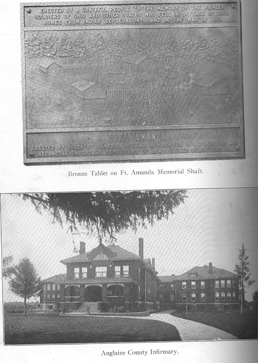
HISTORY OF AUGLAIZE COUNTY - 449
Big Captain Johnny, who also figured in the scrimmage which cost Logan his life, had his home on the west bank of Pusheta creek, just about where that stream empties into the Auglaize, west of Wapakoneta, is said to have been seven feet in height and "as frightfully ugly as he was large." It is said that he died about four years following the close of the war and was buried in the burial ground maintained by his people at the mouth of the Pusheta.
ORGANIZATION OF LOGAN TOWNSHIP.
Logan township, which is bounded on the north by Allen county, on the east by Duchouquet township, on the south by Moulton township and on the west by Noble and Salem townships, was formerly a part of Allen county, its lands having been included in Amanda and Moulton townships of that county. Upon the delimitation of the township lines upon the erection of Auglaize county in 1848, three tiers of sections were taken from the lower part of Amanda) township and one and one-half tiers from the upper part of Moulton township and to the new township thus erected was given the name of Logan. It is in this township, on the northern border of the same, along the river at the site of the old Ottawa town in section 22 that Ft. Amanda was erected as a means of defense along the Auglaize during the War of 1812, and the site of this fort, a detailed story of which is set out elsewhere in this work, became the center of settlement of that section of the county in the days when white men came to seek their homes in the wilderness here. In the chapter relating to the settlement period the story is told of the first land entries in this township and of how the old block houses of the fort served the first settlers as places of habitation until they could put up cabins of their own and better suited to their notions of living An older review has it that "at the time of the organization of the township in 1848 the Defiance road was the principal one, the others being called `hoop-pole' roads. The construction of roads and the build-
(28)
450 - HISTORY OF AUGLAIZE COUNTY
ing of bridges were slow of progress until 1880. That year marks a new era in the history of the township. In that year the Kossuth and Amanda roads were constructed. Two years were sufficient to demonstrate the great utility of these public enterprises. Since then nearly every public road in the township has been piked. Since 1880 the rude wooden bridges have been replaced by substantial iron structures."
In this township at the time Auglaize county was erected in 1848 there were the following landowners listed for taxation : Russell Berryman, Thomas Berryman, William Blackburn, William Barr, Ebenezer Buck, Jacob Baker, Henry Barnes, Jr., E. G. Barney, John Cunningham, Thomas Clawson, Hercules Carroll, James Crozier, Nathaniel Clawson, James Chaney, Robert Dillon, David Y. Yates, Green Everett, John Ferrell, Daniel Gregory, Francis Gregory, Harrison Gregory, Jacob Haines, Jacob Hiveday, George B. Holt, George W. Holmes, Edward Helfenstein, Martin Hire, Helands, Ezekiel Hoover, Elijah Kemer, John Hemelin, William Lapham, Robert Moody, William Miner, Henry McConnell, Abraham Miller, Isaac Mills, Ruel Pritchard, Thomas Prosserd, Simon Perkins Jacob Perkins, William Ringer, David Richardson, G. W. Richardson, William S. Rose, Albert Spiker, Henry Stoddard, Philip Terwillinger, William Taylor, Peter Voris, J. and C. N. D. Waite, Abraham Whetstone and J. A. and E. M. Whetstone.
THE COMING OF THE RAILROAD.
The village of Buckland, the only village in this township, was laid out in the fall of 1872, following the survey of the line of the old Lake Erie & Louisville railway (now the Lake Erie & Western railway) through that part of the county, two of the landowners there at the site of the old Indian village of Whitefeather, John H. Gochenour and Josiah Clawson, having realized that this was a very likely site for a railway station when the trains presently should be running along there. Their original plat, which was filed
HISTORY OF AUGLAIZE COUNTY - 451
for record on February 1, 1873, was a plat of thirty lots, west of the river in section 11, broken diagonally about the center by the line of the railway, Clawson's land lying to the north of the railway and Gochenour's south, and they gave to their prospective town the name of Whitefeather. When the railroad came along the railroad company named the station which they established at that point Buckland, in honor of General Buckland, of Fremont, one of the active promoters of the road, and this also became the postoffice name of the town. When in 1891 the village, which by that time had acquired a population of 200 or more, applied to the commissioners of the county for a grant to incorporate for civil and school purposes, a petition was presented asking that the name of the place be changed from Whitefeather to Buckland and it was so ordered. At the first village election W. G. Brorein was elected mayor ; W. U. Lathrop, clerk; W. N. Dingledine, treasurer; T. Bodkin, marshal, and Dr. R. W. Sharp, J. H. Gochenour, D. W. Kiester, Henry Sites, Fred Ziegenbush and A. Nuss, members of the town board. Since the establishment of this village several additions have been made to the original plat as the growth of the town warranted and the present population, according to the census report for 1920, is 258. Buckland is a convenient local trading point and has stores and shops sufficient for the demands made upon it in this direction, but its proximity to the neighboring cities of Wapakoneta and St. Marys has operated to prevent any very active growth.
The first postoffice within the present bounds of Logan township was established at old Ft Amanda in the days of the post riders, who rode between Piqua and Defiance, and Samuel Washburn was the first postmaster. This section of the county, there along the river, was a favorite hunting ground not only for the Indians but for the white settlers and it is related that the forest abounded in game of all kinds. An older chronicle relates of Russell Berryman, one of the first settlers in that township, that at a deer crossing one morning he shot seven deer before breakfast. The river then
452 - HISTORY OF AUGLAIZE COUNTY
also is said to have abounded with fish of many varieties not now found in it and that at certain seasons sturgeons of great size would come up the stream from the Lake. It is related that on one occasion Thomas Berryman was crossing the river on a footlog and saw a great sturgeon struggling up the ripple. The water was shallow and the fish was floundering under the log when Berryman leaped upon its back and forcing both hands into its gills attempted to steer it ashore. The struggle was long and tense, but finally Berryman landed his prize, which proved to be about eight feet in length. Besides the Logan reservation in this township, which has been noted above, the Wapakoneta ten-mile Indian reservation covered the southeast quarter of the township and until lands there were opened to settlement in 1832 settlers were backward about locating in that part of the county, which thus got a later start than some other portions of the county.
MOULTON TOWNSHIP, GLYNWOOD AND MOULTON.
Moulton township, situated in the midwestern part of the county, is made up of one-half of sections 7, 8, 9, 10, 11 and 12 and sections 13 to 36 of township 5 south, range 5 east, and thus covers twenty-seven squares miles. The township is bordered on the north by Logan township, on the east by Duchouquet township, on the south by Washington township and on the west by Noble township. It is drained on the east by the Auglaize river, which enters in section 36 and winds west of north and out in section 11, taking several remarkable twists and turns on its way. Six Mile creek, a tributary of the St. Marys river, drains the western half of the township and these two streams are supplemented by a complete system of drainage ditches, which long ago reclaimed what formerly was a good bit of waste land in the township. Push- eta creek empties into the Auglaize in section 36. Two unincorporated villages, Glynwood, on the creek in the southwest quarter of section 20, and Moulton, on the southern edge of
HISTORY OF AUGLAIZE COUNTY - 453
the township in the southwest quarter of section 33, are trade and social centers of much convenience to the people of the township. Glynwood is situated on the Lake Erie & Western railroad, which enters the township from the northeast in section 10 and passes out on its way to St. Marys in section 30. Moulton is situated on the Toledo & Ohio Central railway and the Western Ohio electric line, which follow the St. Marys and Wapakoneta highway along about the southern border of the township. The old Wapakoneta Indian reservation line cut through this township at almost the immediate center north and south. Due to the peculiarly irregular conformation of Auglaize county, Moulton township is the only one of the county's fourteen townships that does not touch a border of one of the neighboring counties.
Moulton township was erected in 1835, three years after the departure of the Indians, and was at that time attached to Allen county. When Auglaize county was erected in 1848, the original congressional township was divided to give to Logan township the upper tier and half the second tier of sections, as has been set out in the story relating to this latter township. The story of the erection of the original township is carried in the journal of the board of commissioners for Allen county, where, as of date December 25, 1835, it is recorded that "Joseph Haskell then presented a petition from the inhabitants of township 5 south, range 5 east, praying to be set off as a separate township and to be designated and known by the name of Moulton. Petition granted. Bonds given and advertisements written for an election to be held at the house of Joseph Haskell on the 30th of January, 1836, for the purpose of electing the necessary township officers." Joseph Haskell had entered four parcels of land, in sections 10, 23 and 25, in this township in 1832, the year the Indians were escorted West and was an active figure in the early development of the township.
454 - HISTORY OF AUGLAIZE COUNTY
OLD CHIEF CORNSTALK AND BLUE JACKET.
With the exception of the lands along the river that old Chief Cornstalk's clan had cleared for their cornfields, the region now covered with well tilled farms was a forest wilderness that offered little encouragement to the endeavors of man, but the settlers realized the job that was cut out for them and with the directness of the frontiersman were not long in getting the job well under way. Old Chief Cornstalk went with his tribe to their new lands in the West in 1832 and there died about ten years later. He was a son of the celebrated Shawnee chief, Peter Cornstalk, who was assassinated at Point Pleasant in 1774, and it has been written of him that, like his father, he "was commanding in appearance and had the lofty bearing of the true savage." With the rest of his Wapakonetan tribesmen he resisted Harmar, St. Clair and Wayne, but after the second battle at Ft. Recovery recognized that the white man was coming in to stay and he signed the treaty of Greenville and ever after was a good Indian, making his home along the Auglaize about two miles down the river from the council house at Wapakoneta until the Shawnees were moved West, he then being past eighty years of age. He directed the farm operations of his people here and when the white men came in they found a good deal of tilled land along the bottoms up through the present Moulton township.
Cornstalk apparently also was somewhat of a statesman. In Henry Harvey's history of the Shawnees it is set out that "when the Wyandot Indians of Ohio sold their reservation to the United States they demanded that the Shawnees should cede to them a tract of land containing 150 square miles, lying at the east end of the Shawnee lands,, claiming that that amount of land was due to them for privileges they had granted the Shawnees in Ohio. The demand was met by violent opposition from the Shawnees. A meeting of the chiefs was held to discuss the unjust demand. Among the most prominent speakers who opposed the measure was Peter Corn-
HISTORY OF AUGLAIZE COUNTY - 455
stalk, a very old man and son of the celebrated Chief Cornstalk, a conspicuous character in the Governor Dunmore war. He declared that he was as old a man as the commissioner was and that he did not believe one word he said about the Wyandots having done so much for the Shawnees. He thought it very strange that the Government could remember so much the Wyandots had done for them and know so little about it. 'Strange,' said he, 'I must have been asleep a long time. 'Well,' he continued, the Wyandots have given the United States a great deal of land; the United States have plenty—more, by far, than the Shawnees have—and I propose that they just give the Wyandots a little, and not beg it of the Shawnees for them.' "
Blue Jacket was another of the Shawnee chieftains who made his home in what is now Moulton township, having his quarters along the river about the center of section 25 and co-operating with Cornstalk in the management of the affairs of that branch of the tribe, after the two had settled down to the business of being good Indians. The name of Blue Jacket is inseparably associated with the bloody operations of the Indians in northwestern Ohio and even those of the writers concerning Indian affairs who persistently affected a sympathetic interest in the redman have little good to say of him. He served as a subordinate under Little Turtle in the battles which terminated so disastrously for Harmar and St. Clair and so distinguished himself in the first engagement at the headwaters of the Wabash (Ft. Recovery) that he was given command of the Indian forces in the campaign which terminated in the battle of Fallen Timbers and the destruction by "Mad Anthony" Wayne of any further hope the redmen may have been cherishing with respect to their continued dominance here. Reluctantly and sullenly he participated in the treaty of Greenville, .'where he (abandoned hope after signing the treaty, and then returned to Wapakoneta, where he spent much of his time bringing in liquor for the redskins. About 1825 he turned this profitable liquor business over to his son, James Blue Jacket, and joined the western tribe
456 - HISTORY OF AUGLAIZE COUNTY
of the Shawnees along the Missouri—a good riddance for Ohio. The younger Blue Jacket kept up his liquor traffic here until the Shawnees were moved West. The story of Big Captain Johnny's village at the mouth of the Pusheta in this township has been told elsewhere.
VILLAGES OF MOULTON TOWNSHIP.
The village of Glynwood, on Six Mile creek and the Lake Erie & Western railway, in the southwest quarter of section 20 of this township was platted by John Glynn, who owned the land there, upon the coming of the railroad, the plat, an irregular tract of thirty lots traversed diagonally by the line of the railway, having been filed for record on July 27, 1876. John Glynn was thirty-one years of age when he came to this country from his native Ireland and located at Columbus, this state. Six years later he came up here and bought the farm on which he settled down in Moulton township. Glynwood is a convenient local trading and shipping point, but has not attained much growth. The village of Moulton, which has been recognized as a similar local center since the days of the old plank road, attained a little more prominence with the coming of the T. & O. C. railway and the Western Ohio electric line, but its situation as a half-way point between St. Marys and Wapakoneta has prevented its expansion. The census report for 1920 gave it a population of 106.
The tax duplicate for the year 1848 reveals the presence of the following landowners in Moulton township when this county was organized: Nathaniel Adams, Christopher Bailey, Augustus Beaver, Jesse Bowser, Thomas Botkin, Jacob Baker, Elias Beavers Gottlieb Buhr, Henry Barnes, Jr., Lewis Breece, Josiah Borton, John C. Bothe, John Bigler, Jacob Bigler, Daniel Cutler, John M. Chamberlain, Samuel Chamberlain, Frederick Clapp, Lewis D. Campbell, John Clawson, Thomas Clawson, Cornelius Christie, William Crowder, Joseph Cumings, Abner Daniels, Job Dillon, Sam-
HISTORY OF AUGLAIZE COUNTY - 457
uel Darnell, ,William Evan, ,Hugh Elliott, James Elliott, Jacob Fleming, Christian Forney, John Fleming, J. G. Frieman, John G. Frische, William Green, James Hecox, Ambrose Harvey, Jesse Hardin, Joseph Haskill, George B. Holt, Daniel Hart, Hugh Jelly, Jonathan Johnston, Evan Jones, George Julian, Stephen Julian, Thomas Jones, Henry Kessekamp, Joseph Keller, Jacob Keiser, Abraham Keller, John Lenox, Michael Leatherman, John McFarland, Martin Meyers, Frederick Marquand, William Moorehead, E. & M. Miller, Andrew McKee, William P. Moarey, Henry McConnell, Benjamin Noggle, Joseph Pritchard, Jacob Perkins, Simon Perkins, John and Peter Primer, Francis Rain, Michael Ringer, William Rise, Samuel Sharp, Schoonover, William Sillins, Samuel Seibert, Michael Seifert, John P. Sillins, Henry Stoddard, George Tester, Margaret Terwillager, Isaac Terwillager, Daniel Voris, John Wahl, Benjamin Whitney, H. D. V. Williams, Thomas West, Sr., Thomas West, Jr., Thomas Williams, John Waite, James and Thomas Wair, Samuel Walker, George Walter, William West, John Young and Thornton J. Young.
NOBLE TOWNSHIP
Noble township in the western part of the county is bounded on the north by Salem township, on the east by Moulton township and a fraction of Logan township, on the south by St. Marys township and on the west by Mercer county. It is made up of sections 7 to 36 of township 5 south, range 4 east, and thus contains thirty square miles. The township is traversed by the St. Marys river, which enters in section 34, pursues a serpentine course east of north through the township and out in section 12, the chief tributary of this stream in this township being Four Mile run, which enters from Mercer county in section 31 and joins the river in section 22, about the center of the township. The Miami & Erie canal follows the general course of the river, with Lock 14 in section 14. The generally low and level surface
458 - HISTORY OF AUGLAIZE COUNTY
of the township, which borders on what formerly was known as the Black Swamp, has necessitated a good deal of pretty expensive artificial drainage, the first important project of which was the Big Run ditch put through in the northwestern part of the township about fifty years ago. Since then, as the land became cleared of its heavy forest growth, drainage has kept pace with the demands of the landowners and it is now one of the most productive portions of the county. There are no villages in Noble township, but it is joined on the south (in sections 33 and 34) by the city of St. Marys, a very convenient commercial and social center for the people of the township.
This township prior to the erection of Auglaize county in 1848 was attached to Mercer county and with what now is Salem township, neighboring on the north, was known as Wayne township, so named on account of the old Wayne military trail having run up through that part of the country. However there also was a Wayne township in that part of Allen county which was taken over by the new county of Auglaize and it thus became necessary to find a new name for the western township which was divided for the sake of convenience, the upper part being given the name of Salem and the lower part the name of Noble. This latter township was named in honor of Elisha Noble, one of the early settlers of that region and who had been serving for six years as a member of the board of commissioners for Mercer county. In the second election held in the new county of Auglaize (1850) he was elected to represent his district on the board of commissioners for this county. Elisha Noble was born on the east shore of Maryland in 1782 and five years after Ohio was admitted to, statehood came to this state, in 1808, and settled in Clinton county, where he was living when the War of 1812 broke out. He enlisted his services and was an active participant in that second struggle for American independence, having been present at the siege of Ft. Meigs and at the battle of the Thames. When the new lands up in this part of the state were opened for settle-
HISTORY OF AUGLAIZE COUNTY - 459
meat he moved here and settled in what then was Mercer county, thus early becoming one of the prominent and influential citizens of this region, where he spent the remainder of his life, his death occurring in 1864.
In the chapter relating to the settlement period mention is made of the first settlers of this township and the tax duplicate for 1848 shows the presence of the following landowners in Noble township when this county was erected: William Armstrong, Samuel Armstrong, Eleanor Armstrong, Joseph D. Blew, Thomas S. Bowles, Samuel Brady, Nicholas Brewer, Nicholas Broadwell, Alexander Conover, Bergen Covert, Aaron Cox, Thomas Davidson, Solomon Denny, John Ellis, Ezekiel Gould, R. B. Gordon, John Hawthorn, Henry W. Hicks, John S. Houston, Joseph Hoover, John N. Hawthorn, James Jeffrey, Israel Johns, Joseph Kelsey, Jared Kelsey, Peter P. Lowe, Franklin Linzee, William Lattimer, Benjamin Linzee, C. C. Langsdon, Caleb Major, Robert Moody, William Mitchell, A. D. Medberry, Frederick Marquand, G. W. McLaughlin, William Neal, John M. Nelson, Jacob Noble, Henry Noble, Elisha Noble, William Over- ley, William O'Hara, Jacob Perkins, John Plummer, Jacob Rice, Jeremiah Rubert, William Sawyer, Madison Sweetser, Frederick VanBillerson, John Vannuys, Griffin Watson, William Weidemeyer and Samuel Weidemeyer. On August 25, 1836, Jesse Belknap filed for record a plat of a town in the southern part of Noble township, to which he gave the name of Janesville. This was a tract of seventy-two lots with a "public square" in the center of the plat. Janesville never got a permanent place on the map.
PUSHETA TOWNSHIP AND THE VILLAGE OF FREYBURG.
Pusheta township, which is made up of sections 1 to 30 of township 6 south, range 4 east, and thus comprises within its bounds an area of thirty square miles, is bounded on the north by Duchouquet-township, on the east by Clay township, on the south by Shelby, county and on the west by Washington township, with the village of Freyburg in the southeast
460 - HISTORY OF AUGLAIZE COUNTY
quarter of section 15, two miles east of the Baltimore & Ohio railway and the main line of the Western Ohio electric railway, which enter the township from Wapakoneta in section 5 and follow the Sidney-Wapakoneta highway east of south and out toward Sidney in section 29, not far from the town of Botkins, in the neighboring county of Shelby. The Toledo & Ohio Central railway also cuts through the northeastern corner of the township in sections 1, 2, 3 and 12. Pusheta creek crosses the township from the east, through the village of Freyburg and Quaker Run rises in the township, flowing northwesterly to enter the Auglaize at Wapakoneta. Other smaller streams offer exceptional advantages for natural drainage and this has been augmented by a thorough system of ditches. The southwest corner of the township drains toward the Miami, the "divide" being caused here by the St. Johns ridge, which extends through the township from east to west, forming an elevated table land. The elevated portion of the township was formerly heavily timbered, the uplands having been particularly rich in hard maple. It is recorded that "for fifty years the ridge was an ideal camping ground and in the months of February and March the Pusheta Indians and other tribes devoted their attention to the manufacture of maple sugar from the extensive sugar maple groves that covered the uplands." This land was occupied by the aboriginals until their departure from this region in 1832.
The territory now comprised within Pusheta township formerly was attached to Allen county and was organized under an act of the commissioners of that county in December, 1836, four years after the departure of the Indians, the journal of the commissioners of that county recording in the minutes of the session of that month that "there was a petition presented by sundry inhabitants residing in the original surveyed township No. 6 south, in range 6 east, praying to be set off as a township under the name of Pusheta, which petition was considered and granted. Boundaries were given and advertisements written for an election to be held at the dwelling house of Joseph Mayer on the 20th inst." This
HISTORY OF AUGLAIZE COUNTY - 461
was probably the house of Joseph Meyers, who had entered his lands in section 14 in the vicinity of the present village of Freyburg in 1833, the year following the departure of the Indians.
THE HOME OF HENRY HARVEY.
It was in this township, in the vicinity of what later came to be known as the Shanahan cemetery, that Henry Harvey, the Quaker missionary and teacher who long ministered to the Indians on the Wapakoneta Indian reservation had his home and his school, and two of his children lie in that quiet rural burying ground, which also was the site of an old Indian burial ground. In this burial ground it also is said there lie the remains of a devoted teacher of the Catholic faith, Sister Mary Green, a native of Canada, who had accompanied a party of visiting Jesuits to the Wapakoneta reservation in 1828 and had elected to remain among the Indians as a teacher. It is said that she died of consumption in the home of Mr. Harvey in 1831 and that many years afterward her brother sought out the place of her burial and was successful in locating the grave in which she lay. The Wapakoneta reservation covered all of this township save the lower tier of sections and half of the second tier from the south.
The name of this township and of the principal stream which flows through it were given in honor of the Indian chief who directed the affairs of that clan of the Shawnees which made their hunting grounds there. In the text of the treaty at the foot of the Rapids of the Maumee in which this reservation was allotted, the name of this chief is spelled Pasheto. Henry Harvey's "History of the Shawnees" renders it Pesheto. Professor Williamson's review carries the observation that "it is not known who took upon himself the responsibility of writing it Pusheta." In this latter form it appears in the first civil records relating to the township and perhaps is a very proper orthographic and phonetic com-
462 - HISTORY OF AUGLAIZE COUNTY
promise agreed upon by the settlers who petitioned for the setting off of a township to bear that name.
The first school house in this township was that erected along Quaker Run in the northeast quarter of section 19 in 1834, a typical log school house which was used for many years afterward. The village of Freyburg in the east half of the southeast quarter of section 15 and occupying the site of a former Indian village there along Pusheta creek, was platted on January 3, 1837, by Beal Spurner, who had settled in this township the year before. The original plat of Freyburg shows a tract of forty-one lots broken about midway north and south by Pusheta creek, the plat comprising four blocks with Schemel street as the north street, Sidney street at the south and with Seiter street on the east and Spring, VanBuren and Walnut the other streets, running north and south. A later addition on the north added Main and Sycamore streets as east and west streets. The proximity of this village to the county seat has prevented any very extensive growth and its position off any railway restricts its commercial activities to purely local needs. It is a pleasant social center, however, and the center of St. John's Catholic parish, which had its establishment there in 1850. The census for 1920 gives the village a population of 150. Though the name of this hamlet is given on the original plat as Freyburg, it more often than not is spelled Fry- burg and is so given in the state gazetteer.
PIONEERS OF PUSHETA TOWNSHIP.
According to the tax duplicate for the year 1848 there were the following landowners in Pusheta township when Auglaize county was erected: Michael Annessor, Margaret B. Altain, Mina Allbrant, L. H. Altenbach, Maritz Altenbach, William Butterworth, Paul Birk, J. & J. Biersdorfer, Joseph Bush, Sr., Joseph Bush, Jr., F. K. Bush, Jacob and Ear- hart Birk, Jacob, Michael, John and Betsy Bubp, Michael Baeumel, Henry Brocus, N. Berlain, Peter Brocus, Joseph
HISTORY OF AUGLAIZE COUNTY - 463
Bauman, Frederick Boardman, Philip Brown, Nathaniel Bowers, Adam Back, Charles Brison, Samuel Bowers, William Bechdolt, Joseph Brockert, John Bresler, Nathan Brokit, C. D. Capner, Jacob Colter, Mary Conklin, William and Edward Craft, Lawrence Clickite, Henry Crowell, Nathaniel F. Canal, David Cromwell, Thomas Cochlin, John Davis, Simon Dresher, Andrew Dresher, Henry Delong, Anthony Dirker, John Elliott, John and Adam Englehaupt, James Elliott, George Emerick, Mathias Eissart, Casper Feuslin, Dominicus Flaiz, Michael Flavias, Sr. Michael Flavias, Jr., Adam Fable, Peter, Charles and Blazy Fisher, George Faller, Lawrence Fisher, Michael Frantz, Andrew Fisher, John Frantz, Henry Freyer, Michael Foessler, John Guesseler, Conrad Grashaus, Earnest Graw, John Gearhart, Ludwig Helpling, Christian Haller, Christian Heisler, Joseph and Farras Hemert, H. H. Hermer, Melchoir Hechel, Bernard Helsinger Albert Heitzler, Samuel Henry, Samuel Harvey, Asa Harvey, Elizabeth Harvey, David Haroff, J. G. Herting, Michael Hemert, Frederick Heidepole, Henry and Conrad Huttes, William Hein, J. Hershman, G. W. Holbrook, Geo. Henzler, Catherine Harbst, John Henskey George Hoffman, Jr., John Hankler, Joseph Haggeman, Benedict Hoover, David and Job Johnston, Jacob Judy, Hugh Jelly, George Kigger, John Kitchen, John Koch, Jr., George Koch, John Kick, Adam Kuecht, Nicholas Knarr, Kloff & Monte, William Kirtland, George Kentner, Lawrence Kohn, Valentine Kinstler, John Kohn, Adam Keifer, John Keller, Augustin Klipfel, Christian King, Andrew Kress, Jacob Kolter, John Kentner, Adam Knear, John King, the Widow Klopfen, John Lenox, Sr., John Lenox, Jr., John Luntz, N. Longworth, Calvin P. Lenox, George Manger, Robert McCullough, Jr., George Masters, Fred Mittendarf , Joseph Millman, John Miller, Casper Marganthel, John Mellinger, ,Samuel and Joseph Meyers, Anthony Meyer, Samuel Marshall, John and Joseph Manger, John Metz, Casper Nippgin, Philip Nagel, Frederick Nanemaker, Frederick Naucamp, Andrew Nuss, Jr., Peter Obelz, Elizabeth Oswald, Sebastian Plum, Casper Peach, Chris--
464 - HISTORY OF AUGLAIZE COUNTY
tian Ruck, John Conrad and T. R. V. Roth, Christian Ruck, Joseph Reisensing, George J. and Peter Rohrbacher, John Rupert, Jacob and G. H. Ruck, Reseberger & Dick, Jacob Ruck, E. D. Roe, John Sametinger, Michael Seller, Isaac Saville, Peter Shoup, George State, Michael Smith, Shireley & Trader, Conrad Schemmel, Benjamin Stanley, Michael and Gervasey Seiter, John Schaffer, Michael Seifert, H. D. Stout, Andrew and Benedict Shaup, John Schaft, Henry Shannahan, William Stockdale, Benjamin Spray, James & R. Spray, Jacob Snider, C. & L. Seiter, John Schurr, Paul Stewart, Lorentz and Christian Sametinger, Charlotte Spankenbord, Samuel Studebacher, Michael Snider, George Schlanker, Frederick Seitz, George Schafer, Anson Sateal, William Trebien, Christian, Abraham, Peter and Jacob Tobias, Mathias Taimmer, Michael Usserman, Henry Ulmer, Philip VanBlaricon, Thomas B. and William A. VanHorn, William Vorhis, Jacob Vorhis, Andrew Vale, Coleban Wilhelm, John Weimert, Jr., Mathias Wagner, Cornelius Winegardner, John and Andrew West, Peter S. Wilson, Nicholas Wehmert, Elizabeth Wise, Christopher Wagner, Henry Waltz, Peter Wagner, John Young, Nicholas Zanglein, David Ziegler and Andrew Zanglein.
In the town of Freyburg in this township there then were listed the following lot owners: Thomas Beer, Charles Behler, James H. Coleman, Charles Freinback, Joseph Flick, Francis Klipfel, Lawrence Kohn, Joseph Meyers, Andrew Nuss, Sr., Andrew Nuss, Jr., Philip and John Nippgar, Gervasey Seiter, Conrad Roth, Beal VanBlaricon and Henry Waltz.
SALEM TOWNSHIP AND THE VILLAGE OF KOSSUTH.
This township, as has been set out above, formerly was connected with what is now Noble township for civil purposes, at that time the lower part of the township having been attached to Mercer county and the upper part to VanWert and Allen counties. It was erected in 1836 and organized in 1837 and upon being taken into the new county of
HISTORY OF AUGLAIZE COUNTY - 465
Auglaize in 1848 was given its present name. It is not a true congressional township, being sections 19 to 36 of township 4 south, range 4 east, and sections 1 to 6 of township 5, same range, and thus has but twenty-four square miles of area. Salem township is the northwestern township of Auglaize county and is bounded on the north by VanWert and Allen counties, on the east by Logan township, on the south by Noble township and on the west by Mercer county, with the village of Kossuth on the Miami & Erie canal in the south half of section 25. The canal traverses the township, ranging from a half mile to a mile and a half from the eastern edge, the curves and angling lines of the waterway having been surveyed with a view to cutting through the "divide" at the most accessible spot, this having been what came to be known as "Deep Cut" on the northern border of the township in section 23. In the days of canal activity Deep Cut attained the dignity of a postoffice and had a store or two, a mill and other forms of enterprise, but with the passing of the canal this point subsided.
Upon the coming of the canal and the gradual settlement of the township along the eastern side it became apparent that a shipping point would be desirable and Samuel Petit laid out a tract of forty-two lots in the southeast quarter of the southwest quarter of section 25, the plat being broken about midway by the canal, and filed his plat for record on March 2, 1858, giving to his townsite the name of Kossuth, in honor of the Polish patriot of that name. Kossuth was a convenient shipping point during canal days, but never got much beyond the hamlet stage, the census report for 1920 giving it a population of 130. During the days of the gas and oil boom the village incorporated for civil and school purposes and Thomas Barnett was elected mayor. That was in 1897. The village surrendered its corporate charter a few years later, accepting the fact that it apparently was not cut out for a city. There is no railway in Salem township and the northern and western portions of the township are dependent on Spencerville, across the line in the
(29)
466 - HISTORY OF AUGLAIZE COUNTY
neighboring county of Allen, and the villages along the railroad to the west in VanWert and Mercer counties for trading facilities.
EARLY SETTLEMENT RETARDED BY SWAMPS.
The St. Marys river traverses this township, entering in section 1 of the lower township and winding and twisting north of west and on out in section 30 of the upper township, with Big Run, in the west part of the township as its chief tributary. With the exception of the ridge which passes through the northern part, the surface of the township is flat and in pioneer days its ever present swails were covered with water during the greater part of the year, the heavy timber throughout this section holding the water as in a sponge. This condition of things operated to retard settlement and but little progress was made in the development of the township until after the construction of the canal, when the coming of saw mills and the opening of a ready market provided an incentive to settlement. With the passing of the forest and the drainage of the swamps that had marked the ground surface, a continuation of the great Black Swamp which held back so much the early settlement of the country north of there, the rich soil responded to tillage and has long been one of the choice garden spots of the county.
In a memoir of Col. William Kennedy, a veteran of the Civil war, who died at his home in this township in 1895, it is narrated that he visited this section of the state in 1840, he then being nineteen years of age, journeying through the woods on horseback, and spent the winter of 1840-41 in Salem township, which then was described as "a savage wilderness for miles in all directions and settlements were few and far between." Despite the wilderness, however, he was impressed with the possibilities of the situation and in 1849 returned and established his home in the northwestern part of the township. At that time there were fewer than seventy taxpayers
HISTORY OF AUGLAIZE COUNTY - 467
in the township, and these were not all residents, many of them having been land speculators who had taken over swamp lands for speculation or for future development.
From the tax duplicate for the year 1848 the following are noted as names of landowners in Salem township when Auglaize county was erected: Christopher Anthony, Simon Brewer, Absalom Bailey, Lewis Brewer, Thomas Bailey, Anson Camp, Sarah Crane, William Crane, Samuel Danner, Alexander Dill, Joseph Easterley, Stephen Fales, Daniel French, Isaac French, Sarah Fisher, Mary French, William Green, Thomas N. Green, Henry W. Hicks, Michael Howbert, John W. Hall, Ezekiel Hoover, Thomas Hussey, Joseph Jones, Jonas Jones, Austin Jones, Lawrence Kennedy, Peter P. Lowe, Benjamin Linzee, Philip Lawrence, Alexander McDonald, Samuel McDonald, William McDonald, Branson J. Miller, Branson Miller, Henry Miller, Joseph McMillan, Fred Marquand, Robert Moody, Andrew Michael, William Nelson, Seth Noble, Charles Noble, Elisha Noble, John C. Noble, Nathan Nye, Jacob Perkins, Simon Perkins, John Partner, Joseph Pierce, Seth Pratt, George Rupert, Jacob Remage, Benjamin Rupert, James Robbins, Evan Stephens, David Sheets, John Sowers, John C. Schamp, Michael Tippey, Thomas Upton, John R. Voris, Jacob VanGundy.
UNION TOWNSHIP AND THE VILLAGE OF UNIOPOLIS.
Union township is congressional township 5 south, range 7 east, and covers thirty-six square miles of as good land as there is in this part of Ohio. It is bounded on the north by Allen county, on the east by Wayne and Goshen townships, on the south by Clay township and on the west by Duchouquet township. The Auglaize river cuts across the northwest corner of the township, with Wrestle creek, Blackhoof creek, Hoffmans creek and Virginia creek as its chief tributaries, and Wolf creek drains toward the south, indicating the presence of the divide in the watershed through this township. The old Detroit, Toledo & Ironton railway (the Ford road)
468 - HISTORY OF AUGLAIZE COUNTY
traverses the township from north to south about a mile east of the western border and through the village of Uniopolis in the southwest quarter of section 17, and the Ohio Electric railway cuts through the northeastern corner of the township, excellent market outlets thus being provided for the people in that part of the county. The village of St. Johns on the Ford railway touches the southern border of the township and these villages offer pleasant social and commercial centers.
Perhaps the oldest person now living in Auglaize county is a native of Union township, born before that township had civic being. This is the venerable James Harrod, now living at Buckland, who was born in what is now Union township on July 3, 1826, and thus is now in his ninety-seventh year. Mr. Harrod is a veteran of the Mexican war and of the Civil war. In 1881 he left this county and went to California, where he remained until in the spring of 1922, when he rementurned to Auglaize county and is now living with kinsfolk in the Buckland neighborhood, with the confident expectation of spending the remainder of his days in the county of his birth.
ORGANIZATION OF THE TOWNSHIP.
The old Wapakoneta Indian reservation covered a bit more than half the territory included in this township, the eastern line of the reservation extending a quarter of a mile east of the central section line of the township, and there consequently was little settlement here until after the departure of the Indians in 1832. The territory included within this township at that time was attached to Allen county, but the same was not formally organized as a separate civil township until in the spring of 1834, by which time there had come to be a sufficient number of settlers thereabout to demand something in? the way of local self government. The journal of the board of commissioners for Allen county of date March 3, 1834, shows that "a petition
HISTORY OF AUGLAIZE COUNTY - 469
was presented by J. C. Lusk praying to have original town 5 south in range 7 east set off to the inhabitants therein for a new township, to be designated and known as Union. Petition granted; bounds given, and advertisements written for an election to be held at the house of Benjamin Corder on the first Monday in April next for township officers."
The tract book shows that both John C. Lusk and Benjamin Corder had entered lands in section 15 of this township, about the center of the township, the year prior to the presentation of this petition and it is apparent that they took an active part in the preliminaries leading to the organization of the township along civil lines. Thirty votes were cast at the election appointed for the first Monday in April following the granting of the petition and John Schooler, John Corder and another whose name seems to have been lost to record were elected trustees, John Balzell clerk and John Morris justice of the peace. It is said that for the first fifteen years of this township's civil operation the township officials served without compensation. It is further said that the first school in the township was taught by R. C. Layton. This was in 1836. The first church erected in the township was the little old log Wesley chapel, built in 1842.
It is narrated of John Morris, the first justice of the peace of this township, a Virginian, who had settled there in 1833, the year following his marriage, that when he came here there was not an acre of land cleared in the township save a few acres which had been tilled in the neighborhood of the old Blackhoof village (St. Johns) and that until he could get up a cabin built on the white man's lines he occupied one of the old Indian huts. A son born to him and his wife in that cabin was the first white child born within the present confines of the township. Among the other early settlers of this township was Hugh T. Rinehart, also a Virginian, who settled there in 1836 and who represented that district on the first board of county commissioners elected, following the erection of Auglaize county in 1848. Mr. Rine-
470 - HISTORY OF AUGLAIZE COUNTY
hart also served for twelve years as justice of the peace in and for this township and rendered wider service as a member of the state board of equalization. The Copelands, Abner Copeland and his family, also Virginians, came in 1836.
There were numerous Virginians and Pennsylvanians among the early settlers of this township, the trend of settlement here having been from the east instead of from the south as in the western part of the county Among these Pennsylvanians were John Harden and family, who settled in 1836. Of this family seven sons and one daughter lived to maturity. In a memoir of John Harden written more than forty years ago it is set out that "Joseph, the third son, was noted as one of the best deer hunters in the country. He was also a famous bee hunter and he and his brothers, Mark and Jesse, supplied the family with meat and honey." The attractive character of the lands here led to rapid settlement after the Indians had gone and by the close of the year 1836 all the lands in the township had been entered save the school section. By 1840 there were four log school houses in the township, church organizations were being effected and the social and civil development of the township was well under way. The sawmills which presently came in expedited the clearing of the land and in proper time farms began to appear and the settlers began to give attention to the solution of the difficult drainage and highway problems which confronted them. The first road opened was that leading down into Logan county by way of Roundhead, this road following the summit of the ridge. Of these early roads, it has been written that "owing to the mucky nature of the soil and deficient drainage they were almost impassable in the winter and spring months." But that, of course, was true of most of the roads hereabout until the pike road came into its own. It was not until 1876 that the Wapakoneta, Waynesfield gravel road, or pike, was constructed. This road passed through Uniopolis and showed the way for the construction of other similar roads in the township, there
HISTORY OF AUGLAIZE COUNTY - 471
being plenty of gravel thereabout for local needs. The railroad came in 1892 and the electric line ten or twelve years later.
THE VILLAGE OF UNIOPOLIS.
It was in the fall of the year following the general settlement of the township that the village of Uniopolis came into being, John Hoffman, owner of the land along the creek which bears his name in the southwest corner of section 17 along the Wapakoneta-Waynesfield road, conceiving the notion of creating there a trading center in rivalry to St. Johns, three miles south at the old Blackhoof village. Hoffman's plat of the townsite was filed for record in the office of the recorder of Allen county on September 27, 1837, the same showing a tract of fifty lots south of the creek. The north and south streets in this original plat are Main and Black- hoof and the east and west streets are Oak, Ohio and South. The trading center started off with a store, a blacksmith shop, a saw and grist mill, and it was not long until church and school followed. Until the coming of the railroad there was little to attract development and the town remained a typical rural hamlet, a pleasant social and commercial center for the community Following the railroad a grain elevator was erected /and the Rinehart flour mill, finding a wider market, was developed until it became recognized as one of the leading flour mills in this region. The lumber mill and the tile factory also expanded and Uniopolis took on new life. The census report for 1920 gives the village a population of 193.
The tax duplicate for the year 1848 reveals the following landowners in Union township when Auglaize county was erected in that year : Jesse Ashburn, Warren C. Allen, Whiting Allen, Salathiel Adrain, Jacob Brobst, Isaac Bennette, Samuel Boolman, Richard Bailey, Andrew and John Brentlinger, Augustus and Samuel Beaver, Samuel, Harrison, George and Wesley Bishop, Daniel Brentlinger, Samuel Bitler, Sr., Samuel Bitler, Jr., Elizabeth, Henry, William
472 - HISTORY OF AUGLAIZE COUNTY
and Daniel Bitler, Levi and Silas Biggs, Daniel, John and Joshua Bailiff, William Bethers, Thomas, Jacob and Isaac Bogart, William Bechdolt, N. R. and James Basil, A. S. Bennett, Reuben Brackney, Joshua Borton, James J. and Samuel Bacome, Allen Besse, Samuel Berry, Joseph Brown, John F. Clark, Moses Collins, Benjamin Cochrane, Abner Copeland, William Carter, Joseph Copeland, Jefferson Caste11, William Conner, Nelson Clarkson, Isaac, James M. and William Childs, Peter, Jabez, John and Mathew Cretcher, J. H. Cateman, John Corder, Thomas and William Dudgeon, David Davis, John English, Hugh Elliott, David Edmiston, Jesse Edge, Samuel Focht, James Frazier, Daniel Focht, Adam Focht, Sr., Adam Focht, Jr.,. Lewis Focht, James Finlow, Isaac Fridley, John Gross, Henry Gerhard, Charles and William Graham, Abraham Gardner, Jesse Golden, Samuel Haggy & Co., Thomas Henry, John Hoffman, Jr., Jesse Hankins, Isaac Hankins, Jesse, John, Mark and Joseph Hardin, George Halter, Hardman Home, John Harrod, John Hager, Elijah Harrod, John Harper, Jr., Manning Holley, Rachael Harrod, H. W. Hicks, Jacob, Michael, William, James and Levi Harrod, Levi Harrod, Jr., Aaron and Joseph Howell, Joseph Hoover, Thomas Henry, Nancy Hester, Joseph Huffer, James J., John P. and Samuel F. Jacobs, Allen Justice, Nathaniel Kimmey, Stephen and Hannah Kent, Lucy Ann Looney, Charles, Benjamin, Joseph and William Lusk, James Lowrey, William M. Layton, George and Jonathan Looney, Abraham Luhmon, Robert Lisle, Isaac Lemaster, Samuel Leigh, Elaner Morris, John McKnight, John McCormick, Joseph A. and Ann Morris, John Morris II, Levi Mix, Neal W. McNeale, Thomas McKee, Daniel, John, George and Daniel Miller, Jr., Ezekiel and Henry Morris, G. T. McLaughlin, Hiram Mussman, Elijah A. Musser, L. G. Moorehead, Thomas Naylor, John Ohler, Moses Porter, Andrew and Lewis Perkins, William Pendry, Andrew Ross, Isaac Rinear, John Rupert, Hugh T. Rinehart, Christopher Rudy, Christopher Richardson, John Rogers, Arnold Smith, Samuel Spees, John Schooler, Felician, John and Jacob Smith,
HISTORY OF AUGLAIZE COUNTY - 473
Andrew Spees, Abraham Skillman, George Swisher, John and Mathias Spees, Harper and Jonathan Stiles, William Shaw, Phebe Sleater, John M. Shaw, Absalom Tipton, Edward Tissue, George and John Vaughn, Jeremiah White, Joseph Weimert, C. C. Wagner, Henry Woolery, John Watt, John Waite, Josiah Wallner, Joseph B. Walton and John Zaner.
In the town of Uniopolis in this township at this time were listed the following lot owners: Alden Besse, Robert Burke, G. W. Bethers, George Coon, Joseph Dawson, Jesse Golden, George Haller, John Hoffman, Sr., John Hoffman, Jr., Eli and Samuel Harter, R. C. Layton, J. McCloud, Felician Smith, William Shaw, John and Daniel Spees. In that portion of the town of St. Johns lying in Union township there then were the following lot owners: William, Henry and Samuel Bitler, John Underwood and Sylvester Vantress. One physician, William Craig, was listed for special license taxation.
WASHINGTON TOWNSHIP AND THE VILLAGE OF NEW KNOXVILLE.
Washington township on the southern border of Auglaize county in the second row of townships from the west is made up of thirty sections (1-30) of township 6 south, range 5 east, five miles north and south and six miles east and west, and thus has thirty square miles of as choice lands as are found in the county. The township is bordered on the north by Moulton township, on the east by Pusheta township, on the south by Shelby county and on the west by St. Mary's township, with the village of New Knoxville occupying three-fourths of a mile square in the southwest corner of the township in sections 19, 20, 29 and 30. The Western Ohio Electric railway cuts across the extreme northwest corner of the township, following the line of the St. Marys- Wapakoneta highway (the old plank road), and is the only railway line in the township.
Washington township is admirably situated so far as
474 - HISTORY OF AUGLAIZE COUNTY
its natural drainage features are concerned, being traversed by Center creek, Clear creek and Muddy creek, tributaries of the St. Marys, and Owl creek, a tributary of the Auglaize, these with their branches being supplemented by an ample and adequate system of ditches and drains, so that there is practically no waste land in the township. From a soil survey it is noted that the soil of this township is generally black sandy loam, intermixed with clay and gravel. The fertile bottom lands along the numerous lateral streams make it one of the best agricultural sections of the county. These lands, it has been observed, as in all other parts of the county, were heavily wooded, "and the improvements that are to be noted at the present time are the results of the most arduous toil." The timber of the township is of the usual varieties indigenous to this region, such as hard maple, beech, elm, ash, oak, walnut, linden, hickory, hackberry, buckeye, etc. -Upon the development of the local gas and oil field this township profited greatly by the numerous profitable wells opened within its territory and there still is profitable production of oil in parts of the township.
ORGANIZATION OF THE TOWNSHIP.
Washington township was formerly attached to Allen county for civil purposes and was given a separate civil entity late in the year 1836, the journal of the board of commissioners for Allen county as of December 1, 1836, noting that on petition of resident citizens in town 6 south, range 5 east, it was "ordered that a new township be erected, to be designated and known by the name of Washington. It was further ordered that legal notices should be posted up in the new township of Washington for the election of township officers, said election to be held at the dwelling house of George Esperson on the 20th day of December, 1836." The Wapakoneta Indian reservation took in a little more than the northeast quarter of this township, and there thus was little settlement here until after the departure of the Indians
HISTORY OF AUGLAIZE COUNTY - 475
in 1832. There had, however, prior to that departure been several entries of lands in that portion of the township not comprised within the reservation, the tract book showing the presence here in 1831 of Shadrach Montgomery, William Spray, Thomas Chambers and Samuel McCullough; and in 1832, of Ephraim McKinney, Samuel Stabler, Samuel Howell, John Campbell and Ebenezer Lucas, and by the time the township was organized in 1836 pretty much all the most desirable land had been taken up.
When the tide of German emigration set in this way these lands attracted the attention of many persons of this nativity and in time the population of the township became predominately German in stock, the first church in the township having been erected by the German Reformed residents who had settled in the New Knoxville neighborhood. This was in 1838, two years following the formal platting of the townsite of Knoxville, which when a postoffice was established there had to take a new name there being another Knoxville in the state (in Jefferson county), and conformed to regulations by prefixing "New" to the original name, since which time it has been New Knoxville.
In connection with the early settlement of this township, special mention is due the name and services of Shadrach Montgomery, who entered his land there in 1831 and early became an influential factor in the development of the new country. Mr. Montgomery, a soldier of the War of 1812, was a Pennsylvanian by birth who had moved over into Ohio after his marriage and settled in Champaign county, where he remained until 1830, when he came up here on a prospecting trip and liked the lay of the land so well that in the following year he entered claim to a tract of land between Clear creek and Owl creek, just below the Indian reservation line, in what is now section 24 of Washington township, and there established a new home in the wilderness, the first permanent white settler in the township. He assisted in the organization of the township in 1836 and in 1842 was elected a member of the board of county commissioners for Allen
476 - HISTORY OF AUGLAIZE COUNTY
county. When Auglaize county was erected in 1848 Mr. Montgomery Was elected a member of the first board of county commissioners and thus helped to organize the new county. He was a great hunter and is said to have killed the last deer and the last wolf seen in this county. Mr. Montgomery died in the fall of 1871, being then past eighty-two years of age. He was indeed one of the "fathers" of the county.
PIONEERS OF WASHINGTON TOWNSHIP.
When Auglaize county was erected in 1848 there were the following landowners in Washington township, as revealed by the tax duplicate for that year: Bernard Afferth, Jacob Arnett, John Arnett, Demas Adams, Jonathan Bolander, John Bates, Gotlieb Burke, William Burton, Case Broderick, Lewis Brocksick, Robert Brannum, J V. Brunner, Samuel Blakesley, Mary Braman, David Catterdon, Charles Cumings, Robert Cathcart, William Cook, Jacob Coverston, Gordon Cecil, Spencer Cole, John L. Campbell, H. H. Conklin, Hollister Cole, Cottril Gershom, Malcolm Campbell, William Casad, Thomas Carey, Joseph Campbell, Morgan Copsey, George Copsey, William Copsey, George Deigle, Henry Fledderjohan, Adam Fledderjohan, William Fledderjohan, Christian Forney, Joel Fuller, Henry Frische, Jacob Fike, John Frounfelter, Thomas Flowers, Ignatz Fisher, Daniel Gerhart, Henry Green, Henry Gudorf, Stratton Gorham, Adolph Haverkamp, Jacob Hudson, Henry Holscher, Jefferson Howell, Bernard Harmer, Jacob Hover, John M. Howell, Benjamin Hawkins, Jesse Hudson, William Hudson, Jesse Hudson, Sr., Christopher Harvey, H. Hicks, Jonathan Hankins, Mary Hall, George Holtzbecker, Benjamin Julian, William Jackson, Anna Koler, William Kuck, John Kitchen, Henry Kruse, Thomas Keiser, J. W. Lutterbeck, Abraham Long, Henry Lutterbeck, Frederick Leathers, Ebenezer Lucas, James T. Luttrell, W. H. J. Lambers, John Miller, J. E. McFarland, Henry Miller, Jacob Miller, William, Adam, Herman and Henry Meckstroth, Shadrach Montgomery,
HISTORY OF AUGLAIZE COUNTY - 477
Samuel McCullough, Frederick Marquand, Cord Meyer, Robert McMurray, Peter D. Mellinger, H. H. Neimeyer, Charles F. Oswald, John Powell, Samuel Pence, William Pence, Joseph Patton, Benjamin Powell, George Roberts, Charles Route, Isaac Rhodes, John Roberts, William Redwilliam, Sarah Roberts, Rebecca Roberts, Jesse Roberts, William Ryan, Zachariah Ryan, Elijah Ryan, John Rode- heifer, Elvira Ritter, Jacob Rolle, Mathias, Solomon, Julian and Benjamin Saum, Henry Shannahan, Philip Stilway, J. H. Schraver, Casper smith, H. W. Sunderman, Conrad and John Stroth, John Straw, Benjamin Stiles, Martin Schade, Isaac Sheets, Henry Shearer, J. Smith, J. B. Tobias, Christian Tobias, John Tailing, Henry Vanneman, Dominicus Vandever, Frederick Wellman, John Wiley, Jefferson A. Walters, Boiles Wirck, Henry Wellman, James J. Wilkins, Daniel Woodruff, V. H. Weaver, Mahlon Wahl, Nehemiah York and John Younger.
In the town of Knoxville (New Knoxville) is this township there then were listed the following lot owners: Andrew Atkinson, John Bosche, B. and S. Brown, Henry Fluke, B. H. Horn, Frederick Leathers, Samuel Long, Cord Meyer, Charles Route, J. G. Strausburg and B. F. Schroeder.
THE VILLAGE OF NEW KNOXVILLE.
New Knoxville, which is situated on the left bank of the Center fork of the St. Marys river in the southwestern corner of Washington township, in the northwest corner of section 29 and the northeast corner of section 30, was platted as a townsite under the name of Knoxville and this plat was filed for record in the office of the recorder of Allen county on July 30, 1836, by the proprietor of the townsite, James K. Lytle, who at that time was operating the mill at that point and very properly had come to the conclusion that this mill and the adjoining store would serve as a nucleus for a village. Lytle had bought this mill from Cummins, Mather & Brown, who had established it, and who upon selling the
478 - HISTORY OF AUGLAIZE COUNTY
mill had opened a store, thus opening a trading center as well as a milling point, and it was not long until quite a nice little hamlet had sprung up there, this having developed during the years until the census report for 1920 now gives it a population of 537, with all the conveniences of a modern village save railway connection, the town having the usual complement of stores and industries and a bank. The town was incorporated in 1874.
High praise for the go-ahead qualities of the people of this progressive village was paid in Meyer's atlas of Auglaize county (1917), which said that "in the writer's opinion New Knoxville is the best kept and most beautiful small town he has ever seen. Its streets are all nicely graded and drained; its sidewalks compare favorably with those of many cities. There seems to be something in the spirit of its inhabitants which keeps them alive to progressive ideas and gives them the courage to use these ideas in the conduct of the village and its improvements." A modern school building was erected in 1915 at a cost of about 830,000 and the admirable architectural features of the churches there add further attractiveness to the town. The original plat of the town carries 102 lots, eleven full squares and three fractional squares, with the cemetery in the southwestern corner of the plat. This plat is bounded on the north by Spring street, on the east by East street, on the south by South street and on the west by West street, with Mill, Main and St. Marys streets as the intermediate north and south streets and Bremen and German as the intermediate east and west streets. The Peoples Savings Bank of New Knoxville was organized in 1910. The current bankers' directory shows the bank to be capitalized at $12,000, with surplus and profits aggregating $9,000; deposits of $301,770 and resources in excess of $330,000. The president of this bank is Herman Kuhlman and the cashier is H. H. Kuhlman.
HISTORY OF AUGLAIZE COUNTY - 479
WAYNE TOWNSHIP AND THE VILLAGE OF WAYNESFIELD.
Wayne township, in the northeastern corner of Auglaize county, is made up of sections 1 to 24 and half of sections 25-30 of township 5 south, range 8 east, and thus contains twenty-seven square miles It is bounded on the north by Allen county, on the east by Hardin county, on the south by Goshen township and on the west by Union township and is traversed in the southwest part by the Ohio Electric railway, which enters in section 7 and out in section 29, passing through the village of Waynesfield on the WapakonetaWaynesfield pike, this village cornering in sections 17, 18, 19 and 20, the only village in the township, though the hamlet of Holden (old Fletchers Chapel), in Hardin county, extends over into this township in section 13. The township is drained by the Auglaize river, which has its headwaters here ; by Willow branch, a tributary of the Miami, and Wallace Fork, a tributary of the Sciota, with Wrestle creek rising here in the western part of the county, and thus has ample outlet for the effective system of drainage ditches which were found necessary in pioneer days to bring a considerable part of the land here under cultivation. The surface of the township consists of numerous ridges extending from west to east and the lands between these moraines are of great fertility. The east prairie is divided between this and Goshen township.
An older review sets out that the pioneers who selected land adjacent to the prairie were more fortunate than those who entered lands farther west in the township, as the prairie produced an abundance of hay in the summer and early pasture in the spring. It has cost large sums of money to bring the prairie under cultivation. There are many miles of ditches in it, cut from ten to thirteen feet in width and from four to seven feet in depth." In this same connection it further was observed that "all the territory adjacent to the Sciota Marsh and prairie had for ages been a veritable paradise for the Indian hunter. Innumerable waterfowl of many
480 - HISTORY OF AUGLAIZE COUNTY
varieties visited the marsh and prairie in the spring and fall and of fur-bearing animals, the beaver, otter, mink, raccoon and muskrat, there was a never-failing supply for the trapper. The timbered land abounded in such game as deer, bear, wild turkey and pheasant. The pioneers, like the aborigines, depended for a number of years upon the chase for a large part of their subsistence. It was no uncommon event for a frontiersman to kill as many as six or eight deer in a day. Of turkeys and smaller game, more could be taken than could be consumed."
THE BEGINNING OF SETTLEMENT.
The lands now comprised within Wayne township began to attract the attention of settlers as early as in 1831 and within two or three years thereafter there had come to be a sufficient settlement here to warrant a demand for a separate civil township and in 1834 the township was erected, it then having been attached to Allen county, and was named in honor of Gen. Anthony Wayne. The first election was held in the house of Samuel Mocraft in April, 1834, and it is said that thirteen votes were cast. James Mahin, who had settled there the year before, was elected the first justice of the peace and Richard Berry, Allen Gilmore and Josiah Dawson the first trustees. The first school building was put up two years later and the first term of school in the township was taught in the winter of 1836-7 by Asa R. Mahin. Hopewell Methodist church was organized about three years later and Wallace Fork Methodist Protestant church was organized about the same time, these movements marking the beginning of the social development of the community. At first the wretched condition of the roads, little more than trails through the woods and over the prairies, and the long hauls necessary to make connection with a milling and trading point worked a hardship upon the settlers, but they got through, gradually working out their own salvation, until in time the lands were prepared for cultivation, market places arose to meet the increasing demands of settlement and the present orderly and
HISTORY OF AUGLAIZE COUNTY - 481
comfortable system was evolved, the progress since the middle '70s having been little short of amazing.
A chronicle of the '70s says in this connection that "F. A. Berry, a son of Richard Berry, who settled in 1834, says the first settlers suffered many privations. Provisions for the families and grain for the stock had to be brought from Logan and Champaign counties, which made toilsome trips, as the roads were bad. The Bellefontaine and Lima road was not cleared all the way and there was no bridge between the north fork of the Miami river and Lima. After there was grain enough raised for bread they had to go to Cherokee to mill, a distance of fifteen miles, which would require two or three days. After they succeeded in raising wheat for sale it had to be hauled to Portland (now Sandusky) or Lower Sandusky (now Fremont). It took about eight days to make the trip and wheat sold for 50 to 60 cents a bushel. It was the only way they had to get money to pay their taxes and get coffee, salt and other necessaries for their families. Sugar was made at home. Deer and coons were plentiful and were the principal meats of the early settlers, as wild turkeys were scarce. The first settlers had a great deal of trouble with their stock, there being no pasture for them except the wild woods, which was common to all."
It is recalled that in the days of the open woods range for stock, each farmer would have a special mark or brand for his stock and cattle and hogs with slit or notched ears, cut in a variety of designs to suit the fancy of the owner, would serve to establish ownership, particularly of the hogs, when these latter would be rounded up for the long drive to market. The sleek, round hog of today is of course a distant cousin of the half wild "razor backs" and "elm peelers" that roamed the woods living on mast in the days of the pioneers.
THE PIONEERS OF WAYNE TOWNSHIP.
When this county was erected there were, according to the tax duplicate for the year 1848, the following landowners in Wayne township : Thomas Atkinson, Richard Anderson, E. C. Atkinson, Nathan, Joseph and Lyman Ballard, R. D.
(30)
482 - HISTORY OF AUGLAIZE COUNTY
Bradin, Abraham Buck, John Burget, Aaron D., John C. and Richard Berry, H. S. Bowdle, Sampson Buffenbarger, James G., Jesse L., Joseph and David L. Bowdle, John Clinging, Richard Campbell, James Coleman, William Cox, Samuel Cavender, Thomas Call, John W. and Richard Cramer, Michael Cover, Eli Crawford, Aaron, Newton, Jonathan, Isaac S., Isaac, Joseph, John R. and Joseph H. Dawson, Josiah, Charity, Arthur C. A., D., John and Amaziah Davison, William R. Dean, Isaac Evans, David and Daniel Ellsworth, John Erwin, John Gossard, Henry Gilroy, Allen Gilmer, Robert Grant, Peter Hippert James Hattery, Alexander Hutchinson, Jacob Hullinger, Israel Helphrey, Daniel Holley, Gilbert Hurley, Jr., Robert Hopecraft, Rachael Harrod, Wesley Hendershot, Elijah Harrod, Jacob Harrod, Jacob Harrod II, Martha Harrod, Sanford Harrod, Ann Maria Inskipp, William Jett, Allen Justice, Marinus King, Jacob Klingman, John and David Kirkpatrick, Edward and William Kearnes, Thomas Kilberry, John Kent, Sarah Ann Lacy, William Lewis, Jacob Ludwig, Samuel Lowman, Benjamin and Richard C. Morris, John Miller, Ira McIntire, Alexander, Mordecai and William Madden, Duncan McGehon, George Meyers, E. McBeth, David Meyers, James Mahin, Jr., Samuel McGovern, Asa R. and James E. Mahin, G. T. McLaughlin, Jacob McPherson, Joseph Morrow, Levi Mix, Jacob Meyers, Joseph Miles, Andrew and Elisha McCoy, Steely Meeks, William Marsh, George G. Moore, John F. Meyer, Abraham Newland, St. Leger Neal, Aaron Owen, James Parks, Colby C. and William Pepple, Thomas Pearce, Henry Payne, William Pearce, Jr., John Perry, Solomon Rudy, George Robinson, Byrd Richardson, Jacob Rudy, Sr., John Ridley, Moses Ross, Mathew Stewart, Jr., William Smith, Robert Sprowle, A. J. Starkey, Preserved Smith, Alexander Templeton, Lee Turner, William Thompson, John and William Whetstone, A. W. Winegardner, Robert Wallace, John Ward, Hiram White, Samuel Williams, Nathan Woodbury, Jacob Williams, Harris Wells, Henry Whetstone, John M. Walcott and John Zaner.
HISTORY OF AUGLAIZE COUNTY - 483
EVAN ATKINSON'S TOWN OF WAYNESFIELD.
The village of Waynesfield, mentioned above and the only village in Wayne township, was laid out by Evan G. Atkinson the year in which Auglaize county was erected and the plat of this townsite was filed for record on July 1, 1848. This plat was a tract covering three blocks and containing twenty-four lots, bounded on the north by Perry street, on the east by Atkinson alley, on the south by Ohio street and on the west by Hickory alley, with Wapakoneta street (the east and west highway) cutting the plat through east and west and Westminster street cutting it through north and south. Mr. Atkinson had established a wayside store there and as settlement increased began to realize that there would be a need for a general commercial and social center, so he provided a townsite which he thought would prove advantageous for location, about midway between Wapakoneta and Kenton. Two or three years later a postoffice was established there, on the St. Marys-Kenton post route, the settlers thereabout having previously had to go to St. Johns to make inquiry for such mail as might be addressed to them. Mr. Atkinson was the first postmaster and served during the Civil war period, continuing his service on up to 1867. The Bennetts started their mill, a combined saw and grist mill, at Waynesfield about 1860 and also later became engaged in the mercantile business, T. S. Bennett serving as postmaster from 1867 to 1874.
Two church organizations, the Baptists and the Methodist Protestants, early effected associations at Waynesfield, the schools became well organized and it was not long until the village began to find that it had a real field to fill. With the coming of the electric railway a new impetus was given to development and the town has continued to grow until the recent census has given it a population of 584. The Waynesfield Chronicle has for years admirably represented the village abroad and in addition to the usual complement of stores and local industries the town has two banks, the Citizens
484 - HISTORY OF AUGLAIZE COUNTY
Banking Company and the Farmers Commercial Bank. The Citizens Banking Company, organized in 1904, is capitalized at $25,000 and according to the current bankers directory shows surplus and profits amounting to $38,160, deposits aggregating $233,000 and resources in excess of $300,000. The president of this bank is Frank Day; vice-president, W. H. Butcher, and cashier, G. R. Wells. The Farmers Commercial Bank, which was organized in 1913 with a capitalization of $25,000, shows according to the above authority, surplus and profits amounting to $6,380; deposits aggregating $143,380 and resources of about $170,000. The president of this bank is H. S. Chapman; vice-president, P. E. Blank, and cashier, J. A. Bowdle.
Waynesfield covers an incorporated area of about one and one-half square miles and "perhaps has a greater per capita incorporated area than any other village or city in the state, covering practically the same area as the city of St. Marys." A very pretty compliment was paid the town in the recent Meyer atlas of Auglaize county, which observed in connection with a survey of the town that it "is the most progressive village of its size that has come under the notice of the writer." And Mr. Meyer knows what goes to make a good town.