50 - HISTORY OF CRAWFORD COUNTY
this trail through southwestern Bucyrus township and through Dallas, into what is now Antrim township, Wyandot county, and made their final encampment near the present town of Wyandot, within ten miles of their destination.
On the morning of June 4th they started along the south bank of the Sandusky, following its course in a northwest direction for six miles where the mouth of the Little Sandusky was reached. Here they crossed the Sandusky, following the trail along the east bank which leads to the Indian towns, and they soon reached the old Indian town of Sandusky, on the east bank of the river, about three miles southeast of the present town of Upper Sandusky. The town was deserted. The guide Slover said that when he was a captive of the Miamis, he frequently visited the Wyandots and this was their principal town. The officers and guides were astonished and a halt was called. The volunteers feared a mistake had been made and that there was no village short of Lower Sandusky (Fremont) forty miles down the river, through a section known to be covered by roving bands of Indians, for they were now in the heart of the Indian country.
It was one o'clock when Crawford ordered the halt; he called his officers into consultation. This lasted an hour. Slover said eight miles further down the river was another Indian town, and in his opinion the Indians had made that their headquarters. Crawford feared they might find this also deserted and there was danger in their getting too far into the Indian country with but five days' of provisions left. It was decided to move forward in search of the Indians. The army crossed the river to the west side, continued along the trail up the west bank to the site of the present town of Upper Sandusky; they continued a mile further, with no sign of Indians and the troops became anxious, and for the first time expressed a desire to return home. Crawford promptly called a halt and a council of war. Col. Crawford and Guide Zane both favored an immediate return, as further progress was dangerous, and the final decision was made to continue that day and if no Indians were discovered they would return. The march was continued, and the troops had gone but a short distance, when one of the light-horse scouts, who in the open prairie were generally a mile in advance, returned at full speed announcing the Indians were in front of them. The volunteers were now enthusiastic and the whole army moved forward rapidly.
The Indians had kept trace of the army ever since it had left Mingo Bottom, and had sent warriors to the Shawanese, in the Miami valley, and to the Wyandots and Delawares, on the Sandusky, to prepare for an attack. The various tribes gathered and when Crawford left the Tuscarawas, in a northwesterly direction, it was known the Sandusky Indians were the objective point. Pomoacan, Wyandot chief, sent special messengers to Detroit, notifying DePeyster, the English commandant at that point, of the intended attack. DePeyster acted promptly, and started Butler's rangers, a mounted troop, to Lower Sandusky (Fremont) by boats to assist their allies; special messengers were also sent by the Wyandots to the Shawanese on the Miami, and two hundred warriors started on their march of forty miles from Logan county to help their brethren. In the meantime the Delawares, under Pipe, had assembled three hundred warriors at his town on both sides of the Tymochtee, about one and a half miles northeast of the present town of Crawfordsville, Wyandot county, near the place now marked by the monument erected on the site where Col. Crawford was burned at the stake. Zhaus-sho-toh was the Wyandot war chief, and the village of Pomoacan, the "Half King," was five miles northeast of Upper Sandusky, in Crane township, on the Sandusky river. Here he had four hundred warriors.
The Americans had advanced about two miles north of Upper Sandusky, and were one mile west of the river, when they met the enemy, the Delawares being in the front line of battle, under Pipe, his assistants being the renegade Simon Girty and Chief Wingenund, the latter having joined the Delawares from his village about two and a half miles northwest of the present site of Crestline. The Delawares had taken possession of a small grove called an "island," and from this they were promptly driven by the Americans. The Wyandots under Zhaus-sho-toh, with whom
AND REPRESENTATIVE CITIZENS - 53
was the British Captain Elliott, came to the support of the Delawares. Elliott took command of both tribes, and the Delawares occupied the west and south sides of the grove, and the Wyandots the north and east. The grove was surrounded by a prairie of tall grass, high enough to be some protection to the Indians, while the Americans had the, better of it by the protection of the grove. The firing began at four o'clock, and the battle lasted until dark. As the Indians exposed themselves when skulking through the grass they were picked off by the American sharpshooters. Some of the borderers from the tree-tops had a better opportunity of detecting the savages. One of these Daniel Canon, an expert rifleman, remarked afterward: "I don't know how many I killed, but I never saw the same head again above the grass after I shot- at it." Toward sunset the Indians became more cautious. The day decidedly favorable to the Americans;. their loss was five killed and nineteen wounded. Indian losses were never known, but their killed and wounded far exceeded the Americans. Although the Americans were in full possession of the field, the Indians were not dispirited. Desultory firing was resumed at six o'clock in the morning and continued until noon, the Americans believing the Indians had not recovered from their defeat of the day previous, and plans were discussed by the Americans to attack the enemy in force; the Delawares were drawn up south of them and the Wyandots north.
Before the plan of attack was matured, a sentinel reported mounted troops coming from the north; they proved to be Butler's rangers, sent by DePeyster from Detroit, and a few minutes later another sentinel reported the arrival of two hundred Shawanese from the south; during the late afternoon additional small detachments of Indians were continually arriving. The council of war now unanimously decided on a retreat that night. About nine o'clock the retreat started and by a circuitous march to the west passed around the Delawares and Shawanese south of them. reaching the old town of Upper Sandusky, three miles southeast of the present county seat of Wyandot county, just before daylight. Here a halt was called and stragglers kept con-
stantly arriving, but Col. Crawford, Dr. Knight and John Slover the guide, and many others were missing.
The command now devolved on Williamson, and his force numbered about three hundred. After a short rest the army went south along the east bank of the Sandusky, crossed the river at the mouth of the Little Sandusky, and then east, skirting the southern bank of the river. They were again on the Sandusky Plains, and when they reached where the town of Wyandot now is, they saw in the distance a large force of mounted Indians and Butler's rangers following in pursuit. They were a dozen miles from the woods on the eastern boundary of the plains, where alone lay safety. Their horses had had two days' rest at Sandusky during the battle, but the eleven days previous marching, and the long night ride had left both man and horses in a jaded condition. They were also hampered by their wounded. Yet Col. Williamson urged his troops forward with all possible speed; he was ably assisted by Lieut. Rose, the military genius of the expedition. The latter was an aide-de-camp of Gen. Irvine, the commander of the Revolutionary forces at Pittsburg, and had been attached to Col. Crawford's staff for this expedition. He was as fearless and brave as he was able and efficient, and to him, more than any other man, was due the successful retreat.*
The retreating column left the Sandusky at Wyandot, and started northeast across the plains. Passing through Dallas into Bucyrus township they crossed what is now the Marion road about a mile north of the Dallas township line, and a little before noon crossed what is now the Sandusky pike two miles north of
* John Rose was known among the Americans as Major Rose. After the Revolutionary War was over he returned to his own country, Russia, and Gen. Irvine received many letters from him, in which he gave his true history. His name was not John Rose, but Gustavus H. de Rosenthal, of Livonia, Russia, and he was a baron of the empire. In an encounter with another nobleman within the precincts of the palace at St. Petersburg, he had killed his antagonist in a duel. He fled to England, where he sailed immediately to America to offer his sword in defense of the colonies in their struggle for freedom. During his absence his relatives secured his pardon from the Emperor Alexander, and permission for him to return, which he did, and became Grand Marshal of Livonia. Baron Rosenthal died in 1830.
54 - HISTORY OF CRAWFORD COUNTY
the Dallas township line, and about three miles south of Bucyrus.* Before they had reached the Sandusky Pike, the faster mounted men of the enemy had overtaken the fleeing column, and were harrassing them with occasional shots. As more and more of the enemy came up and scattered along the flanks of the marching column the firing became more severe, and it required all the skill and encouragement of Col. Williamson and Lieut. Rose to prevent the demoralization of the troops, and to preserve the column in solid marching order. The woods and safety were still six miles away; they were in an open prairie rapidly being surrounded by double their number of infuriated savages from whom they could expect no mercy, and the weary column struggled on. About two o'clock they were within a mile of the woods; on both sides and at the rear were hundreds of the enemy, pouring in a galling fire, and the rear guard was in confusion; the Indians had pressed forward and were seeking to bar their entrance to the woods, and the troops in advance, showed signs of wavering. Williamson urged them to stand firm, stating: "Not a man of you will reach home if each one decides to shift for himself. Your only salvation is keeping in line. Our ranks once broken, all is lost." The danger of the demoralization of the troops became so great that a stand had to be made. A point was selected where there is a slight rise in the ground in the northeast quarter of Section 22 in Whetstone township. †
The troops had crossed what is now the Galion road a little west of where the monument now stands marking the site of the battle, which really occurred a little north of where this monument was placed. A body of light horse troops was thrown forward to protect the entrance to the woods, the little army was reversed, and facing to the west hurriedly formed into solid rank to resist the attacking foe. Fortunately for the Americans, in their haste to pursue the retreating troops, the British had left their artillery behind. During the
* Locations are given as they exist today. To 1782 this county was a wilderness, covered with forests, prairies and swamps.
† Butterfield.—Crawford's campaign against Sandusky. The west half of this quarter section is owned (1912) by J. B. Campbell; its cast half by Sarah R. Lust.
morning march through the dry prairie a scorching sun had added to the discomforts of the tired troopers, but toward noon a breeze had sprung up, and the sky became overcast with clouds, and when the halt was made a storm was threatening. Having hurriedly formed in battle line, the Americans awaited the assault, and six hundred painted, yelling savages, with their British allies, charged them in front and on both flanks. Rose rode down the line, unmindful of the hail of bullets pouring in, urging the men to stand firm, to aim true, and to see that every shot brought down a man. The first attack was repulsed, the line was unbroken and the Americans regained confidence, and the second attempt to break their lines was another failure. Then Indian caution prevailed, and under protection of the high grass they continued their attack, until the threatening storm broke forth, and both armies were drenched to the skin, rendering most of the fire-arms useless. The battle had continued for an hour «-hen the severe rain caused a cessation of hostilities. The Americans had suffered a loss of three killed and eight wounded, among the latter was Capt. Joseph Beam, who was shot through the body. Although the wound was thought to be fatal, he was taken home and eventually recovered. The loss of the enemy was far greater than that of the Americans.
When the rain put a stop to the battle the Americans hurriedly buried their dead, cared for their wounded, making them as comfortable as possible for transportation, and again formed in line of march. The enemy, seeing the column again on the retreat, rallied their forces and renewed the pursuit, firing on the column from a respectful distance. Capt. Biggs' company was covering the retreat. They had led the advance in the outward march and were now reduced to only nine men. Some of these were wounded and all greatly exhausted, and there was again danger of the ranks being demoralized by the fire of the enemy, and each man attempting to shift for himself. Again the companies began to waver under the irritating attacks of the enemy, and it took the heroic exertions of the officers to prevent the retreat from degenerating into a hopeless rout. The company in front was ordered to file to the deft, the bal-
AND REPRESENTATIVE CITIZENS - 55
ance of the army marched forward, when that company wheeled into line and became the rear guard; then another from the front took its place, each in turn protecting the rear, and confidence took the place of fear, and the weary march finally ended when the tired troopers entered the friendly shelter of the dense woods.
The battle of Olentangy on June 6, 1782, may have been but a skirmish, but it is interesting historically as a battle of the American Revolution, fought on Crawford county soil. The battle of Sandusky on June 4, was also in what was Crawford county from 1820 to 184, so the only two battles of the Revolution that occurred west of the Alleghenies, are of historic interest to this county.
Of the expertness of the American marksman, Butterfield, in his work "Crawford's Campaign Against Sandusky," gives an incident which relates to the battle of Olentangy. It was told him by George W. Leith, of Nevada, a grandson of John Leith. John Leith was a trader at the Indian town of Sandusky, and was there when the news arrived of the approach of Crawford's army. On June 4, the day before the battle, he started down the Sandusky river with his goods and furs seeking safer quarters. He camped that night on the banks of the river a little below Tiffin. Here a Frenchman, who was an Indian interpreter, on his way to join the Indians at Sandusky, spent the night with him. The next morning, hearing the firing, the Frenchman hurriedly left for the field of battle. Reaching the Indians, he dressed himself in their costume, and in a spirit of bravado painted a large red spot on his breast, remarking to one of the Indian warriors, "Here is a mark for the Virginia riflemen." He accompanied the Indians in their pursuit of the retreating army, and took part in the battle of Olentangy, and when the Americans went over the battlefield gathering up their dead and wounded they found the Frenchman, cold and stiff in death, with a bullet hole passing through the red mark.
By nightfall the Americans reached the place where they had made their first camp in Crawford county, near Leesville, and here they passed the night, the enemy camping about a mile to the rear. In less than twenty-four hours they had covered forty miles and both armies were completely exhausted. The next morning the Americans resumed their retreat, being occasionally fired on by the savages, the last shot as they were leaving what is now the borders of Crawford county, just north of Crestline. From there they marched to the Ohio with no sight of the enemy. They reached the Tuscarawas towns on June 10, and Mingo Bottom on the 13th, covering the distance in less than seven days, and even with this speed they were rejoiced to find some of their missing comrades, whom they had feared had either been lost or fallen into the hands of the enemy, had arrived before theta—some of them as much as two days previous. The outward journey had consumed eleven days, the route taken having been about one hundred and eighty-five miles each way.
When the retreat was started Col. Crawford missed his son John Crawford, his son-in-law, William Harrison, and his nephew. William Crawford. While looking for these relatives, Dr. Knight joined him. Both waited, calling for the absentees, until all the troops had passed. By this time there was severe firing in the direction of the retreating army. An old man and boy joined Crawford and Knight. It being dangerous to attempt to reach the main column the four went north about two miles, and then turned due east, over a mile north of the battle ground. A little before midnight they reached the Sandusky which they crossed less than a mile south of the village of the Wyandot chief Pomoacan. The old man lagged behind, and frequent stops were made for him to catch up. Finally an Indian scalp-halloo announced that the old man had been overtaken by some wandering savage and killed. At daylight Crawford, Knight and the boy entered Crawford county about two miles northwest of where Oceola is now situated, their progress being slow on account of the darkness and the jaded condition of the horses. Here Crawford and the young man were compelled to abandon their horses, and on foot they continued their journey east, bearing toward the south, and about two o'clock fell in with Capt. Biggs, who had carried Lieut. Ashley from the battle, the latter being badly grounded. The five continued an hour longer when a heavy
56 - HISTORY OF CRAWFORD COUNTY
rain came on and they were compelled to go into camp, which they did near the line between Holmes and Liberty townships, about two miles north of Bucyrus, having only made nine miles since daylight. The next morning the five continued their journey, passing through the southwest corner of Liberty and crossing the Sandusky two or three miles east of Bucyrus, and soon entered Whetstone township. While marching through the woods they discovered a deer recently killed, with some meat sliced from the bones. This they took with them and a mile farther espied smoke of a fire. They approached it carefully and were of the opinion some of their own party had encamped there the previous night. They used the fire to roast their venison, and while eating were joined by one of their own men, the man who had killed the deer, who hearing them in the distance had secreted himself in the woods believing them to be Indians. After eating their breakfast of venison the party continued their march until about two o'clock they reached the point on the Sandusky, in section 12, Jefferson township, where the troops had left the river on their., outward march. It was near this point the enemy had camped the preceding night. A discussion arose as to the future course; Crawford held to follow the course of the army as they could make better time along a known trail, and that there was no danger, as the Indians would not follow the retreating army into the woods, and they were now several miles from the plains. Capt. Ashley and Lieut. Biggs thought the safer course was through the woods, avoiding all Indian trails. Craw ford's plan was followed, the Col. and Dr. Knight leading, on foot; about a hundred yards behind was the wounded officer on horseback, Lieut. Ashley, with his friend Capt. Biggs, while at the rear were the two young men. They followed the south bank of the Sandusky, through the site of the present town of Leesville and just east of that place several Indians started up less than fifty feet from Crawford and Knight. The Doctor jumped behind a tree and was about to fire, when Crawford, observing how many Indians there were, advised him not. An Indian who knew them came forward and shook hands Capt. Biggs in the meantime had fired on the savages, but missed, and he and his companion Lieut. Ashley, took to the dense woods, as did the two young men. The party that captured Crawford and Knight, were Delaware Indians, who under their chief, Wingenund, had followed the retreating army as far as their camp, which was only half a mile distant from the place where they captured Crawford, about a mile and a half northwest of Crestline.
Crawford and Knight were taken to Wingenund's camp, where they found nine other prisoners. Wingenund sent a message to Capt. Pipe, announcing the capture of Col. Crawford, the leader of the expedition, and of the other prisoners, and received word to bring them to the headquarters of the Delawares on the Tymochtee. It was about three o'clock on Friday, June 7, that Crawford and Knight were captured, and on Sunday evening, June 9, some Delaware warriors returned bringing with them the scalps of Capt. Biggs and Lieut. Ashley, the two young men having escaped. On Monday morning, June 10, they started for the Indian towns on the Sandusky. Crawford had been told that Simon Girty was at Pomoacan's village, and as Girty knew him and had frequently been his guest at his home in Pennsylvania, he requested that he be taken there. As this would lead the Indians past the place where the two horses of Crawford had been abandoned, Wingenund consented. The Indians were seventeen in number. They followed the trail about three miles when the party separated. Crawford, guarded by two Indians, bearing to the northwest over the route by which he came, and the other sixteen with their ten prisoners going west over an Indian trail to the old town of Upper Sandusky, crossing the river southwest of the present site of Bucyrus. Crawford arrived at the Half King's house and had an interview with Girty, who promised to do what he could for him. After, his interview with Girty Crawford was taken up the river, about eight miles, to the Old Town, where the other prisoners were. Here Pipe and Wingenund had preceded him, and painted the face of the prisoners black, which meant death. On Crawford's arrival he was greeted by both chiefs with words of friendship, but he, too, was painted black. The whole party now started for the village of the Wyandots where Craw-
AND REPRESENTATIVE CITIZENS - 57
ford had spent the night, Crawford and Knight being guarded by Pipe and Wingenund. As they marched they came to the dead bodies of four of the prisoners, tomahawked and scalped.
At the present site of Upper Sandusky, instead of continuing their march to the Half King's Wyandot town, they bore to the northwest for the Delaware town of Tymochtee. On reaching the Little Tymochtee about three miles from the Indian village, Knight was made a present to the Shawanese, to be taken to their town on the Mad river for torture, the other five prisoners, with their hands tied behind them, were given over to the squaws and boys, and were tomahawked and scalped, the bloody scalps being dashed in the faces of both Crawford and Knight. The line of march was again taken up, and the party were met by Simon Girty and several Indians, who had cone across from the Half King's town to witness the death of Crawford. From now on both Crawford and Knight were struck over the head, face and body with the fists, or with sticks and clubs of the Indians. They soon reached a bluff near the Tymochtee, about three-quarters of a mile up the stream from the Delaware village, where a fire had already been prepared. The account of the death of Crawford is taken from the narrative of Dr. Knight, written in August, 1782, at Pittsburg. There being no printing office in Pittsburg at that time it was sent to Philadelphia and published in November, 1782. Speaking of the tortures of Crawford Knight says:
"When we went to the fire the Colonel was stripped naked, ordered to sit down by the fire and then they beat him with sticks and their fists. Presently after I was treated in the same manner. They then tied a rope to the foot of a post about fifteen feet high, bound the Colonel's hands behind his back and fastened the rope to the ligature between his wrists. The rope was long enough for him to sit down or walk round the post once or twice and return the same way. The Colonel then called to Girty and asked him if they intended to burn him?—Girty answered, `yes.' The Colonel said he would take it all patiently. Upon this Captain Pipe, a Delaware chief, made a speech to the Indians, viz : about thirty or forty men, sixty or seventy squaws and boys.
"When the speech was finished they all yelled a hideous and hearty assent to what had been said. The Indian men then took up their guns and shot powder into the Colonel's body, from his feet as far up as his neck. I think not less than seventy loads were discharged upon his naked body. They then crowded about him, and to the best of my observation, cut off his ears; when the throng had dispersed a little I saw the blood running from both sides of his head in consequence thereof.
"The fire was about six or seven yards from the post to which the Colonel was tied; it was made of small hickory poles, burnt quite through in the middle, each end of the poles remaining about six feet in length. Three or four Indians by turns, would take up, individually, one of these burning pieces of wood and apply it to his naked body, already burnt black with the powder. These tormentors presented themselves on every side of him with the burning fagots and poles. Some of the squaws took broad boards upon which they would carry a quantity of the burning coals and hot embers and throw on him, so that in a short time he had nothing but hot coals of fire and hot ashes to walk upon.
"In" the midst of these extreme tortures, he called to Simon Girty and begged him to shoot him; but Girty making no answer he called to him again. Girty then, by way of derision, told the Colonel he had no gun, at the same time turning about to an Indian who was behind him, laughed heartily, and by all his gestures seemed delighted at the horrid scene.
"Girty then came up to me and bade me prepare for death. He said, however, I was not to die at that place, but to be burnt at the Shawanese towns. He swore by G—d I need not expect to escape death, but should suffer it in all its extremities.
"He then observed, that some prisoners had given him to understand, that if our people had had him they would not hurt him ; for his part, he said, he did not believe it, but desired to know my opinion of the matter, but being at that time in great anguish and
58 - HISTORY OF CRAWFORD COUNTY
distress for the torments the Colonel was suffering before my eyes, as well as the expectation of undergoing the same fate in two days, I made little or no answer. He expressed a great deal of ill will for Col. Gibson, and said he was one of his greatest enemies, and more to the same purpose, to all which I paid very little attention.
"Col. Crawford at this period of his sufferings besought the Almighty to have mercy on his soul, spoke very low, and bore his torments with the most manly fortitude. He continued in all the extremities of pain for an hour and three-quarters or two hours longer, as near as I can judge, when as last, being almost exhausted, he lay down on his belly; they then scalped him and 'repeatedly threw the scalp in my face, telling me "that was my great captain." An old squaw (whose appearance every way answered the ideas people entertain of the Devil) got a board, took a parcel of coals and ashes and laid them on his back and head, after he had been scalped; he then raised himself upon his feet and began to walk around the post; they next put a burning stick to him as usual, but he seemed more insensible of pain than before."
Dr. Knight was at this time taken away to Capt. Pipe's house, and did not see the final death of his commander. It was late in the afternoon when the torture of Col. Crawford commenced, and the Indians reported later that he breathed his last just as the sun was going down, and that the Indians covered the body with fagots, and around the blaze held a war lance until late into the night. The next morning as Knight started for the Shawanese town, the charred bones of Crawford were pointed out to him by his captors.
On his way to the Shawanese town Knight escaped, and after a very toilsome journey and much suffering, reached his friends in safety, passing through southern Crawford, or very near its border on his return journey. Slover was captured but he, too, made his escape.
The Wyandots had nothing to do with Crawford's death. He was a Delaware prisoner. The Wyandots for some years had ceased the burning of prisoners at the stake. The Delawares and Shawanese still adhered to the custom. The Delawares, however, were only by courtesy on the Wyandot's land, and Butterfield says that through a trick The Pipe and Wingenund obtained the Half King's consent to the death of Crawford. They sent to Pomoacan, a messenger, bearing a belt of wampum, with the following message "Uncle! we, your nephews, the Lenni Lanape, salute you in a spirit of kindness, love and respect. Uncle! we have a project in view which we ardently wish to accomplish, and can accomplish if our uncle will not overrule us ! By returning the wampum we will have your pledged word !" The message puzzled Pomoacan, and he questioned the messenger, who could give no information, and the Half King, believing it was some new expedition of the Delawares against the white settlements, sent back word: "Say to my nephews they have my pledge." This was the death warrant of Col. Crawford.
Many writers incline to the theory that Col. Crawford suffered torture in retaliation for the massacre of the Moravian Indians, who were Delewares. In a sense, this may be true, but The Pipe had a supreme contempt for the Moravian branch of his tribe; still, they were Delawares, and the Indian tribal spirit called for the tribe to avenge their death, even if they refused to revenge it themselves, although most of those who escaped the massacre joined their comrades in the fight against Crawford. It is probable, however, the fate of Crawford would have been the same if the Moravian incident had not occurred. From 1776 to 1781 the Delawares and Shawanese had made expeditions to the border, murdering and massacreing, and, when possible, brought prisoners back to their villages to die by torture. It was the knowledge of these constant barbarities which led to the Moravian and the Crawford expeditions. Added to this was the fact of imperative orders of the British officer at Detroit to his Indian allies to send no more prisoners to that place. The Wyandots killed theirs, sometimes after having made them run the gauntlet; the Delawares and Shawanese killed theirs, frequently with all the forms of crudity their fiendish ingenuity could invent.
Cornwallis had surrendered at Yorktown on October 19, 1781, which practically ended the war of the Revolution, although the treaty
AND REPRESENTATIVE CITIZENS - 59
of peace was not signed until a year later, Nov. 30, 1782. The British still retained possession of Detroit, and kept the Indians of the northwest hostile to the Americans, and the depredations still continued. The Americans, however, were now more free to protect their border, and expeditions were sent against them in the Miami valley and up toward the Maumee and Detroit, the Wyandots sending all their warriors to oppose the Americans on these expeditions. On Jan. 27, 1785, a treaty was signed at Fort McIntosh, a fort on the Ohio, thirty miles below Pittsburg, at the mouth of the Beaver river, where the town of Beaver, Pa., now is. This treaty was made between the Americans and the Wyandots,* Delawares, Chippewas and Ottawas. The boundary line between the United States and the Wyandots and Delawares was declared to begin "at the mouth of the river Cuyahoga, and to extend up said river to the portage between that and the Tuscarawas branch of the Muskingum, thence down that branch to the crossing place above Fort Laurens (on the border line of Stark and Tuscarawas counties, near where the town of Bolivar now is) thence westerly to the portage of the Big Miami, which runs into the Ohio (its western point being Fort Recovery in Mercer county) at the mouth of which branch was Fort Slovel which was taken by the French in 1752; then along said portage to the Great Miami or Ocoee river (Maumee) and down the south side of the same to its mouth, then along the south shores of Lake Erie to the mouth of the Cuyahoga river, where it began." All of the territory inside this boundary (all of northwestern Ohio), was assigned to the Indians, with a few trading posts reserved, six miles square at the mouth of the Sandusky, and a tract two miles square at Fremont,
Sha-tay-ya-ron-yah, or Leather Lips, who signed this treaty and kept it, was afterward murdered under Indian law on account of his fri819hip for the Americans. In 1i8io Tecumseh commenced his organization of the Indians against the whites, but found the
*The Wyandots signing this treaty were Tar-he (or Crane), T. Williams Jr., Tey-yagh-taw, Ha-ro-en-you (or Half King's son), Te-haaw-torens, Aw-me-yee-ray, Staye-tak, Sha-tay-ya-ron-yah (or Leather Lips), Daugh-shut-tay-ah, Shay-aw-run-the.
Wyandots, led by Tar-he and Leather Lips, were bitterly opposed to the plan. Gen. Harrison was of the opinion the chief's death was the result of the direct ci810d of Tecurnseh. In June, 1i8io, Leather Lips was an old man, and was on the Scioto river about twelve miles above Columbus, when parties arrived direct from Tecumseh's headquarters at Tippecanoe, accusing the aged chief of witchcraft. An Indian Council was called, which lasted for three hours. His accusers from Tippecanoe were very bitter in their denunciations. The venerable chief made a calm and dignified and dispassionate reply. Some whites present endeavored to save him, but the fierce vindictiveness of the opposition made all appeals for mercy useless. Sentence of death was pronounced and six Indians appointed as his executioners. After the sentence Leather Lips walked slowly to his camp, calmly ate his dinner, washed, and dressed himself in his best apparel, wearing his finest skins and brightest colored chieftain feathers. He painted his face as a warrior. When the hour arrived, arrayed as a chieftain, his erect stride and gray hairs made his appearance graceful and commanding. He walked slowly to his doom, chanting the Indian death song in a voice of surprising melody and sweetness. Wyandot warriors slowly followed, timing their march to the mournful dirge. At the grave he shook hands with all present, and the Wyandot captain of the executioners offered a prayer, after which Leather Lips knelt, and while offering a prayer to the Great Squiit, one of the executioners qi,tly approached from behind, and buried a tomahawk in his brain. He was buried in his chieftain's robes, and with all his decorations. He had given his life as a penalty for keeping his word to remain loyal to the Americans, and a dozen or more of the white men were there to witness the cowardly act, and never raised a hand to stay the brutal murder.
Jan. 9, 1789, another treaty was made by Gov. St. Clair at Fort Harmar (Marietta), with the Wyandots and others, confirming the treaty of 1785. It was not kept and the Indians, supplied with arms and ammunition by the British at Detroit, continued their depredations, and several expeditions sent against them were disastrous to the Americans. Fin-
60 - HISTORY OF CRAWFORD COUNTY
ally in 1794, Gen. Anthony Wayne, "Mad Anthony," led the expedition against them, and at the battle of Fallen Timbers he gained a complete and decisive victory, and on August 3, 1795, the Greenville treaty was signed, making the Indian reservation about as before.
On July 4, 1805, another treaty was signed at Fort Industry between the United States and the Wyandots and other tribes, by which the eastern boundary of their reservation was a meridian line, starting at a point on Lake Erie, 120 miles west of the western boundary of Pennsylvania, thence south to the Greenville treaty line. This line was the present west boundary of Erie and Huron counties; it passed through Crawford county giving the present eastern seven miles to the United States, the western thirteen miles being reserved to the Indians. It touched the Greenville treaty line about two miles east of what is now Cardington, in Morrow county. All east of this north and south line, north of the Greenville treaty line, extending to the Cuyahoga river was now open to settlement. For this territory the Indians were given goods to the amount of $20,000, and were to receive in addition $7,500 in goods annually. From this new territory Richland county was created in 1807, and it included the four eastern miles of what is now Crawford county, all of Auburn, Vernon and Jackson, and the eastern two miles of Jefferson and the eastern four miles of Polk. Between the western boundary of Richland county and the eastern boundary of the reservation, a three mile strip was left unattached, the present three eastern sections of Cranberry, all of Sandusky and the three western sections of Jefferson and Polk. For some years the Indians remained peaceful, their severe losses in their constant wars having so greatly reduced their numbers that they realized, without help, all further opposition to the Americans was hopeless.
This peace would have continued but for the actions of the British in forcing the war of 1812. England for several years had been stopping American ships on the high seas, seizing seamen on those vessels and impressing them into the British navy on the ground they were British seamen. Many American born sailors were thus seized, and to all protests the British government turned a deaf ear. The British also instigated the Indians in the northwest to recommence their depredations against the Americans, and Tecumseh organized the savage tribes, and when war was declared by the United States Tecumseh and nearly all the northwestern Indians joined their forces with the British, with headquarters at Detroit. Tarhe "The Crane," was chief of the Wyandots at that time, and assisted by Between-the-Logs, another Wyandot chief, urged their tribe to remain neutral, which the majority of them did, very few Wyandots following the lead of Tecumseh. At the breaking out of the war, the first year in the northwest, the Americans met with a constant succession of reverses.
In July, 1812, Gen. William Hull, in command at Detroit, surrendered that post to the British and Indians, without firing a gun. The allied army consisted of a thousand British and six hundred Indians. The force surrendered was 2,500 men, with thirty-three cannon, arms and ammunition. Just prior to the surrender a detachment of five hundred had been sent south to guard- some supplies coming from Ohio. These were a part of Hull's army and were surrendered also, and as they were returning they were met by a company of British soldiers who astonished them with the statement that they, too, were included in the capitulation. The American troops were released on parole. A number started home on foot, others were transported in boats across Lake Erie to the mouths of the Sandusky, Huron and Cuyahoga rivers, and left at those points to go overland the nearest route to their homes, many passing through Crawford as the nearest way home.
Gen. William Henry Harrison was placed in command of the army in the northwest in September of 1812, the objective point of this campaign being to regain Detroit from the British. Gen. Harrison immediately established a line of defense across the state from Wooster through Crawford county, to Upper Sandusky and St. Mary's to Ft. Wayne. The army was divided into three divisions, the left composed of the Kentucky troops and the Seventeenth and Eighteenth U. S. regulars under Brigadier General Winchester; their route was up the Miami, with the base of supplies at St. Mary's, Auglaize county. The
AND REPRESENTATIVE CITIZENS - 61
central division was composed of 1,200 of the Ohio militia and eight hundred mounted infantry under Brigadier General Tupper, with their base of supplies at Fort McArthur (Kenton, Hardin county). The right was composed of three brigades of militia from Pennsylvania, Virginia and Ohio, and were to assemble at Fort Ferree, a fort erected at Upper Sandusky, where Gen. Harrison had his headquarters. During the early winter these troops were assembling at the three different points a large number of the right division marching to their post through Crawford county. On October 22, Gen Harrison wrote to the war department : "I am not able to fix any period for the advance of the troops to Detroit. It is pretty evident that it cannot be done, on proper principles, until the frost shall have become so severe as to enable us to use the rivers and the margin of the lake for the transportation of our baggage on the ice." He also stated that to go from Columbus to Upper Sandusky, for every team employed in transporting supplies it would require two teams loaded with forage for their subsistence, and that at Upper Sandusky it was necessary to accumulate not only provisions for the men but forage sufficient for at least two thousand horses and oxen, that would necessarily have to be employed in advancing the main expedition. During November and December Gen. Harrison did what he could toward improving the roads.
While at his headquarters on the Sandusky, Tarhe, the Wyandot chief, called on Gen. Harrison, and suggested that a meeting of the Indians be held, as it was his opinion many of the Indians had been deceived into joining the British forces. In response to this, a council of Indians, both friendly and unfriendly, was held on the American side of the Detroit river at Brownstown. The Wyandots were then the leading and most powerful Indian nation, and Tarhe, their chief, sent a strong message urging them to remain neutral. Tarhe's message was received in sullen silence, and Round Head, a Canadian chief, and a Wyandot, made a bitter speech against the Americans, which was endorsed by practically all present. The British were represented at the council by two agents, Elliott and McKee, and Elliott, seeing the spirit of the Indians, made a very insulting
speech, boasting of the victories already achieved, and alluding to the President of the United States as a squaw, and saying: "If she receives this as an insult and feels disposed to fight, tell her to bring more men than she ever brought before. If she wishes to fight me and my children she must not burrow in the earth like a ground hog* where she is inaccessible. She must cone out and fight fairly." The leading chief of the Wyandots present was Between-the-Logs, the chief orator of that nation, and to the insulting speech of Elliott he made a dignified reply:
“Brothers, I am directed by my American father to inform you that if you reject the advice given you, he will march here with a large army, and if he should find any of the red people opposing him in his passage through this country, he will trample them under his feet. You cannot stand before him.
"And now for myself, I earnestly entreat you to consider the good talk I have brought, and listen to it. Why should you devote yourselves, your women and your children to destruction? Let me tell you, if you should defeat the American army this time you have not done! Another will come on, and if you defeat that still another will appear that you cannot withstand; one that will come like the waves of the great water, and overwhelm you and sweep you from the face of the earth.
"If you doubt the account I give you of the force of the Americans, you can send some of your own people, in whom you have confidence, to examine their army and navy. They shall be permitted to return in safety. The truth is your British father lies to you and deceives you. He boasts of the few victories he gains, but never tells you of his defeats, of his armies being slaughtered, and his vessels being taken on the big waters. He keeps all these things to himself.
"And now, father, let me address a few words to you. Your request shall be granted. I will bear your message to the American father. It is true none of your children appear willing to forsake your standard, and it will be the worse for them. You compare the Americans to ground hogs, and complain of their mode of fighting. I must confess that
* Alluding to the Americans having pits in the embankments to shelter them from cannon balls thrown into their forts.
62 - HISTORY OF CRAWFORD COUNTY
a ground hog is a very difficult animal to contend with. He has such sharp teeth, such an inflexible temper, and such an unconquerable spirit, that he is truly a dangerous enemy, especially when he is in his own hole. But, father, let me tell you, you can have your wish. Before many days you will see the ground hog floating on yonder lake, paddling his canoe toward your hole, and then, father, you will have an opportunity of attacking your enemy in any way you may think best."
This closed the council, the Canadian Indians remaining with the British, while the Ohio Wyandots followed the advice of Between-the-Logs. Tarhe made another attempt and sent another message to his Canadian Wyandot kinsman: "Let all the Wyandots abandon the British. They are liars and have always deceived the Indians. They built Fort Miami, as they said, to be a refuge to the Indians. When wounded and bleeding, after our defeat by Gen. Wayne, we fled to their fort for protection, they shut the gates against us." Later in the campaign Tecumseh threw this same treacherous act up to Gen. Procter. It referred to a campaign when "Mad Anthony" Wayne defeated the British and Indians, and the British sought refuge in Fort Miami, and closed its gates against their fleeing Indian allies. He called attention to several other acts of perfidy of the British but it had no effect on his Canadian people, although nearly all the Wyandots in Ohio remained on the side of the Americans; only a very few joining the British.
During the war of 1812 Gen. Harrison had his headquarters much of the time along the Sandusky river. He established Fort Ferree, the present site of Upper Sandusky; Fort Ball at Tiffin and Fort Seneca half way between Tiffin and Fremont. This latter place had been a trading post over a century, established by the French, and here was Fort Stevenson.
On December 17, 1812, Gov. Meigs sent a message to the State Legislature appealing for aid for the Ohio. militia at Sandusky, in which he said : "The situation of the men as to clothing is really distressing. You will see many of them wading through the snow and mud almost barefooted and half naked. Not half the men have a change of pantaloons, and those linen."
In January, 1813, Gen. Harrison marched from Upper Sandusky to the Maumee and about January 20 erected Fort Meigs, on the south side of the river just above where Perrysburg now is, and for the balance of the winter supplies and troops were sent forward and the fort strengthened. Toward the last of April the fort was besieged by Gen. Procter and Tecumseh with two thousand British and Indians, but the small force there made so determined a resistence until re-inforcements arrived under Gen. Clay, that on May 5, the allies gave up the siege and retired. Gen. Harrison sent word to Gov. Meigs that more troops were needed, and they were soon on their way to the different posts. On May 8 the commander at Fort Ferree wrote that five hundred men had arrived that day and a thousand more would be there the next day.
On July 21 Gen. Procter and Tecumseh again laid siege to Fort Meigs with four thousand British and Indians, Gen. Clay being in command of the Fort. The British general, Procter, left Tecumseh to watch the Fort, while he, with five hundred British troops and eight hundred Indians, marched to Lower Sandusky (Fremont) to capture Fort Stevenson, which was garrisoned by one hundred and fifty men under Major Crogan, a young mate of twenty-one. They arrived before the Fort on August 1st, 1813, and Procter demanded its surrender under the threat that its defense against his superior force was hopeless, and if they were compelled to capture the place, it would be impossible for him to restrain the savagery of the Indians, and the entire garrison would be massacred. The demand was refused and on August 2d the attack commenced, and after several hours of fighting the enemy endeavored to take it by assault but were repulsed with great slaughter. Gen. Harrison was at the time at Fort Seneca, nine miles up the river, with a large force of troops, and Procter fearing an attack in return gave up the attempt and returned to Detroit. Their loss was perhaps one hundred and fifty killed and wounded. The American loss was one killed and seven wounded.
The Ohio militia continued pouring into Fort Ferree until in August there were from five to six thousand men there under com-
AND REPRESENTATIVE CITIZENS - 63
mand of the Governor, Return Jonathan Meigs. It was impossible to care for so many, besides the enemy had abandoned their attempt to capture Fort Meigs and retired to Detroit, and the pressing need for the militia had passed, so all but two thousand were disbanded and sent home, an order which was received with the greatest disapproval by the disbanded troops, and led to indignation meetings in which severe resolutions were passed against Gen. Harrison.
On September 10, 1813, Perry gained his signal victory on Lake Erie and Gen. Harrison pushed forward into Michigan to retake the fort. Reaching Detroit he found the place deserted, the British and Indians having retired across the river into Canada. On October 2d, Gens. Harrison and Shelby, with 3,500 Ohio and Kentucky troops, started after the retreating army and overtook the allied forces at the river Thames, eighty miles from Detroit. A battle followed on October 5, in which Tecumseh was slain, which so demoralized his Indian followers that they immediately took flight. A large number of the British were killed or captured and the rest fled. This was the final battle of the northwest, and from that time the settlers of northwestern Ohio were no longer disturbed by the British or Indians. The war, however, continued in the east and south, until the last battle was fought at New Orleans, on January 8, 1815, by Gen. Jackson, who, with six thousand men, administered a crushing defeat to Gen. Packenham's force of 12,000. The troops of Packenham were the pick of the British army, the survivors returning to Europe in time to take part in the battle of Waterloo, while the troops of Jackson were the raw militia of Kentucky, Tennessee and the Northwest, but every man a marksman. In the repeated charges of Packenham against the breastworks of the Americans the world was given an example of the height to which disciplined soldiery can be brought.
During the war of 1812, in the battles along the Maumee, the brutal murderings by the Indians of the soldiers after they had surrendered, were of frequent occurrence. Unarmed prisoners were butchered and scalped; huts containing the wounded were set on fire, the infuriated savages surrounding the burning buildings, and as the maimed and crippled soldiers endeavored to escape they were bayonetted back into the flames. Some prisoners were taken by the Indians to their towns to undergo death by torture. During this war the English endeavored to curb the cruelties of their Indian allies, but it was generally useless, and it was only on a few occasions that
Tecumseh himself was able to restrain the ferocity of the savages.
The Wyandots being at peace with the Americans, and Harrison's headquarters for his principal army of advance during the war being in what was Crawford county from 1820 to r84, there were no disturbances in this section; in fact at the time of the War of 1812 to 1814, there was not a single settler on any land within the borders of the county, it was still an unbroken wilderness, crossed by a military road in the south and another through where Bucyrus is now located, with Indian trails covering the county in various directions.
CHAPTER IV
SETTLEMENT OF THE COUNTY
Crawford County Organized—Previous Ownership—Indian Reservations—Formation of Wayne County—Delaware and Known Counties Formed—Richland County Organized—Boundaries of Crawford County in 1820—The Wyandot Reservation Purchased—Indian Villages in Crawford County—Army Routes—Early Roads—The Sandusky Plains—Passage of Crooks' Army— Ludlow's. Survey—Bad Lands—Abandoned Cabins—Crawford County in its Crude State—The "Old Purchase"—The Westward Movement—Inhabitants of the County Prior to 1815—Jedediah Moorehead—John Pettigon, the First Land Owner—William Green, the First Permanent Settler—Other Early Settlers in the Various Townships—A Fatal Accident—Early Distilleries—Indian Treaty of 1817—The Land Secured by it—Supplementary Treaty-7 he New Land Surveyed and Settled—Where the Pioneers Came From—Their Real and Personal Estate—Log Cabins and How They Were Built—Accidents—Furniture—Provisions —Baking—Water Supply—Log Rolling —Clothing—Crops and Harvesting—Grist Mills—Honey and Bee-Hunting—Cranberries —Scarcity of Money—Price of Various Products—Blazed Trails—Neighbors' Visits—Pioneer Hospitality—Mails—The Traveling Minister—Family Services—Medical Resources and Early Doctors Pioneer Pastimes— Funerals—improvements—The County Erected and Named—Population in 1820—List of Settlers.
O! the pleasant days of old which so often people praise!
True, they wanted all the luxuries that grace our modern days:
Bare floors were strewed with rushes—the walls let in the cold;
O! how they must have shivered in those pleasant days of old!
I love to sing their ancient rhymes, to hear their legends told—
But, Heaven be thanked! I live not in those blessed times of old!—Francis Brown.
On Feb. 12, 1820, the Legislature of the State of Ohio passed an act erecting the County of Crawford, and on Jan. 31, 1826, another act was passed, authorizing the citizens of the county to elect their officers and Crawford became one of the counties in the great State of Ohio.
Prior to this the territory comprising Crawford county had been under various controls. The first civilized owner was Spain, when it became Spanish territory in 1492, by the discovery of Columbus, and the claims of Ferdinand and Isabella, approved by Pope Alexander VI., which made all newly-discovered territory, west of the Atlantic, Spanish possessions.
In 1497, and subsequent years, the Cabots, John and Sebastian, especially the latter, explored the Atlantic coast from Canada to Florida, and by virtue of 'their discoveries England claimed the entire country north of Florida from the Atlantic to the Pacific. Later England made grants of lands to colonization companies, and what is now Crawford county, under one of these grants, came under the jurisdiction of Virginia. The present northern boundary of Crawford was the north line of Virginia territory. From this line north to the Lake belonged to Connecticut, also supposed to extend through to the Pacific ocean.
In 1554 Cartier went up the St. Lawrence as far as Montreal, and for over two centuries France made explorations of the entire coun-
- 64 -
AND REPRESENTATIVE CITIZENS - 65
try west of the Alleghenies and north of the Ohio river. France explored it and fortified it, erected trading posts and made settlements, claimed it by the right of discovery and had control of it. England, however, still claimed it by reason of the Cabots' coast discoveries, and the further claim that in several treaties with the Iroquois Nation, the last in 1744, they had purchased of that Indian nation the entire territory from the Alleghenies to the Mississippi, north of the Ohio river. As a result of these conflicting claims, in 1755 the Seven Years War started between England and France. The French were defeated, and in 1763, by force of arms, the land became English, and Crawford county was Virginia territory.
In 1774 England made all the land, from the Ohio to the Lakes and from Pennsylvania to the Mississippi, Royal Domain and a part of the Province of Quebec, so Crawford county's headquarters was now Canada.
In 1776 the War of the Revolution started, and again by the force of arms the ownership changed, and by the final treaty signed in Paris, Sept. 3, 1783, Crawford became a part of the new Nation.
By the Indian treaties of Jan. 27, 1785, and Jan. 9, 1789, all of Ohio west of the Cuyahoga river, and about the northern half of the State west of that river, including nearly all of northern Indiana and all of eastern Michigan was reserved to the Indians, and this vast territory was designated as Wayne county, with headquarters at Detroit.
On July 4, 1807, another treaty was made with the Indians extending the eastern boundary of the Indian reservation fifty miles further to the west. This placed the boundary line of the reservation in Crawford county. The eastern line of the reservation being the present eastern line of Liberty and Whetstone townships. The seven eastern miles of the present county were now open to settlement, and of this territory the four eastern miles were a part of Fairfield county, and the balance a part of Franklin county. In 1808 Delaware and Knox counties were created, and the eastern part of the county was Knox and the western part Delaware.
Jan. 7, 1813, Richland county was organized, and the four eastern miles of the present
Crawford were a part of the new county, the balance of the county being Delaware.
Sept. 20, 1817, a treaty was made with the Wyandots, together with a supplemental treaty on Sept. 17, 1818, by which all of northwestern Ohio was purchased from the Indians, their only reservation being a few tracts, the largest twelve by eighteen miles in size in what is now Crawford and Wyandot counties. This newly opened section for three years remained a part of Delaware county.
By an act of the Legislature of Feb. 12, 1820, Crawford county was formed, consisting of a tract of land, commencing at the present western boundary of Auburn and Vernon townships, and extending west thirty-three miles, including all of the present Wyandot county except an irregular strip of about four miles on its western border. The northern boundary was the same as today. The southern boundary was two miles north of the present southern line of the county. For judicial purposes the new county was placed under the care of Delaware. Dec. 15, 1823, Marion county was organized, and Crawford came under its judicial jurisdiction, and for the convenience of settlers in the northern portion, all land north of the Indian reservation, including one tier of townships east and west, was placed for judicial purposes tinder the care of Seneca county. The Seneca county portion was practically Texas. Lykins, and the western portion of Chatfield.
On Jan. 31, 1826, Crawford county was organized, the same territory as formed in 1820, an area of about 594 square miles.
In 1835, six miles of the eastern portion of the Wyandot reservation was purchased from the Indians, and a few years later all of the present Crawford county was open to settlement. On March 7, 1842, the balance of the Wyandot reservation was purchased, and the last foot of soil in Ohio owned by the Indians passed from their possession.
The organization of Wyandot county on Feb. 3, 184,, changed Crawford county to its present borders. Crawford lost to Wyandot on the west a strip of land eighteen miles square; from Richland on the east was added a strip four miles wide and eighteen deep. From Marion on the south a strip was added twenty miles long and two wide, making the
66 - HISTORY OF CRAWFORD COUNTY
new and present Crawford county about 20 miles square, with an area of nearly four hundred square miles.
Previous to the war of 1812 there was no settler in Crawford county. Prior to that time the Indians had villages and camps in various parts of the county. An Indian village had once been located in the northwestern part of Auburn township, just cast of what is now North Auburn station. Another village was that of the Delawares, half a mile northeast of the present site of Leesville. Another was a Wyandot village on the bank of the Whetstone in what is now the corporate limits of Galion. There may have been a village four miles west of Bucyrus on the Grass Run, If it was not a village it was used so frequently as a camp as to leave many of the signs which mark the sites of Indian villages. The same is true of a site on the Sandusky south of the Mt. Zion church, and another point on the Sandusky a mile above the present village of Wyandot. Early settlers found land cleared at these places which had been used for the raising of corn; there were also a few fruit trees, but the clearing being not over an acre they may have been only annual camps. Some writers hold it was on the Sandusky river at one of these points where the Moravian Indians spent the winter of 1781, when they were forced to leave their home on the Tuscarawas, and were brought as prisoners by the British and Wyandots to Crawford county. The Indians had camps all over the county, one which they used during the maple sugar season was on what is now the public square at Bucyrus; others were along the banks of the rivers and bordering the plains used during their hunts; in Chatfield and Cranberry and northern Auburn and southern Holmes were those used during the cranberry season. Many an early settler on his first arrival made use of these little shelters which had been erected by the Indians.
During the War of 1812 troops passed through what is now Crawford county; the eastern division of the army had its headquarters at Upper Sandusky: a fort was built there, called Fort Ferree, and it was here the bulk of the stores for the entire army operating on the Maumee was assembled, most of these stores being brought north from Franklinton (Columbus), and entered the original Crawford county several miles west of the present western boundary of the county, at Little Sandusky. But one or more roads had been cut through the forest from the eastern to the western part of Crawford county for the transportation of troops and supplies from the east to the Upper Sandusky headquarters.
In 1805 the seven eastern miles of the present Crawford had been purchased from the Indians, and in 1807 this portion of the county was surveyed. A map published in 1815 gives a road that goes west along the present boundary line between Vernon and Jackson townships; at the southwest corner of Vernon it bears to the north one mile in three, leaving Sandusky township one mile north of its southern boundary; it is then marked through the unsurveyed Indian reservation as an air-line to Upper Sandusky, which would pass along the present north corporation line of Bucyrus in Holmes township, and leave the present county about a mile south of Oceola. Another of these military roads entered the county at where Crestline now is; bore to the southwest, practically along the line of the present Cleveland, Columbus and Cincinnati road, passed through Galion north of the Whetstone, * and followed about the line of the present Galion road to Bucyrus, keeping to the high ground north of that road; crossing the Sandusky at Bucyrus, and getting to the high ground north of the present Pennsylvania road, going west to Upper Sandusky. This road is not given on the map printed in 1815, but that a military road existed somewhere along this route call hardly be questioned. H. W. McDonald, in his thorough survey of the county forty years ago, traced it plainly through Jackson and Polk townships. In 1821 James Nail was living two miles north of Galion, and he wanted to find the place where the Indians gathered their cranberries, so he started on a searching expedition with two of his neighbors. He says : "We took horses and horse feed and went southwest until we struck the Pennsylvania Army Road, which we could easily distinguish." After following that road several miles, he thought they were not "get-
* In 1833 the Legislature changed the name of this stream to the Olentangy.
AND REPRESENTATIVE CITIZENS - 67
ting far enough north," therefore "we turned further north," and crossed the Sandusky at McMochael's, whose land was then about two miles up the river from Bucyrus. The language of Nail plainly shows that when they struck the Army road they followed it in a northwesterly direction, but not far enough north to suit them so they turned further north. Added to this, Seth Holmes, who came with the Nortons in 1819, was a captain of teamsters in the army in 1812, and always insisted that on the march to Upper Sandusky he camped one night on the banks of the Sandusky, the camping point being near where the Pennsylvania railroad now crosses East Mansfield street.
The celebrated Sandusky Plains in this county extended from the eastern part of Whetstone township west to the Sandusky river, the Pennsylvania railroad being about the northern boundary. Outside of this section the county was practically all forest, where trees would have to be cut to make a road. During the War of 1812 the entire militia of the state, nearly twelve thousand in number, were assembled at Upper Sandusky; many regular troops were also massed there, and there can be no question many of these passed through Crawford county, probably nearly all of them on horseback, marching light without camp equippage, and followed the Indian trails, and their passage gave rise to the traditions handed down of several of Gen. Harrison's Military roads in Crawford county.
The army that passed through Crawford county was Pennsylvania troops under Gen. Crooks. They arrived at Mansfield a little after the middle of October, where they stopped several weeks for rest and to await their supplies. About Dec. loth Gen. Crooks received orders from Gen. Harrison to proceed to Upper Sandusky. At that time reports from the supply train showed it would reach Mansfield in adayy or two, and on Dec. 12th, Col. Anderson arrived with the stores. He reports : "On the 12th we reached the village of Mansfield. where we found two blockhouses, a tavern and two stores." The army train of which Col. Anderson had charge consisted of 25 cannon, mostly four and six pounders, each of these drawn by six horses; then there were the twenty-five cannon carriages each requiring four horses; fifty covered wagons containing the stores, with six horses to each; the ammunition was in large covered wagons, each with six horses; one large covered wagon drawn by six horses contained iron-bound kegs filled with coin for the payment of the troops. After remaining in Mansfield two or three days to rest the teams they started for Upper Sandusky about Dec. 15. Each teamster was armed with a gun in case of an attack by the Indians. The army train had reached but a short distance from Mansfield when a heavy snow fell, and the ground was covered to a depth of two feet. The ground had not yet frozen for the winter, and the heavy wagons and ordnance cut into the soft earth, and frequent stoppages had to be made to extricate some wagon that had become stalled. At night, after a toilsome day's journey, the snow had to be cleared away to secure a camping place; they had no tents, and trees were cut down and large fires burned all night to keep them from freezing. This toilsome journey of about 43 miles from Mansfield to Upper Sandusky, through Crawford county, took them about two weeks and they reached Upper Sandusky on New Year's Day, 1813. But the first road through Crawford county had been made.
What this army road was like is best shown from a letter written by one of the Pennsylvania troopers to a friend at Pittsburg, when he continued his march from Upper Sandusky to the Maumee, in March, 1813: "Early the next morning at two o'clock our tents were struck, and in half an hour we were on our way. I will candidly confess that on that day I regretted being a soldier. We walked thirty miles in an incessant rain. For eight miles of the thirty the water was over our knees and often up to the middle. The Black Swamp, four miles from the Portage river, and four miles in extent, would have been considered impassable by any man not determined to urmounttt every obstacle. The water on the ice was about six inches deep. The ice was very rotten, often breaking through, where the water was four or five feet deep. That night we encamped on the best ground we could find, but it was very wet. It was next to impossible to kindle fires. We had no tents, no axes ; our clothes were perfectly soaked through, and we had but little to eat. Two logs rolled together
68 - HISTORY OF CRAWFORD COUNTY
to keep me out of the water was my bed." This was Gen. Harrison's military road, over which he had to transport all his troops and supplies from the eastern division of his army. If the Pennsylvania trooper had left Upper Sandusky on his homeward journey, and passed on his way east through the plains of southern Crawford, the description in March, 1813, would have been exactly the same.
It was in 1807 that Maxwell Ludlow surveyed the eastern seven miles of the present Crawford county. He passed over what is now the rich farming lands of southern Vernon, and in his surveyor's notes says: ."This mile is low land ; the swamp is bad and no water; am very thirsty; had but one drink in 48 hours." Surveying the line between Vernon and Auburn townships he writes: "I have traveled the woods for seven years, but never saw so hedious a place as this." The land was so awful that the surveyor abandoned the proper spelling of the descriptive word in expressing his disgust. In northwest Auburn, between sections 3 and 4, just west of Coykendall's run, he writes: "Second rate lane, except the prairie, 20 inches deep in water." In Polk township, he fared some better. He writes: "Level. Good meadow ground. Some swamps. Many crab apples. Hickory, sugar, beech and swamp oak." Ludlow's territory stopped before the Plains were reached. And it was not until 1817 the western part of the county was opened to settlement, and it was surveyed by Sylvester Bourne in 1819. Here, on the Plains, in southern Holmes, and in the cranberry region of Chatfield and Cranberry he had difficulty in setting his stakes, and in some cases had to use a log or boat.
The Plains were so unhealthy from the disease that lurked in the swampy ground that many an early settler abandoned his claim in disgust, leaving behind an empty cabin and a few unmarked graves of those of his family who died before he could leave the unhealthy spot. When Abraham Monnett reached Crawford in 1835, he states that on the Plains he could count at least 4o abandoned cabins of settlers who had given up the hopeless fight. It was impossible to get pure water in this region. Bourne says in his notes: "Nearly all the water I get by digging in the prairie is strongly impregnated with copperas; so much so as to be very disagreeable to the taste." Along the river he writes: "There are many springs along the banks of the Sandusky river, below the high water mark, impregnated with sulphur, some with iron, and some with copperas, and some with all of these." When Nail made his trip in 1821, across northern Whetstone nearly to Bucyrus, and then north to the Cranberry marsh, he summed it up : "As long as we followed the army road the weeds were as high as the horses' heads, and from there the country was heavily timbered. We concluded this country would never be settled."
This was Crawford county in its crude state, just as nature had formed it, and before the hand of civilization had touched it. This was the land to which the early pioneers came, the wilderness which they transformed into the cultivated farms of today, with the rich fields of waving grain on every hand, and hundreds of miles of pikes to take the place of that solitary army road which wound its way through the swamps and forests of the virgin soil.
In 1809 Huron county was organized, which .bordered on the seven eastern miles of Craw-ford's present northern boundary. In 1813 Richland county was organized, and included in that county was all of the present Auburn, Vernon, Jackson, the two eastern miles of Jefferson and the four eastern miles of Polk.
All of Huron and Richland counties had become open for settlement by the treaty of July 4, 1805, and settlers began taking up land in those counties. But settlement was partly stopped by the breaking out of the war of 1812. After peace was declared in 1815 the westward movement again commenced, and from Huron and from Richland the settlers drifted over into what later became known as the "Old Purchase," of which the seven eastern miles of Crawford were a part.
Prior to 1815 there had been whites residing in this section. Not bona fide settlers, but hunters and trappers, who with the Indians wandered all over the region, erecting their small cabins, and making their living from the skins and furs they gathered during the season. Many of these were men whose business was hunting and trapping. There were others who for some offense had fled from civiliza-
AND REPRESENTATIVE CITIZENS - 69
tion to find safety beyond the reach of all law. These were little better than desperadoes, and this class were the men who in the earlier days by their treatment of the Indians, stealing their horses, robbing their traps, and even shooting them without provocation, engendered much of the bitterness which later caused the savages to fall with barbarous cruelties on the innocent and harmless settler. Around the Plains were the bee-hunters, who in the summer season traced the bees to their hiding places, marked the trees, and in the Fall gathered the honey. These were the first white residents of Crawford, and as the real pioneer came they went farther into the wilderness.
One of these hunters and trappers who built a home for himself and family in Auburn township, this county, was Jedediah Morehead; he was what was known as a "squatter," owning no land, but "squatting" wherever it was most convenient for his hunting. He was the first white man to build a real cabin for himself in the county. He came with his wife and a large family of children, and built his primitive cabin on a narrow neck of land in Auburn township on the Honey Creek, convenient to the marshes, where he trapped the beaver and the otter, the most valuable furs in those days, the skins of these animals having a market value of $5 to $8, the otter having the higher value. His cabin was of brush, bark, and small logs, and some of the old settlers of half a century ago were of the opinion he came there during the War of 1812; he was certainly there in 1815, and probably in 1814, and his cabin, crude though it was, is reported as being the first cabin erected in the county. His business was exclusively hunting and trapping; he was on friendly terms with the Indians, and was sometimes absent for weeks at a time on his hunting expeditions, returning loaded with skins. He is also reported as having a cabin and living a part of the time in northern Vernon. He cleared no land, and when the real pioneer came he moved farther west with his family, but the site of his first cabin in Crawford county is still known as Morehead's Point.
John Pettigon was a soldier in the War of 1812, and during the latter part of the war he purchased a small tract of land in the southern portion of Auburn township; on this he built a small cabin in 1814, and moved into it with his wife and family. He was the first land owner in the county, but he devoted his time to hunting and trapping. Like Morehead the support of his family was his rifle, the sale of furs procuring what necessaries of life the forest would not furnish. He carried his furs on his back to Huron on Lake Erie, exchanging them for ammunition, salt and flour. He also had a cabin in northern Vernon, to be more convenient for deer. On what is known as the Cummins farm, in Vernon, was a deer lick, and here it was easy to secrete himself and kill the deer as they came to drink. His principal associates were the Indian hunters, and as the settlers began entering land in his section, he, too, left for the more unsettled western regions.
In 1815 the first real pioneer arrived in what is now Crawford county. It was William Green. He came from Massachusetts, and entered 160 acres of land in the southeastern part of Auburn township, section 27. He built his log cabin in the woods in the fall of 1815. Then he returned to Licking county, where he had left his wife and children with relatives or friends until he could prepare a home for them. He spent the winter in Licking county, and in the spring of 1816 came with his wife and family to their new home and commenced the work immediately of clearing the land and in the fall of that year gathered his first crop. His descendants are still residents of Auburn township.
A man named Deardorff entered a quarter section in Auburn in 1815, on which he lived for several years and then sold out and moved away. About this time came Jacob Coykendall, settling in section 15 on a small stream in the eastern part of the township, which gave the stream the name of Coykendall Run. He became active in the affairs of the township, and early built a saw and grist mill on the little stream.
William Cole came in 1817, and remained a resident of the township until his death, leaving a large family of descendants, many still living in that section. Charles Morrow settled in Auburn the same year, but after remaining a few years he left.
In 1818, the new settlers were David Cummins, William Laugherty, Charles Dewitt, and
70 - HISTORY OF CRAWFORD COUNTY
the Bodleys—Levi, Lester, Jesse and John. Probably about the same time Henry Reif settled in the township, but no record can be discovered as to the date.
In 1819 Adam Aumend arrived with his wife and daughter, both named Mary. He was a shoemaker by trade, and was the first shoemaker to work at his trade in the county, and after his day's work was done, in the evening and on rainy days he made shoes for his family and the neighbors. His land was 320 acres, which he purchased of Henry Reif at $2.50 per acre. It was in the northwestern part of the township. One, of his sons, Adam, who came with him was a young man of age. Samuel Hanna came in 1819, and remained a resident of the township until his death, and the original land is still in the possession of his descendants.
Resolved White and his wife Lucy came in 1819. He was a lineal descendant of Peregrine White, the first Pilgrim child born in America. He was born on the Mayflower while it was lying at anchor off Plymouth Rock. In an old New England Bible is the following record of this first birth: "Sonne born to Susanna Whie (White) Dec. 19, 1620, yt six o'clock morning. Next day we meet for prayer and thanksgiving." The record would seem to indicate that in those days the father was not of sufficient importance to receive mention. His name was William White. Resolved White bought 160 acres of land of William Laugherty in section 29, a mile north of the present village of Tiro. It is still owned by his descendants.
In 1816 Aaron B. Howe came, one of the active men in the affairs of the township. He settled on section 16, and the second election in the township was held at his cabin in 1822.
In 1820 Rodolphus Morse came with his wife Huldah, and son Amos, an infant one year old. He purchased 160 acres of land in section 29 of William Laugherty at $3.75 per acre. Morse immediately took an active hand in township affairs, and in 1824 secured the establishment of a post office, which was called both Tiro and Auburn, and he was appointed Postmaster by President Monroe. The office was in his log cabin two miles north of the present village of Tiro, where it remained for many years.
John Webber and Palmer and Daniel Hulse were settlers prior to 1820. The Hulses were brothers, and probably lived in the eastern part of the township, in what is today Richland county. They were active in the early affairs of the new township, gave it its name and the first election of township officers was held at the cabin of Palmer Hulse, on April 12, 1821.
Other early settlers were the Sniders and Kelloggs, as on Dec. 9, 1822, the first known wedding took place in the township when Sallie Snider was married to Erastus Kellogg.
In Vernon township the first early settlers were the two hunters, Jedediah Morehead and John Pettigon, both of whom built cabins in the northern part of the township and lived there with their families, but clearing no land hunting and trapping their sole occupation, and on the arrival of early settlers they took their departure.
The first real pioneer in Vernon was George Byers, who built his cabin on or near the present site of the village of West Liberty in 1817 or 1818. He was more of a hunter than pioneer. He trapped bears, wolves and foxes; in one winter he secured a hundred mink, besides many coons, a number of beaver and a few otter, the swampy regions in Vernon making it a home for these fur bearing animals, although, like bears, they were not very plentiful. He did some farming, as in 1820 he had several acres cleared, and as his occupation was chiefly hunting the size of the clearing indicates he had been there two or three years at that time. Andrew Dixon and David Anderson are both reported as settling in Vernon in 1819. Both of these men became prominent in the affairs of the township, and many of the descendants of the Dixons are still in the township.
In what is now Jackson township the first settler was Joseph Russell, who entered land about a mile south of the present town of Crestline, and built his cabin there in 1820. His entire tract was a dense forest, and his first work was to clear the land for farming purposes. Soon after he settled there another pioneer arrived in John Doyle, who entered a tract near him. Early pioneers mention two other families of whose names there is no record. Of one of these is handed down by the descendants of Christian Snyder, who settled in Jefferson township in 1817, the first fatal ac-
AND REPRESENTATIVE CITIZENS - 71
cident among the pioneers. In the clearing of the forest the first work of the pioneer was to fell the trees and cut them into logs; then the neighbors came willingly from miles around; the logs were rolled to one or more points in the clearing, piled into great heaps, and set on fire. The pioneer had cleared his ground, the neighbors had responded, and the fire started. The man himself was keeping watch to see that the logs were properly burned,—"mending up" it was called. The clearing was some distance from his cabin, and the wife, finishing her evening work, had gone to bed. In those days, a trail after game, a visit to some neighbor several miles distant, might take a man away from home for several hours, so there was no anxiety on the part of the wife when the husband was absent for a few hours. The next morning her husband not having arrived she started in search of him, and found that in attempting to keep the logs in position on the burning pile, one long heavy log had fallen, pinned him to the earth, and he was burned to death.
The first settler in the present township of Jefferson was Jacob Fisher, who came in 1816, settling on land he had entered, just south of the gravel bank of the Pennsylvania road. He bought the land for $1.25 per acre, and arrived in a two-horse wagon with his wife and eight children. His cabin was of unhewn logs, the usual crude structure, about 18 or 20 feet in length. He lived there until 1860, when he sold out and moved to the newer country of Missouri.
Westall Ridgley came to the township in 1816 or 1817. He came in a wagon with his wife and eight children, four sons and four daughters, some grown. He was well-to-do for those days and brought cattle and hogs with him and many useful articles for the household. He built a large cabin and was one of the prominent men in the early affairs of the county. His sons had no love for farming, and spent their time in the woods on hunting expeditions with the Indians, but they brought in the game for the support of the family. The girls were true pioneers, and were of much assistance in the house, and at times in the work of the farm in the busy season. The four daughters made the Ridgley home the popular headquarters of the young men for miles around.
Christian Snyder came in 1817, settling on section 17, purchasing 160 acres of Jacob Fisher at $3 per acre, some of the land Fisher had entered the year previous at $1.25. The family consisted of himself, wife and eleven children. They drove through from Westmoreland county, Pennsylvania, in a two-horse wagon, and from Mansfield he came ahead on foot to erect a cabin prior to their arrival. The old road from Mansfield started northwest from that place and after a few miles turned southwest, following almost the present Pennsylvania road from Mansfield to Crestline. When the family came to follow they took an old trail directly west from Mansfield, which for a time was passable for their wagon, but later became only a trail through the forest, so they were obliged to make a way for themselves through the woods, cutting down the small trees, and their trip from Mansfield to their new home north of Galion, took them nearly a month, and about a mile east of their destination they crossed the old army road they should have taken. However, the family were in plenty of time, as Snyder had experienced some delay in getting to his land, and the only part of the cabin built on their arrival was the foundation on which a rude floor had been laid, but on this floor, in the open air, they spent their first night, and awoke in the morning to find that a snow-storm had given them an additional covering of six inches. The arrival of the new settlers was soon known, and the neighbors responded, and the cabin was erected, and even the Indians made friendly calls and left venison and game for the newcomers.
In 1818 John Adrian settled west of the Snyders on section 13, the first Frenchman to make his home in the county. He did very little in the way of clearing his land, but started a distillery instead, the first in the county. He was a man of tremendous strength and it is reported of him that he could pick up a barrel and take his drink from the bunghole. It is probable that the frequency with which he performed this feat for the astonishment of his neighbors, was the reason he became his own best customer, and his distillery
72 - HISTORY OF CRAWFORD COUNTY
became unprofitable and was discontinued. Besides whisky was then only seven dollars a barrel. Since that first distillery, whisky in this county has gone up very largely in price and gone down very largely in quantity.
About 1818 Lewis Leiberger settled about two miles north of Galion, and was joined in 1819 by James Nail, who entered 160 acres of Government land at $1.25 per acre adjoining Leiberger's tract and made his home with the latter until the fall of 1821, when he married a daughter of William Brown, a sister of Mrs. Leiberger, walking to Delaware to get his license.
Other settlers in Jefferson prior to 1820 were Thomas Ferguson, J. S. Griswell, and Peter Beebout, all settling on the high ground near the Sandusky river.
The first settlers in what is now Polk township were Benjamin Leveridge and his two sons, James and Nathaniel. They came in 1817, the latter part of their journey cutting their way through the woods. Benjamin Leveridge built his cabin on what is now Atwood street, near the springs; James built his on the ground which for so many years was the residence of David Mackey; Nathaniel built his on what is now the Public Square. His father and brother had water in abundance from the springs in their neighborhood, but on the high ground Nathaniel had no water. and dug a well, and traces of this old well were found when the Square was improved in 1880.
George Wood and David Gill arrived in 1818, and settled north of the Whetstone, near the military road of 1812. They were brothers-in-law and came from Pennsylvania. Wood was a carpenter and Gill had a much better education than the average pioneer, and later taught school and became the clerical official for the township.
Benjamin Sharrock came in 1818, and built himself a temporary cabin in the western part of the city of Galion near where the Portland road crosses the Bucyrus and Galion road. Here his family lived while he walked every day to his land a few miles south, where on the banks of the Whetstone he built his cabin, to which he removed with his family, later building a saw and grist mill and a distillery.
He became early a prominent man in that section.
On Saturday, Dec. 19, 1819, on foot, with his axe and his rifle over Ills shoulder, Asa Hosford walked into what is now the city of Galion, of which city, although not the founder, he became the father. He was accompanied by his brother Horace, and they stopped with Benjamin Leveridge. Horace Hosford erected a blacksmith shop at where is now the crossing of the Portland and Galion road. Asa Hosford later built a saw and grist mill on the Whetstone, southwest of Galion, still known as Hosford's mill.
Samuel Brown and his son Michael came in 1819, settling on section 27, now the Beltz farm three miles west of Galion. One of his daughters married Lewis Leiberger and another James Nail.
In 1818 Nehemiah Story came with his f amily ; his son Nathaniel was of age, and with them was Father Kitteridge. The first winter they occupied a cabin belonging to John Leveridge, southwest of the Public Square, and the next Spring Nathaniel's home was west of Galion on the brow of the hill on the north side of the Galion road, which had been occupied by a man named Sturges. Father Kitteridge made his home with Story, and devoted all his time to hunting. Other arrivals about this time were J. Dickerson, whose cabin stood on what is now the Gill property on West Main street. David Reid and a man named Pletcher were also there.
In 1819 Disberry Johnson came to Polk township, numerically the "star" pioneer of the county. He came to Ohio after the war of 1812, settling in Harrison county. His wife died leaving him a widower with six children. He married a Mrs Cooper, a widow with six children. By this marriage there was six children, and Johnson decided to move to a new home. One of his daughters was married, so he started with his wife and his five original children, the six Cooper children, and the six Johnson-Cooper children, nineteen in all and they settled on section 26, just east of William Brown. Johnson was prominent in the township, was Justice of the Peace for many years, and died in 1868 at the advanced age of 104, leaving many descendants all over the county.
AND REPRESENTATIVE CITIZENS - 73
In 1819 Samuel Knisely settled in Sandusky township, and since that date the Kniselys have been prominent in the county, a descendant, Richard Knisely, being president of the Crawford County Pioneer Association for years. James Gwell is reported as settling in Sandusky in 1819 and a man named Elder in 1820. Samuel Shull settled in Sandusky township in
1820.
No record is found of any pioneer in Cranberry township prior to 1820; many hunters had been all over this region, notably Morehead and Pettigon, living in huts of bark and brush, but the tide of immigration had ignored it, and it was still a swampy, virgin soil, the home of the rattlesnake and the beaver, and the hiding place for wild game, with its only product an annual harvest of cranberries.
The eastern portion of the present county had been purchased from the Indians in 1805, surveyed in 1807, but owing to the Indians and the War of 1812 the taking up of this land was delayed, but from 1815 on these lands became settled, and the pioneers in their westward march cast their greedy eyes on the hunting grounds reserved to the Indians just beyond, which included all of Northwestern Ohio, in this county that reservation being two miles in Cranberry, and all of Liberty and Whetstone' Lykins, Holmes and Bucyrus, Texas, Tod and Dallas.
In 1817 Lewis Cass and Duncan McArthur. met with the sachems, chiefs and warriors of the Wyandot, Seneca, Delaware, Shawanese, Pottawatomie, Ottawa and Chippewa tribes, at the foot of the rapids of the Maumee, and on Sept. 20. 1817, a treaty was signed by which the United States secured all this land, all of northwestern Ohio, barring a few reservations. The sections of the treaty relating to Crawford were as follows :
Article II.—The Wyandot tribe of Indians, in consideration of the stipulations herein made, on the part of the United States, do hereby forever cede to the United States, the lands comprehended within the following lines and boundaries: Beginning at a point on the southern shore of Lake Erie, where the present Indian boundary line intersects the same, between the mouth of Sandusky Bay and the Portage river, thence running south * with said line to the
* The line passing through Crawford was the present dividing line between Sandusky, Jefferson and Polk on the east and Liberty and Whetstone on the west. In Cranberry the line ran about one and a half miles east of. the present western boundary of that township.
line established † in the year one thousand seven hundred and ninety-five by the treaty of Greenville which runs from the crossing place above Ft. Laurens ‡ to Loromie's store; il thence westerly with the last mentioned line to the eastern line of the reserve at Loromie's store ; thence with the line of said reserve north and west to the northwest corner thereof; thence to the northwestern corner of the reserve on the river St. Mary's at the navigable head thereof; thence east to the western bank of the St. Mary's river aforesaid; thence down the western bank of said river to the reserve at Ft. Wayne; thence with the line of the last mentioned reserve, easterly and northerly, to the river Miami of Lake Erie; thence down on the north bank of said river to the western line of the land ceded to the United States by the treaty of Detroit, in the year one thousand eight hundred and seven; thence with the said line south to the middle of said Maumee river, and easterly with the line of the tract ceded to the United States by the treaty of Detroit aforesaid, so far that a south line will strike the place of beginning.
Artide III.—The Wyandot, Seneca, Delaware, Shawanese, Pottawatomie, Ottawa and Chippewa tribes of Indians accede to the cession mentioned.
Article VI.—The United States agree to grant by patent, in fee simple, to Doanquod, Howoner, Rontondee, Tauyau, Rontayau, Dawatont Manocue, Tauyaudautauson, and Haudawaugh, chiefs of the Wyandot tribes, and their successors in office, chiefs of the said tribes, for the use of the persons, and for the purposes mentioned in the annexed schedule, a tract of land twelve miles square, at Upper Sandusky, the center of which shall be the place where Fort Ferree stands; and also a tract of one mile square, to be located where the chiefs direct, on a cranberry swamp on Brokensword creek, and to be held for the use of the tribe.
Article VII.—And the said chiefs, or their successors may, at any time they may think proper, convey to either of the persons mentioned in said schedule, or his heirs, the quantity thereby secured to him, or may refuse to do so. But the use of the said land shall be in the said person; and after the share of any person is conveyed by the chiefs to him, he may convey the same to any person whatever. And any one entitled by the said schedule to a portion of the said land, may, at any time, convey the same to any person, by obtaining the approbation of the president of the United States, or of the person appointed by him to give such approbation. And the agent of the United States shall make an equitable partition of the said shares when conveyed.
Article VIII.—At the special request of the said Indians the United States agree to grant by patent, in fee simple, to the persons hereinafter mentioned, all of whom are connected with the said Indians, by blood or adoption, the tracts of land herein described:
To Elizabeth Whitacre, who was taken prisoner by the Wyandots, and has since lived among them, 1280 acres of land. (This land was near Fremont, Sandusky county.)
To Robert Armstrong, who was taken prisoner by the Indians, and has ever since lived among them,
† About one mile east of Cardington, Morrow county.
‡ Northern boundary Tuscarawas county.
Western part Shelby county.
* Maumee River.
74 - HISTORY OF CRAWFORD COUNTY
and has married a Wvandot woman, 640 acres. (This land is now a part of Tiffin.)
To the children of the late William McCollock, who was killed in August, 1812, near l Maugaugon, and who are quarter-blood Wyandot Indians, 640 acres. (This land is now a part of Tiffin.)
To John Vanmeter, who was taken prisoner by the Wyandots, and who has since lived among them, and has married a Seneca woman, and to his wife's three brothers, Senecas, 1,000 acres. (This land was on the Honey Creek, Seneca county.)
To Sarah Williams, Joseph Williams and Rachel Nugent, late Rachel Williams, the said Sarah having been taken prisoner by the Indians, and has ever since lived among them, and being the widow, and the said Joseph and Rachel being the children, of the late Isaac Williams, a half-blood Wyandot, 160 acres. (This land was on the Sandusky, below Fremont.)
To Catharine Walker, a Wyandot woman, and to John R. Walker, her son, who was wounded in the service of the United States, at the battle of Maugaugon, in 1812, 640 acres of land each. (This land was on the Honey Creek, near Tiffin.)
To William Spicer, who was taken prisoner by the Indians, and has ever since lived among them, and has married a Seneca woman, 640 acres on the east bank of the Sandusky.
To Horonu, or the "Cherokee Boy," a Wyandot chief, 640 acres. (This land was where the Tymochtee empties into the Sandusky.)
Article XV.—The tracts of land being granted to the chiefs, for the use of the Wyandot, Shawanese, Seneca and Delaware Indians, and the reserve for the Ottawa Indians, shall not be liable to taxes of any kind so long as such land continues the property of said Indians.
Article XIX —The United States agree to grant by patent, in fee simple, to Zeeshawan, or John Armstrong, and to Sanondoyourayquaw, or Silas Armstrong, chiefs of the Delaware Indians, living on the Sandusky waters, and their successors in office, chiefs of the said tribe, a tract of land to contain nine square miles, to join the tract granted to the Wyandots of twelve miles square, and to include Capt. Pipe's village.*
The reservation of twelve miles square was all in what was originally Crawford county. Its eastern boundary was about three-quarters of a mile west of the present western boundary of the county.
By this treaty the United States were to pay the Wyandots a perpetual annuity of $4,000; the Senecas, $500; the Shawanese, $2,000 annually for fifteen years; the Chippewas $1,000 annually for fifteen years ; the Delawares, $500, but no annuity. The Government also agreed to pay for property and other losses sustained by the Indians during the war of 1812 : to the Wyandots, $4,319.39; Senecas, $3,989.24; Delawares, $3,956.50; Shawanese, $420; and
* This village was the present village of Little Sandusky, in southern Wyandot, a part of Crawford from 1820 to 1845.)
to the Senecas an additional sum of $219; to Indians at Lewis' and Scoutash's towns, $1,227.50; to the representatives of Hembis, $348.50. The Shawanese were also to receive $2,500 under the treaty of Fort Industry in 1805. The United States were also to erect a saw and grist mill for the Wyandots, and to provide and maintain two blacksmith shops, one for the Wyandots and Senecas, and the other for the Indians at Hog Creek. † The value of improvements abandoned by the tribes when they left their land was to be paid for. The land bought by the United States of the Indians was a tract as large as about one-third of the State of Ohio. It proved to be an excellent and profitable bargain—for the United States. They secured something over ten million acres, which they soon placed on the market at $1.25 per acre and upward.
The reservation of twelve miles square was all in what is now Wyandot county. But a supplemental treaty was made to this original treaty on Sept. 17, 1818, between Lewis Cass and Duncan McArthur, the Commissioners for the United States, and the sachems, chiefs and warriors of the Wyandot, Seneca, Shawanese and Ottawa tribes.
When the original treaty was made in 1817, the Wyandots positively refused to sell their land. Most of the other Indian nations were willing to sell, and promptly set up a claim of ownership to much of the land which belonged to the Wyandots, and agreed to sell the land to the Commissioners. The Wyandots denied these ownerships and called attention to the fact that at all previous treaties these same tribes were at the front with their fraudulent claims, when in reality nearly all the land they had they only occupied through the courtesy of the Wyandots, who were the sole and only owners of the land. The Commissioners preferred buying of the Wyandots, but as they absolutely refused to sell, the Commissioners decided to buy it of the other tribes. It was in vain that Between-the-Logs, the orator of the Wyandots, protested on behalf of his tribe, calling attention to the fact that when their American father was at war with their enemies, the English, the great American chief made his home on the land of
† - Hardin County.
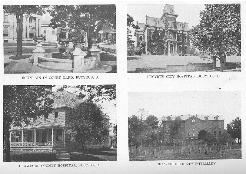
AND REPRESENTATIVE CITIZENS - 77
the Wyandots during that war; that the Wyandots were the only tribe that remained loyal to their American father, and in the latter part of that war it was yandott braves who fought side by side with their American friends, and at the request of the American father delivered all their prisoners to the great general unharmed. The land had to be had, so the eloquence of Between-the-Logs was useless, and finding their land would certainly be taken, the Wyandots made the best of a bad bargain by signing the treaty, and so came in for a share of the payments.
That winter Between-the-Logs and several other chiefs and warriors of the Wyandot, Seneca and Delaware tribes, took "the long trail" east, and one morning presented themselves before the Secretary of war at Washington. The Secretary was very much surprised at their call, and his first words were a mild rebuke that they had come to Washington without his first having received word from the Commissioners of their intended visit. Between-the-Logs tersely replied: "We got up and came of ourselves. We believed the great road was free to us."
They explained why they had felt compelled to sign the treaty as the only way of protecting a part of their rights; that the Commissioners had not treated them fairly, and without their knowledge they had come to the "Great Father" for justice. The Secretary looked the matter up and took them before the "Great Father," President Monroe, who listened patiently to Between-the-Log's eloquent plea for justice for his people. It was found a wrong had been done the Wyandots, so instructions were sent to the Commissioners to rectify this wrong, and the supplemental treaty was made at St. Mary's, on Sept. 17,118.. Article two of the supplemental treaty says :
"It is also agreed there shall he reserved for the use of the Wyandots, in addition to the reservation before made, fifty-five thousand six hundred and eighty acres of land to be laid off in two tracts, the first to adjoin the south line of the section of 640 acres of land heretofore reserved for the Wyandot chief, "Cherokee Boy," and to extend south to the north line of the reserve of twelve miles square at Upper Sandusky, and the other to join the east line of the reserve of twelve miles square at Upper Sandusky, and to extend east for quantity."
They were also to receive sixteen thousand acres of land, commencing a mile north of the
present town of Carey and extending into Seneca county, a tract five miles square; also160 acres in Sandusky county. The Wyandots were also to receive an additional annuity of $500; the Shawanese $1,000; the Senecas $500, and the Ottawas $1,500.
Of the 55,680 acres, 2,240 was in the grant south of that given to Cherokee Boy. The balance was attached to the twelve mile square reservation on the east. This tract entered the present Crawford county just north of the half section line of section 35 in Dallas township, continued east through sections 31 and 32 in Bucyrus township and nearly to the centre of section 33 (the south line was a little over half a mile north of the southern boundary of Bucyrus township) ; it then went north twelve miles through sections 28, 21,16, 9 and 4 Bucyrus township, a trifle over two miles west of the present western line of the city of Bucyrus; through sections 33, 28, 21,16, 9 and 4 Holmes township, three quarters of a mile west of Brokensword; continued north a trifle over three quarters of a mile in section 33 Lykins; then west through sections 32 and 31 Lykins and 36 and 35 Texas, about three quarters of a mile south of Benton. This reserved to the Indians about the western two and a half miles of Bucyrus and Holmes, the northern two miles of western Dallas, the southern half mile of Lykins and Texas, and all of Tod, barring it to settlement, except that with the consent of the Government the Indians could sell the land.
The treaty of September, 1877, with the supplementary treaty of a year later opened to settlement all of northwestern Ohio, except that reserved to the Indians, about 225 square miles. In 181g it was surveyed by Sylvester Bourne and Samuel Holmes. The new territory was known as the New Purchase, and although there was still plenty of land unoccupied that had been purchased from the Indians in 1805, yet the fact of new land being thrown on the market gave it to the settlers a sort of superior value and a feeling that it was a choicer article. Even before the surveyors had completed their work sufficient to place the land on the market at the land offices, settlers were in the New Purchase lookingupp land.
The first settler to enter the New Purchase
78 - HISTORY OF CRAWFORD COUNTY
was Samuel Norton. With him were his wife and six children; his brother-in-law Albigence Bucklin, with a wife, six children and an adopted daughter; and Seth Holmes, their driver and guide. These first pioneers drove through from their home in Eastern Pennsylvania, a distance of about bo0 miles, in a large schooner wagon, and arrived in October, 1819, the Nortons locating their home on the banks of the Sandusky, west of the present Sandusky avenue bridge at Bucyrus, land now owned by Christian Shonert; Bucklin and family were also on the banks of the Sandusky between the brewery and the T. & O. C. road. (Up to half a century ago the main channel of the river was at the foot of the bluff back of the brewery.) Seth Holmes made his first headquarters in an abandoned cabin that was standing where is now the court house yard. A family by the name of Sears were the next arrivals, locating just west of Oakwood cemetery; they remained only a short time and removed to parts unknown. Daniel McMichael came in 1819, and stopped for a time in the eastern part of the county (what is now Polk township), near where Norton and Bucklin also left their families until they could find land that suited them. After Norton had selected his land, McMichael came to the same section and entered land just north of the river: also land in the southwest corner of Liberty township, where he built a mill. In the Spring of 1820 David Beadle came with two sons, Michel and David, and a son-in-law John Ensley, who married Ann Beadle. Michel was married, and had 80 acres on West Mansfield street, just west of Norton, and south of this his father had S0 acres, his son David, a young man of 18, making his home with him.
In 1820 Ralph Bacon settled on the east half of the south east quarter of section 25 in Liberty township. With him and his family came Auer Umberfield as a teamster.
In 1819 John Kent settled in Whetstone township, and in 1820 he was followed by Joseph S. Young, Noble McKinstry, Martin Shaffner and a man named Willowby.
In Dallas township in 1820 were George Walton, G. H. Busby, Matthew Mitchell and Samuel Line.
In Chatfield township in 1820. Jacob Whetstone had erected a cabin and cleared some land. His occupation was that of a hunter; he wandered all over that section and never settled permanently in any one location.
As early as 1820 no pioneer had settled in Cranberry, Lykins, Holmes, Texas or Tod.
In 1820 there were about sixty known families in Crawford county, and counting all the members of those families there must have been between five and six hundred people in what is now Crawford. Heading the list was Disberry Johnson of Polk with a wife and 17 children, while on the section adjoining was Samuel Brown with a wife and several children, so that in 1820 the metropolis of Crawford county was in western Polk. Christian Snyder was in Jefferson township with a wife and eleven children, and in the same township was Westall Ridgley and Jacob Fisher each with a wife and eight children. In Bucyrus was Samuel Norton with a wife and six children, and Albigence Bucklin with a wife and seven children, one an adopted daughter. The "metropolis" (the largest population in one section), only remained in western Polk for about a year when the settlement of Bucyrus transferred it to that place, where it remained until the census of 1870 transferred it to Galion, where it remained for forty years until the census of 1910 again transferred it to Bucyrus.
The early pioneers came from New England and Pennsylvania and New York with a few from Virginia. They came in wagons drawn by one horse or a yoke of oxen, sometimes a two horse wagon, always weeks on the trip and sometimes months, and with the exception of a very few all took tip their claims in the forest where the land had to be first cleared to give them the ground for the raising of their crops.
Having selected his land the first work of the pioneer was the erection of some shelter for the protection of himself and family. Sometimes the pioneer left his family with friends or relatives in one of the eastern counties, and came on foot with his axe and rifle. erected his little cabin, and returned for his family. The cabins were all of logs, the "lean-to" the most primitive, which was simply a three-sided shelter, built of saplings, and very small logs, sloping to the ground at the rear, with only the two sides and the slop-
AND REPRESENTATIVE CITIZENS - 79
ing roof, the front being hung with skins as a protection from the wind and rain. These cabins were similar to the hunters' "camps," and in only a very few cases did the early pioneers of Crawford start with so crude a shelter.
The early pioneers brought very little with them except large families; some had practically nothing; others had a few chickens, a few hogs, sometimes a cow, and some no more stock than the horse or the yoke of oxen that had brought them on their long and toilsome journey in the one wagon. Some came on foot, carrying their little all on their backs.
With the first pioneers in the different sections it was impossible to build a cabin of very large logs. The first arrival selected his site, cut down the smaller trees, and from these made the logs which he could handle alone, and with these logs he built his home, chinked up the cracks with mud, covered it with saplings and brush, and had a place to live. As neighbors came within a radius of several miles the pioneer had an easier task. He selected his site on some dry ground, near a stream or spring that would furnish him with water, a site where most of the trees were of the uniform thickness for the logs he desired; these trees he felled himself, cut them into logs of the proper length, beveling the ends so they might fit as closely together as possible. Everything being in readiness the neighbors came, and the cabin was erected by strong and willing hands, the pioneer adding the roof, and also the door and perhaps a window at his leisure. The general size of these earlier cabins was 14 to 16 feet long, with a heighth of six to eight feet. The ground logs were first placed in position, and on these the additional logs were piled, the beveling and notching of the logs holding them in place at the corners. As the cabin increased in height, these logs, a foot in diameter, had to be lifted into position, which was done by the strong arms of the men, some with hand spikes and skid-poles, and when it came to the gable logs at the ends, each shorter than the one below it, they had to be held in place until the ridge pole and cross pieces were in position. In the erection of the cabin the responsible positions were the corner-men, men with a clear head and a quick eye, expert with the axe, who notched the logs as
they were lifted into place. The building of these cabins was not without danger, for sometimes, fortunately seldom, a heavy log slipped from the hand-spikes or the skid-poles, while strong arms beneath were shoving it into position, and an accident occurred, a broken arm or leg of some one caught beneath the heavy log. Sometimes a life lost. Leveridge was killed at a cabin raising where the city of Galion now stands, and a year or two later, in 1822, Heman Rowse was crushed to death by a falling log at a cabin raising a mile south of Bucyrus.
The cabin erected, the pioneer put on his own roof, made of clap-boards, cut as thin as he could make them with an axe or an adze, and over the cracks a second layer. He chinked and daubed the sides, filling in the cracks between the logs with moss and sticks, plastering it with mud, both inside and outside the cabin. This daubing had to be renewed nearly every year, as the rain softened the mud and washed it away. The chimney was built on the outside, at one end of the cabin. The base of the chimney was generally of irregular stones, plastered with mud, while the upper portion was sticks laid rail-pen or corn-cob fashion and plastered with mud. Sometimes where stone was scarce, the entire chimney was of sticks plastered with mud. The fireplace was sometimes so large that logs six to seven feet in length could be burned in it, the "back log" being so heavy it had to be towed or snaked into the cabin by a horse, and it took strong arms to roll it into position, where it would burn for a week. There was an advantage to the pioneer to keep a roaring fire, as all the wood he burned meant so much more of his land cleared.
The door was a crude structure, the logs being cut away in the front of the house, and the door made of lumber roughly split from the logs with bars across to hold it together, and hung with wooden or leather hinges. A wooden bolt was inside the cabin, which fitted into a groove, and this bolt could be raised from the outside by means of a latch-string of deer hide, which ran through a little hole above the bolt, and hung outside, hence the expression, "the latch string is always out." All that was necessary to lock up the house was to draw the string inside, but this was seldom
80 - HISTORY OIL CRAWFORD COUNTY
done even at night. After his cabin was erected the pioneer took his time to building his door, and until this was done, the opening was covered with skins to keep out the wind and rain, and a large fire kept burning on the outside at night to keep away the wild animals that were prowling through the forest. If .i window was added a small section of the logs was cut away, the same as for the door, and the opening was covered with greased paper or the thin skin of some animal, glass was too expensive, besides there was none to be had in the early days in the wilderness.
In fact nearly every one of the earlier cabins was completed and occupied for years with not a nail or a screw or a piece of metal used in its construction; everything of wood and leather, and that leather the skin of some animal of the forest.
Some cabins had the bare ground for a floor; others had a puncheon floor, boards split from logs and smoothed as well as the work could be done with an axe. If a small article slipped through the cracks all that was necessary was to raise one of the puncheons and recover the missing article. If the cabin was of sufficient height, it boasted of a loft, puncheon boards being laid across where the slope of the roof commenced. This made a sleeping place for the children, and was reached by climbing up a ladder and through a hole cut in the boards. This was also the guest chamber, the visitor mounting the ladder to his sleeping apartment and crawling on hands and knees to his bed, which consisted of a tick stuffed with dried leaves, with plenty of skins and furs. Here he could listen to the pleasant patter of the rain on the clapboard roof, sleep soundly, and in the morning at the rear of the cabin find a wooden washbowl, get his own water from the spring or well, and prepare himself for the wholesome breakfast.
Some of the early pioneers brought small articles of furniture with them, but in most cases much of it was made by hand after their arrival. The table was a wide hoard, carved with an axe and supported by legs cut from small saplings; the bed was made the same way, and the primitive cupboard with its few rough shelves was handmade. On these shelves were the dishes; the one or two cooking utensils of iron or pewter; the few dishes brought from the old home, and the others of wood, made in the evening from the buckeye; plates and saucers and basins of wood. Occasionally there were knives and forks, but not enough to go around, and wooden ones took their place, the hunting-knife of the pioneer being the carving knife for the meal.
Game was abundant, and without leaving his little clearing the early pioneer could easily secure an abundant supply of meat; deer and turkey were plentiful; so were the smaller game, rabbit and squirrel, but powder and ball were too expensive to waste in killing these, except in case of absolute necessity. Bread was the scarce article and at times had to be used sparingly. After his first crop the pioneer diet was game, potatoes and cornbread, with cranberries, honey and dried apples as the luxuries. On important occasions they indulged in wheat bread, and even served tea. There were no stoves, and the cooking was done in the large fire-place, the kettles or pots hung on an iron or wooden crane suspended over the fire. The frying pan had a long wooden handle, and was used for cooking both the meat and the corn cakes, either held over the fire or placed on a bed of burning coals drawn out over the hearth.
Bread was baked in a covered "bake kettle," and under and over it was a bed of burning coals constantly renewed. Later, many pioneers had a bake oven built of stones and mud near the cabin. Sometimes the bread was baked in the hot ashes underneath the fire, or on a board tipped up in front of the fire. It was in this manner the true "hoe cake" was baked, the broad hoe being used for the purpose, which gave it its name; also called "johnny-cake," a corruption of journey cake, bread in convenient shape for taking on a journey. Corn was the staple article of diet, and was cooked in several ways: it was made into hominy or boiled into mush; cooked in a covered oven as corn pone; cooked in front of the fire as johnny-cake, or cooked in round balls as corn dodgers. Like the old New England woman who never baked anything but apple pies, she always responded to inquiries as to what kind of pies she had, that she had three kinds: "open-faced, kivered, and crisscrossed." The pioneers had the same variety in their corn-bread; and it was a variety, as
AND REPRESENTATIVE CITIZENS - 81
the various ways of cooking gave a different taste to the bread. There were times after the husband had returned from one of his long journeys to the mill that the good house wife became the envy of her neighbors by actually serving them with wheat bread when they called.
Potatoes, both Irish and sweet, were baked in the ashes, and although the ashes had to be brushed off, this manner of cooking was then, as it is today, the most palatable and wholesome way of preparing the food. A haunch of venison, a piece of pork or beef, and turkeys were cooked by suspending in front of the fire, and constantly turning them, while beneath was a pan which caught the drippings.
Before mills were within easy reach, every pioneer was his own miller, and ground his own grain. His mill consisted of a solid stump into which he cut or burned a hole in the shape of a mortar, and in this placed a quantity of corn, and with a heavy block of wood or stone pulwerized the grain by constant pounding. A more advanced way was to have the pounder attached to the end of a pole like a well-sweep, so that heawier pounding could be done and a larger quantity of grain pulverized more rapidly. In this way sometimes half a bushel of corn could be placed in the hollowed out stump at one time. The grain once pulverized it was sifted into three different grades for use, the coarser grade requiring six to eight hours of cooking before it was thoroughly prepared for food. These stump mills were known as Indian mills, and for centuries all the grain used by the Indians had been ground by the squaws in this manner.
If the pioneer had not located beside a stream or spring, his first business was to dig a well ; water was generally to be found in this county at a very fete feet. The well was lined with stones of all sizes, plastered with clay, and a well-sweep easily constructed ;—a long heavy pole hinged in a fork at the top of a tall pole, and a rope or chain to which the bucket was attached. It was a very simple contrivance and the water could easily be drawn from the bottom of the well. In parts of the county, notably the plains, the wells were made by sinking a hollow sycamore into the ground, but the water was a very poor article, and generally very unhealthy; sometimes the well was made of wood.
Having prepared a place in which to live, the next business of the pioneer was the clearing of his land, and the trees were felled and cut into logs. He then secured game in abundance from the surrounding forest, went to the nearest settlement, sometimes a two days' journey, where he secured what provisions he must buy, and the whisky, which was regarded as a necessity in those days. Everything being in readiness, the neighbors came from miles around, and willing hands soon rolled the heavy logs into piles, making sport of the work by dividing the party into two sides and separating the logs equally, each side endeavoring to be the first to pile up their logs, the victors being rewarded by the first drink from the jug, while the thirsty vanquished patiently awaited their turn. The immense piles were set on fire, and walnut and wild cherry, oak and maple, and ash and hickory, worth more today many times over than is the land itself, were burned as useless. Inside the cabin the women had not been idle, and the rough hand-made table was covered with good wholesome food to which perfect health and the best of appetites did ample justice, and a dance generally followed, in which old and young alike joined. To these gatherings at the call of some new neighbor, every pioneer was glad to respond. They gave their time willingly, and freely and frequently. One of the pioneers in his notes of these early days says that in one year he put in twenty-nine days responding to calls for assistance at cabin-raisings and log-rollings.*
The wifely duties did not stop at the cooking. To her also fell the preparation of much of the clothing for the family, she doing the spinning and the weaving. The spinning wheel was to be found in nearly every cabin on which the yarn or the flax was spun. Some early settlers brought sheep, but there was no protecting them from the wolves, and it was years before any sheep could be raised in the county. From Knox county, and what is now Morrow. the pioneers made long journeys through the wilderness, and brought back a few pounds of wool. This was carded and
* John O. Blowers. Liberty township.
82 - HISTORY OF CRAWFORD COUNTY
made into rolls by hand cards, and the rolls spun on the wheel. A common article of apparel was the linsey-Woolsey, the chain warp being linen and the filling or woof of wool. This made the dresses for the women and girls, and jeans were woven for the men's clothing. The skins of the deer and the coon were made into garments for the men, and even the little girls sometimes had dresses of fawn skins, colored and fringed and prettily picturesque. These homemade fabrics were dyed with walnut, indigo or copperas, and striped or checkered goods were easily made by dying the yarns the different colors before they were placed in the looms.
The pioneer was also his own shoemaker and hatter, tanning his own hides in a vat made of a hollow log sunk in the ground, and in the evening by the fireside making his own shoes, and those for the family.
The costume of the men was a hunting-shirt hanging loose, made of skins or of woolen made by his wife. It was a sort of blouse, belted at the waist, and inside this loose blouse was the storehouse for his day's provisions and any small articles he might need; his breeches were of deer skin, comfortable and warm in dry weather, but in wet weather very uncomfortable and disagreeable, and then it was that at night he never threw them on the floor, but when he. succeeded in getting them off, leaned them against the wall for use in the morning, when he again put them on with the sane ease and comfort that a man might experience in incasing his legs in a couple of stove pipes. His shoes were of his own make, as heavy a sole as possible, with the tops made of skins reaching above the ankles and laced with thongs of deer skin. In summer he used the softer moccasin. His head was covered with a coonskin cap, or a hat made of the skin of some animal, cured and pressed by himself, and made into whatever shape or style that best suited his fancy.
The women were clothed mostly in linsey Woolsey garments made by themselves of the raw material; a linen waist of flax they themselves had spun; heavy shoes and stockings, all home made, and in winter gloves of buckskin made by themselves.
As late as 1845 a young boy came to Bucyrus from one of the townships to get the advantage of the better schools the village afforded and he wore his coonskin cap and buckskin breeches, his shoes being home-made by his father or himself, and forty years after this a familiar figure on the streets of Bucyrus was one of the pioneers always wearing his deerskin vest.*
On his first cleared land the pioneer planted wheat, corn and potatoes, a few other vegetables, and a small patch of flax from which to make the clothing. Some had a crude plow they had brought with them; others made their own, and the harrow was also of their own make, sometimes rough brush drawn over the ground. The grain was harvested with a sickle or scythe, the former being the most convenient on account of the many stumps, and near these stumps the hunting knife was used. The wheat was threshed by spreading it on the barn floor, and having the patient oxen tramp it out, or the pioneer with his heavy shoes doing the work himself by tramping, or with a flail. It was winnowed by taking a heavy sheet and with men at the corners swing it rapidly over the grain, creating a wind to blow away the chaff, if the pioneer had to depend on himself alone, he selected a day with a good wind, and filling a bucket with the grain held it as high above his head as his arms could reach, and slowly poured it out, the wind blowing away the chaff. Two or three pourings soon had the heavier wheat fairly separated from the lighter chaff.
Prior to 1820 there was not a grist mill in Crawford county, so the pioneer pounded his own grain into the best flour he could in his hollow stump, sometimes using a hand mill similar to our old-fashioned coffee mills. In this it took an industrious housewife several hours to grind a very little quantity of meal. Another device for corn in an emergency was the grater—jagged holes punched in a piece of tin or iron, and taking an ear of corn rubbing it over the rough edges. It took about four hours by this process to get enough meal to give each member of the family a very small taste of corn-bread in the morning. Some of the pioneers state there were times when the
* Thomas Fuhrman, father of Mrs. Geo. Donnenwirth and Mrs. A. J. High.
AND REPRESENTATIVE CITIZENS - 83
cornmeal was so scarce that the family were all put on an allowance.* With the early settlers the nearest mill was miles away, the principal ones being at New Haven in Huron county; Fredericktown and Mt. Vernon in Knox county; one three miles southeast of Mansfield, and another at Lexington in Richland county. There were no roads, only trails through the forest, and the settler loaded his sacks of grain on the horse and started for the mill, leading his horse the entire distance, sometimes compelled to wait his turn at the mill. The trip took two to four days. The return journey he might ride, as the load of the horse was much lighter the miller having taken from a fourth to a half of the grinding as his share. If the pioneer had no horse, he made the long journey on foot, carrying what grain he could on his back. Very soon mills were started nearer home, generally a horse mill, run by horse or ox power, erected by some enterprising settler for his own use; to this the neighbors came, using their own horses or oxen to furnish the power to run the mill. The mills were very crude in construction, and sometimes four horses had to be attached to move the clumsy machinery. It was also slow work and the meal ground very coarse. Water mills w ere built along the little streams, but on account of the smallness of the streams in this county when there was enough water to run the mills, the ground was almost impassable, and during the summer season when the trails could be used, there was no water in the streams and the mills were idle, and in the dead of winter the streams were frozen, so the pioneer had difficulty in keeping a supply of meal on hand. It was years before the conditions of the roads improved in many sections, and as late as 1845, E. B. Monnett now living in Bucyrus, started with a four-horse team from his father's farm in Dallas township with half a dozen sacks of wheat to be ground at the mill at Wyandot. Small as the load was the team was stalled, and he had to secure additional help to get the wagon through the marshy ground. As late as 1837 when the farmer took his load of grain to Sandusky it took from six to seven days to make the trip on account of the had roads; he received his
* Lewis Cary, Bucyrus.
50 to 60 cents a bushel for his wheat, and brought back a consignment of goods for some merchant for which he was paid about 50 cents a hundred pounds. Goods for the eastern part of the county and some for Bucyrus were hauled overland from Philadelphia and Baltimore. Generally for Bucyrus they came by water to Sandusky, and were hauled from there by land. The freight charges reached as high at times as four dollars a hundred pounds so nothing but absolute necessaries could be shipped.
With the early pioneers there was an abundance of game, but as the county became more populated game became scarcer, but the pioneer had brought with him cattle and hogs. The hogs ran at large, fattening on the nuts and grass of the forest; on the rattlesnakes and small vermin, and they became wild. While wolves prevented the raising of sheep, experience soon taught them to let the wild hogs severely alone, and even the few bears found discretion the better part of valor and left the hogs to root in peace, and unless very hungry never molested them. Each farmer had a special mark for his hogs, but in their wild state they were very prolific, and many of them were practically common property. As to those marked and half wild, sometimes a pioneer was near-sighted and failed to recognize the mark of his neighbor on the hog he had shot—but in the main they were honest and the wild hogs of the forest and the rapidly increasing stock of cattle made up for the constant lessening of the wild game.
Another plentiful thing was honey, which could be gathered by the pioneer himself or purchased of the Indians or the bee-hunters. The Indians also supplied the pioneers with an abundance of cranberries when in season. Many of the pioneers became experts in bee-hunting, narked the trees in the summer, and in the autumn gathered the harvest, which was not only a welcome addition to the family provisions, but was an article almost sure to bring cash in the market, 50 cents a gallon.
There was very little money in those days, business being carried on by exchange, the storekeeper being the clearing house. He gave the pioneer credit of about a cent a pound for the hogs he delivered, and two cents for his cattle; 25 cents each for his coon and mink
84 - HISTORY OF CRAWFORD COUNTY
skins, and $1 for a deer hide; 40 cents a bushel for his wheat and three cents a dozen for his eggs and the same price per pound for his butter, and sometimes would not take his butter and eggs at any price, but he was glad to get the honey at fifty cents per gallon. In return he charged his customer with $2 to $3 a pound for tea, and very few charges too as not many could afford the luxury of tea; 75 cents a pound for coffee; $5 for a barrel of salt that weighed 50 pounds; $2 a pound for powder and 25 cents a pound for lead; $2 a yard for calicoes and prints; and the only cheap thing was the whisky at fifty cents a gallon. Everybody used it in those days and it was regarded as more of a necessity in the house than tea or coffee, and few social gatherings were complete without it. Money was not an absolute necessity as even the county officials, with a salary of $50 to $100 a year, were in some other business, and taxes could be, and were, paid in skins or produce, which the treasurer turned into cash. The merchant, too, when he sent his skins and produce to the market, exchanged them for the goods he needed, paying or receiving the balance in cash.
On the arrival of a neighbor a trail was blazed through the woods so the nearest families could visit back and forth without getting lost in the forest, and the women folks made their friendly calls. Then it was the hostess did the honors, proudly displaying all her little cabin possessed. In one case all the newcomer could boast of in the line of a cooking vessel was a solitary pewter pot, but it was bright and glistening from the polishings it received through its constant use. But to her it was enough. She placed it on the fire, and in it the pork was tried into lard, and in the same vessel the cakes were fried in the lard; it was washed and cleaned and in it the short cakes were baked; then it was used as a bucket, taken to the spring and filled with water, again placed on the fire and the water boiled, and it being her first "state occasion" a little tea was taken from her meagre store and the meal served to her first guest in her new home, all prepared in the one and only cooking vessel she possessed.
Strangers were always welcome and every traveler received a hospitable reception. If he was in search of a location he was doubly welcome, and the pioneer dropped his work to show his visitor all the best sites in the neighborhood that were yet on the market, and if the stranger did enter land in that section he was welcome to bring his wife and family of half a dozen children to make their home with him until he and his sons and the neighbors had erected a cabin for the newcomer. If a settler arrived in the fall the neighbors all kept a careful watch that he suffered for nothing until he could clear his ground and raise a crop of his own. It was not uncommon to make the newcomer a present of land to induce him to locate in their neighborhood, and in one case in this county a pioneer induced a man to remain by selling him eighty acres off his own land for $100, taking his pay in a note due in one hundred years without interest.* The note is not yet due, but will be in 1920.
The homes of the early settlers were indeed far in the wilderness for it took from two to four weeks for their mail to reach them from their old homes in the East, and when a letter did arrive it was marked "clue 25 cents," for postage in those days need not be paid in advance and the charge was according to distance. Neither was the letter always sent to where the addressee lived, but to the nearest postoffice. Prior to 1823 the postoffice of residents of Crawford was Mansfield or Delaware, and the pioneer store-keeper going to one of these places brought back whatever letters were there for any one in his neighborhood. When a postoffice was established at Bucyrus in 1823, that little village received the letters for residents for miles around, those of Whetstone, Liberty, Sandusky, Chatfield, Lykins, Holmes, Texas and Tod townships all getting their mail at Bucyrus. When a letter did arrive for some settler the watchful postmaster requested some man who happened in from that section to notify his neighbor that a letter had arrived for him. The pioneers were generous: they shared with those in need; of the stock or game killed many a neighbor received a portion; but he could not put up the 25 cents for the letter due, because money was something he did not have. But he was still the true neighbor, and after reaching home, when the evening work was done, he went through the woods to the home of his neighbor, several
* Benjamin Sharrock, Polk township.
AND REPRESENTATIVE CITIZENS - 85
miles away, and notified him that there was a letter in the postoffice for him. Now the scene of anxiety is transferred to the little farm they have nothing to dispose of, but the postage must be raised to secure the news from home, so the hens are "summoned to duty," and after patient watching and waiting eight dozen eggs are gathered and the pioneer goes to Bucyrus and exchanges his eight dozen eggs for the "24c due" letter, and returns to his clearing to read over and over again the news from the old home anywhere from a month to six months old.
There was no class of people more welcome among the pioneers than the traveling minister. Long before the first white man had ever dreamed of settling in this wilderness, these faithful servants of God had risked their lives, and many lost them, too, in preaching the Gospel of Christ to the savages. And when the settler came, these ministers, on foot or on horseback, wandered through the sparsely settled region, and the largest cabin or barn was the meeting place of the settlers for miles around to hear once more the word of God. It was not denominational preaching; sometimes it was one creed, sometimes another, but a minister of any denomination was welcome, and although a man may not have been a professing Christian, if his cabin were the larger or the more central it was used for the services, and it was an honor and pleasure to him to entertain the minister. Later the different denominations became numerous enough to hold services of their own special creed at irregular intervals. Violent pulpit oratory was regarded as more necessary in those days than at the present time, and the preacher soared to his highest flights in picturing the terrors and horrors of a brimstone hell. The construction of his sentences, as far as grammar was concerned, was a secondary consideration, and frequently was a neglected art. The loudest in their oratory, both in preaching and in prayer, were looked upon as the better Christians, and when one of these became thoroughly warmed up to his work his prayer could be heard for half a mile.
Among the more religiously inclined morning and evening services were held, the head of the house reading a chapter from the well-worn family Bible, giving out a hymn in which all
joined in the singing, and closing with one of his far-reaching prayers. If a guest were present, known to be a Christian, by courtesy he was asked to lead in the family services, and if he failed to "loosen the rafters" in his instructions to the throne of grace, the thoroughness of his conversion was doubted, and he was never again invited to lead in prayer in that household. Many others were milder in their forms of worship, but among the more zealous the religion of most of the milder class was looked upon with suspicion, and hopes and prayers were freely offered that the scales might fall from their eyes and they become truly converted. But as sure as "the groves were God's first temples," so the purest and truest of religion existed in the hearts of these pioneers. No destitution was so severe in his own family that he ever failed to share the little that he had with his poorer neighbor; no sickness ever invaded any family in his section when he failed to respond with sympathy and with succor; and when the icy hand of death had robbed some poor struggling family of a loved one, every pioneer's heart beat in sympathy with his sorrowing neighbor, and every pioneer's hand tendered assistance and relief. They were true Christians in the broadest and best sense of the word, and in the books above where the recording angel has written the list of those who loved their fellow men, the names of these early pioneers will be found leading all the rest.
Each settler was his own doctor, and the minor diseases were cured by their own simple remedies. In the loft of each cabin, or in the cabin itself along the wall, hung the wormwood and pennyroyal, sassafras and sage, tansey and catnip, and other herbs and barks gathered and dried for sickness, and the minor cases were cared for with these simple ingredients. In each neighborhood some man was depended upon to set a broken leg or arm, and it was fairly done with no charge, the patient on his recovery as a remembrance of the kindly act sending around a deer he had shot. But there were times when the disease or the accident was beyond the knowledge or the skill of the household or the neighbors. Then it was one of the family or a kindly neighbor started through the woods anywhere from ten to forty miles for medical aid, and a day or two later
86 - HISTORY OF CRAWFORD COUNTY
returned with the doctor on horseback, with his saddlebags containing his wonderful medicines, who gave what treatment he thought the patient needed, and left advice for future care, for the distance was too great to make a second call possible. He was paid for his trip, if there was anything to pay with—a little cash, or some skins or some provisions; perhaps nothing, and a year or two later receive a wagon-load of potatoes or of corn, some choice skins, or a cash payment from the pioneer who had not forgotten his faithful services. The doctor was satisfied; he had gone the toilsome journey as an errand of mercy and as a professional duty, and the pecuniary reward was a secondary consideration.
But the pioneers had their pleasures as well. They had their cabin-raisings and their log-rollings; and they had their shooting matches, for markmanship with the rifle was their highest sport. Then there were the quilting-bees and the husking-bees, and after the work was over many provisions were eaten and much whisky drank. Whatever the occasion for the gathering may have been it was followed by a most bounteous meal of the wholesome provisions that the forest and the farm could supply, and always enjoyed, for good appetites were never lacking in those early days. The natural result of these gatherings and the dances with which the occasions closed, were the weddings, where the bride was complimented and admired, resplendent in a new calico gown that cost $i a yard and was made by herself out of five yards of goods; the happy groom, envied and congratulated, his hair smoothed and plastered to his head and polished and glistening with a superabundance of bear's grease. And after the wedding the feast, the long table so crowded and covered with the good things prepared that no one could see that a table cloth was lacking. After the feast all the young folks escorted the bridal couple to their new hone, which was another little log cabin in the forest, but its building and furnishing had been the willing work of the young husband for many an evening after his day's work had been completed on his father's farm.
Sometimes and frequently, the angel of death invaded the household, and a parent or child was called away. If a child, it was the father who went sorrowfully to the woods and selected the straightest tree from which he made the little coffin, lovingly staining the wood with walnut, and tenderly covering his rough work with ferns and flowers, and the neighbors came from miles around, and in some pretty and quiet spot on the little farm the body was placed in its last earthly home, one of the elderly pioneers conducting the services with preaching and with prayer. If it was the husband called away, the duties of caring for the family fell upon the stricken wife, and many a boy of eight or nine became the useful assistant of the widowed mother as the provider for the younger members of the family. If help was needed, the pioneer neighbors, after their own hard day's work was done, assembled of an evening at her little clearing, and prepared the land, and planted the seed, and harvested the crop, and kept up their kindly work until the children were old enough to care for the family.
So the pioneers of Crawford settled the county, passing through frequent trials and undergoing many privations, with certainly one redeeming feature in their own experience in the wilderness, and that was that by the time the first settler placed his foot on Crawford soil, the Indians had been so thoroughly whipped and cowed into submission that no settler's cabin in this county was ever burned, and no pioneer was ever murdered and scalped by the savage tribes, as was so frequent and so harrowing in the eastern and southern counties in the earlier days.
Slowly but surely the primitive cabins gave way to those of hewn logs and to the double log cabins; and these were in turn followed by a few frame houses, and an occasional brick residence. Each year the acreage of cleared land increased; new roads were laid out and the earlier ones improved; little settlements were started which became villages, grew into towns, and expanded into cities, and the wilderness of a century ago became the rich and fertile fields and farms, and the busy and prosperous villages and cities of today.
On Feb. 12, 1820, the Legislature passed an act erecting a county which they named Crawford, after Col. William Crawford, who was burned at the stake in 1782 within the confines of the county then created. In 1820 the present county of Crawford had within its borders
AND REPRESENTATIVE CITIZENS - 87
less than a hundred settlers, who with their families numbered about 500 persons. As nearly as can be gathered the principal settlers up to 1820 were as follows:
Auburn Townships. 1814—Jedediah Morehead, John Pettigon. 1815—William Green, Samuel S. Green, Jacob Coykendall, John Deardorff. 1816 —Aaron B. Howe. 1817—William Cole, Charles Morrow, 1818—Levi Bodley, Lester Bodley, Jesse Bodley, John Bodley, David Cummins, Charles DeWitt, William Laugherty, Henry Reif. 1819—Adam Aumend, Adam Aumend, Jr., Samuel Hanna, Resolved White1820—Rodolphus Morse, Erastus Kellogg, Jacob Snyder, Palmer Halse, Daniel Hulse.
Bucyrus Township 1819—Samuel Norton, Albigence Bucklin, Seth Holmes, ____ Sears. 1820—Davidid Beadle, Michael Beadle, Joseph Ensley, William Young, George Young, John Young, Joseph Young.
Chatfield Township 1820—Jacob Whetstone.
Cranberry Township. No one.
Dallas Township 1820—G. H. Busby, Samuel Line, Matthew Mitchell, George Walton. Charles White.
Holmes Township. No one.
Jackson Township. 1820—Joseph Russell, John Doyle.
Jefferson Township 1816—Jacob Fisher. 1817—Christian Snyder, Westell Ridgley, Peter Beebout, Thomas Ferguson, J. S. Griswel. 1818—John Adrian, Lewis Leiberger, James Nail.
Liberty Township. 1819—Daniel McMichael 1820—Ralph Bacon, Auer Umberfield.
Lykins Township. No one.
Polk Township. 1817—Benjamin Leveridge, James Leveridge, Nathaniel Leveridge 1818—Nehemiah Story, Nathaniel Story, Father Kitteridge, Benjamin Sharrock, George Wood, David Gill 1819—Samuel Brown, Michael Brown, Asa Hosford, Horace Hosford, Disberry Johnson, John Sturgis. 1820 - J.J. Dickerson, David Reid, William Hosford, ____Pletcher.
Sandusky Township. 1819—Samuel Knisely, James Gesell. 1820—Samuel Shull, Mathew Elder.
Texas Township. No one.
Tod Township. No one.
Vernon Township 1818—George Byers 1819—David Anderson, Andrew Dixon.
Whetstone Township. 1819 —Johnhn Kent. 1820—Noble McKinstry, Joseph S. Young, Martin Shaffner, John Willowby.
CHAPTER V
ORGANIZATION OF THE COUNTY
First Elections—Boundaries—First Taxes—Early Roads—Location of County Seat—Col. Kilbourne's Proposition—Settlement of Bucyrus—Crawford County Organized—The Fight on Commissioners—Their First Proceedings—Readjustment of Township Lines, 1831-1835—Indian Purchase, 1835—The Leiths—Justice Garrett—Formation in 1845 of Crawford County as it Now Exists—Later Township Changes—New Roads—The Courts— Contest for County Seat—Donations of Leading Citizens—Erection of Court House— Visit of General Harrison—The County Jail—Population of Crawford County in 1830 and 1850—Construction of Railroads—New Court House—Improvements—The Court House of 1856—The New Jail—Care of the Poor—Abuses of the Old System—The County Infirmary— More Roads—Difficulties of Travel in Early Days—The Mails—Turnpikes and Stage Routes—Early Stores—Population by Townships—List of Residents in 1826.
Toil swings the axe and forests bow;
The fields break out in radiant bloom;
Rich harvests smile behind the plow,
And cities cluster round the loom.—Anon.
On Feb. 20, 1820, the Legislature passed a act creating fourteen counties out of the territory purchased from the Indians in 1817—Crawford, Allen, Hardin, Hancock, Henry, Marion, Mercer, Paulding, Putnam, Sandusky, Seneca, Van Wert, Williams and Wood, Later, from these counties, were erected Auglaize, Defiance, Fulton, Lucas, Ottawa an Wyandot, the latter being formed almost ex elusively from Crawford in 1845, taking 28 square miles from this county, 47 fror Marion, 45 from Hancock and 24 fror Hardin. The new, county of Crawford a erected in 1820 was 18 miles from north t south and thirty-three from east to west, or 594 square miles. Its northern boundary was the same as today; its southern boundary tw miles north of the present county line. On the cast it commenced on the present eastern boundary of Cranberry and Sandusky townships, and extended west to seven miles beyon Upper Sandusky, the present western bound aries of Crawford, Salem and Mifflin townships in Wyandot county. As surveyed the territory was townships 1, 2 and 3 in ranges 13, 14, 15, 16 and 17 east, and the western half of townships 16, 17 and 18, in range 21 west. The new county of Crawford, not having sufficient population, and not having sufficient taxable property to bear the expense of a county government, was placed temporarily, with its sister county of Marion, under the jurisdiction of Delaware county.
The first act of the commissioners of Delaware relating to Crawford county was on March 9, 182o, when they passed a resolution creating that part of Crawford county lying west of what is the western boundary of Bucyrus township into a township to be known as "Big Rock, and an order issued for the election of township officers."
On June 5, 1820, another resolution was passed creating the township of Harmony, which was that part of Crawford county, extending from the present western boundary of Bucyrus township to the Richland county line, which was then the present western boundary of Auburn and Vernon townships. Crawford county was now two townships. Harmony
township (all of Crawford east of the western
AND REPRESENTATIVE CITIZENS - 89
boundary of Bucyrus township) is never again mentioned in connection with Crawford county, but later in the Delaware records this territory is referred to as Sandusky township, so it is probable that when the action of the commissioners was referred to the court for approval the name of the township was changed to Sandusky. This is indicated from the fact that the Delaware commissioners on Dec. 23, 1822, passed the following:
"Ordered, that all that part of Sandusky township which lies west of the middle of the seventeenth range of lands be and the same is hereby erected into a separate township by the name of Bucyrus."
Prior to this. the Delaware commissioners had erected the township of Crawford, which was six by eighteen miles in size, and embraced what is now Texas township, Crawford county, and Sycamore, Tymochtee and Crawford townships in Wyandot county. Here an election was called, the first in the new county of Crawford. It was held on April 1, 1821, at the home of Henry Lish, who ran a ferry across the Tymochtee on the road leading from Upper Sandusky to Little Sandusky (Fremont). There were just thirteen voters present, and fourteen offices to fill, and Elijah Brayton was the man elected to two offices.
One of the last acts of the Delaware commissioners relating to Crawford County was on March 2, 1824, when they created the township of Whetstone, as it exists today, except that in the rearrangement of Crawford county in 1845, two miles were added to Whetstone on the south from Marion county.
On June 6, 1821, the first taxes were Ievied in Crawford county, and the commissioners decided to levy the taxes "to the full extent allowed by law, to wit: horses, 30 cents each; cattle, i0 cents each; houses, &c., the one-half of one per cent."
The principal business of the Delaware commissioners relating to Crawford county was the matter of roads. On Dec. 5, 1821, they granted the position for a road commencing in Marion county and joining the State road from Columbus to Portland (Sandusky) at a point near Sharrock's mills. On this road Conrad Roth was one of the viewers, and James Kilbourne the surveyor. On March g, 1822, a road was petitioned for through what is now Wyandot county, on which William Holmes was one of the viewers. On June 3, 1822, John B. French presented a petition for about the present road from Bucyrus to DeKalb, running east, south of the Sandusky river, and crossing that stream at the old Luke tavern. Michael Beadle, Joseph S. Young and Daniel Palmer were appointed the viewers and John Marshall, the surveyor.
Westell Ridgely presented a petition for the present road from Leesville to Bucyrus, on Dec. 2, 1822.
In May and June of 1822, Col. James Kilbourne surveyed the present Sandusky pike. His surveyor's notes show that nearly a mile n0rth of where the road crossed the Brokensword it passed through a pondy swale half a mile wide, and a half a mile further they cut through the "southwest bend of the great marsh."
On Jan. 20, 1823, the commissioners granted the petition for a road from the "Upper Sandusky fort to the Richland county line." It passed Crawford on the present boundary line between Bucyrus and Dallas township, and on to Galion. On Dec. 3, 1822, James Kilbourne presented a petition for a road starting in Marion county, passing through Whetstone. and Sandusky, and "crossing the Sandusky river below the mouth of Lost Creek, and then angling northwest to strike the Columbus to Portland road. This road is probably the one that joins the Portland road at West Liberty. Amos Earl and John B. French were two of the viewers.
Dec. 1, 1823, Zalmon Rowse petitioned for a road commencing at Sandusky avenue, Bucyrus, and running east along the south line of Norton's property, the present Middletown road. Thomas McClure, Auer Umberfield and John Maxfield were the viewers. There had been some irregularity in the papers for the road from Leesville to Bucyrus, by Westell Ridgely, so on Dec. 2, 1823, it was petitioned for again by Asa Howard, and three of the viewers were John B. French, Amos Earl and Amos Utey, and this time the road was laid out.
In 1821 James Kilbourne had gone through where Bucyrus now is, looking for a location for a road from Columbus to the Lake, a road having already been built from Columbus to Norton, in the northern part of Delaware
90 - HISTORY OF CRAWFORD COUNTY
county. During that year he entered into a contract with Samuel Norton to lay out a town on Norton's land on the south bank of the Sandusky, and the plat of the new town, called Bucyrus, was filed in the office of the recorder of Delaware county on Feb. 11, 1822, the first recorded entry of the name Bucyrus.
On Dec. 15, 1823, the Legislature passed an act authorizing Marion county to elect officers, and become an organized county, at the same time transferring Crawford county to the jurisdiction of Marion county, and Feb. 17, 1824, placing the northwestern part of the county under the jurisdiction of Seneca county. The act went into effect on May 1, 1824, and on May 3, 1824, the first election took place for the new county officials of Marion. The officers elected were Sheriff, Auditor, Coroner and three County Commissioners. There were no candidates from Crawford, except one County Commissioner, and it must have been understood that Crawford was to have one of the Commissioners, as Crawford's candidate headed the list. The vote on Commissioner was Enoch B. Merriman (Crawford county) 247; Matthew Merritt 209, Amos C. Wilson 157, William Cochran 122, John Page 102, Alexander Berry, Jr. 69, Eber Baker 53, David Tipton 47. William Wyatt 26. Merriman, Merritt and Wilson were elected. At the regular election following, on Oct. 12, Merriman again led the poll, the vote for commissioner being Enoch B. Merriman 297, -Amos C. Wilson 256, John Page 226, Matthew Merritt l09; Richard Hopkins 130. Merriman, Wilson and Page elected. At this election C. Roth was a candidate for Auditor. He was the only other candidate besides Merriman from Crawford county, but he was defeated, receiving only 33 votes. His opponent, Hezekiah Gorton, receiving 334.
At this election Crawford cast its first vote for Governor, and the vote of Marion and Crawford combined was 380, the Federalist candidate, Allen Trimble, receiving 275, and the Democratic candidate, Jeremiah Morrow, receiving 105. The returns show that at that time there were but two voting townships in Crawford county. The eastern three miles (present width of Sandusky township), was Sandusky township, then three miles wide and 18 deep, and cast 7 votes for Morrow and 5 for Trimble; then came Bucyrus township, twelve miles wide and 18 deep, extending from the present eastern boundary of Whetstone and Liberty to the western boundary of Bucyrus, Holmes and Lykens. This township cast 49 for Trimble and i for Morrow. What is now Texas, Tod and western Dallas voted as a part of Grand Prairie, Marion county, while all of Wyandot belonging then to Crawford, voted with Seneca c0unty.
In this first vote probably 115 were cast in Crawford county and 265 in Marion county, and of this 115 the present Crawford had 64 of the votes and the present Wyandot 51. The Crawford vote being the 50 in Bucyrus, 12 in Sandusky, and 2 in what is now Texas township, but it is a singular fact that in this first election, Bucyrus township, which included in that election, all of the present townships of Bucyrus, Holmes, Lykins, Chatfield, Liberty. Whetstone, and the western mile of Cranberry gave "Trimble 49, and Morrow democrat 1. In the more than four-score years that have passed since this first political vote, the democratic vote has very largely increased, but unfortunately there is no way at this late date to discover who it was that cast that first democratic vote in Bucyrus, from whom so numerous a progeny has descended. At the Presidential election in 1908, the territory that was then Bucyrus township gave the following vote: Democratic 1839, Republican 1151, scattering 97. Any one interested can figure for himself the per cent of increase in the democratic vote in the last 84 years.
Mr. Merriman resigned as commissioner and was succeeded by Zachariah Welsh, whose farm was near here the village of Wyandot now is, the Wyandot part of Crawford county. At the election in October 1825, Zalmon Rowse was elected as the commissioner from Crawford county, taking the place of Welsh.
On Oct. 4, 1821. the first agreement between Samuel Norton and Janes Kilbourne was signed to lay out a town on Norton's land. Various changes were made, and an amended agreement was signed on Dec. i, 1822. and in this agreement it is stated the town is "now named Bucyrus."
The sale of lots of the new town commenced, and the wisdom of the location was demonstrated by the interest taken in the new
AND REPRESENTATIVE CITIZENS - 91
village. But the projectors of the new town recognized the fact that it was in the southeastern part of the county, nine miles being east of them and twenty-four west; six miles south of it and twelve north, so Col. Kilbourne brought pressure to bear on the Legislature for tine organization of a new county to be called Bucyrus, so arranging this territory that Bucyrus would be in the centre, and have no opposition as the county seat. To facilitate this movement, Samuel Norton issued the follow agreement
"Know ye that I, Samuel Norton, of Bucyrus, in Crawford county and State of Ohio, have agreed, and do agree, as this instrument witnesseth, that in case the county of Bucyrus should be established by law at the approaching session of the Legislature, for which petitions will be presented, and the seat of justice permanently established in the town of Bucyrus, then, and in that case, I will give, and, by a warranty deed free and clear of all incumbrance, convey unto such agent or agents as may be appointed to the trust, for the use of said new county in defraying the expenses of erecting a court house and offices in said town of Bucyrus, one equal third part in number and value of all the numbered lands and outlots of said town, or that may be numbered within the present year, which remain to me as original proprietor thereof; that is to say, one-third of all the lots numbered on the recorded plat of said town, or that may be numbered as aforesaid, excepting those which have been bargained and sold, or that may be sold to individuals, by deeds or title bonds prior to the acceptance of this offer and excepting also the fractional parts of said town, originally belonging to Abel Carey and Daniel McMichael. On a plat of said town accompanying this obligation are distinctly marked the lots by their numbers and situations composing the said third part intended to be giyen for the public uses aforesaid, and the foregoing agreement and the just fulfillment thereof I bind myself, my heirs, executors and administrators. firmly by these presents. In witness whereof, I have hereunto set my hand and seal at said Bucyrus, this 20th day of November, 1823.
SAMUEL NORTON.
In presence of A. L. Shover.
Notwithstanding the influence of Col. Kibourne in the State, and the petitions presented by the few but enterprising citizens of Bucyrus, the Legislature declined to erect the new county of Bucyrus. In 1823 an enumeration of the voters of the State had been taken, and this count showed that Crawford county had 244 electors and Marion 517, so the Legislature, instead of erecting a new county, passed an act authorizing Marion county to elect officers and organize, placing Crawford county temporarily a part of Marion.
The first road laid out by the Marion commissioners was what is now the Marion road, on June 8, 1824, "commencing at David Tipton's farm, thence on nearest and best road to Bucyrus, making Benjamin Salmon's peach orchard, Benjamin Fickle's farm, and David Bryant's points." Tipton's farm was two miles this side of Marion where the road from Upper Sandusky forms a point by joining the Marion road. The same day a road was established "beginning at the east line of Crawford county, at the crossing of the road leading from Wooster to Upper Sandusky, thence on the nearest and best ground to Bucyrus, making Daniel Michael's mill a point on said road." This road passed through Liberty, north of the Sandusky, crossing the river at McMichael's mill, which was on the south bank of the river but across the road from the present eater works reservoir. The road then joined the Mansfield road and entered Bucyrus. A part of the road has long since been abandoned, and the balance straightened.
On Dec. 7, 1824, Heman Rowse, Nathaniel Plummer, Benjamin Parcher and John McClure were appointed viewers for the road from Norton to Portland, first established by the Delaware Commissioners. (Two years later made a state road, the Sandusky Pike.)
Dec. 17, 1824, what is now the Mt. Vernon road was laid out. A part of it was to go west on a road that runs from the Plains t0 James Nail's mills '`until it crosses the bridge through the long swamp, thence running north-westwardly so as to cross the Whetstone about ten or fifteen rods north of Clinger's fields," thence to intersect the Bucyrus road running to Galion. Clinger's fields were about the northwest quarter of section 33, Whetstone, two miles northwest of New Winchester.
The last road the Marion commissioners ordered was the Little Sandusky road, "commencing at or near the Little Sandusky bridge, thence by nearest and best ground to Bucyrus, passing Selick Longwell and Thomas Terry." This road and the Leeville road are the two most meandering roads in the county: in the years that have passed they have been straightened in many places.
From 1820 to 1826 there was a constant and steady stream of settlers taking up land along the few roads, and on the best farming lands of the county. The establishing of a town by
92 - HISTORY OF CRAWFORD COUNTY
Norton and Kilbourne had brought many to the new village, and the settlement in and around Bucyrus, had brought business to the village so that it boasted of two taverns, a mill, three stores, two tanneries, and several small shops. It was the only village in the eastern section of Crawford, but in the Wyandot portion was McCutchenville, also a village of perhaps three hundred people, a few larger than Bucyrus. Prior to 1822, the only outlet for a market from Bucyrus was over the crude road constructed by the settlers themselves, through the present Liberty, Sandusky and Auburn townships to New Haven, but roads had soon followed to Mansfield, Sandusky, Mt. Vernon and Delaware, the Sandusky road in 1822, being a better outlet for the lake than the one to New Haven. Having failed in the erection of a new county to be called Bucyrus, the citizens of the village and of the county had constantly brought pressure to bear on the Legislature to organize the county, and make the county seat Bucyrus. Finally, on Jan. 31, 1826, the act was passed, but instead of establishing the county seat at Bucyrus, the act referred the matter back to the voters, the location of Bucyrus being too far from the centre of the county to warrant their making it the county seat. Instead they ordered an election of officers in the new county, with the proviso that the commissioners elected should select temporarily the county seat. At that time the population of the county was about as follows, the table being given in a way to show those in the present Crawford part and in the Wyandot part: