FOREWORD
The writing of a local history is always a difficult and more or less unsatisfactory task. There is the constant danger that the narrative degenerate into a collection of useless generalities, or that it expand into an overgrown city directory, a catalogue of unrelated details. To this is added the delicate task of personal allusion, the selection of material, the problem of what to include and what to exclude, of proportionate emphasis upon the various activities, and, lastly, the problem of sources of information. These for the earlier days of American cities are meager and often unsatisfactory. Moreover the usual municipal routine of American cities is devoid of dramatic interest, its episodes are unspectacular, do not appeal to the imagination or fire the heart and are therefore almost colorless, alike to the historian and to the reader ; there is no compelling appeal, no literary lure.
When the author was asked by the publishers to write this history, these difficulties and others made him reluctant to undertake so arduous a task. When finally it was determined to prepare the work, the book was not planned to be a complete or comprehensive history of Cleveland, the limitations of time and space and the stress of professional duties at once forbade that ; nor to be a mere narrative in chronological sequence of the city's achievements. But it was designed to cover the greater activities in some detail, to slight others with scant notice, and to dwell particularly upon the sociological and the political city, rather than upon the commercial and industrial city. And this partly for the reason, that American cities have, been too often described as purely commercial machines, grinding out in inexorable routine, regardless of cost and oblivious to culture, the wealth of the land. They have been too long maligned, idealists have scoffed, reformers upbraided, and philosophers have mocked them. But they continue to grow, they are the most significant units of our national life, giving shelter and employment to millions.
This book has been written from the viewpoint of one who does not believe merely in the commercial theory of American cities, but who regards all legitimate activities of man as a natural expression of the spirit of progress, and believes that the modern city is the highest expression of material civilization ; that in it are to be found not only all the vices that have held the race to the earth, but also all the potencies that are striving for the well being of mankind.
In order to bring more completely before the mind of the reader the individual factors and activities that have made the city, the usual plan of writing in chronological sequence has been abandoned. Instead, the activities of the city have been
8 - HISTORY OF CLEVELAND
treated in their proper unities rather than in epochs. Ten major groups or divisions have been determined upon and under these are treated the factors of the city's growth. The first naturally is the geographical group, dealing with the natural environment, the physical relations of the city. These include the river, the lake, the climate, the geology, the soil, the contour of the surface. In this group also are the purely geographical factors, the land, the territory, the Western Reserve, the state, the county, the city streets, and boundaries. Into these natural conditions came man. The second group therefore deals with population. This includes the moundbuilder, the Indian, the explorer, the surveyor, the pioneer, and latterly, the immigrant. Man's physical relation to this environment provides the third group, sanitation, health and fire protection. Hereip are considered the waterworks, the fire department, sewers, street cleaning, garbage collection, the parks, the medical and dental professions. The next relation of the population is, governmental and political, embracing the government of the territory, state, county, village, and city ; with the greater political movements that have accompanied our people's attempt at self-government, with the courts, and the bench and the bar. The military relations forms the next group. The scant records of Indian relations, of the war of 1812 and the war with Mexico, and the ampler activities of the Civil war and the war with Spain are here included. The social relations of the population include the development of domestic life, of music, art, the drama, architecture, the taverns and hotels, and the unusual episodes, such as the visits of distinguished men. The religious and benevolent relations are worked out largely in church life ; in benevolent organizations ; in private and public charities and other activities. The literary relations embrace the more distinctly cultural activities, the early literary life, public and private schools, newspapers, the collegs, the university and the libraries. The commercial and financial relations are placed next. They include early trade and barter, mercantile development, manufactures, banks and other mercantile and financial institutions. Finally comes the wider relation with other communities through transportation. Here are mentioned the roads and turnpikes, canals and railroads, lake traffic and electric lines, telegraph and the mails.
Authorities. The principal sources consulted for the preparation of this volume are the following: (1 ) The newspapers. All the oldest files have been carefully read. A newspaper conscientiously edited shows the state of public sentiment and impulse and political conditions and economic movements as no other source of information does. The older papers contain notices of meetings and accounts of important events that are today recorded in more substantial form. The early papers were careful in news gathering and had not learned the vicious modern art of news making. The advertisements and market reports form valuable sources of information. The "Cleveland Herald" was particularly well edited, and its files are of the greatest value. The Jubilee number of the "Waechter and Anzeiger" August 9, 1902, is a most valuable resume of the city's growth, and is wonderfully illustrated.
(2) The records of the council meetings of the village and city, the annual reports of the city departments, and of the public schools and library. These are valuable mainly as a record of official action. They do not reflect social and political sentiment. The annual city reports are particularly valuable for showing the
HISTORY OF CLEVELAND - 9
development of public works, such as the extension of streets, the building of bridges, etc. Until recent years, these reports are meager and their contents poorly classified. The financial reports are particularly unsatisfactory.
(3) The city directories. These begin in 1837 and are almost unbroken in their annual series. They give a great deal of information. The advertisements of the earlier ones are instructive. Lists of the officers of the city and county are found in them in convenient form. A perusal of the names and occupations shows the ethnic and economic status of the population.
(4) The records in the county offices, notably of the surveyor, for information concerning highways and of the recorder for real-estate. transfers. The reports of state officers, particularly of the secretary of state, the auditor, the state board of elections and the state board of public works. The reports in the United States engineer's office for the development of the harbor.
(5) The federal census reports. These are valuable. They are gathered with as much care as such data can be and give a great deal of information beside the merely statistical, particularly upon manufactures and commerce.
(6) The complete files of the Ohio laws for records of the incorporations of companies to 185o and for village and city charters ; the reports of the state board of public works for development of the canals.
(7) The annual reports of the Chamber of Commerce contain valuable data. Nearly all of the more important societies, charitable, etc., now publish annual reports of their doings.
(8) The tracts of the Western Reserve Historical Society. They cover a large range of subjects and make more available some of the manuscript material in the society's collection. Those by Colonel Whittlesey and Judge Baldwin are especially valuable.
(9) The Annals of the Early Settlers' Association. These are valuable and unique. They preserve often in quaint form, the narratives of the earliest pioneers and give valuable sketches of the lives of the early settlers. Some of the later papers are prepared with great care.
(10) Of the later city, many good magazine articles are written. Poole's Index gives these, and Mr. Brett, of the public library, has had a complete list prepared for ready reference. The "Magazine of Western History," formerly publishe.d in Cleveland and edited by James Kennedy, contains some good material, especially of a biographical nature.
(11) Of books written on Cleveland's history none compares in value with Colonel Charles Whittlesey's "Early History of Cleveland." It contains virtually all there is obtainable on the subject of our first dozen years. Such supplementary manuscripts as are in the Historical Society, covering this period, are unfortunately not yet available to the general reader. The city owes to Colonel Whittlesey a large debt of gratitude for this and multitudes of other services he rendered to the community, a debt that is as yet unpaid. Other histories are : A biographical compilation, in 1869, unique in that it is illustrated with the actual photographs, taken by James Rider ; Crisfield Johnson's "History of Cuyahoga County," of value for its military records of the Civil war ; the "World's History of Cleveland," 1896, a centennial compilation by the "Cleveland World;"
10 - HISTORY OF CLEVELAND
and James Kennedy's "History of Cleveland," 1896, valuable as a comprehensive and condensed narrative in chronological order.
(12) Of general works, the following have been consulted. On Indian wars and prerevolutionary days, Parkman's "Conspiracy of Pontiac," and "Jesuits in America," and Bancroft's "History," volume 3; Albach's "Annals of the West," Pittsburg, 1857, valuable as a general survey of the development of the middle west, contains a bibliography of important works. Howe's "Historical Collections of Ohio." Caleb Atwater's "History of Ohio," Cincinnati, 1838, gives a quaint account of Ohio in the '3os. "Biographical Annals of Ohio," published by the state, for biographical and statistical information. The "History of the Great Lakes" contains the best available information concerning the development of lake shipping. "St. Clair Papers," edited by William H. Smith ; Maxwell's "Code Laws of Northwest Territory, 1796 ;" and Jacob Burnett "Notes on Northwest Territory," for the territorial period of our history.
(13) On the judiciary, the "Cleveland Bench and Bar." On public schools, besides the annual reports, Andrew Freese "Early History of the Cleveland Public Schools;" W. J. Akers, "Cleveland Schools of the Nineteenth Century." On city finance, the comprehensive monograph, "The Finances of Cleveland," by C. C. Williamson, Ph. D., Columbia University Studies, 1907. On canals, annual reports of Ohio state board of public works and Ohio canal commissioners ; Canal Documents, Charles N. Morris, "Internal Improvements of Ohio," 1825-5o, volume 9 of American Historical Association publications ; John Kilbourne "History of Ohio Canals ;" E. R. Johnson's "Inland Waterways, Their Relation to Transportation," American Academy of Political Science, 1893. For railroads, Poor's "Manual ;" Moody's "Manual ;" early reports and "Guides." For street railways, the excellent monograph by W. R. Hopkins on "Street Railway Problem in Cleveland," American Economic Association Studies, 1896.
(14) The publications of the State Archaeological and Historical society contain some local material, as do historical collections of Mahoning Valley, Youngstown, 1876; the History of Trumbull County, 1882, and Lane's History of Summit County.
(15) Of general interest are the following local works : "Women of Cleveland and Their Work," Mrs. W. A. Ingham. The entertaining works of Harvey Rice, "Sketches of Western Reserve Life," "Pioneers of the Western Reserve," and "Incidents of Pioneer Life;" O. J. Hodge "Memoriae," a little volume of charming personal recollections ; "Autobiography and Recollections of a Pioneer Printer," Eber D. Howe, Painesville, 1876.
Other references will be found in their appropriate places in the various chapters.
For obvious reasons, the old names of the streets have been retained. In the Appendix will be found a list of these streets, with their present numbers.
It has been the plan to have the illustrations and maps supplement the text. Many persons have kindly aided in the search for illustrations that have historical value.
Of acknowledgments, a multitude must be made. A number of the venerable pioneers have been interviewed. Colonel O. J. Hodge has particularly been called upon a number of times.
HISTORY OF CLEVELAND - 11
Among the many who have given valuable aid and information are: Caesar A. Grasselli ; Senator B. F. Wirt, of Youngstown ; James F. Jackson, of the Associated Charities ; Judge George S. Adams, of the Juvenile court ; Judge Willis Vickery, of the Law School; Hon. F. M. Chandler ; city and county officials ; W. J. Springborn, director of public service, prepared in a painstaking manner much information concerning the earlier city streets and public works ; Andrew Lea, both as county surveyor and as director of public service; R. Y. McCray, clerk of the county commissioners and of the city council.
For information concerning Italian population, to Attorney B. D. Nicola; and concerning the distribution of the various ethnic elements, to Edward B. Janoushek, in the county clerk's office. Mr. Janoushek prepared the map showing the ethnic distribution of the population.
For information concerning the social settlements to the head workers.
For information concerning the private schools, to Mrs. W. R. Warner and Miss Alice Hanscom, and the principals of the various schools.
Colonel John S. Millis, United States engineer, has permitted the most generous use of the records of his office, covering the development of the harbor. C. B. Galbreath, state librarian at Columbus, has kindly furnished me with copies of documents not available in Cleveland. Dr. John W. Perrin, librarian of Case library, has accorded generous use of the volumes of that valuable library.
The following have kindly reviewed chapters of the work : Thomas H. Wilson, Charles B. Gilchrist, Howard Strong, Chas. Kennedy, Miss Alice Hans- corn, City Engineer Hoffman, J. W. Walton and Walter P. Rice. Paul Leland Haworth, Ph. D., has patiently read the manuscript of the volume, and made many useful suggestions.
My special acknowledgments are due to the trustees of the public library and especially to Librarian W. H. Brett and to his courteous assistants in the reference room. A special place for work was prepared for me in the overcrowded quarters, where were placed at my disposal the city directories, city reports, census reports and other series, where they could be constantly consulted. References were looked up, many lists of articles, authors and other data made and every part of the library placed at my disposal. Perhaps, when another history of Cleveland is ripe, there will be a new library building, with plenty of room for research and study. But there cannot be more courteous hospitality.
No history of Cleveland, indeed no history of the Western Reserve or of Ohio, can be written without constant consultation of the large collections of the Western Reserve Historical Society. All of these collections were most generously placed at my disposal. Here are the complete files of all the newspapers, of public records, of laws, of ordinances ; here are innumerable manuscripts, a large collection of maps and pictures, an extensive collection of the early Gazetteers, also large collections of local histories and many general volumes. I am under special obligations to W. H. Cathcart, the president, and A. M. Dyer, the curator, of this society.
12 - HISTORY OF CLEVELAND
And finally, to those who have generously contributed special chapters to this volume. Many of them have done a pioneer work, bringing together data for the first time that lay scattered in many places. Their contributions to local history will be the more appreciated when it is realized that they are all very busy with important affairs and gave their labors unrewarded, excepting as their work is its own recompense.
The author has had no connection with the biographical volumes, and has no interest of any kind in them.
That error should creep into a work of such magnitude, with such a multitude of details, is inevitable, in spite of caution. The facts and dates have been verified, the more important ones several times, and on disputed points all the authorities compared and whenever possible the original sources consulted. Whenever quotations have been made, their sources are given.
It is the hope of the author that this volume may add somewhat to that true municipal spirit in our city, which forms the active principle in all municipal progress.
Cleveland, March, 1910. - S. P. O.
DIVISION I.
THE GEOGRAPHICAL AND PHYSICAL RELATIONS
OF THE CITY.
CHAPTER I.
GEOLOGY
By Professor W. M. Gregory. Cleveland Normal School.
The earth formations of Cleveland can be traced to the events of three geological eras. Its oldest formation is the bed-rock of the Paleozoic era. The important and widespread Pleistocene deposits were formed during the Glacial period. The most recent geology is the record of the present streams and land movements.
In the middle west the ancient rocks or the hard crystallines are represented by the Archean formation of the Superior region. While in the northern and eastern half of the Mississippi valley the formations are almost entirely of the Palaeozoic era in which the coal, limestone, shale and sandstone deposits of the Ohio region were formed. The Carboniferous shale and coal formations of central and southeastern Ohio were formed in a great depression which existed between the Devonian limestone of the Cincinnati anti dine and Appalachia. This region has been uplifted and dissected by stream action, making a hill and valley country, which is well adapted to the economical mining of coal. The limestone of the state constitutes a belt extending from the islands in Lake Erie, southward along the western border of the state.
The lowest beds outcropping in Cleveland are the Devonian shales and sandstones, which constitute the Erie shale or Chagrin formation and the Cleveland shale. Above these are the beds of the lower carboniferous which form the red Bedford. shale and the Berea grit ; both of these formations dip slightly to the southeast and near the limits of the county pass beneath the following beds : the black Berea or Sunberry shale which lies just above the Berea grit, the Cuyahoga shale and the Cuyahoga formation.
The Erie shale or Chagrin formation which constitutes the rock bluff on Lake Erie and is found in the sections exposed in the creek valleys, consists of a soft gray shale with many calcareous fucoids and iron concretions. These beds are generally distinctly laminated, faulted and contain a vast number of
16 - HISTORY OF CLEVELAND
small folds which in the stream valleys are due to the soft material buckling under the weight of the rock above. The gray shales of this formation occur up to about two hundred feet above Lake Erie in all of the rock sections in the valleys of the creeks in this region. The shales of these formations are used extensively in the manufacture of brick, tile, sewer pipe and paving blocks by the various clay working plants in the city. In the valley of Mill creek at the plant of the Cleveland Brick and Clay Company, there occurred in August, 1908, a remarkable earth slip. The amount of material which was displaced vertically some seven feet in the face of the one hundred and twelve feet high cliff was estimated at one hundred thousand tons.
The black bituminous Cleveland shale is thirty to forty feet in thickness and contains many concretions of pyrite and weathers rapidly upon exposure to the atmosphere. The Bedford shale, named from its numerous outcrops at Bedford, varies from its prevailing red color to blue in different localities and is from fifty to one hundred and fifty feet in thickness. In this formation at Cleveland, there occurs a thirty foot bed of sandstone which supplied for years a good flagging and building stone. This sandstone is the bluestone from which the first grist mill wheels for Cleveland were obtained and is now quarried in a very limited way along Mill creek. The eastern outcrop of this same stone is the Euclid sandstone of East Cleveland which has been used generally for sidewalks and foundations. The creeks whose valleys are in bed-rock in this region nearly all form waterfalls where the stream passes from the hard stratum of the Cleveland bluestone to the underlying shale, which is soft and rapidly eroded.
The Berea grit in northern Ohio is easily traced in the outcrops of the hard resistant sandstone at Medina, Amherst, Berea, Independence, Penninsula and Chagrin falls. These sandstone beds vary from fifty feet at Berea, to more than two hundred feet at Amherst, where is located the most extensive sandstone quarries of the state. The extent of this stratum and its homeogeneous texture combined with its cheapness creates an increasing demand for it as building material and paving blocks. The gritty texture of the Berea stone makes it especially suitable for abrasive purposes and more than four-fifths of the grindstones of the United States are quarried and manufactured in the northern part of Ohio.
The Sunberry shale is a thin black layer above the Berea grit, and in places is very fossiliferous, especially at Berea and Chagrin falls. The Cuyahoga formation consists largely of shales and flaggy sandstones which are well exposed in the bluffs of the Cuyahoga valley.
The Black Hand formation contains a conglomerate which constitutes the highest land in the county. The conglomerate has a coarse sandstone as a matrix in which white quartz pebbles are embedded. This formation dips to the southeast and is at the base of the coal series of Ohio, and it is quite possible that it has the same relation to the Pennsylvania coal fields. The larger streams of northeastern Ohio have their source in spring from the base of this conglomerate. Little Mountain, the highest northern point of Ohio, is capped with this formation which has a similar relation to the highlands in the southern and eastern part of Cuyahoga county. The conglomerate is well exposed in the gorge of the Cuyahoga river below the falls, where the soft shales have been eroded and this rock forms the cliffs. The Boston ledges, an old picnic ground between Akron
HISTORY OF CLEVELAND - 17
and Bedford, now almost destroyed by a railroad cut, were cliffs of this conglomerate which had various fantastic forms : "The Balanced Rock," "Noah's Ark" and "Gibraltar." Chesterland Caves, near Gates Mills, Steven's Gulch west of Chardon, Thompson and Nelson ledges, are all in this Carboniferous conglomerate, which has a distinct influence upon the topographic features of this region.
The general relief of Cleveland was determined by glacial action which distributed vast amounts of rock material over this region and molded the various surface forms. During the glacial epoch, a continental ice-sheet existed over a large part of the northern area of this continent, and in Ohio, all but the southeastern part of the state was thus covered. The ice-sheet not only transported much material but it eroded the surface and smoothed off its irregularities. The hard rock material, as it was carried along in the base of the ice mass, often channeled the country bed-rock, producing striae and grooves. The Corniferous limestone of Kelley's Island in Lake Erie, contains some of the best illustrations of the abrasive action accomplished by the glacier. The sandstone of Cleveland heights has in many places striations produced in this manner, while the granite boulders which have been found quite widely distributed throughout the city were not "hurled by a furious volcanic eruption from the depths now occupied by Lake Erie," but are witnesses of the ancient ice-sheet which transported them to this locality from the northern Canadian ledges. The vast amount of glacial drift that is distributed over this region forms a veneer coating on the old rock surface which is thickest in the filled valleys of the old rivers and thinnest on the highlands. In various places in the Cuyahoga valley and near Kamm's Corners in the Rocky river valley a compact till occurs, which is distinctly different from the till lying above it and was deposited by an ice-sheet older than that which formed the present surface of this locality. Along the edge of this ice-sheet there was deposited irregular belts of rolling hills called moraines, which are composed of unstratified clay, sand and a great variety of boulders. In this city such deposits constitute the Cleveland moraine, which extends south of Big creek, eastward through Garfield park, Randall and Corlett. These belts of drift have greatly modified the drainage lines of northern Ohio. One of these moraines diverted the Grand river from its preglacial channel through Geneva village to its present course which is parallel for a long distance with the shore of Lake Erie. The upper course of the Cuyahoga is due to glacial material, which near Akron turned the river northward into its old preglacial channel.
When the ice front in northern Ohio retreated by melting, the resulting water was drained southward into the Mississippi, but when the ice withdrew north of the Ohio divide the water was impounded between the highland to the south and the edge of the ice-sheet forming the glacial lake. Lakes of this formation existed at the ends of the various ice-lobes which occupied the basins of the Great Lakes. As the ice retreated, lakes were formed at successive lower levels. In this region Lake Maumee was the first Hof these glacial lakes and as the ice retreated, Lake Whittlesey, Lake Warren, and the Algonquin Lakes were successively formed.
Lake Maumee was formed at the end of the Erie ice lobe in the northwestern part of Ohio. The Maumee beaches and old lake plains are distinct surface fea-
18 - HISTORY OF CLEVELAND
tures between Cleveland and Toledo. In Cleveland, this old Maumee beach is two hundred feet above Lake Erie and as this lake formed an embayment in the Cuyahoga valley, its beaches are found along its sides as far south as Boston.
The highway from Brooklyn to Willow is just above the crest of the Maumee beach and on the eastern side of the valley are many ridges and terraces which belong to the Lake Maumee level.
Lake Maumee drained to the south by a river which occupied the present Maumee valley, but when the icelobe uncovered a lower outlet which was to the north in Michigan, the lake was lowered thirty feet, and its successor is called Lake Whittlesley.
Lake Whittlesley was nearly twice the present area of Lake Erie and it drained to the north across Michigan into Lake Chicago, which stood at the end of the Michigan icelobe and was the predecessor of Lake Michigan. The beaches of Lake Whittlesley extend from Buffalo nearly to Fort Wayne, then northward to Ann Arbor and into the Saginaw valley. In this city the Dennison avenue ridge indicates where this lake stood. The extensive sand and gravel beaches extending from south of Harvard street to the Fairmount reservoir were formed during the time that Lake Whittlesley existed at this level. The regularity of these beaches attracted the attention of Colonel Charles Whittlesley, who traced them some distance westward from this city and this ancient glacial lake was named "Whittlesley" after this Cleveland man who was one of the earliest investigators of the history of the Great Lakes.
The retreat of the ice-sheet still farther to the north opened an outlet which lowered Lake Whittlesley nearly fifty feet and formed Lake Warren, which .stood one hundred and fifteen feet above Lake Erie. The ridge upon which Euclid avenue is located is part of this shore line of Lake Warren. The further retreat of the ice-sheet to the Ontario highland opened much lower outlets and all of the smaller glacial lakes blended into a large one called Lake Algonquin, whose outlet was through Lake Nipissing to Lake Ontario, thence into the St. Lawrence outlet. A later change caused the water of Lale Erie to flow over the Niagara escarpment at Lewistown and then Niagara commenced to cut back its course to Lake Erie.
The influence of these old beach lines has been quite marked upon the life of the city. The Indian traces were on the crests of these beach ridges and the first blazed trail into Cleveland was likewise along the top of one of these ridges. The early settlers selected farms along these ridges ; such settlements were beginning to appear in 182o along the Euclid and Woodland ridges. Other settlers found homes and farms along the Detroit and Dennison ridges on the west side, while the St. Clair ridge offered similar situations. In the further growth of Cleveland the ridges formed important roads in the woods. On the St. Clair ridge was the North road and the Middle road on the Euclid ridge led eastward to Buffalo, while the South road followed for a part of the way the Woodland ridge. Today these old ridges are the source of sand and gravel for building purposes, and in many places these operations have obliterated all traces of their existence. In some of the buildings the difference in elevation between the crest and the base of the beach is distinctly shown as in the old Arcade between Euclid and Superior avenue.
CHAPTER II.
GEOGRAPHY OF CLEVELAND.
By Professor W. M. Gregory, Cleveland Normal School.
LOCATION.
Mathematically, Cleveland is in eighty-one degrees, forty minutes, nine and six-tenths seconds of west longtitude from the Greenwich meridian and has the north latitude of forty-one degrees, thirty minutes, one and six-tenths seconds. (1)
Sunny Naples has nearly the same latitude as this city, while Chicago and New York have a similar relative location. In the early stage of its growth, Cleveland was located as a town, six miles from Newburg on the Heights, and now it is the metropolis of this state, at the center of the south shore of Lake Erie. In this location Cleveland holds a strategetic point in trade, for it is midway between the great sources of the most important raw materials of commerce—the iron and the coal. This city stands the nearest of all the lake ports to the nation's coal wealth, and is the center of the lake coal trade for the northwest and the Ontario peninsula. The lake passenger traffic centers here and its median location in the great rail traffic between the west and east is a strong factor in its industrial strength. So important was the central location of this city, that in the early colonial days, Benjamin Franklin considered it an important post between Pittsburg and Detroit. Today within five hundred miles of this city are the most important cities of the nation, all the vast wealth of coal, a liberal share of its iron ore, three-quarters of the grain is produced, seven-eighths of the manufacturing is done, and almost a half of the people of the country live. The central location of the city allows the external forces to exert a potent influence in the development of its various institutions.
AREA.
The city expands along the southern shore of Lake Erie for nine miles, and it extends for more than six miles to the south. Its present area of 41.17 (2) square miles is about equally divided by the river and the geographic center of the city is within the yard of the Standard Oil Company's plant on Broadway. The area of Cleveland is larger in proportion to its population than many others of its class, and hence there is less of the congestion that is so common in other large cities. The city spreading over a large area makes the land relatively plentiful and cheap. This city has a larger proportion of home owners than any of the other large cities, more than thirty-seven per cent of the homes being owned, and it can, therefore be justly called, "The City of Homes."
(1) This is the exact longitude and latitude of the lighthouse on the end of the government pier in the Cleveland Harbor, according to the most recent calculation by the lake survey.
(2) Excluding Collinwood.
20 - HISTORY OF CLEVELAND
SHORE FEATURES.
The shore-line of Lake Erie at Cleveland is remarkably regular, having only the slight indentations of Rocky river, a few small brooks and the large estuary of the Cuyahoga. A striking feature of this shore topography is the almost unbroken succession of bold cliffs, standing from sixty to eighty feet above the water. These cliffs are of rock from Edgewater Park westward, to the emergence of the old preglacial channel of Rocky river which is nearly a quarter of a mile west of the present mouth of this stream. Along the water front of Cleveland, eastward from Edgewater park, the cliff material is entirely of lake sand and clay, which gives a much less abrupt slope on the cliff face than is present on the rock to the west. The soft materials were easily eroded under the action of the lake waves and shore currents. Colonel Charles Whittlesley made several surveys of the landward retreat of the shore line, and from 1800 to 185o in the region east of the Cuyahoga's mouth, there was a loss of land to the lake of over five hundred feet. The encroachment of the lake upon the land, is now effectively prevented by the extensive breakwater system, the numerous commercial docks and many private protective piers. The steep face of the rock cliff of the western part of the shore, makes it picturesque but dangerous. The sudden summer storms which rise so unexpectedly from Lake Erie, have wrecked many small pleasure crafts and not a few larger boats on its perpendicular cliffs. This danger the Indians fully appreciated and it was their custom to render a generous offering of tobacco to the Great Spirit for safe passage while journeying along
this part of the shore.
SURFACE FEATURES.
The surface upon which Cleveland is built, is characterized by its several diverse parts, each of which exerts a considerable influence upon the city's life. These various relief features are as follows : The flats along the Cuyahoga, the delta and lake plain on which Cleveland's business centers, the cliff regions gullied by the brooks, and the heights or uplands.
THE HEIGHTS.
The heights are prominent in the east and northeastern part of the city, where there is a continual bluff from Euclid to East.Cleveland, extending through Lake View cemetery and along Woodland Hills avenue south to the valley of the, Cuyahoga river. The average elevation above Lake Erie of the uplands is about two hundred and eighty feet, and the highest point in the city is south of Garfield monument, which stands on the edge of heights. West of the river the heights are subdued and do not attain the elevation that is present in those on the east side. It has been shown that glacial action scrubbed off the softer sandstone in the west, rendering indistinct the slopes and cliffs. The heights are underlain by the Cleveland bluestone, which constituted the important building and flagstone in the early days of the city, and tits its resistant character is due the cliffs on the east side. A large quantity of this stone was quarried in the Doan Brook region in 1850 and it is still worked in a limited way at Ambler Heights and on Mill creek near the state insane asylum. The edge of the cliff along the heights, is an
HISTORY OF CLEVELAND - 21
attractive residential location because of the magnificent view of the city and the lake. Some of the finest homes in the city have been built along Overlook Road. Homes in this region are characterized by the beauty of the estate and their magnificence. The favorite estate of John D. Rockefeller is on the heights, and slopes down to the lake plain. Its location makes possible a wonderful combination of hills, brooks, drives and lakes, for which Forest Hills is noted. The heights are growing more slowly than any other part of the city, but in the future they will be the residential section of the city.
The elevation of the heights particularly fit it for a residential section of the city, but the elevation offers considerable disadvantage to all lines of traffic entering the city from the south and east. The large east and west trunk railroads are confined to the lake plain, between the cliff and the lake, while other lines follow the creek valleys, which afford a natural and easy grade from the heights down to the lowlands.
THE CLIFF SLOPES AND GULLY REGIONS.
The elevation of the heights above the lake, makes the slope from the uplands to the lower lake plain very abrupt in places, and this steep slope gives the smaller streams considerable velocity. All the small streams tributary to the Cuyahoga and the lake have eroded deeply their valleys, and near where the streams pass from the heights to the lower plain of the old lake delta, this gullying is most pronounced. The slope of the cliffs is most abrupt in the region of Ambler Heights, Lake View cemetery and East Cleveland, where glacial action did not remove the sandstone cap, but where the cliff is largely shale it has rapidly weathered into long gentle slopes. The development of gullies by the creek is very pronounced at Euclid postoffice, where Euclid creek has a deep, narrow valley, which in places is less than an eighth of a mile wide, and nearly one hundred and eighty feet deep. In this region the Erie shale is capped by a heavy sandstone which has been rapidly trenched by water action. Nine Mile creek in East Cleveland has accomplished some gullying, on the face of the steep slope in this region, while only a small amount of slope carving has been done by the branches of Dugway brook in the Lake View cemetery and on the Rockefeller estate. The effect of this difference of elevation between the lake plain and the heights is well illustrated in the narrow and deep cut valley of Doan brook in which for over a mile this brook flows rapidly over a rock strewn bed in a valley nearly a hundred feet deep and less than an eighth of a mile wide. The natural beauty of this brook valley and its uselessness for private purposes has especially fitted it for park use, and in 1890 it was ceded by Martha Ambler to the city. The depth of the valley prohibits many cross roads and rimming its edges are wide boulevards which converge at the Shaker lakes. The natural beauty of the valley has attracted many to build magnificent homes along its edge, and the gullying done by this creek as it passes to the plain, has made a
22 - HISTORY OF CLEVELAND
charming scenic region, of what otherwise would have been a monotonous upland with a steep slope.
On the slope from the uplands to the lake plain, Giddings brook and the branches of Kingsbury run have accomplished only a slight amount of trenching in a few ravines in the region of Woodland Hills avenue. Mill creek has cut a deep and narrow valley where it turns to the south near the state insane asylum, and here its branches have done considerable gullying in Calvary cemetery and Garfield park. The valley of this latter creek as it descends from the highlands is utilized as a highway into Cleveland for all traffic from the southeast. The double tracks and storage yards of the Pennsylvania railroad and the Wheeling and Lake Erie occupy this land between Cleveland and Bedford. The paved highway the Cleveland and Akron Electric Railroad find the grade of this valley and its direction of great advantage in handling interurban traffic.
THE DELTA AND THE LAKE PLAIN.
When Lake Erie was expanded and stood two hundred feet above its present level, it then covered a large part of Cleveland, and the present level lake plain of sand and gravel was formed. The lake when thus expanded had a large arm or embayment to the south, into which the Cuyahoga flowed from the south and constructed a delta in the same manner that it is now carrying sand and silt into the present lake. In gradually falling and receding into its present position, Lake Erie stood at several successive levels, all of which are plainly marked by the former beach lines and the delta was continually built lakeward, so that a deep covering of sand was deposited over much of the region. The old delta is roughly outlined as a triangle with its base extending from Edgewater park on the west to Gordon park on the east, and it tapers south to fin apex in the valley of the Cuyahoga river.
The surface of this delta is practically a smooth plain, slightly sloping to the lake, above which it stands elevated from eighty to one hundred and twenty feet. The streams crossing this area of unconsolidated sand and clay have rapidly lowered their courses to the present level of Lake Erie. The principal entrenching has been done by the Cuyahoga river which has cut in the center of the delta, a deep and narrow valley, which divides the city into an east and west side. The branches of the Cuyahoga on the old lake plain have all gullied deeply the surface and entrenched their courses. In some of these, i. e., Big creek, Mill creek, Morgan run and Kingsbury run, the small valleys are over a hundred feet in depth, and form physical boundaries for their section of the city as distinct as those on the opposite sides of the Cuyahoga river. Big creek separates Brooklyn from the west side and it was under these physical boundaries that Brooklyn developed into one of the units of Greater Cleveland. On the east side, Kingsbury run, with its deep gullies, determined the southern boundary of early Cleveland, and south of this stream, Newburgh had its original site. Morgan run and Burke branch, with their extensive gullies, divide the surce south of Kingsbury run, into several distinct districts. These creeks have influenced more or less, the direction and location of certain streets, especially Broadway and Kinsman avenue, which run roughly parallel with the gullies and on the level land between them. The
HISTORY OF CLEVELAND - 23
many deep gullies prevented the extension southward from Kingsbury run of many streets, and hence, the early crosstown traffic was confined to those few streets bridging the gullies, and small trading centers grew up as the result of the focusing of this travel at the crossings.
The original area of these gullies and other side ravines was much larger than at present, for they have been for years dumping grounds and are now being rapidly filled. The cost of bridges over these steep sided ravines, which are confined almost entirely to the old lake plain south of Kingsbury's run, is an expensive item to the tax payer, and they have hindered the development of these parts of the city.
On the smooth sandy delta and lake plain with its ridges, excepting the gully regions of Big creek and Newburgh, there is every natural advantage offered for the development and growth of a modern city. The sandy soil offers a splendid natural drainage and the establishment of sewer, conduits, gas-mains and water pipes is easy and inexpensive. In places where the sand is underlaid by heavy deposits of clay, and the sand has had an opportunity to become water soaked the resulting quicksand is a serious hindrance to building operations of all kinds. In foundation construction the quicksand is often so troublesome that a solid sheath of steel piles is built about the property and with the water shut out a secure foundation is more easily obtained. The building of sky scrapers on this delta soil was believed impossible by engineers, and after several years of careful observation on some of the larger buildings, no indications of serious settling have been found. The smooth character of this plain has been of the greatest advantage to the general traffic of the city and facilitated the establishment and building of streets which converged at the Public Square. The difference in elevation between Euclid and Superior avenues is due to an old beach ridge, and does not seriously interfere with trade and traffic in the retail district.
THE RIVER FLATS.
The floodplains or the flats along the Cuyahoga river are the only lowlands in the city. They have an elevation of from ten to fifteen feet above the level of Lake Erie. These flats are the bottom lands in the narrow and steep sided Cuyahoga valley, which was formed by the rapid cutting of the loose delta material by the river. The unusual erosive action of the river was due to the lake level falling allowing the stream a steep slope upon which to erode the unconsolidated material of the lake plain. When the bed of the river was lowered to the lake level, the stream could no longer erode vertically, and then it began to meander or wind from side to side back and forth across the valley, forming the great loops in the river in which the cutting is on the outer curve of the bends. This is the present condition of that part of this river which lies within the city limits. The material carried by the river is deposited along the inner bank of these great ben* and forms the river plain, Which is the richest land of this region, and was the first cultivated by the early settlers. The Cuyahoga flats lie eighty feet below the general level of the old delta, and within the city limits they may be divided into two distinct parts. The narrow section extending from the old canal to the lake, which is the region of great bends and the broad part to the south, which promises to be
24 - HISTORY OF CLEVELAND
a great industrial district when the river has been widened and deepened. The lowlands about the mouth of the river was the first land to offer a cabin site for the early explorers and traders. It was here that material was loaded onto the batteaux for coast trade to Sandusky and Detroit. The cabin of Lorenzo Carter, the first ferryman of the Cuyahoga, was located on the flats a short distance north of the present Superior street viaduct, which made it a trading center and the inn for all corners. The upper flats were easily cleared of the scanty timber and the wheat and corn were first grown here for the bread and corn whiskey that were of such importance in the early life and trade of these settlers.
The low, swampy character of the lower flats, especially about a long deep stagnant pond which was the old course of the river near its mouth, was responsible for much fever and ague in the families that settled about the Carter cabin. This unhealthfulness of the flats caused a number of the early arrivals to migrate to the high lands at Newburgh. The flats were first of importance in the development of the city when the Cuyahoga with its portage at Akron became a connecting link in the trade between Pittsburg and the post at Detroit. This trade led to the establishment, at the mouth of the Cuyahoga, of docks and warehouses by the various commercial establishments. The easy approach to the city from the south along the flats of this river, was especially favorable to canal construction. This gave Cleveland a great commercial advantage over its neighboring towns. on the south shore of Lake Erie. The activity occasioned by the canal increased the lake shipping, the value of the ample room on the flats for dockage and abundant warehouse space, first became evident. Following closely the expansion of the lake commerce, the various manufacturing interests had their growth, and again the value of the flats along the river was an important factor, for they offered convenient manufacturing sites combined with excellent shipping facilities. The marvelous growth of many of the great industries of the cities is closely related to the advantages afforded by this flat river land which caused such distress to many of the early families. The same advantages that brought the canal and increased the lake shipping were also very important in making this region a railroad termini. The rail interests found the broad expanse of the flats of much advantage in the handling and the storage of freight, and today this region is occupied by lines of traffic, storage yards and warehouses which make it the center of the shipping interests of the city. The lake shipping activities are confined largely to the northern section of the flats, constituting the great freight depot of Cleveland. The manufacturing interests are slowly creeping to the south, expanding into many of the numerous creek valleys and eventually as the growth of the city continues, the broad extension of the flats to the south will be entirely occupied by the great industrial concerns which are making this part, the workshop of Cleveland.
THE CUYAHOGA RIVER.
The Cuyahoga river and its valley gave Cleveland important advantages as a town site in those days of the growth of towns into cities on the shore of Lake Erie. Many of the early settlers foresaw the advantages of a town site at the mouth of the Cuyahoga and chief among the early visitors and explorers to this
HISTORY OF CLEVELAND - 25
region was Rev. John Heckewelder, a Moravian missionary, and excellent geographer. His map and a brief description of the Cuyahoga valley made in 1796, is one of the rich treasures of the Western Reserve Historical Society. It is believed that his descriptions had an influential part in bringing Moses Cleaveland to this region, for this map and its accompanying manuscript was prepared some eighteen years before the Cleaveland party landed at the mouth of the Cuyahoga.
The accompanying notes are taken from the Heckewelder manuscript and they are remarkable as the first of a host to extol the rare combination of advantages found in this site :
"Cujahaga certainly stands foremost and that for the following reasons :
1. "Because it admits small slopes into its mouth from the lake and affords them a good harbor.
2. "Because it is navigable at all times with canoes to the falls, a distance upwards of sixty miles by water, and with boats in some seasons of the year to that place and may, without any great expense be made navigable for boats that distance at all times.
3. "Because there is the best prospect of water communication from Lake Erie into Ohio by way of Cujahaga and Muskingum river :—a carrying place being the shortest of all carrying places which interlock with each other and at most not above four miles.
4. "Because of the fishery which may be erected at its mouth, a place to which the white fish of the lake resort in the spring in order to spawn.
5. "Because there is a great deal of land of first quality on this river.
6. "Because not only the river itself has a clear and lively current, but all waters and springs emptying into the same prove by their clearness and current that it must be a healthy country in general.
7. "Because one principal land road, not only from the Allegheny river and French creek, but also Pittsburgh, will pass through that country to Detroit, it being by far the most level land path to that place." Mr. Heckewelder draws the conclusion that "Cujahaga will be a place of great importance."
The importance of the Cuyahoga as a highway was evidently greatly appreciated by those mysterious builders of mounds, as scattered along the entire course of this stream are mounds, fortifications, caches and signal stations. Colonel Charles Whittlesley investigated very thoroughly these mound formations. in the deep valley of the Cuyahoga, along its high banks and on the sharp spurs which extend into the valley bottom are many ideal places for earthworks. The majority of these are on those spurs or necks near the high bluffs which command a good view of the river. The faint outline of one of these forts can still be distinguished on the top of a spur south of the entrance of Tinker creek into the river, and another fort is on the east side of the river south of Chaffee. That the red man appreciated the valley of the Cuyahoga as a connecting link between the rivers of the center of the state and Lake Erie is shown by the well traveled trail, "The Portage," at Akron, which was long used as a road and can be trac at the present time. The lower part of the river valley between Akron and Cleveland was a great rendezvous for Indians and it is reputed that the famous Indian chieftain 131ackhawk was born in this region.
26 - HISTORY OF CLEVELAND
In the days when this western country was taking form, it was Benjamin Franklin who first recommended the occupation of the land at the mouth of the river as a military post, later Washington pointed out that the Cuyahoga was a vital link in the country between the Ohio and Lake Erie, and that this stream would become an important factor in the development of the domestic commerce of the future.
The striking feature of this river is not its length nor its volume, but its very irregular course. The Indian term for crooked, or "Cayhaga" was applied to it, from which the modern name Cuyahoga is derived. The river has the form of a great bow, the middle of which is at Akron, one end at Cleveland, and the other due east from the city about thirty miles on the highlands west of Montville, in northeast Geauga county, where the head waters of the stream have an elevation of over seven hundred feet above Lake Erie. This irregular shape of the stream so entirely different from that of a regular river, was a source of frequent error on the part of the early surveyors, whose maps often show it ending near Akron, and it was some time after the early exploration before the true course of the river was known.
The present source of the Cuyahoga in Geauga county is in the bedrock of the Carboniferous conglomerate which consists of snow white pebbles of quartz, firmly cemented together. It is a rather porous rock, but does not weather rapidly, and forms many of the hilltops and ledges in northern Ohio. The Thompson, Nelson and Boston ledges, as well as the rock above the soft shales in the gorge of the river at Cuyahoga Falls, are composed of this conglomerate. The Cuyahoga valley in the upper part of its course is marshy and shallow, especially in the vicinity of Burton. Here its features are so entirely different from those found in its middle course that it is difficult to recognize it as part of the same stream. The upper course of the Cuyahoga has been determined by glacial deposits which caused the stream to flow south and near Akron it was forced westward into a deep preglacial valley. In getting into this old valley the river descends about two hundred feet in three miles, and has cut a deep, narrow gorge of over three miles in length at Cuyahoga Falls.
At several places in this narrow gorge the walls are quite near together, while the softer rock beneath die tope ledges has been worn away forming various fantastic caverns ; the largest of these has been called "The Old Maid's Kitchen." The water at the falls is controlled by a series of small dams to supply waterpower and Hildreth, who journeyed in this region in 1837, made the generous prophecy that it was destined to be the Lowell of the West. The descriptions of the falls by the earliest explorers are of chief value in showing the contrast between the present volume of the controlled stream and the former torrent of rushing water which formed the narrow and steep sided gorge. It is now much visited for its beauty in the falls below the village where the stream forms a small but splendid cascade, the high bold ledges and the picturesque arrangement of mills along the stream.
It is between the falls and Akron, that the river makes the great bend and turns to the north. The preglacial valley in which it flows to the north is deep, narrow and partly filled with silt and glacial gravel, so that the present river is not cutting on the old stream bed, but is removing the former deposited material which
HISTORY OF CLEVELAND - 27
partly fills it. The extent and the depth of this old preglacial valley has been quite accurately determined from the many wells that have been drilled for gas, water and oil. At Akron, glacial material fills the bottom of this valley to the depth of over three hundred feet, and it was partly this material that diverted the river to the north. In various places between the falls and Cleveland, the sides of this preglacial valley come quite near together and often form falls or rapids. At Boston, the valley is not more than half a mile wide and its sides are one hundred to one hundred and fifty feet above the river, which in places is cutting at the gravel and silt which are here from two hundred to three hundred feet deep. The branches of the river are small, swift and cutting deep ravines in the soft sandstone and shales in the valley sides. There is a surprisingly large number of these runs between Boston and Independence. In many of these small creek valleys it is possible to obtain a complete section of the rock of this region.
Many of these small branches illustrate the general effects of glaciation in their changed course, filled valleys, waterfalls and boulder strewn beds. The Brandywine creek is divided sharply into two different sections. That part from Little York to the old mill at Brandywine is adjusting itself to a new course determined by glacial deposits and at the old mill it forms a waterfall where it drops sixty feet into its old preglacial channel. The gorge which has been formed is deep, narrow and steep sided. The old mill is a relic of the pioneer days when grist mills were few on the Western Reserve. Its iron work is very crude and its oak frame is as firm as when its timbers were hand hewn and pinned together by George Wallace over three generations ago. At the falls of the Brandywine, the lower gray rock is the Erie shale or the Chagrin beds which form the extensive outcrops on the shore of Lake Erie. Above it is a small layer of the black bituminous Cleveland shale and still higher, is the red Bedford shale. On top of the shale and forming the projecting ledges is the hard Berea sandstone, upon which the old mill still stands to receive the water upon its seventeen foot wheel.
From the highlands just north of Chaffee, there are splendid views of the river valley to the south. Here it is less than half a mile in width. The steepness of the valley side forces the highway, the canal and the railroad very close to the edge of the river. The appearance of the Cuyahoga valley in preglacial time was quite remarkable, in that it was so deep and narrow. At Boston the old river bed was at least two hundred feet below the present one, while at Willow there is a difference of over two hundred and fifty feet between the river now and in the past. One mile east of Tinker's creek station, on the Valley Railroad, it is over four hundred feet to rock. In Cleveland the drilling of many wells has enabled the tracing of this old valley throughout its course in the city. It passes through Newburgh where the old river bed is four hundred and seventy feet below the present level of Lake Erie to near the corner of Bratenahl and Girard avenues, where it is five hundred and twenty feet or more below the lake level. The general belief is that the preglacial stream drained a large part of the country south of Cleveland into a larger stream which occupied the present bed of Lake Erie. The accompanying cross-section gives an idea of this old valley in Cleveland.
28 - HISTORY OF CLEVELAND
Before the glacial lakes that preceded Lake Erie subsided, the valley of the Cuyahoga was an arm of these lakes which extended at least as far south as Boston. The larger branches flowing into this arm built deltas and carried silt into the valley. These old deltas appear very distinctly at Boston, at Brecksville, and opposite the mouth of Tinker's creek. Professor Frank Carney of Dennison University, considers that these deltas are probably old moraines, the surface of which has been partly worked over by these streams. These old deltas push the present stream to the opposite side of the valley and, furthermore, the amphitheater like areas in the valley are not due to the meandering character of the stream. The occurrence of these areas just north of the old deltas is explained by an icelobe occupying this position in the valley and preventing its filling with glacial material and as the ice block melted, left the present expanded area. The origin of the large expansion of the river valley known as the "upper flats," may be due to its occupation by a stagnant ice bock which melted more slowly than the surrounding ice. The lower part of the flat nearest the lake has been formed by the river action as it swings against the valley sides in its broad bends. In this part of the valley, the flats on which the river flows are about fifteen times the stream's width, and it is the only section of the Cuyahoga's course in which the stream has not been wholly or partly influenced by glaciation.
The river has always carried much sand and silt into the lake which obstructs its mouth and forms an obstacle to navigation. There is ample evidence historically and geographically, that the mouth of the river has changed very materially as the lake currents have cut away the soft material of the bluffs. The eastern bluff was extended at least a quarter of a mile west of the present channel to the lake. The Western Reserve Historical Society has carefully preserved a model entitled "A Plan of the Cuyahoga River," constructed by Dr. Sterling in 1879, which depicts very distinctly the old course of the river, the cutoff end of the bluff and the great bends in the lower course of the Cuyahoga. The early account in 1876, by Colonel James Hillman, refers to a "sunfish" pond which was west of the river's mouth and was part of the old river bed. At that time the outlet of the river was so choked with sand that an opening was made with shovels for the passage of small boats. The diagrams and maps of Colonel Charles Whittlesley show the outlier of the eastern bluff in about the present location of Whiskey Island. In a very crude sketch entitled "Cleveland Under the Hill," made by Allan Gaylord in 1800, the cutoff and isolated end of the bluff stands out very distinctly as also does a part of the old end of the river to the west, which is now occupied by the ore docks and shipyards. According to Mr. I. A. Morgan, in 18i1 it was quite common to find the river "sometimes completely barred across with sand, so that men having on low shoes have walked across without wetting their feet," and "the outlet was some one hundred and twenty yards west from where it is now (1881)."
The great swinging bends of the river were a considerable advantage to Cleveland's development for ample docks, storage yards and factories could be located directly on the river's bank. Today as the flats are becoming crowded, many hindrances to navigation and rapid transportation have arisen. The great bends do not allow the easy manipulation of the six hundred foot freighters and
HISTORY OF CLEVELAND - 29
have caused a decrease in the ore receipts in this port from fifty per cent. of all Lake Erie ports in the '60s to ten per cent. today. The twenty-two bridges crossing the winding course, are of vast expense to the city and more than half of them actually obstruct navigation. It frequently takes larger boats almost as long in this winding journey to the upper ore docks, as it does for them to unload a great cargo of ore. If "Collision Bend" at West Third street were cut off by a channel from Columbus road to the Central viaduct, it would save more than four hours of time.
CHAPTER III.
THE CLIMATE.
By Professor W. M. Gregory, Cleveland Normal School.
The location of northern Ohio, in the north temperate zone within the interior of a vast continent and south of one of the great lakes, gives a complex character to its climate. The state being in the belt of the prevailing westerlies and midcontinent in its location, the "whirling storms" consisting of a great circling mass of air, called "high" and "low" areas, are well developed, and as northern Ohio is in the average path of their eastward movement across the country, its weather is a continuous repetition of the atmospheric changes that accompany them.
The "high" and "low" areas, so called from the barometric pressure at their respective centers, each bring characteristic weather conditions to those regions over which they pass. The "low" is an ascending current of air of relative high temperature, and "low" pressure accompanied by some rainfall ; in the eastern half the winds are from the south and in the western half from the north, and the sky is usually cloudy. The "high" is a descending air current with a relatively low temperature, high pressure, clear sky, no rain and cold winds. These areas so frequently disturb the regular atmospheric conditions by producing storms, and they influence to such an extent transportation and the general activities of the people, that the United States government expends a large sum each year to watch their eastward course across the country and issue daily weather maps, warnings, and special forecasts of the weather. The various weather changes which these areas bring to Cleveland, are characteristic of the temperate zone over the land and are of distinct types for each of the seasons. The weather changes are the most rapid and pronounced during the winter.
Northern Ohio, lying just south of Lake Erie, has a temperature mitigated in the extremes of cold and warm by this great body of water which extends eastward from Toledo to Buffalo. The water absorbs the heat slower than the land and the surface air in the summer is warmer a short distance inland than on the lake shore. In the winter the lake retains the heat and does not allow the temperature along the lake shore to fall rapidly. This influence of the lake upon the temperature, is clearly shown by comparing the range of temperature at Cleveland, with that of an inland city of the state or making a similar comparison with the
30 - HISTORY OF CLEVELAND
temperature range of a city in the same latitude as Cleveland, but entirely away from the lake influence. The absolute range of temperature of one hundred and thirty-nine degrees at Des Moines, Iowa, which is in this latitude, when compared with the range of one hundred and sixteen degrees of this city, illustrates the tempering influence of extremes by a great body of water. Within the interior of the state the range of one hundred and twenty-two degrees at Columbus, one hundred and forty-two degrees at Coalton, and one hundred and sixty-two degrees at Wausseon, when compared with the range of Cleveland and other lake ports again show the mitigating influence of Lake Erie.
The lake has a marked influence upon the growth of the vine throughout this region. Some authorities state that the vine flourishes in northern Ohio because of the ample opportunity in the late falls for the ripening of the fruit and the moderate range of temperature throughout the winter. These conditions along with the favorable soil, account for the concentration of the vine products of the state along the south shore of the lake, especially in the Sandusky and Put-in Bay districts.
In spite of the moderating influence of the lake, the cold days of January and February in the lake ports are penetrating and chilling in a manner that is unknown in very cold weather of the western plains where the air is so dry. The rapid changes in the temperature accompanied by cold, damp winds in midwinter, influence the city's health. Colds, chills, pneumonia, influenza, diphtheria, etc., are characteristic diseases which are most numerous at the season, when the time of sudden changes is at its maximum.
The average temperature of Cleveland is forty-nine degrees. The highest temperature reached in this city was on August 12, 1881, when the thermometer registered ninety-nine degrees, and the lowest was seventeen degrees below zero on January 29, 1873. The coldest month is January, but the coldest days usually come in February. July holds the record as the warmest month. The winter temperature averages twenty-eight degrees, the spring forty-six degrees, the summer seventy degrees and the fall fifty-two degrees. The daily temperatures as shown by the observed readings at the office of the United States Weather bureau, in the Society for Savings building, always varies considerable from the street temperature obtained at the kiosk on the square. On August 26, 1909, the maximum at the weather bureau station was seventy-eight and eight-tenths degrees, while at. the kiosk it was eighty-six degrees. The minimum for the same date was seventy- three and eight-tenths degrees at the station, and seventy-two and eight-tenths degrees at the kiosk. For December 30, 1909, the maximum was eleven degrees and the minimum was one degree at the station, while at the kiosk the same respective temperatures were eight degrees and four degrees.
The average temperature of this city is very near that of a dozen of the larger cities of the United States and Europe. The isotherms of forty-five degrees and fifty degrees mark the line of the early western migrations of colonial days. The early interest of the New Englanders was drawn to this region on account of the soil and its inviting climate. Manasseh Cutler said of this region in 1787: "The advantages of every climate are here blended together." The location of the Western Reserve, a strip of land 120 miles long on the south shore of
HISTORY OF CLEVELAND - 31
Lake Erie, was chosen for its fertile soil and its salubrious climate, tempered by the water's influence,
The winds of Cleveland are irregular and varied, for this is the region of the prevailing westerlies, The lake influence disturbs the regular course of the southwest winds, producing the land and lake breezes which make the summer weather delightfully cool. The winds average for the year from the southeast, though the city is in the region of the prevailing southwest winds. This modification of the wind direction is due to the land and lake breeze, the direction of the shore line, the topographic features of the Cuyahoga valley and the highlands to the south. The eastward drift of the upper air currents is shown by the higher clouds. The great balloon race which started from St. Louis, Missouri, in June, 1907, was a clear demonstration of the eastward drift of the westerly winds over Ohio. One of these balloons which descended near the eastern end of Lake Erie, was carried westward a considerable distance out of its course by the lower air currents, while by the upper east flowing currents, the winner of the race was carried to the northeast.
In the belt of country bordering the lake shore, the land and lake breeze is well developed in the summer, for the difference in temperature of the land and the lake is greater in the summer months. The lake breeze grows stronger each day in the spring until July, when it regularly appears each morning, much to the comfort of the city. In the fall, the warm moist winds from the lake are chilled by the cold air over the land, causing heavy fogs which delay movement of the boats in the river and along the shore. The winter winds, compared with those of the summer, are stronger, more irregular and more characteristic of the westerlies in direction and in their storms. The winter "thaws" come from the warm south winds and are invariably followed by cold "waves" bringing cold, northwest winds and low temperature. On February 15, 19o9, and March 17, 1900, "sleet" storms occurred which were very destructive to property. The former storm was especially disastrous to telegraph and railroad companies, particularly on the trunk lines to the east and west of the city where there were thousands of poles broken by the heavy weight of the ice covered cables. In the severe local storm of April 21, 19o9, which occurred about noon on this date, the darkness was intense, the temperature fell rapidly, the winds- veered suddenly and the pressure increased rapidly. The wind in this storm reached a velocity of eighty-four miles an hour, and in the southeast and southwest parts of the city, a number of people lost their lives, and the estimated damage of one million dollars to property, was the greatest storm loss the city ever suffered. Mr. James Kenealy, local forecaster of the weather bureau at Cleveland, considered this a local storm, having its origin in some of the counties of northwestern Ohio.
The rainfall of northern Ohio is nearly thirty-four and eighty-six one hundredths inches for the average year, while it has been as much at fifty-three and fifty-one one hundredths inches, and as scarce as twenty-four and fifty-three one hundredths inches. It is generally supposed that more rain falls near the lake than inland ; this is not true, for all of the cities in the center of the state have an average rainfall of over forty inches. This is partly due to the greater elevation of the land in the central part of the state. The summer and spring rains are the heaviest which is fortunate for these months constitute the growing season in
32 - HISTORY OF CLEVELAND
truck garden and on the farm. During these months, severe thunder storms are frequent and are often accompanied by rainfall so heavy as to form cloud bursts, which in a short time do considerable damage to crops and property. The formation of these eastward moving thunder storms with squall cloud, dust whirl, rain curtain, thunder heads, lightning and high overflow clouds, is a common occurrence of the midsummer and one of the chief sources of the summer rainfall. It was one of these sudden squalls that drove away the British naval boat, "The Queen Charlotte," in the war of 1812, at the time she was preparing for action against Fort Huntington, which defended Cleveland.
The months of August and September are frequently times of great droughts. In 1908 many sources of water supply for farmers and villages about Cleveland were dry and water was hauled some distance from muddy creeks or the lake. In some places in northern Ohio, during the drought of 1909, drinking water sold at ten cents a gallon. Factories have been closed, stock often driven from six to ten miles for water and small towns have carefully conserved their water supply for fire protection. Cleveland's water supply from Lake Erie is practically inexhaustible, and at the close of each drought, the heavy rain carries much contamination into the lake which increases the normal number of typhoid cases in the city. Cleveland often has more rainy days in the year than other cities of Ohio, but not as much rain as places of fewer rainy days, but heavier storms. The snowfall averages about fifty inches and it is equivalent to about one-seventh of the total rainfall. The winter' of 1907-08 had the greatest snowfall, sixty-two and five-tenth inches, and the least fall was fourteen and nine-tenths inches during the winter of 1899-90. The greatest fall of snow for any single month occurred in February, 1908, and was thirty-five inches.
Cleveland has the largest number of cloudy days of any city of the state. This is not due to general climatic conditions, but rather to the location of the city and its industries. When the city is seen from the distance, it appears covered with a great gray cloud. It is estimated that over a hundred thousand tons of coal are daily consumed in the city, and though there are many smoke consumers in operation, the merchants estimate that due to the smoke and soot there is an annual loss of twenty-five per cent on all white goods sold, or about twelve dollars per capita. The red ore dust from the iron ore furnaces is carried a considerable distance and its effects have caused many law suits for damage to the property in the vicinity of the furnaces. The city forester estimates that twenty per cent. of the trees lost in a year are due to the atmospheric conditions brought about by the smoke and the dust. The cloudiness gives a rich coloring to the sunsets and the twilight arch in the east is seldom seen.
In the belt of land bordering the lake, the first killing frost comes about the 24th of October, while in the central part of the state the first frost comes from one to two weeks earlier. The same is true in the spring when the last frost comes about the loth of April, while in the central part of the state, it is the middle of May before the time of a heavy frost is passed.
The change from a summer to a winter season in this city vitally influences the occupation of thousands of men employed in the ore, freight and passenger transportation by boat ; dry docks are then most active in repair work and the coal accumulates on the dock for opening of navigation. The many building
HISTORY OF CLEVELAND - 33
operations are almost entirely suspended. Paving and sewer construction is confined largely to summer months. During the fall and after the great harvest of the northwest, there is always a rush to get the grain to market and if the fall storms are severe many lake disasters occur.
The fall storm's have taken their full toll of lives and property from the beginning of navigation on the Great Lakes by La Salle in the famous "Griffin," which was lost on its return from Green Bay. Major Wilkins' expedition was wrecked near Rocky river, in 1763, when seventy men and all supplies were lost. A similar fate came to the first steamboat on the Lake Erie, "The Walk-in-the Water" which was wrecked near Buffalo. Even the stanchest boats cannot withAtand the fury of these lake storms and one of the strongest of the modern boats on the lakes, the Marquette and Bessemer No. 2 car ferry disappeared suddenly in the storm of December 15, 1909.
The coming of the cold season affects the commission business. The vast quantity of perishable stuff if shipped at all, has to be consigned as the weather conditions will permit and the fluctuations in prices of the staple vegetables are due frequently to the losses by the frosting of the shipments. Transportation of all kinds is vitally affected by the winter weather changes, during which time there is always an epidemic of late trains, wrecks, and consequent loss of life. Heavy snow or dense fogs delay street cars so that thousands of people are unable to fulfill business engagements. Sleet storms often completely cripple telephone and telegraph service for days, while the heavy floods following a spring rain frequently swell the rivers so that communication by rail is prevented and there is serious damage by washouts, ice-dams and floods to the railroads in the flats. Certain classes of merchants follow very carefully the weather conditions, so that their display of goods may suit the changes.
CLIMATIC TABLES PREPARED FROM THE REPORTS OF THE UNITED STATES WEATHER BUREAU STATION AT CLEVELAND, OHIO.
TEMPERATURE DATA.
CHART NOT SHOWN
34 - HISTORY OF CLEVELAND
CHAPTER IV.
THE NORTHWEST TERRITORY—OHIO—THE WESTERN RESERVE—
THE COUNTY.
After the peace with Great Britain, the vast area lying beyond the mountains and bordered on the west by the Mississippi river, became appendant to the thirteen states. The careful statesmanship of the fathers is seen in the ordinance of 1787, the first fundamental act passed by an American Congress for the governing of a territory. The boundary of this enormous territory was originally the Ohio river on the south, the Mississippi on the west, the Great Lakes on the north, and Pennsylvania and Virginia on the east. It remained in this original parcel until May 7, r800, when Congress divided it, by a line "beginning at the Ohio, opposite to the mouth of the Kentucky river and running thence to Fort Recovery, and thence north until it shall intersect the territorial line between the United States and Canada." The western portion was called Indiana, the eastern, Ohio.
The first state carved out of the Northwest Territory was Ohio. On April 30, 1802, Congress passed an act whereby the people of the eastern division were "authorized to form for themselves a constitution and state government, and to assume such name as they deem proper, and the said state, when formed, shall be admitted into the Union, upon the same footing with the original states in all respects whatever." And on February 19, 1803, Congress passed an act citing the fact that, on the 29th day of November, 1802, the people did "form for
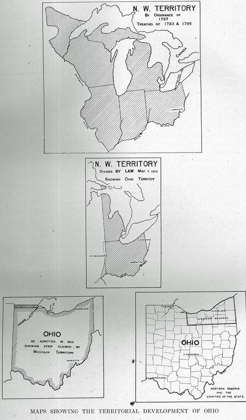
HISTORY OF CLEVELAND - 35
themselves a constitution and state government, and did give to the said state the name of the 'State of Ohio ;' in pursuance to an act of Congress * * * whereby the said state has become one of the United States of America," and then providing for the execution of the United States laws in the new state.
With the exception of the line touching Michigan, there has been no dispute of the state boundary. The controversy with Michigan, the "Toledo War," was caused by the claim of Michigan that the strip of land, from Lake Erie to the Indiana boundary, upon which Toledo is located, belonged rightfully to Michigan under article V. of the ordinance of 1787, which ambiguously described the southern boundary of one of the five states that might be erected out of the territory as passing east and west through the southerly extremity of Lake Michigan. Ignorance of the southerly extent of Lake Michigan produced the present jog in the boundary of northwestern Ohio. Michigan was loath to relinquish this strip, and when in 1835 Lucas county was organized, troops from Michigan entered Toledo, the county seat, to prevent the session of the courts. Ohio soldiery were also present. But no blood was shed, and President John Quincy Adams palliated Michigansis feelings when her statehood was discussed at Washington, in 1837, by exchanging the rich northern peninsula for the meager Maumee strips ; an exchange which at that time was considered a poor trade.
Originally, two counties were erected in the Northwest Territory, Washington, with Marietta as the county seat, and Wayne, with Detroit as the county seat. A portion of the boundary line between the two was the Cuyahoga river. So the site of the present city of Cleveland was in the two original counties. July 29, 1797, Jefferson county was erected, and that portion of the Western Reserve which lies east of the Cuyahoga river and the old Portage path, was part of the new county. The county seat was Steubenville. July 1o, i800, Trumbull county was organized, and this embraced all the Western Reserve including the Firelands and the Sandusky Islands. These counties were created by executive proclamation. But when the state was organized, the legislature created the counties. So, in December 21, 1805, a law taking effect in March, 1806, created the county of Geauga out of a portion of Trumbull county. This included a goodly portion of the present Cuyahoga county. February pp, 1807, the legislature authorized the sister counties of Portage, Ashtabula, and Cuyahoga. The new county of Cuyahoga was not organized until 1810. It embraced that part of Geauga west of the ninth range of townships. The act described the boundary as follows : "On the east side of the Cuyahoga river, all north of township 5, and west of range 9; on the west side of the river, all north of township 4 and east of range 15, a space between ranges 14 and 20 on the west ;" and "the county of Huron being attached to Geauga, for judicial purposes." Several changes in this boundary were subsequently made. January 15, 1811, the line between Huron and Cuyahoga counties was changed. Beginning at southwest corner of Strongsville, the line was extended westward to the ' southeast corner of Eaton, thence north to the northwest corner of Eaton, to the middle of Black river following its channel northward to Lake Erie. The organizing of Medina county, February 18, 1812, brought a second change in the western boundary. The line was carried northward from the northwest corner of Eaton to the northwest corner of Ridgeville, thence west to Black river and to
36 - HISTORY OF CLEVELAND
the lake. Lorain county was organized April 1, 1824, and took the town of Columbia and the west half of Olmsted from Cuyahoga county, but the half of Olmsted was restored to Cuyahoga, by act of January 29, 1827. On March 20, 1840, Willoughby township was taken from Cuyahoga county and given to the newly organized county of Lake, January 29, 1841, Geauga county was given a strip ninety rods wide, extending from the northeast corner of Orange township, down its east line to the east and west center road, while the village of Chagrin Falls, with lots 17, 18 and 19 in Russell township, were annexed to Cuyahoga county. The final change in the boundaries of the county, was made on January 11, 1843, when the Orange township strip was returned to the county. The organization of Cuyahoga county dates from January 16, 1810.
THE DESCENT OF TITLE TO THE WESTERN RESERVE.
The story of the various claimants to these lands of the west embraces the records of the heroic period of voyage and discovery, of colonization, of the final independence of the colonies, and of interstate controversy over boundaries and possessions.
The history of these disputes will be briefly related in this connection, although they are only partially of a geographical nature, and therefore might properly come tinder the divisions of government. The basis of all land titles in Cleveland is contained in these shifting claims.
The sovereignties of Spain, France and England, successively claimed the continent of North America ; Spain, by virtue of a grant from the Pope and the explorations of De Navarez and De Soto in the Gulf of Mexico ; England by virtue of the voyages of the brave John and Sebastian Cabot along the eastern coast, and France by virtual occupation of the vast regions of the St. Lawrence, the Lakes, and the Mississippi, by the intrepid La Salle and his worthy successors.
Meanwhile English colonists came to lend the permanence of occupation to the title by discovery. Their settlements ranged along the Atlantic coast. But the activity of the French had by 1749, hemmed in the English by a line of military posts extending from the Bay of Fundy, through Quebec, Niagara, Oswego, Buffalo, Presque Isle (Erie, Pennsylvania), the Allegheny and Ohio rivers and the Mississippi river. Such a proximity of world powers eager to secure a virgin continent, made war inevitable. The close of the French and Indian war in 1760, found England victorious and in possession of all the lands east of the Mississippi, excepting the Island of Orleans.
Our search for the descent of title, then, is confined to England and her liberal grants to court favorites, trading companies and colonies.
On the 10th of April, 1606, the first charter of Virginia was granted. There were really two charters, one to the London, or South Virginia company, and one to the Plymouth. or North Virginia company. Their grants extended from 34 degrees north, to 45 degrees south, and were given to secure the discoveries of the Cabots. The North Virginia company planted a colony at the Kennebec river in Maine, while Jamestown, on the James river, was founded by the South Virginia company. The London company's grant extended from
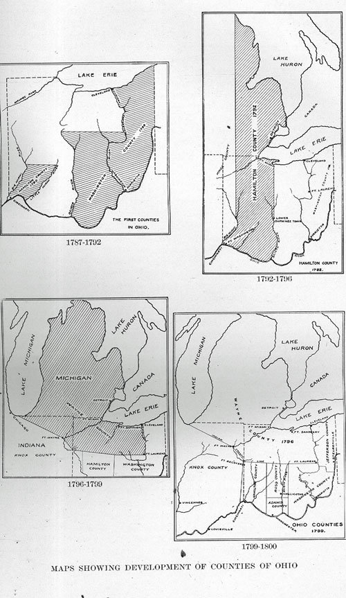
HISTORY OF CLEVELAND - 37
Cape Fear to the Potomac, and the Plymouth company's extended from Newfoundland to the Hudson.
In May, 1609, a second Virginia grant was made, the London company receiving "All those land, countries and territories lying and being in that part of America called 'Virginia,' from the point of land called 'Cape, or Point Comfort,' all along the sea coast to the south, and two hundred miles, and all that space and circuit of land from the sea coast of the precinct aforesaid, up into the land throughout from sea to sea, west and northwest." This ambiguity prevailed until after the Revolution. A third charter of Virginia was granted March 12, 1611, embracing everything between the thirtieth and forty- first degrees, north latitude.
The New England, or Plymouth company, received a further charter November 3, 1620, embracing the territory between the fortieth and forty-eighth degrees, north latitude.
All of these charters were declared forfeited by quo warranto in 1624-25, and Charles I made Virginia a royal colony by proclamation.
In March 4, 1627, the Plymouth company conveyed Massachusetts to Sir Henry Roswell and others, and two years later Charles I confirmed this grant. In 1630, the council of Plymouth granted Connecticut to the Earl of Warwick. On the 19th of March, 1632, the Earl of Warwick, as president of the Plymouth council, conveyed Connecticut to Viscount Gay and Seal and to Lord Brook, and others, by deed. Upon the surrender of the Connecticut charter, a new one was granted by Charles II, April 23, 1662.
In 1664, Charles II, in spite of previous grants to the Plymouth company and the London company, ceded to his brother, the Duke of York, the lands that had been occupied by the Dutch in New Netherlands from the Delaware river to the Connecticut river, and sundry other lands on the St. Croix, in Maine.
Finally, on March 4, 1681, Pennsylvania was granted to William Penn, These charters embracing the later states of Massachusetts, Connecticut, New York, Pennsylvania and Virginia were made with a magnificent disregard for each other's claims, and their boundaries were described with great ambiguity. But they all extended across the continent to the mythological "South Sea," so that the peace of 1781, found all these states making vigorous claims to the Northwest territory.
In 1784 Congress asked all the states claiming territory in the northwest to cede their lands to the Confederacy, in order to aid in the payment of the war debt and to promote the general harmony of the Union.
To the claim of Virginia, under the colonial charter, was added the more substantial right by colonization. In spite of the fact that England, after the peace of 1760 had strenuously forbidden the settlement west of the Alleghenies, the news of the fertile valleys beyond the mountains, of the beautiful river, and of the equable climate, lured many a squatter.
The Ohio Land Company was organized in 1748. George Washington's brothers Lawrence and Augustine were among its members, and by the close of the Revolution there were many frontier huts in the western land. Virginia, however, ceded her rights to the territory on November 1, 1784. The claims of
38 - HISTORY OF CLEVELAND
New York were ceded to the Confederation, March I, 1781, after the determining of her western boundary.
On April 18, 1785, Massachusetts ceded her rights west of the meridian that had been determined upon as the western boundary of New York. But when the western line of Pennsylvania was surveyed in 1785-86, a slight readjustment was necessary in this meridian. Pennsylvania ceded her claims in 1786, after her western boundary had been fixed.
Thus, all the vast pretenses that had survived the colonial epoch, were amicably settled, excepting only the claims of doughty Connecticut. Her charter of 1662, described her limits as "Bounded on the east by Narraganset river, commonly called Narragansett bay, where the said river flows into the sea; and on the north by the line of Massachusetts plantation, on the south by the sea ; and in longitude as the line of the Massachusetts colony, running from east to west, that is to say, from the said Narragansett bay in the east, to the South sea on the west, with the islands thereto adjoining." The conflict which this generous grant engendered with New York, was settled by royal commission soon after the granting of the charter ; the controversy with Pennsylvania, as to the lands between 41 and 42 degrees of latitude, included in the charters of both states, was settled in favor of Pennsylvania, by a commission of Congress in 1782. But, deprived of her claims in New York and Pennsylvania, Connecticut did not relinquish her hold on the lands west of Pennsylvania. To these, she asserted her rights by a resolution of the legislature in 1783, claiming thereby "the undoubted and exclusive right of jurisdiction and preemption to all the lands lying west from the western limits of the state of Pennsylvania, and east of the Mississippi river, and extending throughout, from the latitude of the forty- first degree to the latitude of the forty-second degree and two minutes, north; by virtue of the charter granted by King Charles II, to the late colony and now state of Connecticut, and being dated April 23, 1662, which claim and title to make known for the information of all, that they may conform themselves thereto:
"Resolved, that his excellency, the governor, be desired to issue his proclamation, declaiming and asserting the right of this state to all the lands within the limits aforesaid, and strictly forbidding all persons to enter or settle thereon, without special license and authority first obtained from the general assembly of this state."
The enterprising state finally complied with the request of Congress, and on the 14th of September, 1786, the congressional delegates from Congress, executed a deed of cession to the western lands, in accordance with instructions given them by the state legislature. But there was a reservation in this deed. The language follows : "All the right, title, interest, jurisdiction and claim of the state of Connecticut, to certain western lands beginning at the completion of the forty-first degree of north latitude, one hundred and twenty-five miles west of the western boundary of the commonwealth of Pennsylvania, as now claimed by said commonwealth ; and from thence by a line to be drawn parallel to, and one hundred and twenty miles west of said west line of Pennsylvania, and to continue north until it comes to forty-second degree and two minutes, north latitude; whereby all the right, title, interest, jurisdiction and
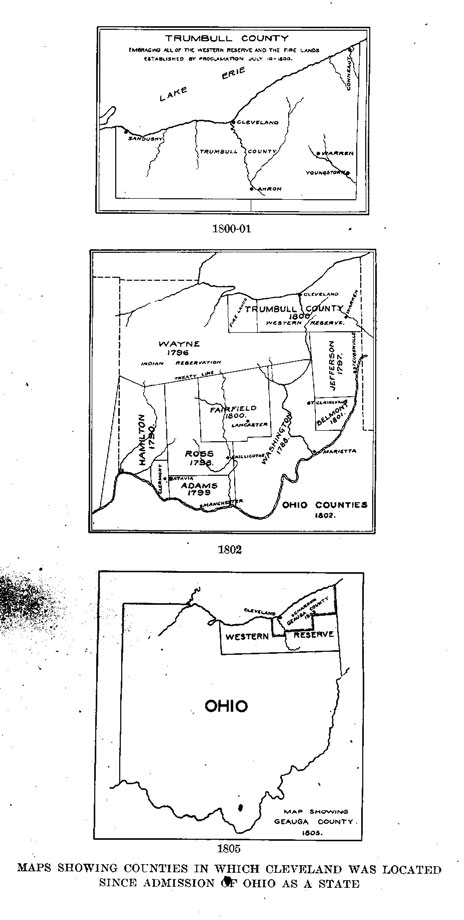
HISTORY OF CLEVELAND - 39
claim of the said state of Connecticut, to the lands lying west of the said line, to be drawn as before mentioned, one hundred and twenty miles west of the western boundary of the commonwealth of Pennsylvania, as now claimed by said commonwealth, shall be included, released and ceded to the United States in Congress assembled, for the common use and benefit of said states, Connecticut included."
This tract of land, one hundred and twenty miles long and of variable width, so reserved, is the famous "Connecticut Western Reserve," which became within a quarter of a century after its creation, the home of a transplanted New England.
Within a month after releasing her claims, Connecticut, by resolution of her legislature, proceeded to prepare for the sale of her Reserve. The resolution provided a committee of three who were empowered to sell that portion of land lying east of the Cuyahoga river, and the old Portage path, the land to be surveyed into townships, six miles square, the price to be six shillings per acre, equal to about fifty cents federal money, and the surveys to begin at the Pennsylvania boundary, the townships to be numbered from Lake Erie southward, and in each township five hundred acres were to be reserved for the support of schools and five hundred acres for the support of gospel ministers.
No surveys were begun by this committee and only one sale was made. This was the famous "Salt Spring Tract" of twenty-four thousand acres in Trumbull county, to General Samuel H. Parsons, of Middletown; Connecticut. His patent was recorded at Hartford, and in the newly established county seat of Washington county, Marietta, and later, because of conflicting claims to the jurisdiction in the Reserve, it was recorded also at Warren, the seat of Trumbull county.
The second parcel disposed of by the state, was the grant made in 1792, to those of her citizens who had suffered through the burning of their homes by the British, during the Revolution. A half million acres were taken from the extreme western end of the Reserve for their benefit. This tract embraces the present site of the counties of Erie and Huron, and was at once called the "Fire Lands."
Indian hostilities and the fact that the purchaser was required to take all risk of title and possession retarded the sale of these lands. The legislature, in May, 1795, determined on a new way of disposing them. A committee of eight citizens, one from each county in the state, was authorized to sell three million acres immediately adjoining the Pennsylvania line, at not less than one million dollars, or one third of a dollar per acre.
The following comprised this committee : John Treadwell, Marvin Wait, Thomas Grosvenor, Elijah Hubbard; James Wadsworth, William Edmond, Aaron Austin, and Sylvester Gilbert. Some of these names have found their way into our local geography.
The time of the appointment of this committee was propitious. Speculation in western lands had revived with the triumphal march of General Wayne through the Indian country, from the Ohio river to Lake Erie, in 1794.
By September 2, 1795, enough buyers had been found to take the entire tract from the committee, at a purchase price of one million, two hundred
40 - HISTORY OF CLEVELAND
thousand dollars. There were thirty-five parties (sometimes reported as thirty- six parties), and thirty-seven individuals (sometimes reported as forty-nine) in this list. 1 They pooled their interests, and deeds dated September 5, 1795, were at once made to them, each one buying as many twelve hundred thousandths as he had subscribed dollars to the fund. These deeds were recorded in Hartford and subsequently in Warren, and the original is in the archives of Western Reserve Historical Society.
These purchasers formed the Connecticut Land Company, and they all joined in a deed of trust, September 5, 1795, to John Caldwell, Jonathan Brace, and John Morgan, and the original is in the archives of Western Reserve Historical Society. The deeds given by these trustees form the source of all land titles in the Reserve. All of the trustees were still living as late as 1836 and joined in transfers made in Cleveland.
The southern shore of Lake Erie was at that time supposed to run nearly due east and west, and therefore there should be a large acreage of land between the lake and the Connecticut Land Company's purchase. This supposititious land was finally sold to "The Excess Company." The great southerly sweep of the lake wiped out all the claims of the Excess Company. It also diminished the Connecticut Land Company's purchase, for it was learned upon the completion of the surveys, that the entire area available was only two million, eight hundred and thirty-seven thousand, one hundred acres, including the islands in Sandusky bay.
CHAPTER. V.
THE PLAN OF THE CITY.
ANNEXATIONS AND BOUNDARIES.
The Connecticut Land Company determined at once, to survey its vast purchase into tracts five miles square, by running meridian lines every five miles west of the Pennsylvania boundary. These townships were described by "Ranges," the first "Range" being adjacent to the Pennsylvania line, and then numbered westward; and by "Tiers," the first "Tier" being on the forty-first parallel, which formed the southern boundary. The northernmost tiers touching the lake, formed irregular, or fractional townships.
The first surveying party was sent out in 1796, under the command of General Moses Cleaveland, of Canterbury, Wyndham county, Connecticut. Augustus Porter, of Salisbury, Connecticut, who had been surveyor in western New York, in the great "Holland Purchase," was the principal surveyor, and Seth Pease of Sheffield, Connecticut, second surveyor, as well as astronomer and mathematician of the party. Under these men were the other surveyors, John Milton Holley, Richard M. Stoddard, and Moses Warren, Jr.
On the 4th of July, 1796, the party entered the Reserve by boat from Buffalo, at the western boundary of Pennsylvania, as fixed by the commission of 1785.
1 See Appendix for list.
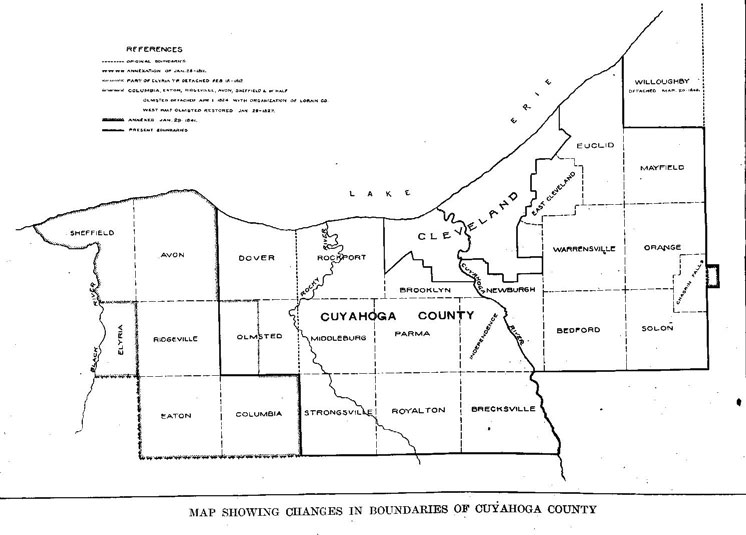
HISTORY OF CLEVELAND - 41
The first four range lines were run in 1796, and nearly all the townships north of the sixth tier, and east of the Cuyahoga river were surveyed. Porter, with a small party, traversed the lake shore westward, to fix the west line of the Reserve. General Cleaveland meanwhile proceeded to the mouth of the Cuyahoga river, reaching here July 22, 1796. He built a cabin on the hillside, south of St. Clair street, and west of Union Lane for the surveyors. Porter returned from his western survey to this cabin and other members of the party arrived at various intervals.
On the 16th of September, 1796, the first survey of the city of Cleveland was begun. On the 22d of September, Holley, Shepard and Spafford, began the survey of Cleveland township and its "hundred acre lots." This township was one of six that the company had determined to allot and sell for the benefit of the shareholders.
Seth Pease made a map of the Reserve in 1797 (this map is now in the Western Reserve Historical Society). The township of Cleveland is there marked as a large and irregular tract consisting of twenty-five thousand, two hundred and forty-two acres. It is described as in range 12, tiers 7 and 8. Out of the original township of Cleveland, have been made parts of East Cleveland, Cleveland and Newburg townships.
The first survey of Cleveland was made by Seth Pease and Amos Spafford under the superintendence of Augustus Porter. Seth Pease probably did much of the work of this first survey, for Spafford was set to work on the survey of Cleveland township on the 22d of September.' (1) The first map made of the city is, however, called "Spafford's Map." It was undoubtedly made here, as it is traced on sheets of foolscap paper pasted together. Whittlesey says the sketch was found among the papers of J. Milton Holley, by his son, Governor Alexander H. Holley, of Connecticut, and sent by him to Colonel Whittlesey. It is endorsed in the handwriting of Amos Spafford "Original Plan of the Town and Village of Cleveland, Ohio, October 1, 1796." (2)
This "original plan" does not evince any originality. It might have been drawn for any other town planted on a plain in the wilderness. It makes no effort to conform to the contour lines of the river valley, and seems entirely oblivious to its magnificent site above the placid lake. Indeed, it is like the plans of other towns made by the same surveyors. They follow a common model, an open square or diamond in the center of a rectangular or square area, traversed by streets laid out in orderly precision, meeting at somber right angles. Nearly all the towns of the Reserve follow this plan.
In Spafford's plans, however, the streets are generously wide. Superior street was at first called Broad street, but the name is scratched out in the original map. Miami street was at first called Deer street, and Ontario street Court street. It is not known whether these changes were made here, or after the map had been taken east. The Public Square is shown as an expansion of Superior street, like a river expanding into a lake. All the town lots are numbered. There are two hundred and twenty of them, and these numbers are found on all titles flowing from this source.1
1 See Barker, "Original Surveys of old Cleaveland," page 223.
2 "Early History of Cleveland," p. 238.
42 - HISTORY OF CLEVELAND
The official report of the surveys was compiled by Seth Pease. He made a map of Cleveland to accompany this report; it is endorsed, "Plan of the City of Cleaveland, 1796." It follows Spafford's map with some slight changes. "The river bluffs are slightly different, and the land's point at the mouth is larger." (1)
Pease was a fine draughtsman, as this map shows. Several copies of it were made, but it was not engraved. A faithful copy of this map is found on page 1, volume 1, of "Maps and Profiles," in the office of the city engineer, made in 1842, by I. N. Pillsbury, then city engineer. Pillsbury had access to the original. Leonard Case endorses his copy in the city records, "as neat a facsimile copy of the original as can usually be made by ordinary writers." Ralph Granger, of Fairport, Ohio, a nephew of Seth Pease, also endorsed this Pillsbury copy, after comparing it carefully with the original. These endorsements are all found on record with this map.
The surveys upon which these maps are based, were completed by October, for, on the 17th of October, Milton Holley writes in his journal, "Finished surveying in New Connecticut, weather raining," and on the following day, "We left Cuyahoga at 3 o'clock, seventeen minutes, for home. We left at Cuyahoga, Job Stiles and wife, and Joseph Landon, with provisions for the winter. William B. Hall, Titus V. Munson and Olney Rice, engaged to take all the pack horses to Geneva. Day pleasant and fair winds ; about southeast; rowed about seven and a half miles, and encamped for the night on the beach. There were fourteen men on board the boat, and never, I presume, were fourteen men more anxious to pursue an object than we were to go forward. Names of men in the boat. Augustus Porter, Seth Pease, Richard Stoddard, Joseph Tinker, Charles Parker, Wareham Shepherd, Amzi Atwater, James Hacket, Stephen Benton, George Proudfoot, James Hamilton, Nathan Chapman, Ralph Bacon, Milton Holley."
These, then are the men who in the mellow Indian summer of 1796, ran the lines through the forests of chestnut and oak, that were to be, within a few decades, the busy thoroughfares of the metropolis of Ohio.
In 1801, Amos Spafford returned and resurveyed the street and lot lines. He fixed the principal corners by driving fifty-four oak posts about eighteen inches square. He charged fifty cents each for these posts, and also charged fifty cents for grubbing out a tree that stood in the northeast corner of the Square. He made a new map of the town following his original plat, but omitted Maiden Lane and Federal street, and added Superior Lane. Ohio street also embraced Miami street. This map with its accompanying descriptions of streets was recorded in Warren, Ohio, February 15, 1802, in volume A, page 100. The record, however, is not endorsed by either Spafford or the Land Company. Such irregularities and informalities were not regarded seriously in early days.
This map was copied by Alfred Kelley, one of the first attorneys of Cleveland, and recorded in Cuyahoga county records, volume A, page 482, on November 22, 1814; and on December 26, 1856, it was transcribed into volume 2, page 24, of maps. It was also transcribed into the city engineer's record, by I. N. Pillsbury.
1 - Whittlesey's "Early History," p. 241.
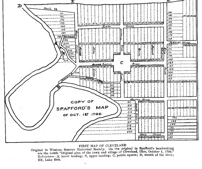
HISTORY OF CLEVELAND - 43
This Kelly copy of the Spafford map is virtually our official land map to which are referred the early titles of Cleveland and which has been constantly consulted for the determining of the original lots and streets.
There are four lanes and ten streets in this map. The streets are six rods, wide, excepting Bath, which is narrower and irregular, and Superior, which is eight rods wide. There are two hundred and twenty lots, all excepting those that border on the lake and on the river, are two chains wide by ten chains deep, containing two acres. The Public Square contains nine and one-half acres, instead of ten as usually represented.
In 1797, the "Second Party" of surveyors arrived in Cleveland under the leadership of Seth Pease as chief surveyor. They proceeded to survey the "Cleveland ten acre lots," comprising the area now embraced between Brownell street and Willson avenue. The survey began August 20th, on Sunday. Three radiating roads were surveyed through the ten acre lots ; "North Highway," now St. Clair avenue, "Center Highway," now Euclid avenue, and "South Highway," now Woodland avenue; each was ninety-nine feet wide, and their corners were respectively, north 58 degrees east; north 82 degrees east, and south 74 degrees east. The "North" road connected with Federal street of Pease's plan, the "Center" road with Huron street, and the "South" road with Erie street.
Inasmuch as these roads radiate, the lots become deeper as you travel from the city, The lots are all the same width ; their area therefore varies from less than ten acres to forty acres, and one, number 166, has one hundred acres. The reason for this variation is to equalize the value of the lots on the theory that the further they are from town the less valuable per foot front. Those on the south side of Woodland avenue are all ten acres, however, because the rear lot line is parallel to Woodland owing to the irregularity of Kingsbury Run ravine, which prevented the expansion of the lots. The numbers begin with the southeast angle of Woodland and Erie streets, and run eastward consecutively, beginning again with the westward lot of the tier it connects with, and so on. Later, when these lots were wanted for city purposes, Payne avenue was opened on the boundaries of the ten acre lots between St. Clair and Euclid, and Garden street (Central avenue) on the line between the Euclid and Woodland ten acre lots.
The survey of these lots was made almost entirely by Moses Warren, Jr., and a copy of his notes was made into the records of the city engineer's office endorsed : "Drawn from the original notes, January 27, 1855. I. N. Pillsbury, C. E." But no map accompanies these notes. In November 22, 1879, John L. Culley, C. E., entered in volume 11, page 32, of the county recorder's maps, a map and notes endorsed : "The above map and field notes of 'Cleveland ten acre lots,' are a correct copy of the same as they are to be found in the office of Leonard Case of this city; the map and notes in said Case's possession are supposed to be the only authentic ones in existence." In the collection of the Western Reserve Historical Society, is a copy of the original Warren notes, entitled, "Traverse of the Portage from Cuyahoga to Tuskarawas, part of the second parallel, and survey of the ten acre lots in the town of Cleveland, by Moses Warren, Jr." Colonel Whittlesey has written on this copy, "Transcribed
44 - HISTORY OF CLEVELAND
by the late General S. D. Harris, surveyor, Ravenna, Ohio, for me," and General Harris endorsed at the bottom, "I certify the foregoing to be a correct copy of the original on file in my office." (Signed) "Samuel D. Harris, county surveyor, Portage county, August 16, A. D. 1845."
Beyond Willson avenue, the land was divided, in Cleveland township, into one hundred acre lots. These lots nearly all became allotments, and the titles to all city lots beyond Willson avenue go back to these "original one hundred acre lots."
The early surveys were made with the chain. These wore a little at the links, and consequently there is an excess of land over the recorded frontage. "Considering, however, that these early surveys were made with the primitive compass and iron chain, and through a thickly wooded country, it must be conceded that the measurements both of the ten acre and the two acre lots, show a notable uniformity of surplus, showing that they were taken with considerable care." * This surplusage is slight and varies with the different streets.
There are three surveyors who have been specially instrumental in laying out the streets of the city, in fixing their monuments and establishing the lot lines. John Shier, the first city surveyor and engineer was appointed May 11, 1836, only two months after the incorporation of the city. He fixed the stone monuments in the streets of the original town. These monuments were substantial and set in the center of the streets. He also surveyed the street lines. He was a very painstaking surveyor, having received a thorough training in his profession in Scotland, his native country. Ahaz Merchant was for many years the leading surveyor in this vicinity. He served as county surveyor for a number of years, and in r835 published a magnificent map of the city. I. N. Pillsbury was elected city engineer in April, 1853. Previous to his appointment, the city engineers had thought their records were their private property, so he found no public records whatever in the office he assumed. He at once began "No. 1 and volume 1, of Engineers' Records," and transferred to them the accurate copies of the earliest surveys mentioned above. The city owes a large debt of gratitude to his faithful research and painstaking records.
In 1854, the city council passed an ordinance, declaring the records made by the city engineers, the property of the city, and since then, the records have been more or less carefully kept.
The west side of the city lying in the original township of Brooklyn was surveyed in 1806 by Abraham Tappan of Painesville. Subsequent surveys of the leading subdivisions, namely, "The Buffalo Company's Purchase," in 1833, near the old river bed, "Barber & Lord's Purchase," "Willeyville," in the big river bend. "The Taylor Farm," "S. S. Stein's Allotment," and "Benedict & Root's Allotment," were all surveyed by Ahaz Merchant.
"It is rare to find an old street laid out perfectly straight, as recorded, and all of the original streets are more or less crooked, due to haste, difficulties of field work, and imperfect instruments of original surveyors." (1) Most of these irregularities in the first city limits have been corrected, and the streets well
* See Barker, "Original Surveys of Cleveland," page 229.
1 - See Barker, "Original Surveys of Cleveland," p. 23r.
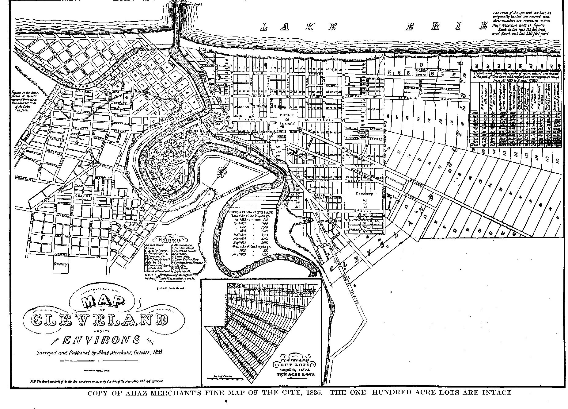
HISTORY OF CLEVELAND - 45
defined, so that "this city is one of the best monumented cities of the land," and few disputes have arisen over improper lines. (1)
From the foregoing it is evident, that while the surveyors laid out a "Plan for the City of Cleveland," in the primeval forests, the city proper has had no guidance in its growth, but has expanded haphazard, like nearly all American cities. The original village plat was confined to a mile square bounded virtually by the lake, the river, Huron and Erie streets. When once the town's real destiny was manifest, these orderly village confines were broken and the city expanded along the lines of least resistance, These lines were the long radial country "highways," leading through the ten acre lots, out into the hundred acre lots and centering in the town. If this radial development had been properly guided by an enlightened pubhc authority, we might now have a city with splendid vistas and orderly geography. But there was no guiding hand, and the farms, the ten acre and the one hundred acre lots that bordered the country roads were dissected into allotments with streets laid out to suit the greed of the owner and with a fine disregard for the unity of the city. It was not until 1875 that state law and municipal ordinance began to regulate in a desultory fashion, the planning of new allotments, and it was not until June 26, 1882, that the city required by an ordinance, prepared by the city engineer, B. F. Morse, that streets laid out in new allotments must conform as nearly as possible to existing streets, and must be properly graded and marked with numbers and properly bridged. The result of this undirected and unrestricted growth is perfectly natural. The network of narrow, crooked and blind streets, bordering our stately "highways" is in a marked contrast to the wide and regular streets of the original town as wisely designed by its founders.
EARLY ALLOTMENTS.
The earliest allotments will here be mentioned. It was the judgment of the earrly real-estate dealers that the city would expand into the valley of the Cuyahoga. The first subdivisions, therefore, border the river.
In January, 1833, Alfred Kelly allotted lots Nos. 191, 192, 193, lying immediately south of Bath street and between Water street and the river, where now are railroad tracks and wharves. In December, 1833, all the land in the first big bend of the river, was subdivided by Richard Hilliard, Edmund Clark, and James S. Clark. This was called the "Center Allotment." It was laid out with beautiful precision into radiating streets, with cross streets at regular intervals. The place where all the radii met was pretentiously named "Gravity Place." Three of its streets became important; Columbus street the great thoroughfare between the east and west side before the building of the Superior street viaduct, Merwin street bordering the river and before the '60s an imrtant shipping and warehouse street, and Commercial street which later gave name to "Commercial street Hill." Columbus street was connected on the wesAt with the Wooster and Medina turnpike. As a further allurement to the e of his lots, Clark built a large block, the Center block, at the north end
1 - John L. Cully, C. E., "The Cleveland Surveys," paper read before City Engineer's Club June 21, 1884
46 - HISTORY OF CLEVELAND
of Columbus street, and two blocks on the opposite sides of Prospect street where it intersects Ontario street.
In April, 1834, Leonard Case subdivided ten acre lot No. i on the old State road to Newburgh. In order to make this land more approachable, he widened the Newburgh road from its width of sixty-six feet as a state road, to ninety-nine feet, the width of Ontario street.
In 1834, John M. Woolsey allotted a number of two acre lots lying south of Superior street and west of Erie street.
In November, 1835, Lee Canfield, Sheldon Pease, and several other gentlemen, alloted the two acre lots in the extreme northeast corner of the city adjoining the ten acre lots ; they also plotted and laid out Clinton park, named in honor of DeWitt Clinton, then a popular public idol. Some fine residences were built facing this park, but the wishes of the promoters that it would become the fashionable residence section, were not realized.
In January, 1836, Ashbel W. Walworth and Thomas Kelley allotted the two acre lots south of Ohio street and one hundred acre lot No. 487, reaching from Ohio street to the river, a lot that had not been surveyed or included in the original plat. A majority of the original two acre lots, were thus subdivided, by 1836, or were in the hands of owners who had built upon them.
On the opposite side of the river, the spirit of speculation was not less active. In 1833 the famous "Buffalo Company's Purchase" was made by a number of Buffalo capitalists. It embraced about eighty acres, bounded on the south by Detroit street, west by the river, and north by the line of Brooklyn township. It was allotted into squares. Its Washington street and Main street are virtually the only survivors of its glory. Immediately west of this allotment, lay the farm of Charles Taylor. In 1835 he alloted it, and its name, "The Taylor Allotment," still survives. This was the first real farm to be allotted and incorporated into the city. Immediately south of the Taylor farm and the Buffalo purchase, a large tract was purchased by Richard Lord and Josiah Barber, and allotted by them.
In April, 1837, a company headed by James S. Clarke (also spelled Clark) allotted "nearly all that part of Ohio City lying south and west of the Barber & Sons' allotment." They named this allotment "Willeyville," after John S. Willey, a prominent attorney. Pearl and Lorain streets and Columbus street were the leading streets of this allotment. It was nearly opposite the Cleveland Center allotment, owned by the same gentlemen. They graded at considerable expense, the hill, leading to Columbus street, and built the famous Columbus street bridge over the river. The plan was to divert the traffic from .Detroit street through their allotments. As a counter irritant, the Buffalo company built a large hotel on Main street, hoping to attract the traveler that came by boat.
These allotments were built on the hysteria of land speculation that preceded the panic of 1837. The result was disastrous. Clark and his associates became insolvent. His fine block and his lots were sold under the sheriff's hammer. The Buffalo Company was bankrupt, and of its big hotel, S. 0. Griswold says, "I visited it officially in 1850; its walls were badly cracked, and it was occupied as a cheap tenement house ; the only remains of its former grandeur, was
HISTORY OF CLEVELAND - 47
its magnificent staircase." (1) Even Clinton park did not escape the common disaster. Its pretentious houses were either moved away or torn down.
After 'the days of business stability returned, the allotments in the valley became the site of manufactories and lumber yards, while the residence portion developed to the east and south.
ANNEXATION AND BOUNDARIES.
On October 23, 1814, an act was passed by the legislature incorporating the village of Cleveland, the act to take effect the first Monday of the June following.
The first boundary of Cleveland is described in the act, as follows : "so much of the city plat of Cleveland, in the township of Cleveland, and the county of Cuyahoga, as lies northerly of Huron street, so called, and westerly of Erie Atreet, so called, in said city plat, as originally laid out by the Connecticut Land Company." On December 31, 1829, the triangle between Vineyard and Superior lanes and the river were annexed, by act of legislature, the boundary then reading aA follows: "Commencing at the northerly termination of Erie street, so called, at the south shore of Lake Erie; thence southerly on the easterly line of said street, and including said street to Huron street, inclusive, thence westerly on the southerly line of said Huron street, and including said Huron street to the Cuyahoga river ; thence down said river to a point twelve rods below the junction of Vineyard lane, so called, with the county road leading from Cleveland to Brooklyn; thence westerly on a line parallel with said county road and twelve rods distant therefrom, to the aforesaid Cuyahoga river; thence northerly down said river to its mouth ; thence easterly along the southerly shore of Lake Erie, to the aforesaid northerly termination of Erie street."
Some years later the land between the county road to Brooklyn and the river was annexed to the village, and the boundary extended eastward and southward to embrace all the two acre lots east of Erie street and the tier south of Ohio street.
March 5, 1836, the legislature passed an act incorporating the city of Cleveland. The first city boundary is thus described in the act: "Beginning at low water mark on the shore of Lake Erie, at the most northeasterly corner of Cleveland ten acre lot No. 139, and running thence on the dividing line between lots number 139 and 140, numbers 107 and 108, numbers 80 and 81, numbers 55 and 56, numbers 31 and 32, and numbers 6 and 7, of the ten acre lots, to the south line of ten acre lots; thence on the south line of the ten acre lots, to the Cuyahoga river ; thence to the center of the Cuyahoga river; thence down the same to the extreme point of the west pier of the harbor; thence to the township line between Brooklyn and Cleveland; thence to the line northerly to the county line; thence eastwardly with said line to a point due north of the place of beginning; thence south to the place of beginning." This extended the boundaries roughly to Frontier and Perry streets and it was an ample provision for it was several years before the city was built up to this boundary.
1 - See "The Corporate birth and growth of the City of Cleveland" p. 206. Tract No. 62, W. R. Hist.. Soc.
48 - HISTORY OF CLEVELAND
March 22, 1850, an area nearly twice as great as that of the original city was annexed, embracing all the ten acre lots of Cleveland township, and all the unsurveyed strip along the river, north and south of Kingsbury run. This extended the boundary eastward to Willson avenue.
ANNEXATION OF OHIO CITY.
The development of manufactories in the river valley brought together physically the rival towns of Cleveland and Ohio City. Their legal union was delayed by warring factions. In 1850, when the legislature had been asked to unite the two cities, a resolution offered by A. McClintock in the Cleveland city council declared that, "Such a union at this time is not desirable, and is not believed to meet the views of our citizens at so short notice." The resolution carried by a vote of five to three.
The legislature passed an act providing for the submission of the question to the electors, whether Ohio City should be "annexed to and made part of the city of Cleveland."
On August 19, 1851, Buckley Stedman introduced an ordinance into the city council providing the submission of the question at a special election in Cleveland, fixed for October 14th. The vote was, "Yeas" eight hundred and fifty, "Noes" one thousand and ninety-eight.
In November, 1853, on motion of Robert Reilley, a committee was appointed by the city council "to consult with the members of the Ohio City council relative to taking initiatory steps towards annexing said city to the city of Cleveland, and report at the next meeting." Robert Reilley, James B. Wigham and James Gardner were appointed, but they could not report "at the next meeting," and the conferences were continued until February I, 1854, when they reported, "that said committee had a consultation with the Ohio City committee and that said committees together had adopted the following resolution, towit : 'Resolved, that we recommend to the councils of the two cities which we respectively represent, to pass an ordinance submitting to the voters thereof, the question of annexing their municipal corporations.' " On motion of Richard C. Parsons, April 3, 1854, the day of the regular municipal elections, was fixed for the vote. In Cleveland, one thousand, eight hundred and ninety- two voted for, and four hundred against annexation, and in Ohio City, six hundred and eighteen for, and two hundred and fifty-eight against annexation.
The new constitution of Ohio allowed the cities to arrange the details of annexing territory, and it was no longer necessary to ask the legislature for permission. The following commissioners were appointed for Cleveland, W. A. Otis, H. V. Willson, F. T. Backus ; for Ohio City, W. B. Castle, N. M. Standart, and C. S. Rhodes.
On June 5th, the commissioners reported that they had arranged "for the terms and conditions on which such annexation shall, if approved by the respective city councils, take place." The report recites that the "City of Ohio shall be annexed to and constitute part of the city of Cleveland," constituting the eighth, ninth, tenth, and eleventh y wards of Cleveland; that the councilmen from these wards hold their seats in the augmented city council ; that detailed
HISTORY OF CLEVELAND - 49
provision were made for the joint liability for public property, bonds and debts of the two cities, excepting the subscriptions to railroad stock made by each corporation. On June 5th the report was adopted by both city councils, and the union was legally consummated. On June 10, 1854, the first meeting of the enlarged city council was held.
This important annexation, extended the boundary of Cleveland beyond the Cuyahoga river, westward to the west line of original Brooklyn township lots No. 49 and 5o, and southward to Walworth run.
By an ordinance passed February 16, 1864, that portion of the flats in Brooklyn township, west of the river, included between Walworth run and the eastward bend in the river, an area of two hundred and sixty and thirty-three hundredths acres was annexed. This embraced the section traversed by Scranton avenue.
February 27, 1867, two important annexations were made, including portions of Brooklyn and Newburg townships, and the land embraced by the big bend in the river, west side. All of the ten acre lots, the entire area included in the original Ohio City, and the one hundred acre lots on the northern part of Newburgh townAhip, were now a part of the city. These newly annexed areas were not very populouA.
In 1869, one hundred acre lot, No. 333, lying in the northeast angle of Quincy and Madison streets was annexed.
In 1872, the village of East Cleveland was annexed. This village had been incorporated in 1866, and embraced the territory bounded roughly by Willson, Quincy, a line east of Doan and a line north of Superior. This important addition to the city included many fine residence streets. The vote taken on annexation was as follows : in Cleveland, "Yeas" seven thousand, two hundred and forty, "Noes" two thousand, eight hundred and eighty-five; in East Cleveland, "Yeas" two hundred and sixty-eight ; "Noes" one hundred and ninety-eight. The annexation waA consummated October 14, 1872.
Three other additions were made in 1872: the territory in the extreme northeastern part of Cleveland, lying between the lake and Superior avenue, and extended to AnAel avenue, and a line between East Seventieth and East Seventy- seventh streets on the east line of old lots No. 347 and 349; a large, irregular portion of Newburgh township, lying between Union street and Quincy avenue and between the river and a line east of Woodland Hills avenue ; and on the west side the area between Clark avenue and Storer avenue. The area of the city was nearly doubled by these annexations and its outlines extended to a line several hundred feet east of Woodland Hills avenue on the east, Union street and Storer avenue on the south, and Buffalo street on the west.
On September 16, 1873, the village of Newburgh was annexed.
No further annexations were made until 1890, when a block on the west side, bounded by Storer, Daisy, Scranton and Rhodes avenues, was annexed.
In 1892, the eastern line was extended by the annexation of an irregular strip north of Euclid avenue, along the "Nickel Plate" railway track, and including Lake View cemetery.
In 1894, part of original one hundred acre lot 312, lying in the southwest angle of Willson avenue and Fleet street, was annexed.