HISTORY CINCINNATI, OHIO.
CHAPTER I
A BRIEF DESCRIPTION OF CINCINNATI.
How blest is he whose doom it is
A wanderer to roam,
Who even in memory can return
To such a lovely home.
Oh, were I in the fairest clime
That smiles beneath the sky,
Here would my spirit long to come—
If not to live, to die.
As yearns the weary child at night
To gain its mother's breast,
So, weary with my wanderings,
Here would I long to rest.
"To the Queen City," by CHARLES A, JONES.
Where grand Ohio rolls his silver floods
Through verdant fields and darkly waving woods,
Beholding oft, in flowery verdure drest,
The green isle swelling from his placid breast ;
Here where so late the Indian's lone canoe,
Swift o'er the wave, in fearless triumph flew,
Behold the stately steam-borne -vessel glide,
With eager swiftness, o'er the yielding tide ;
And where so late its shelter, rude and low,
The wigwam reared, beneath the forest bough,
Lo! cities spring before the wondering eyes,
And domes of grandeur swell into the skies.
[Lines prefixed to Bullock's Sketch of a Journey, 1827.]
To the Queen of the West,
In het: garlands dressed,
On the banks of the Beautiful River.
H. W. LONGFELLOW.
Cincinnati is situated on the north bank of the river Ohio, the part of it first settled being opposite the mouth of the Licking river, upon the site of the original village of Losantiville. Its latitude is thirty-nine degrees six minutes north; longitude eighty-four degrees twenty-seven minutes west. It is three hundred and ninety miles west of Washington city; four hundred and sixty-six miles by the river, or two hundred and fifty miles in a direct line, southwest of Pittsburgh; one hundred and twenty miles southwest of Columbus, and two hundred and fifty-five from Cleveland; and five hundred miles by river, or two hundred and ninety directly, to the mouth of the Ohio at Cairo. The city is built upon three terraces, The first, or that next the river, has an average height, above low water in the river, of sixty feet;, the second of one hundred and twelve feet; and the third, or the general level of the hills, rises to commanding heights varying from three hundred and ninety-six feet on Mount Adams to four hundred and sixty feet on Mount Harrison, west of Mill creek. The first terrace was found by the early settlers to extend from a gravelly hill or bluff near the present line of Third street, between Broadway and a point west of John street, to an abrupt but not very high bank about one hundred feet south of the hill, which was penetrated here. and there by small coves. Between this bank and the river was a low but sloping shore, always flooded in time of high water. All this has been changed, including the disappearance of the bank and bluffs, by the progress of improvement in the older part of the city. The second terrace stretched from the general line of Third street in a gentle rise, as now, back to the hills. From this the ascent to the third plateau, or the summit of the hills, is in many places exceedingly abrupt, and is surmounted in part by graded and macadamized roads up the ravines between the spurs, and in part by four inclined places—at Mount Adams, at the head of Main street, at a slope on Mount Auburn, near the head of Elm street, and at Price's hill, near the west end of the city, up all of which cars are pulled by powerful steam engines. These hills, with the popular resorts and places of amusement thereon, constitute the chief attraction of the city, and are almost world renowned in their fame. Mr. John R. Chamberlain, writer of the valuable article on Cincinnati in the American Cyclopaedia, says they form "one of the most beautiful natural amphitheatres on the continent, from whose hilltops may be seen the splendid panorama of the cities below and the winding Ohio. No other large city of the United States affords such a variety of position and beauty." They are described as having been exceedingly attractive in their pristine loveliness. Mr. J. P. Foote, in his "Schools of Cincinnati," writing of the hills as they appeared in the early day, says; "At that period they formed a border of such surpassing beauty, around the plain on which Cincinnati stood, as to cause us, who remember them in their beauty, almost to regret the progress of improve-which has taken from us what it can never restore." The names of the principal eminences, from east to west of the city, are Mount Lookout. the Walnut Hills
Mount Adams, Mount Auburn Clifton Heights, Fairmount,
10 - HISTORY OF CINCINNATI, OHIO
Harrison, Mount Hope, Price's Hill, and Mount Echo. The average height of the hills above tidewater at Albany is eight hundred and fifty feet, and of the second terrace five hundred and forty feet; it being twenty-five feet below the level of Lake Erie. Low water mark in the river at Cincinnati in four hundred and thirty-two feet above the sea, and one hundred and thirty-three below Lake Erie. The descent from the upper plane of Cincinnati below the hills to low water is therefore one hundred and eight feet.
The major part of the city, for population and business, though by far the smallest in territorial extent, lies upon the first and second terraces. They are part of a beautiful and fertile plain, lying in an irregular circle, and extending on both sides of the river, about twelve miles in circumference. It is cut into unequal parts by the course of the river, which here makes several curves, but has a general northeast to southwest direction: On two sides of the northern section of the plain, which is the smaller, the city is built along the narrow spaces between the hills and the river, and to some extent on the hills themselves. On the northeast, for four and a half miles, or to and including Columbia, now a part of the city, this belt is but about five hundred yards wide; on the southwest the width is only, three hundred yards to the city limits, a mile and three-quarters beyond the point where the hills, after curving around this part of the plateau, return to the river, about three miles from the point at which they left it on the other side. The city has thus a very extensive water-front—about eleven miles, allowing for the curvatures of the river, and taking in, among the annexations of the last ten years, the old village of Columbia on the one side and the former suburb of Sedamsville on the other. The average width of the city site is three miles, although up the valley of Mill creek, since the annexation of Cumminsville in 1873, the extreme breadth is five and one-half miles.. The total area enclosed by the corporation lines is fifteen thousand two hundred and sixty acres, or very nearly twenty-four square miles—an increase of seventeen square miles since 187o (when it comprised but four thousand four hundred and eighty acres), by the successive and rapid annexation of suburbs. The older part of the city is intersected by the valley of Deer creek on the east, which is now dry except after heavy rains, and is partly occupied by the great Eggleston avenue sewer; and by the Mill creek valley on the west, which is broad and fertile, and comparatively level for many miles to the northward. Beyond Mill creek the hills are cut through by the narrower valley of Lick run.. The former contains a good sized stream, which has been greatly serviceable for mills and other purposes, since an early period in the history of the place.
The main body of the city, including the business portion and the densest population, borders on the river between the mouth of Deer creek on the east and that of Mill creek on the west, a distance of two and one-half miles. North of East Liberty street and the Hamilton road, the hillsides from Deer creek to Mill creek are terraced with streets, and [in places] covered with dwellings to their summits. Mount Adams, overlooking the southeast corner of the plateau, has streets thickly lined with dwellings on its summit and west and south sides. The remainder of the city, including the narrow. valleys along the river, above and, below the city proper, the village of Cumminsville, next the northern corporation line in Mill creek valley, and the several table-land villages from. Woodburn on the east to Fairmount on the west, is irregularly built. In the northwest part are native forests and cultivated farms. On the western hills are vineyards and gardens. Between Harrison avenue and the Twenty-fifth ward (Cumminsville) are many vegetable gardens.*
THE SUBURBS.
A number of villages, formerly suburbs, are now included in the city. The principal of these, beginning on the east, are Columbia, Walnut Hills, Mount Auburn, and Cumminsville. Fairmount is a residence quarter west of Mill Creek valley, and Sedamsville is mainly a manufacturing district, lying south of the western range of hills, between it and the river, about three and a half miles from Fountain Square. Fulton is a part of the city at the base of the hills on the other side of the plain, beginning beyond the Little Miami railway depot and running in a narrow tract northeast to Pendleton village, which lies between it and Columbia. Northeast of Columbia the city includes 'a part of Tusculum. Due north of it, at the extreme northeast corner of the city, is Mount Lookout, a small but attractive suburb, in part outside the corporation limits, and the seat of the Cincinnati observatory; about north of the dividing line between Fulton and Pendleton, and on the hills, is the little plat known as O'Bryonville, between which and Walnut Hills is Woodburn, an extensive and well-built area; and west of Walnut Hills, between Mount Auburn and the north corporation line, is Corryville, a residence and business quarter, on the west of which is the spacious and beautiful Burnet Woods Park, and on the north, just outside the city, in the southwest part of Avondale, the famous zoological gardens. Camp Washington occupies a limited space between the Miami canal and Mill creek, in the vicinity of the workhouse and the house of refuge. Brighton is not marked as a district quarter upon the latest maps, but is that part of the city reaching from the junction of Freeman street and Central avenue west to Mill Creek, and takes its name from the former existence of the city stockyards there. Barrsville, Forbusville, Peterstown, and Lick Run are hamlets adjoining or not far from Fairmount, on the heights west of Mill Creek; and Weaversburgh is a station on the Westwood Narrow Gauge railroad west of Fairmount, and close to the corporation line. These highlands, between Fairmount and the Ohio, are as yet occupied to but a limited extent, from the difficulty with which most ,parts of them are still reached from the city. "The outer highland belt of the city commands distant views of hills in Kentucky and Ohio, and of the valleys of Mill Creek, the Licking, and the Ohio. It is beautified by elegant residences in the midst of extensive and highly cultivated landscape lawns, whose shrubbery is often the native forest, and is traversed by winding avenues. From the eastern corporation line, through East Walnut Hills and Woodburn to West Walnut Hills, mansions occupy grounds of from three to seventy-five acres. The blue limestone of the hills is used in the construction of the finest buildings; [and some of them have been erected from material
* American Cyclopedia, article Cincinnati.
HISTORY OF CINCINNATI, OHIO - 11
quarried upon the very grounds they occupy.] West Walnut Hills and Mount Auburn, though in parts quite compactly built, abound in elegant and costly residences, each having from one to four acres of grounds."*
Outside the city, but in immediate proximity to it, are several lovely suburbs. Prominent among these is Clifton, between Cumminsville and Avondale, with the Burnet Woods park cornering upon it at the southeast. It is described as "a most beautiful suburb, and an almost continuous landscape garden." + It has many fine groves and costly residences. The grounds about them occupy areas of ten to eighty acres. Avondale, next east of Clifton, and north of Corryville and Walnut Hills, comprises about eight hundred acres of territory, and is also superbly built. Its views include the neighboring hills, which, however, shut out the river scenery from the denizens of this suburb. East and northeast of this are Norwood, Oakley, Madisonville, and other places of suburban residence; and between the last named and Columbia is Linwood, a small place near the Little Miami railroad, six and a half miles from the court house in Cincinnati. College Hill, away to the northwestward, about eight miles from Fountain Square, occupies the highest ground in the county, on the heights west of Mill Creek. Glendale is another famous suburb in this direction; also Carthage, eight miles out, near which are the Longview and the Colored insane asylums, and the city and county infirmaries. North and northeast of the city are also Bond Hill and Hartwell; Mount Washington and California are eastward, beyond the left bank of the Little Miami; Riverside, a suburb of two and one-half miles length along the river, adjoins Sedamsville on the extreme southwest of the city, and beyond it are Delhi and other suburban villages scattered along the shore. In all directions from the city, but particularly to the north, northwestward, and northeastward, a score of miles, are many other places which may properly be reckoned suburbs of Cincinnati. On the Kentucky side are Covington, west of the Licking river, now a considerable city, the largest in Kentucky except Louisville, with West Covington, Ludlow, and Bromley as suburban places for itself and Cincinnati, along the river to the west, and Latonia Springs, five miles out, on the Lexington pike, as a favorite place of resort and residence. On the other side of the Licking, opposite Cincinnati, is Newport, with the United States barracks and a considerable population; and northeast of it, also on the Ohio river, are the villages of East Newport, Bellevue, and Dayton. Newport is connected with Covington by a suspension bridge across the Licking, and with Cincinnati by the Louisville Short Line railroad bridge, which is also used for street-cars and other vehicles, and for foot passengers. The Cincinnati Southern railway bridge connects Cincinnati and Ludlow; but it is used only for the purpose of the railroad. Between these two bridges is the main artery of communication between the two sides of the Ohio in this region—the renowned suspension bridge, a
* American Cyclopedia.
+ King's Pocket-book of Cincinnati.
mile from the former and a mile and a half from the latter, and connecting Cincinnati from near the foot of Walnut and Vine streets with Covington. It is not used for any steam railroad, but all the Covington lines of street-cars, with one line of the Newport horse-cars, cross it, with other vehicles and foot passengers in vast numbers. Three ferries also connect Cincinnati with Covington, Newport, and Ludlow, respectively; and the abundant facilities of access, with other inducements, have led to the residence of large numbers of Cincinnatians in the Kentucky suburbs. In the vicinity of the city and suburbs, on both sides of the Ohio, are many beautiful drives.
THE OLD CITY.
This part of Cincinnati—that on the plain—is laid out quite regularly, somewhat on the Philadelphia plan, and with a number of the Philadelphia street names. The streets are generally from one and a half to two and a half miles long, and fifty to one hundred feet wide. The latter is the common width. "West of Central avenue they run north from the river and east from Mill creek, while east of that avenue their direction from the river is slightly west of north. The streets and avenues are generally paved or macadamized, many of them being adorned with shade trees. The buildings are substantial, and chiefly of brick. A grayish buff freestone, for fronts, is universally used for large business houses and the finest residences in the city proper, though many of the residences on the hills are of wood. The prevailing height of business buildings is five stories, though many are six. Dwellings are generally high and narrow, and seldom have front yards. The chief mercantile quarter covers about three hundred acres, and lies between Fifth street and the river, and Broadway and Smith street. Business is not concentrated as in other cities. Manufactories are scattered through all parts of the city and its suburbs. Pearl street, which contains nearly all the wholesale boot and shoe and dry goods houses, is noted for its splendid row of lofty, uniform stone fronts, between Vine and Race streets. Fourth street, the fashionable promenade, and the most select retail business street between Broadway and Central avenue, a mile in extent, is noted for its splendid stone-front buildings. Third street, between Main and Vine, contains the banking, brokerage and insurance establishments, and the attorney's offices; and west of Vine the large clothing houses. Within a quarter of a mile of the custom house and post office are most of the chief theatres, newspaper offices and libraries. In Pike street, in Fourth street from Pike to Broadway, and in Broadway between Third and Fifth streets, are the mansions of the 'East End'; in Fourth street, west of Smith street, in Dayton street, and in Court street, between Freeman and Baymiller streets, those of the 'West End.' The large district north of the Miami canal, which enters the city from the northwest, and extends south to the Ohio river, is known as 'Over the Rhine.' It is densely populated, almost exclusively by Germans; has numerous beer gardens, saloons and concert halls, and is thoroughly German in its characteristics. In this vicinity are all the great brew-
12 - HISTORY OF CINCINNATI, OHIO.
eries of Cincinnati."* About twenty-five thousand persons occupy this populous district. Some of the beer and wine cellars of the quarter will hold half a million gallons of liquor. It furnishes many famous places of resort, especially for Germans and on Sunday. The superb Music hall and Exposition buildings are situated here, on the block bounded by Elm, Plum, Fourteenth and Grant streets; also Washington park, opposite Music hall, occupying four and one-third acres, and containing a bronze bust, heroic size, of Colonel Robert L. McCook, one of Cincinnati's dead in the late war. West of Music hall, on the other side of the canal, is the. immense Cincinnati hospital—eight buildings in one, occupying nearly two squares. In the old city are, of course, all the leading hotels, among which the Burnet, the Gibson, the Grand and the Emery are conspicuous; also the more costly and elegant church edifices, as St. Peter's (Catholic) cathedral, with its peculiarly graceful spire, its colonnade of Corinthian columns, and its musical chimes, several of the Presbyterian churches, St., Paul's Methodist, St. John's Episcopal church, the Hebrew temples, and many others; the buildings of St. Xavier's, the Wesleyan Female, the Cincinnati, and the several medical colleges; 'the Mechanics' institute, the Public library and others ; the great Government building going up on Fifth street, near Fountain square; the City building and the County Court house; the singular Trollopean Bazaar, on Third, near Broadway;t several fine club houses; Pike's, Robinson's, and the Grand Opera houses, and the Melodeon and Mozart halls ; and a number of small parks, as the Washington, the Lincoln, the Eighth-street, the City building, and the Water-works parks, all small; Fountain square, with the magnificent Tyler-Davidson fountain, the most notable work of art in the city, forty-five feet high, costing, with the spacious esplanade on which on which it stands, over two hundred thousand dollars; the Masonic temple, an imposing freestone-front building in the •Byzantine style; the Hughes and Woodward high schools, and most of the other public school buildings; and many more interesting and elegant structures. Most sites of historic interest, are in this part of the city, as the site of Fort Washington, on and near the junction of Third street and Broadway, and others.
IN THE ANNEXATIONS.
Outside the older city, however, is Camp Washington, a place of rendezvous and equipment for troops in the Mexican war; beyond it is Cumminsville, where " Ludlow's Station" was situated during the early years of white settlement here; and at the extreme eastern part of the city is Columbia, where the first settlement in the Miami country was made. Upon the Camp Washington tract are the enormous buildings occupied by the Cincinnati Workhouse and House of Refuge ; upon the hillside at Fairmount, to the southwest, is the former Baptist Theological Seminary, now the "Schutzenplatz," a German club-house, commanding a superb view of the Mill Creek,
* American Cyclopedia.
+ Torn down in February, 1881.
Lick Run and Ohio valleys; and adjoining Cumminsville are the Wesleyan and Spring Grove cemeteries, the latter of six hundred acres, the largest and otherwise one of the finest cemeteries of the country, considered by some the most picturesque large cemetery in the world. Cumminsville has also the Catholic orphan asylum. On the hills are the various large buildings and gardens, constituting the famous hill-top resorts, one at the head of each inclined plane. Many schools of note are on or near these heights—as the Cincinnati University, the Mount Auburn young ladies' seminary, Mount St. Mary seminary, Mount St. Vincent young ladies' seminary, and Lane theological seminary; charitable institutions—the Cincinnati orphan asylum, German protestant orphan asylum, the Widows' and Old Men's home, and others; some fine churches; the Zoological gardens, just beyond the city limits; one small park—Hopkins—on Mount Auburn, and the two great parks of the city—Burnet woods, containing one hundred and sixty-seven acres, nearly, with a lake of about three acres, and famous for its grand concerts of summer afternoons—also Eden park, east of the old town, largest of all the city's parks, comprising two hundred and six acres, on which are located the large reservoirs of the city water works, and a neat stone building called the Casino or Shelter House, from which, as well as from other spots in the park, many charming views may be had. At the further end of Pendleton, on the bank of the river, is a pleasant, finely-improved tract of twelve acres—private property, but used much by picnics and pleasure parties—which was formerly known as East End garden, but is now called Woodland park.
THE RIVER
makes a great bend and two small ones in front of the city, and‘ thus affords a very extensive river front. Most of this is private property, and is considerably occupied, not only for steamboats, but for coal-boats, barges, log- , rafts, and other water-craft. The city owns the landing from near the water-works, east of the Little Miami depot, to Mill creek, and leases the larger part to steamboat lines, ferry companies, and other parties. The Public Landing, so-called, which has been such from the earliest period of the city's history, extends from the foot of Broadway to the foot of Main street; and it is here most of the river steamers, some of them very large and elegantly appointed, are to be found moored. A wharf master and wharf register collect dues from vessels for the privileges of this landing, and otherwise look after the city's interests on the river. The Ohio is liable to great and sudden freshets, particularly in the spring, when it has sometimes risen fifty to fifty-five feet above low-water mark, and formerly did immense mischief. The flood of 1832 marked sixty-two and a half feet, and that of 1848 fifty-seven feet above low-water. These were very destructive, and are memorable in the annals of the city. About twelve hundred acres in the Mill creek valley were formerly subject to inundation; but that tract has been considerably narrowed by "making land" above high-water mark for manufactories, dwellings, and other improvements demanded by the growth of the city. The
HISTORY OF CINCINNATI, OHIO - 13
bottom-lands are rendered highly fertile by the annual overflows, and are in great request, so far as they are still available, for market gardening; also, in the lowest spots, for brickmaking. The deposit of fine clay in these places from a single inundation is sometimes four inches deep, is very smoothly laid, and when removed is almost ready, without further preparation, for the mold. The river has been, as will be shown further in this volume, an extremely important factor in the growth of the city.
CANALS.
The Miami & Erie canal was one of the first projects of the kind to be executed in the State. Its history has been detailed in the first division of this book. It enters the city at Cumminsville, on the east side of Mill creek and some distance from it, and ,proceeds in a winding but generally southeasterly course, with a right angle at the intersection of Canal street, to the basin at the corner of Canal and Sycamore streets. From this point to the river, just east of the Little Miami depot, it has been abandoned, or rather converted into a huge closed sewer called Eggleston avenue sewer, which occupies in part the bed of the former Deer creek, and discharges through a spacious tunnel into the river at the point named. The remainder of the canal, extending to Toledo, is still in use.
The excavation and abandonment of the Whitewater canal, the only other canal which Cincinnati has had, have been related in the history of Hamilton county.
STEAM RAILROADS.
The railway connections of Cincinnati are exceedingly numerous, far-reaching, and important, as has been seen in the chapter on this subject in the previous part of this work. The railways entering this city upon their own or others' tracks, are the New York, Pennsylvania & Ohio (formerly the Atlantic & Great Western), the Bala more & Ohio, the Cincinnati Southern, the Cleveland, Columbus, Cincinnati, & Indianapolis (popularly known as the "Bee Line"), the Cincinnati, Hamilton, & Dayton, the Marietta & Cincinnati, the Cincinnati & Muskingum Valley, the Cincinnati, Hamilton, & Indianapolis, the Cleveland, Mt. Vernon, & Columbus, the Dayton Short Line, the Louisville Short Line, the Little Miami, or Pittsburgh, Cincinnati, & St. Louis ("Pan Handle"), the Ohio & Mississippi, the Whitewater Valley, the Fort Wayne, Muncie, & Cincinnati, the Cincinnati, Wabash, & Michigan, the Cincinnati, Richmond, & Chicago, the Grand Rapids & Indiana, and the Indianapolis, Cincinnati, & Lafayette; besides the narrow-gauge roads—the Cincinnati & Eastern, the Cincinnati & Portsmouth, the Cincinnati & Westwood, and the College Hill railways. All of these, except the railways from the south, come in by the narrow strips of land left in the Ohio valley on each side of the old city, or by the Mill Creek valley; and most of them enter three depots—the Plum street, the "C., H., & D.," at the corner of Fifth and Hoadly streets, and the Little Miami, at the corner of Front and Kilgour. The Cincinnati Southern has its own depot, at the corner of McLean avenue and Gest street. All the depots are near the river, and those in the eastern and western parts of the city proper are connected by a track for limited use in transferring freight. The Kentucky Central, which has its northern terminus in Covington, may also be considered as in the Cincinnati system.
HORSE RAILROADS.
These include four lines to Covington, one of them through Newport; another Newport line; the Elm street and the Vine street lines, connecting with the Clifton line by the inclined plane near the head of Elm street; the Main street line, using another incline at the head of Main street to reach its track to the Zoological gardens; the Bay miller street line, connecting at the foot of Mt. Adams with an incline to the summit, up which, cars, horses and passengers are taken as they drive upon its carriage from the street, and at the top connecting with the Eden Park, Walnut Hills and Avondale line; the Eighth street line, connecting with the inclined railway at Price's Hill; the Cumminsville and Spring Grove line, which has recently been extended to Fountain Square, furnishing the longest ride in the city, between five and six miles, for a single fare; the Walnut Hills line up Gilbert avenue; the Third street line; the Seventh street line; the John street line, and the Riverside and Sedamsville line. A recent extension on Liberty street gives a new line to Brighton by Fourth and Main streets. The Elm street line, at its eastern terminus in Pendleton, connects with steam dummy lines for Columbia and Mount Lookout. The direct Newport line makes connection with a dummy line for Bellevue and Dayton. All the down-town horse railways start from or near Fountain Square. Most of the lines are consolidated, so that tickets sold by one line are usable upon others.
OTHER FACILITIES
of transportation are abundant. A number of omnibuses and stage lines run to points in the country from five to thirty miles distant, not reached by the steam or horse railways, and several lines of river steamers ply" between Cincinnati and other points on the Ohio, Cumberland, Mississippi, Arkansas, White and Red rivers. The bridges and ferries also supply great public needs nearer home. The Miami stockyards, on Eggleston avenue, covering three acres, and furnishing accommodations for ten thousand animals, facilitate the delivery of cattle, hogs, and sheep to several of the railroads. The United Railroads Stockyard company occupies a larger tract, fifty acres on Spring Grove avenue and Mill creek, near Cumminsville, where the land and improvements, affording accommodations for five thousand cattle, ten thousand sheep, and twenty-five thousand hogs, have cost over three-quarters of a million of dollars.
The completion of the canal at Louisville around the falls of the Ohio, some years ago, now allows the largest Mississippi river steamers to come up to, this city.
TELEGRAPHS AND TELEPHONES.
These are sufficiently numerous for all public and private needs. The Western Union and the Atlantic & Pacific undertake the far-away communications; the city and suburban telegraph association, the board of trade
14 - HISTORY OF CINCINNATI, OHIO.
telegraph, the police and fire telegraphs, have important local uses; as also the Bell telephonic exchange, with which the former Edison telephone exchange has been consolidated.
MISCELLANEOUS.
We have aimed in this opening chapter of the history of Cincinnati to present mainly the things which appear outwardly, to give a bird's-eye view of the city. Other and less apparent matters, as the city government, the police and fire departments, the water and gas works, the manufactures, trade and commerce of the city, its religious, educational, literary and charitable institutions, its newspapers and periodicals, the public libraries, and many other subjects, will be set forth under their appropriate heads hereafter.
CHAPTER II.
ANCIENT WORKS UPON THE CITY'S SITE.
Lonely and sad it stands;
The trace of ruthless hands
Is on its sides and summit, and around
The dwellings of the white man pile the ground;
And, curling in the air,
The smoke of twice a thousand hearths is there;
Without, all speaks of life, within,
Deaf to the city's echoing din,
Sleep well the tenants of that silent mound,
Their names forgot, their memories uncrowned.
Upon its top I tread,
And see around me spread
Temples and mansions, and the hoary hills,
Bleak with the labor that the coffer fills,
But mars their bloom the while,
And steals from Nature's face its joyous smile;
And here and there, below,
The stream's meandering flow
Breaks on the view; and westward in the sky
The gorgeous clouds in crimson masses lie.
The hammer's clang rings out
Where late the Indian's shout
Startled the wild fowl from its sedgy nest,
And broke the wild deer's and the panther's rest.
The lordly oaks went down'
Before the ax—the canebrake is a town;
The hark canoe no more
Glides noiseless from the shore;
And sole memorial of a nation's doom,
Amid the works of art rises this lonely tomb.
It, too, must pass away;
Barbaric hands will lay
Its holy ruins level with the plain,
And rear upon its site some goodly fane.
It seemeth to upbraid
The white man for the ruin he bath made.
And soon the spade and mattock must
Invade the sleepers' buried dust,
And bare their bones to sacrilegious eyes,
And send them forth some joke-collector's prize.
—"To the Old Mound," by Charles A. Jones, son of an old Cincinnati family, who died at Cumminsville in 1851.
THE ANCIENT PEOPLE.
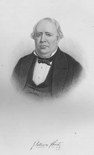
The settlers of Losantiville, and afterwards the immigrants to Cincinnati for more than a generation and a half, found the plainest indications that a numerous and intelligent people had been here before them. The red man had left few tokens of his occupancy, and those of bin the most insignificant character; but beneath the deep shades of the luxuriant forest, overgrown by trees of centuries' growth, upon both the upper and lower terraces, it is said, were the unmistakable remains of structures erected there by a strange, mysterious race, whose very name, to say nothing of their history and tribal relations, had long been covered by the dust of oblivion. As Professor Short remarks, in his North Americans of Antiquity:
The same sagacity which chose the neighborhood of St. Louis for these works, covered the site of Cincinnati with an extensive system of circumvallations and mounds. Almost the entire space now occupied by the city was utilized by the mysterious Builders, in the construction of embankments and tumuli built upon the most accurate geometrical principles, and evincing keen military foresight.
ENCLOSURES AND EMBANKMENTS.
Almost every one of the leading classes of Mound Builders' remains was represented in the Cincinnati works. The chief work was probably a sacred enclosure, since it had no ditch, and occupied a position offering no special advantages for defence. It was an earth wall or embankment, encircling the entire blocks now bounded by Fourth and Fifth, Race and Walnut streets, and including some fractions of adjoining blocks. Its figure was not mathematically exact, and was probably not intended to be so. It was a very broad ellipsis, eight hundred feet in diameter from east to west, and about six hundred and sixty from north to south. An opening or gateway ninety feet wide appeared on the east side of the wall, upon or near the line of .Fourth street. The height of the work, as found by the pioneers, was scarcely a yard, but the base of the embankment averaged ten yards in thickness. It was heaped up with loam similar to that found in its immediate vicinity, and was of quite uniform composition throughout, as discovered by subsequent excavation and, removal. Nothing found inside the main work indicated that manual labor had been expended therein, the ground being somewhat irregular and uneven, and evidently left by the Builders pretty nearly in a state of nature. There was no ditch within or without the walls. From each side of the gateway, and exterior but contiguous to the wall, stretched away a broad elevation or parapet, of somewhat indeterminate figure. From that on the line of Fourth street could be traced a bank of only twelve inches height, but with a nine-foot base. It extended southward fifty to seventy-five yards, until within a few yards of the edge of the upper plain, or the "hill," as it was then called, when it turned to the east, and ended in a mound at the present junction of Main and Third streets, about five hundred feet distant from the point of departure. No similar wall from the other side of the gateway was observable; but at a short remove north of it were two other elevations, isolated though near each other, over six feet high, and probably artificial, though of shapeless form.
More than four hundred yards east of the work just described, between Broadway and Sycamore streets, was
HISTORY OF CINCINNATI, OHIO - 15
a bank of about the same dimensions as to height and thickness, which reached in a slight curve from Sixth nearly to Third. The circle of which it was a segment, whether ideal or embodied in earthwork, was an immense one. "It was evidently," says Judge Burnet, in his Notes, from which many of these facts are derived, "a segment of a very large circle, with its centre just south of the other work described." The remainder had been left unfinished. or was leveled after construction. From a point near the south end of the segment formed a low wall could be traced to the river, and was found to correspond in a remarkable way, in height, extent, and direction, with another embankment, about half a mile distant, in the western part of the village site. Both of these had disappeared by the year 1815.
Mr. Robert Clarke, in his pamphlet on the Pre-historic Remains at Cincinnati, printed in 1876, is not inclined to give credence to the story of this extension to the river, "as it would extend the works to the bottom-land, on which Mound Builder's works are seldom anywhere found. It is more probable that this embankment turned westward and joined the other embankment at the mound."
Upon the present track of Fifth street, still east of all the works Mentioned, and about four hundred feet from the segment, was a circular enclosure of sixty feet diameter, bearing evidence of construction by heaping up earth from the ground within. It was, when found, but one foot high, on a twelve to fifteen-foot base.
In the north part of the old town, between Elm and Vine streets, and six hundred yards from the great ellipsis (now between the canal and Fourth streets), were two extensive earth walls, also of convex shape, but not constituting an enclosure. They were each seven hundred and sixty feet long, about two feet high, and ran in exact parallels in a general east and west direction, forty-six feet apart, measuring from the middle of the embankment, for two-thirds of the way, when they converged slightly to forty feet width, and so continued to the end. At about the point where the convergence began, there was an opening of thirty feet in the southern bank.
Many other inequalities of surface, upon sites more or less irregular, were observable in the early day; but by the time the attention of antiquaries had been much directed to them, twenty-five to thirty years after settlement, they had become too obscure and ill-defined to warrant detailed description. Strange to say, the plains on the other side of the river, in Kentucky, did not present, according to Judge Burnet, the slightest vestige of ancient earthworks.
TUMULI.
Upon the upper plain on which the principal part of Cincinnati is located, were found several large mounds or pyramids. The largest of these was due west of the great ellipsis, and five hundred yards distant froth it. It was situated just where the alley between Fifth and Long-worth streets intersects the .west side of Mound street, to which it gave the name; and was formed, it is believed from its composition, simply by scooping earth from the surrounding surface and heaping it up smoothly. The composition and structure of the mound were thus described by Mr. John S. Williams, editor of the American Pioneer, in volume II of that magazine:
The earth of the mound is composed of light and dark colored layers, as if it had been raised, at successive periods, by piling earth of different colors on the top. This appearance might have been produced by successive layers of vegetation and freezings, which were allowed to act on each layer before the mound received a second addition to its height. In some parts the layers are completely separated by what appears to have been decayed vegetable matter, such as leaves and grass, as the earth is in complete contact, except a very thin division by some such substance. In some places through the mound there are vacancies, evidently occasioned by the decay of sticks of wood, leaving a most beautiful, impalpable powder. Throughout the mound there are spots of charcoal, and in some places it is in beds. In one or two places which we observed, the action of fire upon the clay had left marks of considerable intensity.
The, shape of its base was that of a regular ellipsis, with diameters about in the ratio of two to one, and the longer diameter in a line about seventeen degrees east of north. It is described by one of the early local writers as "a considerable mound of great beauty, about fifty [?] feet high, constructed with great exactness, and standing upon a base unusually small compared with its height." The long diameter of the base was about seventy feet; the shorter thirty-five. Its circumference was four hundred and forty feet, and its height was twenty-seven feet so lately as 1815, though about eight feet had been cut from the top of it in 1794 by General Wayne, who posted a sentinel, with a sentry-box, upon it, while his army was encamped in the Mill Creek valley. From its summit, it is said, a view of the entire plain could be commanded; and it is a very interesting tact wholly unique, so far as we know, in the history of the mounds—that this order of General Wayne restored the structure for a time to what was doubtless its ancient character and use in part, as a mound of observation. Some superficial excavations were early made in this mound, resulting in the finding of a few scattered human bones, probably from intrusive burials, a branch of deer's horn, and a piece of earthenware containing muscle shell. Long afterwards (1841) the removal of the mound in the grading of the street and alley, brought to light one of the most interesting memorials of antiquity ever discovered, which willl be noticed at some length below. The lines "To the Old Mound," quoted at length at the beginning of this chapter, were addressed to this ancient remain. Three smaller mounds stood in the close neighborhood of this, also containing human remains. Five hundred feet north and somewhat eastward of this work, near the northeast corner of Mound and Seventh streets, was another, a platform mound, probably about nine feet high, circular, and nearly flat on top. In this were found a few fragments of human skeletons and a handful of copper beads that had formerly been strung on a cord of lint.
Northeast of this eminence, and several hundred yards distant, on the east of Central avenue, opposite Richmond street, near Court, was another circular mound but three feet high, from which were taken unfinished spear' and arrow-heads of chert or flint.
But the most remarkable of this class of the Cincinnati works which did not long survive the advent of the
16 - HISTORY OF CINCINNATI, OHIO.
white man, was the mound at the intersection of Third and Main streets, near the site of the older as well as the later First Presbyterian churches. It was the mound formerly, mentioned as terminating the wall from the great ellipsis, and was one hundred and twenty feet long, sixty feet broad and eight feet high, of an oval figure, with its diameters nearly on lines connecting the opposite cardinal points of the compass. It was gradually destroyed at an early day by the necessity of grading Main street to reduce the difficulty of ascent from the lower plain to the higher. The strata of which it was composed, proceeding from without, were: First, a layer of loam or soil like that upon the adjacent natural surface. The articles found in the tumulus were a little below this stratum. Second, a layer of large pebbles, convex, like the outer one, and of uniform thickness. Lastly, gravel, considerably heaped up in the centre, and containing no remains. Many interesting articles were found in the process of excavation and removal—pieces of jasper, rock crystal, granite, porphyry, and other rocks, mostly cylindrical at the extremes and increasing in diameter toward the middle, with an annular groove near one end, and all evincing much skill of the Builders in cutting and polishing the hardest rocks. Numerous other articles, made of cannel coal, argillaceous earth, and bone, including the sculptured head of a bird, supposed to be intended to represent that of an eagle; bits of isinglass or mica, lead ore, and sheet copper, all supposed to be used partly for ornament and partly in religious observances; with beads of bone or shell, the teeth of some carniverous animal, probably the bear, and several large marine shells; also a quantity of human bones, apparently belonging to twenty or thirty skeletons, were found in this work. The last mentioned remains were generally surrounded by ashes and charcoal, and sometimes were found enclosed in rude stone cists or coffins. The stratum above these seemed to be undisturbed, and had evidently been laid after the precious deposits were made. One of the old writers also mentions among the discoveries in this mound certain other articles, "most probably deposited in it after Europeans began to visit here"— as pieces of hard brown earthenware; the small image of a female holding an infant in her arms and supposed to represent the Virgin Mary, finely wrought in ivory but somewhat mutilated; and a small, complex instrument of iron, greatly corroded, and supposed to be used for weighing light articles." The last two statements are decidedly apocryphal, though Judge Burnet apparently gives credence to them and repeats them in his Notes.
This ancient work was noticed very early by Colonel Sargent, secretary of the Northwest Territory, in a letter from Cincinnati, dated September 8, 1794, and enclosing drawings of relics exhumed from a grove near the mound. His correspondent, Dr. Benjamin S. Barton, of Philadelphia, made them the theme of an elaborate letter to Rev. Joseph Priestly, the famous Indian theologian, philosopher and scientist; and the correspondence was published, with illustrations, in volumes four and five, of the transactions of one of the learned societies of the Quaker city.
A DENUDED MOUND.
In 1874 Dr. H. H. Hill discovered a cluster of ancient graves on the extreme point of Brighton Hill, at the west end of the range of hills north of the old city, which Mr. Clarke thinks were once covered by a mound that has been in the course of the ages washed away by the rainfalls to or near the level of the original surface. Many loose stones, in groups or piles, had been long observed at this spot, and had been conjectured to be the remains of an ancient stone work. The human remains were included within a circular spot about forty feet in diameter, and the bones were so greatly decomposed that they soon fell to dust. From some indications in the position of the bones there is reason to believe that Indians were buried here, as well as Mound Builders. Many teeth and tusks of animals, fragments of stag-horn, with various implements made from bone, pieces of mica, stone hammers, gorgets and pipes, spear and arrow-heads, copper and bone awls, and fragments of shells with traces of carving thereon, were also found in the burial-place. It was a very interesting find. The mound supposed to have stood over the remains and relics is that designated by Mr. Clarke, in a quotation we shall make hereafter, as the "Brighton Hill mound." It was also, probably, one of the series of signal-mounds in the Mill creek valley.
"DUG-HOLE."
Over half a mile north of the ellipsis, which serves as a convenient point of departure for distances to the other works, was an excavation or "dug-hole," believed to be artificial, but not apparently connected with any other work. It was nearly fifty feet in diameter at the top, as measured from the top of the circular bank formed by throwing out the earth, and almost twelve feet in depth; and was by some of the early settlers supposed to be an old, half-filled well. It probably belonged, however, to the age of the Mound Builders, and to the class of ancient remains known as "dug-holes," originally intended as reservoirs for water or store houses of provision.
A SCHOLAR'S VIEW.
General W. H. Harrison, in his instructive address before the Historical and Philosophical society of Ohio, in 1837, published in their transactions, and also in pamphlet form, gave the following view of the works, as they appeared in the white man's early day here:
When I first saw the upper plain on which that city stands, it was literally covered with low lines of embankments. I had the honor to attend General Wayne two years afterwards, in an excursion to examine them. We were employed the greater part of a day, in August, 1793, in doing so. The number and variety of figures in which these lines were drawn, was almost endless, and, as I have said, almost covered the plain—many so faint, indeed, as scarcely to be followed, and often for a considerable distance entirely obliterated; but, by careful examination, and following the direction, they could again be found. Now, if these lines were ever of the height of the others made by the same people (and they must have been to have answered-any valuable purpose), or unless their erection was many, years anterior to the others, there must have been some other cause than the attrition of rain (for it is a dead level) to bring them down to their then state. That cause I take to have been continued cultivation; and, as the people who erected them would not themselves destroy works which had cost them so much labor, the solution of the question can only be found in the long occupancy
HISTORY OF CINCINNATI, OHIO - 17
and the cultivation of another people, and the probability is that people were the conquerors of the original possessors. To the question of the fate of the former, and the cause of no recent vestige of settlements being found on the Ohio, I can offer only a conjecture, but one that appears to be to be far from improbable.
The general thought the occurrence of tremendous floods, like those o 1793 and 1832, might be sufficient to drive off the builders, "not only from actual suffering, but from the suggestions of superstition ; an occurrence so unusual being construed into a warning from Heaven to seek a residence upon the smaller streams."
THE WORKS IN 1817.
Many were still remaining. Judge Burnet, writing at this time, notes them as "numerous here, and consisting of two circular banks, mounds, tumuli, etc." A house then stood at the corner of Mound and Third streets, upon the site of the tumulus there. Several streets were intersecting the remains, and they did not long thereafter maintain their ground against the march of improvement, which in time obliterated the last vestige of the monuments of ancient civilization, so far as the surface of the site of Cincinnati exhibited them.
THE WORKS IN 1819 AND 1825.
The maps prefixed to the first and second directories of the city, published in 1819 and 1825, however, take notice of the existence and position of the enclosures and mounds upon the site of Cincinnati, though not precisely as they have been described above. One work, the large ellipsis, is delineated as surrounding completely the block between Fourth and Fifth, Race and Vine streets, except a very small part of the northwest corner, about half the next block east, and some parts of the adjacent blocks north and south. Adjoining the northeast part of it, on the north half of the block bounded by Third, Fourth, Vine and Race streets, appears a large mound, with a single embankment running almost due south to the lower part of the block, and thence across the next block eastward to the mound at the northeast corner of Main and Third. The enclosure is represented as an irregular circle, of about six hundred feet diameter. The convex parallel walls between Canal and Twelfth are shown as a long enclosure, extending almost diagonally from a point a trifle east of Vine street across the block bounded by that place and the streets before named, and about half-way across the block next on the west.
Wayne's sentry-post is plainly marked as a large tumulus at the southeast corner of Fifth and Mound, and the others mentioned as being in the west and northwest part of the town are here—the mound upon the upper side of Seventh street, below Smith, near the rope-walk then standing; that on Western Row, nearly at the head of Richmond; one large mound west of Plum, near the old corporation line on Liberty street; and also one in the eastern part of the city, directly on Fifth street, half a block beyond Broadway. The mound on Fourth street stood nearly where Pike's Opera house now is.
Thus it appears that the ancient works upon the site of Cincinnati were still so well defined, so late as 1825, as to &serve, if not demand, a place upon the map of the city.
THE CINCINNATI TABLET.
In November, 1841, the large tumulus near the corner of Fifth and Mound streets was removed, in order to extend Mound street across Fifth and grade an alley. A little above the level of the surrounding surface, near the centre of the mound, were found a large part of a human skull and two bones of about seven inches length, pointed at one end. It was undoubtedly the grave of a Mound Builder, probably a great dignitary of his tribe. Under the fragmentary skull of the buried Builder was a bed of charcoal, ashes and earth, and therein a very remarkable inscribed stone which, after much discussion, including the publication of Mr. Clarke's interesting pamphlet in vindication of its authenticity, has been pronounced a genuine relic of the period of the Mound Builders. It is not lettered or inscribed with hieroglyphics, but is marked with curious, broad lines, curves and scrolls. Some have thought they could trace in these the outline of a figure, perhaps an idol; but the better conjecture seems to be that it served for a record of calculations and a scale of measurement. The following description and remarks upon it are extracted from Messrs. Squier and Davis's "Ancient Monuments of the Mississippi Valley":
The material is fine grained, compact sandstone of a light brown color. It measures five inches in length, three in breadth at the ends, and two and six-tenths at the middle, and is about half an inch in thickness. The sculptured face varies very slightly from a perfect plane. The figures are cut in low relief (the lines being not more than one-twentieth of an inch in depth), and occupy a rectangular space of four inches and two-tenths long by two and one-tenth wide. The sides of the stone, it will be observed, are slightly concave. Right lines are drawn across the face near the ends, at right angles, and exterior to these are notches, twenty-five at one end and twenty-four at the other. The back of the stone has three deep longitudinal grooves and several depressions, evidently caused by rubbing--probably produced by sharpening the instrument used in the sculpture. [Mr. Gest, however, the present owner of the stone, does not regard these as tool marks, but thinks they have some special significance.]
Without discussing the singular resemblance which the relic bears to the Egyptian cartouch, it will be sufficient to direct attention to the reduplication of the figures, those upon one side corresponding with those upon the other, and the two central ones being also alike. It will be observed that there are but three scrolls or figures—four of one description and two of the others. Probably no serious discussion of the question whether or not these figures ate hieroglyphical, is needed. They more resemble the stalk and flowers of a plant than anything else in nature. What significance, if any, may attach to the peculiar markings or graduations at the end it is not undertaken to say. The sum of the products of the longer and shorter lines (twenty-four by seven and twenty-five by eight) is three hundred and sixty-eight, three more than the number of days in the year ; from which circumstance the suggestion has been advanced that the tablet had an astronomical origin and constituted some sort of a calendar.
We may perhaps find the key to its purposes in a very humble, but not therefore less interesting class of southern remains. Both in Mexico and in the mounds of Mississippi have been found stamps of burnt clay, the faces of which are covered with figures, fanciful or imitative, all in low relief, like the face of a stereotype plate. These were used in impressing ornaments upon the clothes or prepared skins of the people possessing them. They exhibit the concavity of the sides to be observed in the relic in question--intended, doubtless, for greater convenience in holding and using it—as also a similar reduplication of the ornamental figures, all betraying a common purpose. This explanation is offered hypothetically as being entirely consistent with the general character of the mound remains, which, taken together, do not warrant us in looking for anything that might not well pertain to a very simple, not to say rude,. people.
3
18 - HISTORY OF CINCINNATI, OHIO..
AN INTERESTING THEORY.
The following discussion from Mr. Clarke's pamphlet may appropriately end this little treatise on the Cincinnati works :
It may be of interest here to examine these pre-historic works in the light of Lewis H. Morgan's "pueblo" theory, as set forth in his article in the North American Review for July of this year. The great central work, an ellipse eight hundred by six hundred and sixty feet, corresponds with his pueblo or village. Its position gave it a measure of security, being on the upper plain, three hundred and fifty feet from its edge, and could be completely screened from view from the river by a belt or grove of trees. The embankment, three feet high (possibly originally higher), with a base of thirty feet, afforded sufficient foundation for their buildings, occupying the circumference of the ellipse, facing inward, presenting a solid timber wall on the outside, with no entrance but by the gateway on the east, which may have been protected by a palisade of round timbers, with proper openings for ingress and egress, and by some structures of the nature of bIock-houses on the higher embankments attached externally at each side of the entrance. From the lower of these block-houses, it will be remembered, ran the low embankment, one foot high, with nine feet base, southward nearly to the edge of the declivity, and then east to the mound on the corner of Third and Main streets. This may have been occupied by a high timber palisade, or a covered way leading to the mound, which was so situated as to command a full view of the Licking river, which enters the Ohio on the opposite shore, and was doubtless an important approach, which it was necessary should be watched. If I am right in supposing that the embankment, of the same dimensions as the last, noticed east of Sycamore, running from Sixth street to near Third street, turned there and joined the other embankment at the mound, and was built upon in the same manner, we would thus have the whole front so defended that it would have to be forced or flanked by an enemy coming from the direction of the Licking river.
East of this high hill, Mount Adams, overlooking the Ohio, and giving a clear view up the river for miles, would be a natural outpost on which it would not be necessary to erect a mound structure. I have never heard of any remains having been found on this hill.
To the west, the hill next the river was so distant, and from its position did not command an extensive enough view of the river to serve as an outlook; so a position was selected near the edge of the plain, about five hundred yards west of the closed end of the village, and a large mound thirty-five feet high was erected, from which could be had an extensive view of the Kentucky shore and of the Ohio river to the bend below the mouth of Mill creek. The Brighton Hill mound would give an extensive view of the whole of Mill creek valley, the whole, as before mentioned, being part of an extensive series of signal stations.
The minor mounds and other works on the upper plain may have been connected with the supervision and care of their agricultural operations on the rich land between the village and the northern hills.
Thus we have a village judiciously located on a fine, fertile plain, and well guarded by the nature of the location and the artificial works erected on a carefully arranged plan.
Mr. Morgan's theory will apply to a large number of the Ohio works. . . . The two larger mounds were so situated that we can hardly avoid the conclusion, though it is only a supposition, that one object of their erection was to serve as outlooks for watching the approaches to their village from the Kentucky side of the river by the Licking, and from the west by the Ohio. From the description of the structure of the mounds and the remains found in them, it is quite certain that they were also grave mounds. They may have been originally placed on these commanding points so as to be seen from a distance (just as we place monuments in prominent positions), and afterward used as outlooks. Dr. Drake, as quoted above, gives sufficient details of the structure and contents of that at the corner of Third and Main streets to warrant this conclusion as to that mound.
ANCIENT VEGETABLE REMAINS.
Although not strictly belonging to the general topic of this chapter, mention may here be fitly made of some interesting "finds" that have been made upon the site of Cincinnati, belonging to a period of ancient vegetation of which many evidences are apparent in Hamilton county, as will be seen upon reference to the second chapter of this book, upon its geology and topography. In 1802 a well was dug by an ancient settler in the centre of one 'of the artificial enclosures above described, and two stumps, of twelve and eighteen inches' diameter, respectively, were met with at a depth of ninety-three feet, standing as- they grew, with roots sound and in place. From the soil that was thrown out in excavating the well mulberry trees grew in large numbers, although none were known to exist on the plain before. About the same time Mr. Daniel Symmes, while digging another well in the eastern part of the town, came upon a large undecayed log twenty-four feet below the surface. It is said that similar discoveries have frequently been made in making deep excavations in different parts of the city, showing that the ancient level of the plain was once far below its present elevation.
CHAPTER III.
THE SITE OF LOSANTIVILLE,
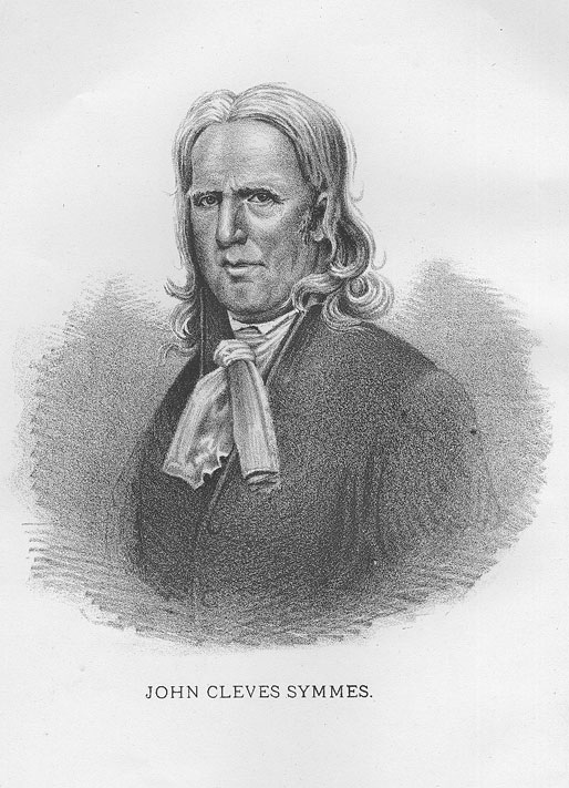
THE original site of Cincinnati, platted and surveyed under the name of Losantiville, was contracted for before the surveys of the Symmes Purchase were made, and the conveyance to Mathias Denman simply specified that his tract should be located as nearly as possible opposite the mouth of the Licking river. When the surveys were completed, it was found that he owned the entire section eighteen, and the fractional section in seventeen lying between that and the river, in township four and the first fractional range, as surveyed under the orders of the prospective patentee, Judge Symmes. The tract covered eight hundred acres, and including the outlots as well as in-lots laid out upon it, comprised the original site of Cincinnati. It extended, on a north and south line, from the present Liberty street to the river. The eastern boundary line ran from the intersection of the old Lebanon road with Liberty street to the Ohio, at a point one hundred feet below Broadway; and the western line ran from the intersection of Liberty street with the Western row (Central avenue) to the river, which is reached just below Smith street landing. This tract, a little less than one and one-fourth square miles, was not quite one twenty-second part of the, present vast area of Cincinnati.
The founders of Losantiville found this site nearly or quite in a state of nature, save the earthworks which indicated its occupancy by a people long before departed. Mr. E. D. Mansfield says it was the site of an old Indian town, and other authorities say that two block-houses had been erected here by the soldiers of an expedition against the Indians, only eight years previous ; but the records of Losantiville are silent concerning the vestiges of the Indian village and the white men's fortifications, if any existed at this time. A dense wood covered the apparently virgin tract. The lower belt of ground was occupied mainly by beech, buckeye, and sugar trees, loaded with grapevines, and interspersed with a heavy undergrowth of spicewood and pawpaws. The same timber
HISTORY OF CINCINNATI, OHIO - 19
prevailed upon the second terrace, with poplars and other trees, some of which were very large. Many of the beeches were also large, and a cluster of these, near "Stonemetz's ford," on Mill creek, was still standing sixty years after the settlement, and bore the name of "Loring's woods"—the only relics of the primeval forest here, except some scattered trees. A group of these trees was also called the "Beechen grove" in an early day.
At the foot of Sycamore street Was an inlet of considerable size, which took the name of "Yeatman's cove," from its neighborhood to the tavern and store of Griffin Yeatman, but also called the "Stone landing," because used for the disembarking of the boatloads of stone brought for the building of Fort Washington, at a spot near what is now the corner of Sycamore and Front streets. At the corner of Ludlow street was another inlet,• called "Dorsey's cove," and another still higher up, just below the mouth of Deer creek. These little harbors were exceedingly convenient as landing-places for immigrants, and were doubtless used also by the crews of boats conveying the earlier expeditions against the Indians. In the shore end of Yeatman's cove the first, little, rude market-house of the village was constructed, to the pillars of which boats were usually tied in seasons of high water.
The north shore of the Ohio, and the ground for some way back, as first observed by the whites at this point, are described as somewhat resembling in appearance the site of Philadelphia. Dr. Daniel Drake, writing twenty years after the beginnings, when the physical features of the place had not greatly changed, except by the partial clearing of the woods, in his "Notices concerning Cincinnati," says:
Its site is not equally elevated. A strip of land called the BOTTOM (most of which is inundated by extraordinary freshes, though the whole is elevated several feet above the ordinary high-water mark), commences at Deer creek, the eastern boundary of the town, and stretches down to the river, gradually becoming wider and lower. It slopes northwardly to the average distance of eight hundred feet, where it is terminated by a bank or glacis, denominated the HILL, which is generally of steep ascent, and from thirty to fifty feet in height. In addition to this there is a gentle acclivity for six or seven hundred feet further back, which is succeeded by a slight inclination of surface northwardly, for something more than half a mile, when the hills or real uplands commence.
These benches of land extend northwestwardly (the upper one constantly widening) nearly two miles, and are lost in the intervale ground of Mill creek. The whole form an area of between two and three square miles—which, however, comprehends but little more than a moiety of the expansion which the valley of the Ohio has at this point. For on the southern side, both above and below the mouth of the Licking river, are extended, elevated bottoms.
The hills surrounding this alluvial tract form an imperfectly rhomboidal figure. They are between three and four hundred feet high; but the angle under which they are seen, from a central situation, is only a few degrees. Those to the southwest and northwest, at such a station, make the greatest and nearly an equal angle ; those to the southeast and southwest also make angles nearly equal. The Ohio enters at the eastern angle of this figure, and, after bending considerably to the south, passes out at the western. The Licking river enters through the southern, and Mill creek through the northern angle. Deer creek, an inconsiderable stream, enters through the northern side. The Ohio, both up and down, affords a limited view, and its valley forms no considerable inlet to the east and west winds. The valley of the Licking affords an entrance to the south wind, that of Mill creek to the north wind, and that of Deer creek (a partial one) to the northeast. The other winds blow over the hills that lie in their respective courses. The Ohio is five hundred and thirty-five yards wide from bank to bank, but at low-water is much narrower. No extensive bars exist, however, near the town. Licking—river, which joins the Ohio opposite the town, is about eighty yards wide at its mouth. Mill creek is large enough for mills, and has wide alluvions, which, near its junction with the Ohio, are annually overflown [sic]. Its general course is from northeast to northwest, and it joins the Ohio at a right angle. Ascending from these valleys the aspects and characteristics of the surrounding country are various. . . . No barrens, prairies, or pine lands are to be found near the town.
Some notices of the site of Cincinnati in the early day have been inserted in the first chapter of this division of our work, and need not be repeated here. A glowing paragraph by Mr. J. P. Foote, concerning the hills in their pristine freshness, will be particularly remembered. The ground on the "bottom" was quite broken and uneven; that on the "hill," or second terrace, was somewhat smoother. The bank which separated them was sharp and abrupt;* and it was a serious question with the fathers whether it should be cut through by the streets with a steep or gentle gradient. Happily for the horses and men employed in the immense transfer business since that day, the problem was solved in the sensible way that might have been expected of the founders of the Queen City, although the costlier. The grade of Main street, for example, was thus in process of time extended along three squares, from Second to Fifth streets (Third street being about one. hundred feet north of the original line of the bank), with an angle of ascent of but five to ten degrees. The constant change of level in the streets, ha the progress of improvement from year to year, made sad work with the relations of sidewalks and pavements (or the spaces where pavements ought to have been), and left many buildings of the early day far above the streets on which they once immediately fronted. Interesting anecdotes are related of the foresight of some of the early business men, who, at once upon the planning and laying foundation of their buildings, went low enough with the latter to meet the future exigencies of improvement. A writer in the first number of Cist's Cincinnati Miscellany, probably Mr. Cist himself, making some notes of "city changes," says:
In the early part of the present century, Broadway, opposite John's cabinet warehouse, was the center of a pond, three or four acres in extent, to which the early settlers resorted to shoot plovers. . . The general level of upper Main street extended as far south as nearly the line of Third street, part of the original surface of the ground being preserved in some of the yards north of Third street to this date (October, 1844). It will readily be imagined what an impediment the bluff bank overhanging the lower ground to the south, and repeatedly caving in on it, must have created to the intercourse between the two great divisions of the city—Hill and Bottom. But this statement, if it were to end here, would not give an adequate idea how far the brow of the hill overhung the bottom region ; for it must be observed that, while the hill projected nearly forty feet above the present level, where its edge stood, the ground on Main street, opposite Pearl and Lower Market streets, corresponded with the general level of these streets, which must have been between thirteen and fourteen feet below the present grade. The whole ground from the foot of the hill was a swamp, fed partly from a cove which put in from the Ohio near what is now Harkness' foundry, and in high water filled the whole region from the hill to within about one hundred and fifty yards of the Ohio in that part of the city from Walnut to Broadway—in early days the dwelling ground,
* An interesting remnant of the old bank at the brow of the hill—the only one left, we believe—is still to be seen at the northwest corner of Third and Plum streets. It is now a back yard, heaped up with old iron.
20 - HISTORY OF CINCINNATI, OHIO.
principally, of the settlers, as it still is the most densely built-on and valuable part of Cincinnati.
The writer then relates some interesting facts of Casper Hopple's old tobacco warehouse, on Lower Market street, which was built upon boat-gunnels many years before—material obtained by the breaking up of the primitive river vessels. In his plan of building, Mr. Hopple had the foresight to place the joists of the second story just fourteen feet above the sills of the door to the first, saying that that would be the proper range of the floor, when Lower Market should be filled to its proper height; which proved, quite remarkably, to be the case, so that his second story became a first, and the first a cellar of the right depth, as originally planned.
This entertaining antiquary also makes mention of Captain Hugh Moore's building, nearly opposite this, on the subsequent site of Bates & Company's hat warehouse, which likewise had boat-gunnels for foundation, with boat-plank for the inside walls, lined with poplar boards, and a clapboard roof. It was, he thinks, perhaps thirty-six feet deep and twenty feet front. Captain Moore secured this building for the sale of his merchandise, it being the only one he could secure for the purpose. And now comes in the remarkable part of the narrative, which makes if germane to this chapter:
"When he had bargained for the house, which he rented at one hundred dollars per annum, and which, with the lot one hundred feet on Main by two hundred on Pearl street, he was offered in fee simple at three hundred and fifty dollars, he brought the flat-boat which was loaded with his store-goods from the Ohio, via Hobson's Choice, not far from Mill creek, up Second or Columbia street, and fastened the boat to a stake near the door, as nearly as can be judged the exact spot where the Museum lamp-post now [1844] stands, at the corner of Main and Pearl streets."
Upon 'the lower slope was a broad swamp, occupying the larger part of the space between Second and Lower Market streets, though a part stretched still further to the south.
CHAPTER IV.
BEFORE LOSANTIVILLE.
AN INDIAN VILLAGE.
It is said, upon the authority of the late Hon. E. D. Mansfield, who makes the remark in his Personal Memories, that the Indians had anciently a town upon the site of Cincinnati. Its natural advantages for the purposes of savage as well as civilized man, would of themselves argue that fact, though no other evidence should exist in corroboration of the statement. Whatever that evidence may be, the history of Indian occupancy at this point has faded out as completely as that of the older and more civilized Mound Builder in this garden spot of the Ohio valley. Neither left a record in literature—not even in that of the sculptured monument, if we except the remarkable little object known as the "Cincinnati stone," discovered in 1841 in the large mound near the intersection of Fifth and Mound streets; and tradition is equally silent, so far as the details of human life in a remoter Losantiville or Cincinnati are concerned. There were the earthworks—most of them low and insignificant in appearance; as they rose in slight eminence or wound their way amid the monarchs of the forest—some so diminutive as to be scarcely distinguishable above the surface; and they were all that told of the presence of man in congregated communities upon this area until Colonel Patterson led his little band to their new homes in the wilderness. Except for those, this was the forest prime val. Anything more would certainly have been noted and recorded by the shrewd, intelligent men who were the founders of the city.
TWO BLOCK-HOUSES.
The statement is made, however, by Mr. Isaac Smucker, of Newark, in one of his interesting historical papers published by the secretary of State in the official volumes of Ohio Statistics (that for 1877 containing this), that Colonel George Rogers Clark, with an army of about one thousand men, all Kentuckians, "in 178o crossed the Ohio at the mouth of the Licking, and erected two block-houses on the first day of August, upon the ground now occupied by Cincinnati." Clark had organized the expedition during the previous month, to march against the Indian villages on the Little Miami and the Mad rivers, to punish the Shawnees for their marauding inroads into the Kentucky settlements. After the reputed erection of the block-houses—which must have been very rapidly accomplished—he resumed the march, and on the fifth day thereafter struck the Indian towns at the site of Old Chillicothe, on the Little Miami. The Indians had anticipated Clark's arrival, however, and themselves applied the torch to their village, leaving little mischief for the Kentuckians to do, except to destroy the ripening corn. But at Piqua, a larger town and the birthplace of the renowned Tecumseh, on the Mad river, about five miles west of the present Springfield, the savages made a stand, preparing an ambuscade in the high grass of a prairie adjoining their lodges, and opened an unexpected and deadly fire upon the invaders. The latter speedily rallied and charged the Indians, who, after a desperate fight, fled the field, losing about twenty dead, and -the Kentucky volunteers as many. The village and several hundred acres of standing corn were laid waste. Colonel Clark then returned to the mouth of the Licking, and disbanded his force.
One member, and but one, we believe, of that band of Indian fighters has left express testimony to the building of the block-houses. Mr. Thomas Vickroy, who was afterwards an assistant in the survey of the site of Pittsburgh,-was out in this expedition. He says:
In April, 1780, I went to Kentucky, in, company with eleven flatboats with movers. We landed, on the fourth of May, at the mouth of Beargrass creek, above the falls of Ohio. I took my compass and chain along to make a fortune by surveying, but when we got there the Indians would not let us survey. In the same summer Colonel Byrd
HISTORY OF CINCINNATI, OHIO - 21
came from Detroit with a few British soldiers and some light artillery, with Simon Girty and a great many Indians, and took the forts on the Licking. Immediately afterward General Clark raised an army of about a thousand men, and marched with one party of them against the Indian towns. When we came to the mouth of the Licking we fell in with Colonel Todd and his party. On the first day of August, 178o, we crossed the Ohio river and built the two block-houses where Cincinnati now stands. I was at the building of the block-houses. Then, as General Clark had appointed me commissary of the campaign, he gave the military stores into my hands and gave me orders to maintain that post for fourteen days. He left with me Captain Johnson and about twenty or thirty men, who were sick and lame.
Nothing more is said in history, so far as the writer of these pages is aware, of these block-houses. The use of the structures, during Clark's brief campaign to the northward, is sufficiently indicated in Mr. Vickroy's statement. As his force was not regularly recruited and paid by the United States or any other constituted authority, there is not the least probability that a garrison was left in it when his march was done and he recrossed the Ohio. In that case the red men would make short work of the obnoxious buildings as soon as they obtained access to them. Such works were not commonly suffered to remain upon lands unoccupied and undefended, as defiant monuments of the hated "Long Knife." Fire would speedily cause them to vanish in air, and the lapse of more than eight years, with floods probably inundating their sites repeatedly, would so cover them with soil and nature's tangled wildwood that the very clearings made for them could not be recognized. We do not learn that there is the faintest clue to the exact locality of these block-houses. But the brief story of them is exceedingly interesting, as that of the first occupancy in houses of the site of Cincinnati by the white man,
August 1, 1780.
ONE BLOCK-HOUSE.
The fact that another block-house stood upon the site of Cincinnati, more than six years before the Ludlow and Patterson party came, seems to be clearly established by similar testimony; not only that of a single person—Mr. John McCaddon, for many years a respected citizen of Newark, in this State, who was present at its building —but also by that of two persons of far greater renown, no less personages than General Simon Kenton and Major James Galloway. General Clark was then making a second expedition against the Miami towns, to avenge the defeat of the Kentuckians at the battle of the Blue Licks August 15, 1782. That disaster had aroused a fierce desire for reprisals upon the Ohio Indians; and, as soon as a force could be collected from the widely scattered settlements, it marched in two divisions, under Colonels Logan and Floyd, for the mouth of the Licking. Clark crossed here with one thousand and fifty men, threw up a block-house rapidly, and marched with such speed one hundred and thirty miles up the Miami country, that the Indians were thoroughly surprised. The principal Shawnee town was destroyed November loth; also the British trading post at Loramie's store, in the present Shelby county—the same locality visited by Christopher Gist in 1752—and he destroyed a large quantity of property and some lives, with little loss. It was a very effective expedition, especially as relieving Kentucky against formidable invasion.
Fifty years afterwards an address issued by the venerable pioneers and Indian fighters, Kenton and Galloway, to call their comrades together for the semi-centennial celebration of theis occupation opposite the Licking, contained these words:
We will no doubt all recollect Captain McCracken. He commanded the company of light horse, and Green Clay was his lieutenant. The captain was slightly wounded in the arm at Piqua town, when within a few feet of one of the subscribers, from which place he was carried on a horse litter for several days ; his Wound produced mortification, and he died in going down the hill where the city of Cincinnati now stands. He was buried near the block-house we had erected opposite the mouth of Licking, and the breastworks were thrown over his grave to prevent the savages from scalping him.
We have also the separate confirmatory testimony of Major Galloway, who was of the party of 1782, and resided long afterwards in Greene county. Ht was well known to many old citizens of Cincinnati. In a letter written to acknowledge the receipt of an invitation to attend the fifty-fifth anniversary of the settlement of Cincinnati, in 1833, he says :
In October, 1782, I accompanied General Clark on an expedition against Pickawayand Loramie's town, and was within a few feet of the lamented William McCracken when he received the wound of which he died on his return, while descending the hill near which Cincinnati now stands, and was buried near a block-house opposite the mouth of Licking.
These cumulative testimonies would seem to place the question of a pre-Losantiville block-house here in 1782 beyond doubt or cavil. But if further testimony was needed, it is supplied by Mr. McCaddon, the old resident of Newark before mentioned, who was vouched for by the editor of the American Pioneer as "a man of sterling integrity." He wrote a letter to that magazine May 16, 1842, in which he gives some account of the second expedition of General Clark against the Miami Indian towns, and says:
At the place where Cincinnati now is, it was necessary to build a block-house, for the purpose of leaving some stores and some wounded men we got of McGary's company. I may therefore say that, although I did not cut a tree or lift a log, I helped to build the first house ever built on that ground, for I was at my post in guarding the artificers who did the labor of building. When this was done we penetrated into the interior in search of Indians.
Mr. McCaddon's letter has especial value, as showing the immediate purpose of the block-house. It is to be regretted that neither he nor either of the other eye-witnesses of its construction gives any hints of its location upon the terraces of Cincinnati, nor any intimation that he saw vestiges of the block-houses of 1780, or even the spots where they stood, which must, within little more than two years after their erection, have been easily recognizable. It is not a pleasant thought, also, that the grave of Captain William McCracken, the brave soldier who died of his wounds while being borne in a rude litter over the height afterward known as Key's Hill, and later Mount Auburn, has remained wholly unmarked and unrecognizable for near a hundred years. Somewhere along the river front of Cincinnati rest his bones; unless, indeed, they have been disturbed by the excavating and unsparing hand of city improvement, and thrown out undistinguished from the Indian and Mound Builder remains, which command simply the curiosity and speculation of the antiquary. The concealment of his re-
22 - HISTORY OF CINCINNATI, OHIO.
mains, to prevent their desecration by the ruthless tomahawk or scalping knife, no doubt aided in the consignment to oblivion of the place of his sepulture. But it is singular that the "breastworks" noted by General Kenton as having been thrown over his grave were not remarked by the first colonists here nor by the subsequent inquirers; since they must have been of a character quite distinct from the remains of the Mound Builders. They were probably but slight, and may soon have become obliterated by the action of rain and flood.
Captain McCracken, when at this point on his way northward with the command, believed he had a clear presentiment of approaching death in a remarkable dream the night before he left the spot, and desired all his associates who might be living fifty years from that date, in case he should be killed on that expedition, to meet at the same place, and celebrate their brief occupation as a mark of respect to his memory, and mark the wonderful changes which would probably then have occurred. It was agreed to by nearly all present; and an attempt was made in 1832, as we have seen, to get the surviving comrades together for the celebration; but it was the cholera year in Cincinnati and elsewhere in the west, and only a few old men gathered, under circumstances of depression and sorrow, to honor the memory of the departed soldier. They, however, banqueted at one of the hotels, at the expense of the corporation, and spent a few hours with interest in the interchange of reminiscences and notes of more recent personal experience.
ANOTHER BRIEF MILITARY OCCUPATION
probably occurred somewhere upon or near the site of Losantiville three years later—a very brief and unimportant one just here, but more prolonged and of considerable consequence elsewhere within the bounds of Hamilton county. As the story forms a very interesting episode in pre-Losantiville annals, it may well be told here, although most of it has little immediate relation to the famous site opposite the mouth of the Licking.
In the early fall of 1785, General Richard Butler, of Carlisle, Pennsylvania, one of the commissioners of the United States Government (Generals Samuel H. Parsons and George Rogers Clark being the others) appointed to make treaties with the western and northern Indians, left his home, under instructions to proceed to the Mi amis and negotiate a treaty there. He kept a full diary of his journey, which has been preserved, and is thoroughly entertaining and valuable in all parts. He left Carlisle in company with "the Hon. Colonel James Monroe, a member of Congress from the State of Virginia, a gentleman very young for a place in that honorable body, but a man well-read, very sensible, highly impressed with the consequence and dignity of the Federal Union, and a determined supporter of it in its fullest latitude." The world heard something more of this young "Hon. Colonel" afterwards. He continued with the general's party in the voyage down the Ohio until Limestone was reached, where he obtained horses and went to Lexington. They got on prosperously in the pleasant autumn weather, and in due time neared the Miami country. The following extracts are from General Butler's entries of Friday, October 21st:
Sailed at half-past two o'clock; passed the mouth of the little Miamis at three o'clock. It is so low there was no water running [!]; above the sand-bank, which is off its mouth, the land is quick, and the little water which issues from it passes through the sand. The bottoms, both above and below, is very flat and low, and I think inundated with small floods. About two miles below is a piece of high ground, which I think will be the site of a town, as will be the case at the mouths of all the principal rivers and creeks of this great country. Below the mouth of this little river about two miles is a very large bank of sand, at which Mr. Zane came in for people to bring in two deers.
Pushed on to the mouth of Licking creek, which is a pretty stream; at the mouth, both above and below, is very fine bottoms. The bottom below the mouth [the site of Covington] seems highest and most fit to build a town on; it is extensive, and whoever owns the bottoms should own the hill also. Passed this at five o'clock; and encamped two miles below on the north side [of course far within the present limits of Cincinnati. This was the most distinguished company this locality had so, far had the honor to entertain.]
There is great plenty of limestone and coal appears on every strand [what could the general have mistaken for coal here?]. Here- is a very fine body of bottom land to a small creek four miles below Licking creek. [This may have been Mill creek; but, if so, the general was far out in his reckoning of distance. If his measure is to be taken with approximate exactness, the stream was of course Bold Face creek, which enters the river at Sedamsville.]
A noteworthy bit of local tradition, relating to the Kentucky side, comes here in Butler's journal:
I am informed that a Captain Bird [Colonel Byrd], of the British, came in the year 1780 from Detroit, down the big Miamis, thence up the Ohio to the mouth of Licking creek, thence up it about fifty miles with their boats. At this place they took their artillery, and cut a road fifty miles into the country, where they attacked several places, and took them; they then carried off the poor, distressed people with their little ones to Detroit in triumph.
This was the expedition spoken of by Vickroy, of six hundred Canadians and Indians, with six cannon, in the summer of 1780, against Ruddell's Station, below the mouth of Hinkston fork, on the south fork of the Licking. It was mainly remarkable for its approach, to the station, cutting its way through the dense woods for twelve days, without the advance being noticed by the garrison. The post was surrendered, on condition that the British should protect the prisoners from the Indians, which they were unable to do, as the savages, at once- after possession was given, rushed upon the hapless people, and divided them as captives among themselves. So disgusted was Colonel Byrd by their conduct that he refused to move against Martin's Station, unless they would leave all prisoners taken there to him. They agreed to this, and for once kept their word, upon the surrender of the station without resistance. It was intended also to attack Bryant's Station and Lexington; but Byrd, who seems to have been a humane and brave man, decided to end the expedition without their capture. It was the seizure of Ruddel's and Martin's Stations, however, with the carrying of a large number of men, women and children into Indian captivity, that prompted Clark's first expedition against the Miami towns.
To return to General Butler's party. The banks of the Licking were afterwards a favorite resort for the hunters of the party, to-hunt buffalo. Further up the Ohio an enormous beast of, this kind had been killed. General Butler writes that its head weighed one hundred and ,thirty-five pounds, that in life it must have stood- over
HISTORY OF CINCINNATI, OHIO - 23
six feet high, and that its total weight was at least fifteen hundred pounds.
The country between a point six miles below the Licking and the mouth of the Great Miami is thus described:
"One mile from this is a bar of sand in the middle of the river; the channel is on the north shore. Here are the dreadful effects of a tornado on the hill; on the north side, from the top down, every tree and the surface of the earth has been washed or blown off. On the south shore there is about four acres of land, the timber of which is totally blown down, which I think will be sufficient for mills part of the season, as it comes out of a hilly country; it has thrown out a great body of gravel, etc., which forms a kind of Presque Isle, on the south side of the 1iver. Two miles below this comes in a small creek, just above which is most excellent land on the face of a beautiful hill. The river is beyond description, deer and turkey sporting before and on each side in great abundance—saw above twenty deers before twelve o'clock. Put in to dine about eleven o'clock about twelve miles below Licking creek.
"Sailed at half past one o'clock, the wind ahead. Here is some very fine lands covered with pine, ash, and other rich timber. Pushed on to the Great Miami, above the mouth of which I ordered the whole to encamp about five o'clock in the evening. I went out with Major Finney to examine the ground for a post."
The general was instructed by a resolution of Congress to plant a military station at any eligible point between the Miami and Muskingum rivers; and although recommended by General Clark, who was at a little fort a few miles below, to select a site beyond the Great Miami, he preferred to remain on the east side, in accordance with his instructions, and chose a spot on the higher ground, afterwards on the farm of the Hon. John Scott Harrison, which was cleared, and the erection of four block-houses and a quadrangular work begun October 25, 1785. Within three days two block-houses were "in a tolerable state of defense, and a third well forward." The party, and the troops with it, commanded by Major Finney and Lieutenant Doyle, were subsisted mainly on bear's meat, buffalo and other game October 3o one Captain Johnston, a settler from below, proposed to have a road marked from Lexington to the fort, which Generals Clark and Butler warmly seconded. A store-house was presently built for the goods.brought to facilitate negotiations with the Indians. Chimneys were built of stones picked up in the neighborhood. November 13th General Parsons, another of the commissioners for Indian affairs, arrived from above, with a boat-load of salt provisions; and there were several other arrivals the same day, of people bound to the falls of the Ohio and other points.
The fort here erected was called "Fort Finney," in honor of the gallant major who commanded the garrison. The following description of it, by Judge Hall, though probably colored somewhat, for his Romance of Western History, is no doubt sufficiently near the facts to warrant its quotation here:
In the eye of a military engineer the fort would hardly have deserved that name, as it was a temporary structure, intended only to protect its small garrison against a sudden attack by an Indian force. It was composed of a series of log houses opening upon an interior area or quadrangle, with a block house or citadel in the centre, while the outer sides, closely connected, permit a square inclosure or rampart, without apertures, except a single entrance and a few loop-holes from which to discharge fire-arms. The whole presented the appearance of a single edifice, receiving light from the centre and forming barracks for the garrison, as well as breastworks against a foe. The forest was cleared away for some hundreds of yards around, leaving an open vista extending to the water's edge, while a few acres enclosed in a rude fence and planted with corn and garden vegetables, for the use of the soldiers, exhibited the first rude attempt at agriculture in that wild and beautiful region.
A council-house was put up to accommodate the Indians, who gradually gathered in and about it; and, while awaiting the arrival of others to hold a pow-wow over the proposed treaty, and being supplied with rum and whiskey by the commissioners, they soon became drunken and troublesome, and importunate in their demands. Finally, by the last of January, after a great deal of difficulty, the representatives of various tribes were got together at the fort, in numbers reported by General Butler as forty-seven Delawares, eighty-three Wyandots, and three hundred and eighteen Shawnees, four hundred and forty-eight in all, counting all ages and sexes. It was a large number to be dependent mainly on the supplies of the Government. No Wabash Indians were present, on account of hostility inspired by the British. The American traders and the Kentucky people, strange to say, seemed also opposed to a treaty, and did what they could to prevent it. Those Indians who came were in bad temper, and at times haughty and disrespectful. Out of an incident arising from this spirit Judge Hall, the voluminous and entertaining writer, formerly of Hamilton county, has woven a romantic story, which is thus prettily told in a chapter of his Romance of Western History; entitled, The War Belt: A Legend of North Bend:
An apartment in the fort was prepared as a council-room, and at the appointed hour the doors were thrown open. At the head of the table sat Clark, a soldier-like and majestic man, whose complexion, eyes, and hair all indicated a sanguine and mercurial temperament. The brow was high and capacious, the features were prominent and manly, and the expression, which was keen, reflective, and ordinarily cheerful and agreeable, was now grave almost to sternness.
The Indians, being a military people, have a deep respect for martial virtue. To other estimable or shining qualities they turn a careless eye or pay at best but a passing tribute, while they bow in profound veneration before a successful warrior. The name of Clark was familiar to them : several brilliant expeditions into their country had spread the terror of his arms throughout their villages and carried the fame of his exploits to every council-fire in the west. Their high appreciation of his character was exemplified in a striking as well as an amusing manner on another occasion, when a council was held with several tribes. The celebrated Delaware chief, Buckinghelas, on entering the council-room, without noticing any other person, walked up to Clark, and as he shook hands cordially with him exclaimed, "It is a happy day when two such men as Colonel Clark and Buckinghelas meet together."
Such was the remarkable man who now presided at the council-table. On his right hand sat Colonel Richard Butler, a brave officer of the Revolution, who soon after fell, with the rank of brigadier general, in the disastrous campaign of St. Clair. On the, other side was Samuel H. Parsons, a lawyer from New England, who afterwards became a judge in the Northwestern Territory. At the same table sat the secretaries, while the interpreters, several officers, and a few soldiers, sat arund.
An Indian council is one of the most imposing spectacles in savage life. It is one of the few occasions in which the warrior exercises his right of suffrage, his influence and his talents, in a civil capacity ; and
24 - HISTORY OF CINCINNATI, OHIO.
the meeting is conducted with all the gravity and all the ceremonious ostentation with which it is possible to invest it. The matter to he considered, as well as all the details, are well digested beforehand, so that the utmost decorum shall prevail and the decision be unanimous. The chiefs and sages, the leaders and orators, occupy the most conspicuous seats ; behind them are arranged the younger braves, and still further in the rear appear the women and youth, as spectators. All are equally attentive. A dead silence reigns throughout the assemblage. The great pipe, gaudily adorned with paint and feathers, is lighted and passed from mouth to mouth, commencing with the chief highest in rank, and proceeding, by regular gradations, to the inferior order of braves. If two or three nations be represented, the pipe is passed from one party to the other, and salutations are courteously exchanged, before the business of the council is opened by the respective speakers. Whatever jealousy or party spirit may exist in the tribe, it is carefully excluded from this dignified assemblage, whose orderly conduct and close attention to the proper subject before them might be imitated with profit by some of the most enlightened bodies in Christendom.
It was an alarming evidence of the temper now prevailing among them and of the brooding storm that filled their minds, that no propriety of demeanor marked the entrance of the savages into the council-room. The usual formalities were forgotten or purposely dispensed with, and an insulting levity substituted in their place. The chiefs and braves stalked in with an appearance of light regard, and seated themselves promiscuously on the floor, in front of the commissioners. An air of insolence marked all their movements, and showed an intention to dictate terms or to fix a quarrel upon the Americans.
A dead silence rested over the group; it was the silence of dread, distrust, and watchfulness, not of respect. The eyes of the savage band gloated upon the banquet of blood that seemed already spread out before theta; the pillage of the fort and the bleeding scalps of the Americans were almost within their grasp; while that gallant little band saw the portentous nature of the crisis and stood ready to sell their lives as dearly as possible.
The commissioners, without noticing the disorderly conduct of the other party or appearing to have discovered their meditated treachery, opened the council in due form. They lighted the peace-pipe, and, after drawing a few whiffs, passed it to the chiefs, who received it. Colonel Clark then rose to explain the purpose for which the treaty was ordered. With an unembarrassed air, with the tone of one accustomed to command, and the easy assurance of perfect security and self-possession, he stated that the commissioners had been sent to offer peace to the Shawanoes; that the President had no wish to continue the war; he had no resentment to gratify; and that, if the red men desired peace, they could have it on liberal terms. " If such be the will of the Shawanoes," he concluded, "let some of their wise men speak."
A chief arose, drew up his tall person to its full height, and assuming a haughty attitude, threw his eye contemptuously over the commissioners and their small retinue, as if to measure their insignificance, in comparison with his own numerous train, and then, stalking up to the table, threw upon it two belts of wampum of different colors—the war and the peace belt.
The chiefs drew themselves up, in the consciousness of having hurled defiance in the teeth of the white men. They had offered an insult to the renowned leader of the Long Knives, to which they knew it would be hard for him to submit, while they did not suppose he would dare to resent it. The council-pipe was laid aside, and those fierce, wild men gazed intently on Clark. The Americans saw that the crisis had arrived; they could no longer doubt that the Indians understood the advantage they possessed, and were disposed to use it; and a common sense of danger caused each eye to be turned on the leading commissioner. He sat undisturbed, and apparently careless, until the chief who had thrown the belts on the table had taken his seat; then, with a small cane which he held in his hand, he reached as if playfully towards the war-belt, entangled the end of the stick in it, drew it towards him, and then, with a twitch of the cane, threw the belt into the midst of the chiefs. The effect was electric. Every man in council, of each party, sprang to his feet; the savages with a loud exclamation of astonishment, "Hugh!" the Americans in expectation of a hopeless conflict against overwhelming numbers. Every hand grasped a weapon.
Clark alone was unawed. The expression of his countenance changed to a ferocious sternness, and his eye flashed; but otherwise he was unmoved. A bitter smile was slightly perceptible upon his compressed lips, as he gazed upon that savage hand, whose hundred eyes were bent fiercely and in horrid exultation upon him, as they stood like a pack of wolves at bay, thirsting for blood, and ready to rush upon him whenever one bolder than the rest should commence the attack,
It was one of those moments of indecision when the slightest weight thrown into either scale will make it preponderate; a moment in which a bold man, conversant with the secret springs of human action, may seize upon the minds of all around him and sway them at his will. Such a man was the intrepid Virginian. He spoke, and there was no man bold enough to gainsay him—none that could return the fierce glance of his eye. Raising his arm, and waving his hand towards the door, he exclaimed; ' Dogs! you may go! The Indians hesitated for a moment, and then rushed tumultuously out of the council-room.
The decision of Clark on that occasion saved himself and his companions from massacre. The plan of the savages had been artfully laid; he had read it in their features and conduct, as plainly as if it had been written upon a scroll before him. He met it in a manner which was unexpected; the crisis was brought on sooner than was intended; and upon a principle similar to that by which, when a line of battle is broken, the dismayed troops fly before order can be restored, the new and sudden turn given to these proceedings by the energy of Clark confounded the Indians, and before the broken thread of their scheme of treachery could be reunited, they were panic-struck. They had come prepared to browbeat, to humble, and then to destroy; they looked for remonstrance and altercation; for the luxury of drawing the toils gradually around their victims; of beholding their agony and degradation, and of bringing on the final catastrophe by an appointed signal, when the scheme should be ripe. They expected to see, on our part, great caution, a skillful playing-off, and an unwillingness to take offence, which were to be gradually goaded into alarm, irritation and submission. The cool contempt with which their first insult was thrown back in their teeth, surprised them, and they were foiled by the self-possession of one man. They had no Tecumthe among them, no master-spirit to change the plan, so as to adapt it to a new exigency; and those braves who, in many a battle, had shown themselves to be men of true valor, quailed before the moral superiority which assumed the vantage-ground of a position they could not comprehend, and therefore feared to assail.
This is a very neat romance, but unhappily it is not historic truth. Judge Hall doubtless based his account upon the narrative of the event in the old Encyclopedia Americana, which in turn rests upon the notes of an old officer, who is said to have been present. These, however, simply say that the Indian spokesman, "a tall, rawboned fellow, with an impudent and villainous look," presented "a black and white wampum, to signify they were prepared for either event, peace or war. Clark exhibited the same unaltered and careless countenance he had shown during the whole scene, his head leaning on his left hand and his elbow resting upon the table. He raised his little cane and pushed the sacred wampum off the table, with very little ceremony."
Another officer who was in the garrison of Fort Finney at this time, but who may not have been in the council-room on this occasion, gives in his diary a slightly different narrative. This was Ensign (afterwards Major) Ebenezer Denny, Whose military journal was published by the Historical society of Pennsylvania in 186o. He records, under date of January 27, 1786:
Shawnees met in council house. . . The Ohio river they would agree to, nothing short ; and offered a mixed belt, indicating peace or war. None touched the belt—it was laid on the table ; General Clark, with his cane, pushed it off and set his foot on it. Indians very sullen. . . Council broke up hastily. Some commotion among the Shawnees. Returned same afternoon and begged another meeting, when their old king, Molunthy, rose and made a short speech, presented a white string, doing away all that their chief warrior had said, prayed that we would have pity on women and children.
This account is repeated in most particulars by the report made by Ensign Denny to Colonel Harmar ten days afterwards; though in this he says nothing of Clark's connection with the incident. He writes in a long letter under date of February 8th: