50 - HISTORY OF PERRY COUNTY.
They were no doubt as successful in capturing that "big" fish with a bone hook as our modern Isaac Waltons are with the latest improved "tackle." They probably had as big stories to tell, too, when they reached home. As to shooting, our Nimrods with their Winchesters would be put to shame.
Buffalo "Trails" — The first road makers in our country were the buffaloes. Their immense bodies, together with their countless numbers served to beat a path through the forest. Their routes were along the hill-tops and the water divides. The Indian, true to Nature's instinct would doubtless have selected the same course. Whether it was because the road was partially made or for another reason, we do know, that the buffalo and the Indian "trails" are practically the same. There are reasons for this selection and it applies with equal force to both Indian and buffalo. The summits of the divides were the driest. The winds sweeping over them usually left them bare of snow in winter. The hills were not so heavily timbered with undergrowth, and they offered excellent outlooks for an enemy.
The Monongahela Trail — Perry county was 'traversed by an Indian "trail," however, before the Wyandots. The principal "trail" in the county was the Monongahela of the Shawnees. The Wyandots used it later in part. It connected the Shawnee towns on the Scioto with the Monongahela Valley. It was the war path, or "through" route between the Shawnee nation and the nearest settlement of whites, which was in south-eastern Pennsylvania. Many white captives were brought from Pennsylvania through Perry county, to the banks of the Scioto. This "trail" struck the Muskingum at Big Rock, followed that stream till
HISTORY OF PERRY COUNTY - 51
they came to Big Bottoms, near where, the town of Stockport now is. At this place the whites built a block-house (1790). The inmates were one day surprised and twelve persons massacred. From this place the "trail" crossed the ridges till it struck Wolf's creek, which it followed to its source, which is at Porterville on the boundary between Perry and Morgan counties. Here it followed the "divide" between Jonathan and Sundaycreek and between Rush-creek and Mondaycreek throughout the county.
The road now known as the Marietta and Lancaster is in part located on the old Monongahela Trail. Later it was known as the Wyandot Trail. The Wyandots had a village at Marietta and one at Lancaster, under the shadow of Mt. Pleasant. When the state surveyed the old Lancaster and Ft. Harmar Road the one made by the Shawnees and Wyandots gave them the most direct route.
Shawnee Run Trail — From this main "trail" there were several subordinates or "loops" that would lead out and then gradually merge back again. Of course the object was to scour the country more completely. There was one of these tributaries that left the main over in Morgan county somewhere 'and reached our county in the neighborhood south of Corning, crossed Sundaycreek, went up through Monroe township following the stream known as Indian Creek west to its source, by way of Buckingham and Hemlock, passed through the low "gap" to Shawnee where they had a village. The stream at Shawnee is known as Shawnee Run and the town and stream stand as monuments to the redman in Perry county. It is plain why this route was selected. At McCuneville is the old "saltlick" where deer and buffalo were wont to
52 - HISTORY OF PERRY COUNTY.
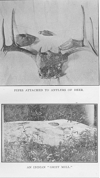
go. The Indian followed them for a two-fold purpose —to capture them and to get salt for himself. From McCuneville it crossed the ridge, past, where the old Stone Church now stands, till they reached Salt Run in Mondaycreek Township. Here was another "salt-lick." Near the source of one of the tributaries of this creek, they had a camping-place among some rocks. The object no doubt was to be close to the "lick" that they might watch for game. At this camping-place may yet be seen their hominy-mill.
In a large rock is a hole shaped like an inverted cone. Here they cracked their corn by means of rock pestles. Many a time has the writer when a boy, left the horse standing in the corn row and gone down to this ancient. "grist-mill" and in imagination, peopled the little valley with Indian hunters returning from the "lick" with deer slung across the shoulders and squaws sitting on that very rock, preparing corn for their meal of samp. After such flights it was pretty hard to get back again to the prosaic work of plowing corn. From here the trail went across the ridges to the headwaters of Little Mondaycreek, which was followed to a point below where Maxville now stands. Here are yet evidences of a camping place on the farm of D. Hardy. Crossing the next ridge we find another camp in what is known as Whiskey Hollow. Here they planted their corn and early settlers in Monday-creek remembered when the Indians would come to plant and harvest their crop. From here the trace went over the ridge to one of the tributaries of Rush Creek and then for Lancaster or Tarhytown as the Indians called it.
Flint Ridge Trail — This trail left the main route in the neighborhood of Porterville and struck for
HISTORY OF PERRY COUNTY - 53
Flint Ridge in Licking county. It is doubtful if this one touched Perry county. But it was very close to the Muskingum line. It passed through Roseville in Melick's Grove. It may have gone through a part of Madison township for it followed Jonathan's Creek. At Flint Ridge it joined another trail that led from the upper Muskingun to the Scioto. Again we can see why this route was selected. Flint Ridge was the flint quarry for all of the Indians between the Alleghenies and the Mississippi, with but a few unimportant exceptions. Evidences can be seen of their labor on every hand. The flint of this place must have been of superior quality for arrow-making, for specimens of Flint-Ridge arrows have been found as far south as Tennessee. The flint forms the cap-rock of a hill for a distance of ten miles and almost its entire length is scarred with the trenches and pits left by the ancient diggers.
Scioto-Beaver Trail — Another " trail " passed through Perry county. It was the Scioto-Beaver. in the northern part, just south of Buckeye Lake. No doubt Christopher Gist on his first trip through Ohio went over this trail. The townships of Thorn and Hopewell were the scenes of considerable activity among the- "Children of the Forest." Stone implements, arrow-heads and amulets have been found in great numbers.
Moxahala Trail — This trail crossed the Muskingum at Zanesville and made its way through the county, by Sego, Somerset and Rushville to Lancaster. Zane's Trace approximately followed this pathway. It was however not well defined. The Indian hunter leaving the established beat would naturally take the high ridge between Jonathan and Rushcreek. It must
54 - HISTORY OF FERRY COUNTY.
be regarded as a. loop from the main Scioto-Beaver Trail. Jonathan's Creek or better the Moxahala was favorite grounds for the Indian hunter. The fact that it ploughs its way through limestone and offers frequent fording places, may be one reason for making it the crossing of the numerous trails.
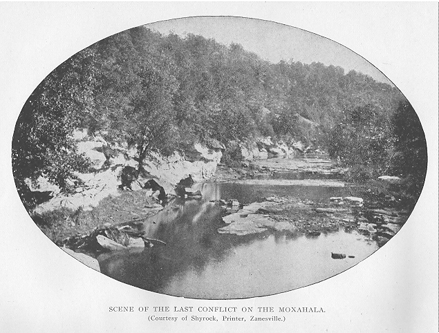
The Indian name "Moxahala " means " Elk's Horn." Look at your map and see why they called it by that name. We can also see why the Jonathan of Judge Spencer's " Legend of the Moxahala " built his rude cave on this creek. The intersection of the trails afforded him excellent opportunity to wreak his vengeance for the murder of wife and little ones. The story as told by Mr. Spencer is this : A man living with his family on Otsego Lake in the east, was attacked by the Indians. His wife and children were massacred, his house burned and he himself severely wounded. After recovering from his wounds, he set out for the west with the fire of revenge burning fiercely in his bosom. He vowed to kill every Indian he could. On the Moxahala in Madison township he built his but among the limestones ledges and here with only his faithful dog he watched for the red man from his hiding place. He was discovered and his tragic death is beautifully told by Mr. Spencer in the
"THE LAST CONFLICT."
The sun had set ; the crescent moon
With halo wan had followed soon ;
And Moxahala shadowed o'er
By Buckeye, beech and sycamore,
Flow'd gurgling 'neath the gloom of night ;
And 'tween the leaves and rippled light,
Look'd, trembling, here and there a gleam
Of starlight on the dimpling stream.
HISTORY OF PERRY COUNTY - 55
With piercing glance and noiseless tread,
Quick from his but the hunter fled,
(While Don, as stealthful, keeping nigh
Glared fiercely round with savage eye),
For having crossed the woody vale,
He came upon an Indian trail,
And all his deadly peril felt;
Well did he know the place he dwelt
Was sought by Indians far and near —
To wreak revenge — for many a year.
The Shawnee chief had tracked the bear,
At last, e'en to his hidden lair.
And, stealing from the bosky glen
With half a hundred ruthless men,
Before 'twas his the foe to take,
He mentally burned him at the stake
For many a murdered warrior's sake.
The red men, feeling sure the prey
Was in his fastness brought to bay.
Closed round the but on every side;
And some the fiery brand applied,
While others, yelling, turn'd to bind
The dreadful foe they sought to find,
And rush'd within with tiger-hound —
But, lo ! no captive there they found.
Hark ! ringing on the midnight breeze
Afar 'neath labyrinthian trees,
A rifle shrieks with sulphurous breath
Sending its message dire with death —
The Shawnee chief with dying whoop
Falls, quivering, midst the motly group.
Ha! now amazement dumb appals —
A sharp report,—another falls —
O pale-face Chief, away ! away!
Loud, fierce, resounds the deep-voiced bay
Of ghoulish forms, a horrid pack,
That, howling, bound upon your track
With bow and spear, and gun and knife,
And tomahawk to take your life !
56 - HISTORY OF PERRY COUNTY.
Away — away — go, seek the cave
Where oft before, your life to save,
With mystery deep, you did elude
The hordes that at your back pursued.
Ah, hark ! They come with sounding tread
And whoops that echo wild and dread !
Dewy, and fragrant breath'd and pale,
Came morn, with wakening voice of bird
And bee, and cool leaf-stirring gale,
And squirrel's chirp, mid branches heard.
'Twas on a hillside's bluffy edge,
Where rocks stuck out with mossy ledge,
Where wavy-scalloped ferns between
The fissured rocks grew rich and green.
And delicate flowers to us unknown
Save — hid from man — in forests lone,
Bloom'd 'neath the trees that, arching high,
Shut out the azure slimmer sky.
Where ivy wild and grapevines clung
To drooping shrubs that overhung
The lichen'd rocks and shady ground,
Beneath the ledge a passage wound,
That, to a cavern dark and small,
Led through a jagged, narrow hall.
There Jonathan the night before
Escaped the Indians in his flight;
He seem'd to vanish — be no more!
And they — with awe and sore affright
And superstitious fancy fraught
Deem'd 'twas a demon they had fought,
And hied them homeward full of thought.
But Jonathan lay cold and dead,
The cavern-floor his rocky bed;
And on his bosom clotted o'er
With oozy drops of clottish gore,
A ball had left its circle red
And in his back an arrow-head,
With shaft prortuding, broke in two,
HISTORY OF PERRY COUNTY - 57
Had proved its fatal guidance true.
Yes, Jonathan, the pale-face Chief,
Had found at last that sweet relief —
Nepenthe for each earthly grief.
And e'en o'er him one mourner kept
His vigil — yea, and, haply, wept;
For think Dewyan alone can know
The bliss of love, the pang of woe:—
With paws upon his master's breast
And plaintive howl of deep unrest,
His lonely dog, though all unheard,
Implored a look, a loving word,
And lick'd his master's cheek and hand,
And seemed to vaguely understand
His soul was in a happier land."
The White Man's Foot — By the Treaty of Greenville in 1795 the Indians gave up their claim to the land that is now in Perry county and after the year 1800 but few were seen within our boundaries. They were then usually straggling parties who returned to -their ancient hunting-grounds as if loath to leave. But the "white man's foot" had come and the days of the "children of the forest" were numbered.
"I beheld, too, in that vision
All the secrets of the future,
Of the distant days that shall be.
I beheld the westward marches
Of the unknown crowded nations.
All the land was full of people,
Restless, struggling, toiling, striving,
Speaking many tongues, yet feeling,
But one heart-beat in their bosoms.
In the woodlands rang their axes,
Smoked, their towns in all their valleys,
Over all the lakes and rivers
Rushed their great canoes of thunder.
Then a darker, drearier vision
Passed before me, vague and cloud-like;
58 - HISTORY OF PERRY COUNTY
I beheld our nations scattered,
All forgetful of my counsels,
Weakened, warring with each other;
Saw the remnants of our people
Sweeping westward, wild and woeful,
Like the cloud-rack of a tempest,
Like the withered leaves of autumn."
The Last of his Race — It seems that the very last Indian seen in our county was killed by the white settlers, in the neighborhood of New Lexington, after that village had been laid out. He, it' appears, lingered about the place for some time, and when he left was followed by the civilized ( ?) white man, to the vicinity of Brier Ridge, at the T. & 0. C. Tunnel, where he was shot. It might be well at this juncture to read Miss Francis' " Lone Indian " which we used to read at school out of the McGuffey Sixth Reader.
Treaty of Fort Stanwix — On October 27, 1784, a treaty was concluded, at Fort Stanwix, New York, with the sachems and the warriors of the Mohawks, Onondagas, Senecas, Cayugas, Oneidas, and the Tuscarawas. The Six Nations here ceded to the Colonial government all their claims to land in Ohio. General Lafayette was present at this treaty.
Under the Banner of St. George.
England claimed the whole of North America. She is never modest about her claims. She based her claim on the fact that John Cabot first discovered the continent. England did very little in the way of exploration. That she thought herself the sole possessor of the New World is evidenced from the fact that the grants given to the colonies, especially Virginia, and Connecticut extended from "sea to sea." And in the case of Virginia from the wording of the charter it ex-
HISTORY OF PERRY COUNTY - 59
tended to the North Pole. It reached for two hundred miles "north and south of Point Comfort, up into the land, throughout, from the sea to the sea, west and northwest." Connecticut was given a strip, the width of the, state from "sea to sea." As has been stated France, too, claimed the same land. The First. Ohio Land Company in 1748 might be said to be the immediate cause of the French and Indian War, which was possibly one of the best things that ever happened the colonies. It not only freed them from subsequent influence of French institutions but it was the school where they learned how to write the Declaration of Independence. The battle of Quebec and the Treaty of 1763 made Perry county a part of England's Royal domain and the banner of St. George, figuratively speaking, floated over the hills and valleys in Reading, Pike and Mondaycreek.
Under the Lilies of France.
Did it ever occur to you that at one time the Flag of France waved over Perry County ? There may never have been really a flag of that nation planted on our hill-tops, but the Lilies of France kept watch over our silent forests from where they were planted on the steeple of some mission house or over the door of a French trading station. The claim of France to this territory was based upon the fact of her explorations.. While neither England nor her colonies had ever given, their consent to France utilizing the rivers and trade of the vast region yet France was in actual possession of it. As "possession is nine points of the law" we must consider that at one time if there had been white people here they would have really been subjects of the French king.
60 - HISTORY OF PERRY COUNTY.
France had done four things that to her mind gave her an undisputed title to the region. The first was the sending of the Jesuit missi0naries who wandered through the unbroken forests, dressed in their simple garb, exploring the rivers, and building missi0n chapels, from whose r0ofs went out to the natives
"The sound of the church-going bell,
The valleys and rocks never heard,
Never sighed at the sound of a knell,
Nor smiled when a Sabbath appeared."
The second was the discoveries of LaSalle. Robert LaSalle, an ambitious young Frenchman, determined to find out something about the interior of the American continent. In the year 1669 with a party of French he sailed over the waters of Lake Erie and crossing the portage of one of the three Ohio rivers that find their sources near the head waters of the streams that flow into the Lake, he' descended either the Muskingum, the Scioto or the Miami and reaching the Ohio was the first white man to sail over the bosom of the Oyo, the Beautiful River. That the French based their right of ownership on the explorations of LaSalle is evidenced from the answer of the haughty commandant at Quebec to the demand carried by Washington in 1753. "We claim the country on the Ohio by virtue of the discoveries of LaSalle, and will not give it to the English. Our orders are to make prisoners of every Englishman found trading in the Ohio Valley."
Another reason for their claim was the reiteration of their title of possession. Eighty years after the voyage of LaSalle and only thirty years before the Second Mayflower landed on the banks of the Muskingum there floated down the Ohio a gorgeously ar-
HISTORY OF PERRY COUNTY - 61
rayed fleet of boats. From the bow of one floating to the breeze was the flag of France. The founding of the Ohio Land Company the preceding year was no doubt the occasion for sending out one Louis Celoron, who crossing from Canada, embarked upon the Allegheny. Arrayed in his "pomp and circumstance," his companions clad in lace coats and doublets, he proceeded in solemn ceremony and much ostentation, as only a Frenchman can, to bury certain leaden plates, that would forever set at rest the real ownership of the region drained by the Ohio and her tributaries. The plate testified that in the year 1749 it was buried as a monument 0f the renewal of possession. "His men were drawn up in order. Louis the XV was proclaimed lord of all that region. The arms of France were stamped to a sheet of tin nailed to a tree ; the plate of lead was buried at the foot, and the notary of the expedition drew up a formal act of the whole proceeding." This ceremony was gone through with at Wheeling, the source of the Allegheny, the mouth of the Muskingum, French Creek, the Kanawha, and the Great Miami. The plates at the Muskingum and the Kanawha were afterward found — the memorials . of France's dream of an Empire in the New World.
The last reason for their claim was the fact that France had actual possession of the territory. A chain of forts extended from Montreal to New Orleans. Their trading stations extended along that entire route. They had spied out the land and foresaw its possibilities in the way of trade. They never expected to col onize it. This fact alone made the Indian a firm ally.
The stories of fertile valleys, of navigable streams, and interminable forests had reached the practical ear
62 - HISTORY OF PERRY COUNTY.
of the Anglo-Saxon colonists, who saw utility in quite a different light. The French could not believe that their efforts in exploration would be of such little use to them and redound only to the good of the English. They made every effort to keep it a part of their royal possessions. The defeat of Braddock gave them temporary hope for its retention, but the fall of Quebec shattered. their hopes and the Lilies of France ceased to wave over the hills of Ohio.
In the Province of Quebec.
The colonies that had land in the West had almost as much trouble in keeping off the encroachments of Great Britain as they had of France. It was but natural that they should think that the French and Indian war was for the purpose of quieting the claims of the colonies over against France. In this, however, they were mistaken. England does not do things that way. They forbade the colonies to make settlements on these lands.. Virginia and Pennsylvania were not inclined to obey. Parliament, therefore, to stop the encroachments, passed what is known as the Quebec Act. This act made all the land in what is now known as the Northwest Territory a part of the territory of Quebec. Thus Perry County was a second time a part of Canada, ruled by a Governor General. The colonists did not like it very well and Virginia paid but little attention to it and never in her own mind thought that it ever belonged to anybody but herself. England's object in this was to keep down the growing power of the colonies, and by having this vast region a part of Canada, they hoped to maintain the Indians' allegiance, which they did to a certain extent. This action of
HISTORY OF PERRY COUNTY - 63
George the Third was considered of such importance that in the Declaration of Independence it was made one of the grievances.
Boutetorst County.
Had your great-great-grandfather left Virginia in 1770 and settled where Glenford now stands, his friends at home would have said that he had gone to live on the Moxahala in Boutetorst County. Virginia would not abide by the Quebec Act. The part she had taken in the French and Indian war she thought ought at least prevent her from losing her land that she obtained by charter. In 1769 her Legislature passed an "Act," placing the territory north of the Ohio and east of the Mississippi under her jurisdiction, as Boutetorst County. The next year George Washington floated down the Ohio to the mouth of the Great Kanawha to select 200,000 acres of land for his soldiers, or their widows, who had served with him in the French and Indian war. This is as near as he ever came to our county. It might be interesting to know that the Island of Blennerhasset, famous in history and story, was a part of this tract. While Virginia had, no doubt, the better claim to this territory, yet under this "Act" her jurisdiction was only nominal, for Great Britain still claimed it a part of the Province of Quebec. It was not until 1778 that she assumed complete control.
The County of Illinois in the State of Virginia.
As far as Land Grants were concerned, the .land that is now Perry County belonged to Virginia. The old "sea to sea" grants to Virginia certainly included our county. That was why the authorities of Virginia took such an interest in keeping the French out of the
64 - HISTORY OF PERRY COUNTY.
region north of the Ohio ; why the Ohio Land Company was formed ; why Christopher Gist was sent out with the "Compass and Pen ;" why Washington was sent on his first public mission, and why Virginia troops composed a part of the ill-fated army of General Braddock. It has been seen that considerable difficulty was experienced as to who should have jurisdiction over the territory northwest of the Ohio. During the Revolutionary War, the land by the Quebec Act was a part of Canada. The forts were in the hands of the British. They incited the Indians against the colonists. George Rogers Clark, a Kentuckian, was sent with an army that captured the forts, drove the British beyond the Lakes, quieted the Indians and extended the control of the Commonwealth of Virginia, and Perry County with the rest of the territory-northwest of the Ohio again became a part of the "Old Dominion" under the name' of the County of Illinois. This was in October, 1778. Patrick Henry was Governor of Virginia and John Todd was made Lieutenant Governor of the County of Illinois.
First White Man in Perry County.
In 1748 a company was formed in Virginia, entitled The Ohio Land Company. The object was to survey the lands and establish English Colonies beyond the Alleghenies. They sent an agent to explore the region. This agent we will recognize as no other than the friend and companion of Washington, when he carried the message from Governor Dinwiddie to the French commander in 1753-4. Christopher Gist traveled through leagues of almost unbroken forest, crossed the Muskingum and Scioto rivers, and was kindly received by the Shawnee Indians, who had a village on
HISTORY OF PERRY COUNTY - 65
the latter stream about seven miles south of Circleville, where the hamlet of Westfall now is. The name of their town was Chillicothe. Christopher Gist encamped one night on the shore of "Big Swamp," which we now recognize as Buckeye Lake. No doubt he was the first white man within the limits of Perry County. Gist started from the forks of the Muskingum, where Coshocton now stands, on January 15, 1751. By drawing a straight line from Coshocton to Westfall, it will be seen that it touches Buckeye Lake, where the village of Thornport now stands.
Land Surveys.
On May the twentieth, 1785, the Continental Congress passed what is known as the " Land Ordinance of 1785." It provided for the survey of lands in the territory northwest of the river, Ohio. The surveys were made under the direction of the Geographer of the United States. The lands were to be surveyed into townships six miles square, bounded by east and west and north and south lines, crossing each other at right angles. The ranges of township& were to be numbered 1, 2, 3, etc. from the Pennsylvania line westward, and the townships in the ranges
2, 3, etc. from the Ohio river northward. Furthermore, the townships should be cut up into lots one Mile square, each numbered from one to thirty-six, beginning in the south east corner and running north to sixth ; then beginning the next range with seven and running to twelve, etc. The lines were to be suitably marked by blazed trees and notches cut into their trunks. In many of the woods of „Perry county can yet be seen the marks of the original surveyors.
5 H. P. C.
66 - HISTORY OF PERRY COUNTY.
The first " Seven Ranges " were surveyed as above, but the remaining fifteen are different in the numbering of the sections. Our section numbers begin in the northeast corner and run west to six ; begin in the next row of sections and run east to twelve, etc.
The surveying began in 1786. The Ranges only extend to the Scioto River, for west of that stream Virginia had retained the land for her Revolutionary soldiers and it was never surveyed. The land in Perry county was not ordered platted till May i8, 1796. In 1799 General Rufus Putnam was made surveyor-general and the work began at once. The land of the Ohio Company had been surveyed before. None ,of our county was in this Company's purchase. But their tract did extend to the southern boundary of Perry and joined the townships of Coal and Monroe.
In the first surveys, the variation of the needle, which at that time was about two degrees east, was seldom corrected. The result was that the north and south lines Would deviate to the west in going southward. This would cause a section to be larger than its 'northern neighbor. By the time the survey reached Perry county, it was necessary to frequently correct by starting from new bases, that the sections might be kept something near the required size. The line between Hopewell and Reading, and Madison and Clayton was such a correction line as can be seen on the map. There is similar correction between Clayton and Pike and between Harrison and Bearfield. It is the most noticeable, however, between Jackson and Mondaycreek. The first five rows of sections in Mondaycreek are each exactly a mile square, but the western row contains over seven hundred acres in each section. This irregularity in the lines was corrected by
HISTORY OF PERRY COUNTY - 67
a "correctional meridian " running north from the Ohio river, to the northern boundary of Perry county. The line on the west of Thorn township is this meridian. But our county got none of its benefits. In Vinton county the correction amounted to a mile in many places.
The northern boundary of Perry county was the northern limit of Congress Land. Licking county belongs to the Military Bounty Lands, which was set aside for Revolutionary soldiers. This Congress Land was at once set up for sale. The most of it sold for $1.25 per acre in half or quarter sections. The Land Offices for the sale of land in this county were located at Zanesville and Chillicothe. The line separating Madison, Clayton, Pike, Saltlick and Coal from Hopewell, Reading, Jackson, and Mondaycceek divided the two Land Districts.
The Ordinance of 1785 further provided that, " There shall be reserved for the United States out of every township the four lots, being numbered 8, II, 26, 29 for future sale. There shall be reserved the lot No. 16 of every township, for the maintenance of public schools within the said township ; also one-third part of all gold, silver, lead and copper mines, to be sold, or otherwise disposed of as Congress shall hereafter direct." In Perry county none of these reservations were made, with the exception of Section 16. In the Ohio Company's Purchase, Section 29 was kept for the support of a minister, and was known as Ministerial Lands.
68 - HISTORY OF PERRY COUNTY.
The Scioto Company Land Scheme.
When Dr. Manasseh Cutler was negotiating with Congress for the land now known as The Ohio Company's Purchase, Col. William Duer of New York, presented a land scheme to be wCoh in connection with it for purposes of speculation. Col. Duer was a man of influence and Dr. Cutler needed him to help secure the passage of his Ordinance. So it was that under the cover of the petition that the. Ohio Company presented for the absolute purchase of 1,500,000 acres, between the 7th and 17th ranges of townships, there was also the option for the right of purchase, or preemption, on over 3,000,000 acres of land lying between the Scioto and Ohio Rivers, to the west and north of the Ohio Company's Tract. This would include all of Perry County. Not many persons living in the county perhaps know that the land upon which they are now living, was once included in a great land scheme, in which the hard' earned francs of many French people, were lost in the very first financial whirlpool, that made itself felt within the confines of Wall Street. The Scioto Company was formed and had its headquarters in Paris. Joel Barlow, author of the Columbiad, and later Minister of this country to France was sent to Paris by Col. Duer to prosecute the sale of land. He had with him a description of the country from Dr. Cutler and a map bearing the indorsement of the United States Geographer.
Paris and France were ripe for anything thee Revolution and the fall of the Bastile had turned tlae country topsy-turvey. The French people naturally
HISTORY OF PERRY COUNTY - 69
erratic, imbued with their new ideas of liberty and equal rights, grasped at any and every Quixotic project.
Barlow, assisted by an Englishman, named Play-fair, who is described as a man with a "good imagination," succeeded, by a glowing description, and many other embellishments, in setting Paris aglow with the craze. They told how delightful the climate was ; how winters were unknown ; how there were trees from which sugar yielded itself spontaneously ; and how another tree yielded ready-made candles. They said that venison was in abundance. And they told the truth when they stated that there were neither lions nor tigers to molest them.
The French seemed to have had quite as "good imagination" as the Englishman, Playfair. They pictured the new land on the banks of the River, Beautiful, and the Scioto, as a veritable "milk and honey" region. Nothing else was talked of in either social or political circles. A man named Brissot came to this country, and wrote a series of letters in such a manner as to complete the popular delusion. He corroborated the previous statements of Barlow and Playfair. The people became wild with excitement. Buyers were numerous. The thrifty middle class were especially importunate. Many disposed of their entire property that they might invest in the Promised Land.
But the Scioto Company could not give a perfect title. They themselves had nothing but an option. Barlow as agent expected from the sale of lands they would be able to make the title good. The "imaginative" Playfair, belying his name, had the money. Barlow was himself duped. The result was that Col. Duer and the Scioto Company failed and their land
70 - HISTORY OF PERRY COUNTY.
.
reverted to the government. The only thing that the Scioto Company did, was the settling of Gallipolis, with French immigrants in 179o. In 1795 the United States Government gave 25,000 acres of land in the southeastern part of Scioto county for such persons that had lost their property at Gallipolis by insecure title. This is known in Ohio history as "The French Grant."
Zane's Trace.
When Ohio was settled, the only highways were the streams and the Indian trails. After the Revolutionary War the rich ()hit, valleys became the goal of immigrants. It was likewise the Paradise of the red men, who contested every acre of the soil. General St. Clair having met defeat at their hands, reported that the greatest hindrance to military operations was the absence of roads, that their presence would be an -incentive to immigration, that it would hasten the settlement of the country and be the best means of quieting the Indians.
Congress at once acted upon the suggestion: The President was authorized to contract with a responsible party,for the opening of a road from Wheeling on the Ohio, to Limestone, Kentucky, on the Ohio. , This road would pass through the best agricultural land that was then open for settlement in the Northwest. Virginians were flocking to the Military Lands, west of the Scioto, to locate their claims. The valleys of the upper Hocking and Muskingum were ideal places for the settler's clearing and cabin.
The work of laying out this road was entrusted to Colonel Ebenezer Zane of Wheeling. Colonel Zane was a man of considerable force of character and played no small part in the settlement of the North-
71 - HISTORY OF. PERRY COUNTY
west. He was an ideal frontiersman. He was thoroughly acquainted with the western wilds from the Potomac to the Ohio. His brothers were men like unto him and assisted him greatly in his undertakings. President Washington could have found no better man. As early as 1769 he came to the present site of Wheeling, recognizing at once its important geographical position. The next year he brought his family. Lord Dunmore, then Governor of Virginia, had the greatest confidence in Colonel Zane, and made him disbursing agent at Wheeling. A fort was erected and named Fort. Finncastle in honor of the titled Governor of the "Old Dominion." Zane was familiar with the events that led to Dunmore's War, his sympathy being with Logan, Chief of the Mingoes, but he took an active part in putting clown that war.
When the Revolutionary War clouds hung heavy over the land, true patriot that he was, he did everything in his power for the establishment of the new nation. While he was never in the Continental army,. yet he served his country in a no less eminent degree.. Living as he did on the very edge of the frontier, he saw that it was as important, that the territory North-West of the Ohio should be held by the colonies as it was to obtain their independence. For the latter without the former would have crippled them and there would have been no room for growth. The struggling nation had no army to protect their frontier. It was left for the most part to such men as Ebenezer Zane, who voluntarily took it upon themselves to protect their homes from the ravages of the red-men, incited by British cupidity and revenge.
The very last battle of the Revolution was fought at Wheeling. The name Fort Finncastle had been
72 - HISTORY OF PERRY COUNTY.
changed to Fort Henry in honor of Patrick Henry the first governor of the Commonwealth. Here on the eleventh of September, 1782, the Indians and British made an attack. Colonel Zane's house stood about fifty yards from the fort. The people took refuge in the fort but Zane and his family remained in their house. It was at this battle that Elizabeth Zane, a sister, performed her heroic act. The defenders of the fort suddenly discovered that the powder was exhausted. There was a sufficient amount in Colonel Zane's house, but how to get it was the question. At this juncture, the girl volunteered to go, saying that her death would not mean so much as a man's. The gates were opened. The Indians saw her hurrying across the open space, but their chivalry forbade them firing on a "squaw." Hastily filling a tablecloth, which she tied about her, she returned to the fort. She had almost reached it, when her purpose dawned upon the Indians and amid a shower of bullets, she passed through the gates. The fort was saved.
During these years, Col. Zane had come into possession of considerable property. He owned the land where Wheeling now is, Wheeling Island in the Ohio river, the present site of Bridgeport and Martins Ferry and a tract extending a considerable distance up Wheeling Creek on the Ohio side.
Jonathan Zane, a brother, was a scout. In 1774 he guided an expedition against the Indians on the upper Muskingum. He served in like capacity on the ill-fated expedition of Governor St. Clair. It is said that if St. Clair had taken his advice, the result of the expedition might have been somewhat different. It is but natural, therefore, that when Ebenezer Zane contracted to cut the road through Ohio, that he should
HISTORY OF PERRY COUNTY - 73
have left it to his brother who was better acquainted with wilderness ways. Jonathan Zane was assisted in the work by John McIntire who had married his sister. For this work Col. Zane was to receive a tract of land, one mile square for every navigable stream he should cross, provided he should maintain a ferry. The work was begun early in 1797. The road was nothing more than a blazed bridle path, with some of the undergrowth and fallen timber removed. This "trace" left Wheeling, followed Wheeling Creek on the Ohio side, to its source, and, climbed to the high ridges of Belmont county. Following this divide into Guernsey county, it passed through Cambridge, and then headed for the falls of the Muskingum at Zanesville. This was the first navigable stream. Zane gave the tract of land here to his brother, Jonathan and his brother-in-law, McIntire. This was to recompense them for their services in opening the road. They in turn leased it to William McCullough and Henry Crook for five years. These men kept the ferry and thus became the first settlers of Zanesville. John McIntire is really the founder of Zanesville. He died in 1815 and is buried beneath the shadows of the McIntire Children's Home, which he founded. This was established as a school for poor children of Zanesville. But upon the organization of the free school system, it was changed to an asylum for unfortunate children, who here find a home and an education. This home derives its revenue from the McIntire estate, which originally was the mile square given to Zane by the United States Government.
This trace struck Perry county as indicated on the map. There is considerable conj ecture as to where it really did pass through the county. The writer has
74 - HISTORY OF PERRY COUNTY.
been for three years gathering data on this first "highway" and he has found in Perry county more uncertainty about the actual route, than in any same dis tance between Wheeling and Maysville. By many it is supposed to be the same as the Maysville pike. Others confuse it with the Old State Road surveyed in 1809. And still others think that the old Drove Road was the original Zane Trace. From such a di versity of opinion it is diffcult to ascertain the exact truth. The route as shown on the map does not pretend to be infallibly true, but as far as can be learned, it is approximately correct. The prevailing idea that Fink's tavern, the nucleus of Somerset, was on Zane's Trace, is hardly correct: And yet, the most of the travel may have gone by way of Somerset. The men who blazed the trail were not particular in hunting the best ground, although they usually aimed to follow the ridges. The last statement would justify the conclusion that Somerset was on the "Trace." But on the other hand the streams served as their guides. No white man had ever traveled the route before. They knew the general directions only. There is no doubt that the Somerset route would have been the better one, and travelers soon found it out. It is the opinion of the writer that the Zane men were trying to find the headwaters of another stream, flowing south, after they left Jonathan's Creek. They passed through the neighborhood of what is now known as Dead Man's Schooh Striking a branch of Rushcreek in southwestern Hopewell, they might have continued along it but for the fact that there is considerable swampy land in that section. This would cause them to change their course and take to the hills. This trace passed over Rushcreek at the Rushvilles and