50 - AKRON AND SUMMIT COUNTY
Sheriff
Jacob C. Bollinger
Prosecutor
Oscar A. Hunsicker
Coroner
M. B. Crafts
Commissioners
Walter T. Akers
A. H. Palmer
S. J. Hagelbarger
Member of Congress, 14th District
M. L. Davey, Kent, 0.
State Senators, Summit County District
W. Oliver Wise
Will R. Price
V. D. Emmons
State Representatives, Summit County
Harry S. Davidson
Geo. H. Bellinger
Chris Weaver
Lloyd Weaver
Elmer E. Boden
Mayor of Akron, 0.
G. Lloyd Weil
Service Director
Fred E. Swineford
Law Director
A. B. Underwood
Finance Director
E. C. Galleher
Safety Director
Robert A. Myers
Municipal Judges
J. Earl Cox
Carl Hoyt
Gordon Davies
Clerk of Municipal Court
Sam J. Cole
Councilmen-at-Large of Akron
W. C. Workman
Kyle Ross
Ed Rose
Councilmen
1st Ward, Dan Shelby
2nd Ward, Pierce Snyder
3rd Ward, Edmund Rowe
4th Ward, E. L. Marting
5th Ward, A. E. Sauder
6th Ward, Henry C. Nelson
7th Ward, L. H. Horner
8th Ward, W. W. Milar
BARBERTON
Mayor of Barberton
W. A. Witner
President of the Council
Victor H. Lucas
Auditor
Floyd S. Dutt
Treasurer
Leonard Monk
Solicitor
George R. Platt
Constables
Michael Biggie
Norman A. Brockett
Councilmen-at-Large
W. C. Baylor
Ernest Heppert
Gus Seiberling
Councilmen
1st Ward, Geo. W. Romig
2nd Ward, Chas. E. Worthen
3rd Ward, A. G. Heighberger
4th Ward, Ralph R. Read
Justice of the Peace
Wert Dean
CUYAHOGA FALLS
Mayor of Cuyahoga Falls
George Porter
President of Council
N. G. White
Auditor
H. 0. Bolich
Treasurer
M. E. Brown
Solicitor
Bruce Bierce
Councilmen-at-Large
Fred Bolich
Geo. W. Clack
C. E. Hurd
Councilmen
1st Ward, F. R. Miles
2nd Ward, Harry F. Jenks
3rd Ward, James E. Preston
4th Ward, N. E. Reemsnyder
Justices of the Peace
Alvin C. Kimball
Frank O. Vail
Constables
David H. Wiley
Frank H. Kilbourne
AKRON AND SUMMIT COUNTY - 51
KENMORE
Mayor of Kenmore
Paul W. Hollinger
President of Council
C. C. Camp
Auditor
Harry D. Willis
Treasurer
G. V. Britton
Solicitor
Ralph J. Myers
Constables
Jacob C. Ritchie
Ralph Crosby
Councilmen-at-Large
M. G. Carillon
Frank N. Gaethke
E. C. Hoffman
Councilmen
1st Ward, Clyde Myers
2nd Ward, Ford Oliver
3rd Ward, Vern Christy
4th Ward, Harley Jones
Justices of the Peace
Milton H. Prentiss
Chas. Smith
COUNTY BOARD OF EDUCATION
Oakley Spaght
Margaret Conger
Mary E. Anderson
Fred J. Hale
John Woodling
BATH TOWNSHIP
Trustees
Preston Davis
E. R. Rockwell
M. J. Hackett
Township Clerk
E. S. Shaw
Constables
Carl Cranz
Ray Baumgardner
Justices of the Peace
R. Hopkins
Walter Cranz
BOSTON HEIGHTS
Mayor
F. L. Dillhoefer
Clerk
Sarah Albright
Treasurer
Chas. V. Ozmun
Marshal
E. G. Lamkofsky
Council
Cicely Albright
Chas. Cramer
Paul H. Gilbert
H. H. McCombe
Lawson Pratt
Wm. H. Ziehlke
BOSTON TOWNSHIP
Trustees
A. W. Bell
E. W. Dickinson
L. A. Truxell
Clerk
Jules E. Boodey
Constables
Alva Morris
A. Dickinson
Justice of the Peace
E. B. Conger
PENINSULA VILLAGE
Mayor
E. B. Conger
Clerk
Martha Morris
Treasurer
A. T. Ingerton
Marshal
Alva Morris
Council
L. Gustafeson
Florence Harrington
Mable Jolly
Julian Morgan
Chas. Truxell
Jas. Morris
COPLEY TOWNSHIP
Trustees
Frank Adair
Frank Gardner
C. O. Yoey
Clerk
Ralph Long
Constable
A. H. Cary
Justice of the Peace
James Lyans
52 - AKRON AND SUMMIT COUNTY
COVENTRY TOWNSHIP
Trustees
B. W. Welton
Ervin Cormany
D. S. Enlow
Clerk
Floyd Wagoner
Constable
R. W. Baughman
Justices of the Peace
M. A. Peterson
B. F. Davis
FRANKLIN TOWNSHIP
Trustees
Clark Denious
R. A. Grove
E. E. Stump
Clerk
Elmer Keller
Constable
Walter Hammer
Justices of the Peace
Lewis H. Smith
Ford Dickerhoof
L. M. Kauffman
J. W. Stauffer
CLINTON VILLAGE
Mayor
Lewis H. Smith
Clerk
L. M. Kauffman
Treasurer
George B. Wright
Marshal
W. J. Kline
Council
W. C. Cavany
H. B. Earnsberger
W. C. Fye
C. W. McGee
R. C. McCloud
J. D. Rich
GREEN TOWNSHIP
Trustees
C. E. Diehl
J. W. Foltz
Louis Swigart
Clerk
Roy LeBerth
Constables
Marvin Stipe
Ford Weaver
Justices of the Peace
J. C. Parks
J. W. Buckman
HUDSON TOWNSHIP
Trustees
Jas. Harper
Chas. Kilbourne
L. H. Oviatt
Clerk
B. S. Sanford
Constables
Clarence Billiter
J. W. Larkin
Justices of the Peace
Raymond Kilbourne
H. M. Darling
HUDSON VILLAGE
Mayor
R. E. Miller
Clerk
B. S. Sanford
Treasurer
R. P. Palmer
Marshal
Clarence Billiter
Council
H. J. Allman
F. F. Buss
B. J. Izant
S. M. Kipp
R. P. Rush
T. J. Turner
MACEDONIA VILLAGE
Mayor
E. C. Peck
Clerk
Warren Forbes
Treasurer
R. C. Behrend
Marshal
F. V. McRitchie
Council
T. B. Burroughs
D. L. Grimm
C. E. Jones
A. S. Neale
A. V. Nufer
Homer Stackhouse
Justice of the Peace
O. E. Griswold
NORTHAMPTON TOWNSHIP
Trustees
D. B. Carter
Jos. Conway
Stanley Stephenson
AKRON AND SUMMIT COUNTY - 53
Clerk
D. O. Corp
Constable
Richard Howe
Justices of the Peace
Wm. Watters
N. A. Bucklin
NORTHFIELD VILLAGE
Mayor
W. J. Burns
Clerk
Harry Grimm
Treasurer
J. N. McConnell
Marshal
Harry G. Smith
Council
N. W, Black
Herbert Cudney
Frank Hale
H. M. Hardesty
V. S. Hubbard
Thos. Ramsey
NORTON TOWNSHIP
Trustees
J. M. Diefendorf
Carl Frase
Geo. M. Mong
Clerk
M. L. Shook
Constable
R. L. Leslie
PORTAGE TOWNSHIP
Trustees
E. S. Blower
Wm. B. Fromm
Adam Klein
Clerk
Henry C. Fromm
Constable
Wm. J. North
Justice of the Peace
Geo. S. Courtney
WESTERN STAR VILLAGE
Mayor
Claud Seiberling
Clerk
J. A. Himelright
Treasurer
Clayton Spicer
Marshal
A. B. Simmons
Council
Wm. Dick
R. J. Long
John McDermott
F. McManus
Eli Reimer
Bert Spicer
RICHFIELD TOWNSHIP
Trustees
R. E. Parker
J. S. Rockwood
D. M. Snyder
Clerk
Philip E. Waldo
Constables
Geo. Buehl
Arthur Scobie
Justices of the Peace
G. P. Fauble
W. J. Smith
SPRINGFIELD TOWNSHIP
Trustees
A. M. Bixler
Frank Brown
J. W. Robinson
Clerk
John Palmer
Constables
John Icenhower
Chas. Kefauver
Ace Miller
Justices of the Peace
H. B. Beach
Emerson Boyer
M. T. Stetler
LAKEMORE VILLAGE
Mayor
A. J. Fultz
Clerk
Mabel Schwartz
Treasurer
Ivan J. Chapman
Marshal
Herman T. Robison
Council
James C. Etnire
Roy Kreighbaum
Edward Lutz
Harry Miller
Harvey J. Snyder
Jacob Wolfe
54 - AKRON AND SUMMIT COUNTY
MOGADORE VILLAGE
Mayor
B. G. Knowlton
Clerk
Kirk Darrah
Treasurer
R. L. Atchison
Marshal
Thos. Youtz
Council
C. C. Grant
Frank Kemerline
C. N. Miller
M. E. Mills
Alfred Nye
W. L. Robenstine
STOW
Trustees
W. C. Arnold
Virgil Housley
Oakley Spaght
Clerk
H. J. Williamson
Constables
F. H. Cox
Fred J. Curry
H. A. Houck
Howard Gaylord
Justices of the Peace
L. E. VanBuskirk
W. F. Carlysle
MUNROE FALLS
Mayor
W. E. Perrine
Clerk
H. L. Olson
Treasurer
L. C. Hartzell
Marshal
J. B. Royer
Council
Julia Cowan
Geo. Hagerman
F. B. Olds
William Ritzman
C. H. Spriggle
Amos Zang
SILVER LAKE VILLAGE
Mayor
J. W. Lee
Council
J. W. Dunlap
Howard M. Glazier
A. R. Markle
C. S. Norris
TALLMADGE TOWNSHIP
Trustees
John Adair
Edgar R. Bowen
W. E. Scherer
Clerk
H. J. Walters
Constable
Bert Karg
Justices of the Peace
Herbert McElroy
E. G. Williams
TWINSBURG TOWNSHIP
Trustees
A. E. Bishop
H. M. Fowler
W. A. Rudd
Clerk
P. M. Booher
Constable
L. M. Prentiss
Justices of the Peace
S. M. Doubrava
C. W. Weimer
JOHN BROWN OF CIVIL WAR FAME
John Brown's brief connection with Akron began in 1844 and ended in 1846. He was a resident of the city for only those two years and after the latter date was in Akron only once, that being in 1856 when he visited here in his campaign to raise funds for the cause of freedom in Kansas. Those are the bare facts of the case but those two years bulk larger in the city's history than the whole career of any life long resident.
It cannot even be claimed that the two years in Akron had anything to do with the shaping of Brown's life. It had already been moulded by his youth in Hudson. He was a matured man of 44 years when he moved
56 - AKRON AND SUMMIT COUNTY
here. And yet the memory of these few months is the finest thing in that intangible something which we designate as the spirit of the City.
Stirring events have taken place in Akron since and many great men have come from here but in matters of civic history the average citizen's proudest boast is still that "John Brown once lived here." The hero of Ossawotomie exerted a mighty influence on Akron although the city apparently had no real bearing on his career.
SPENT YOUTH NEAR HERE
Aside from any question of direct connection with the city, however, Akron, merely as a portion of Summit County, may rightly claim a share in the proud distinction of having played a tremendous part in the building of the character of America's martyr. Connecticut gave birth to John Brown, Kansas and Virginia were the scenes of his mightiest exploits and Virginia witnessed his death but the formative years of his childhood, youth and young manhood were spent in the surroundings of Summit County.
John Brown was born at Torrington, Connecticut, on May 8, 1800. Five years later his father and mother, Owen and Ruth Brown, emigrated to the wild Ohio frontier and settled at Hudson. In Connecticut his father had been a tanner and shoemaker and the family had lived in poverty. The best blood in the country flowed in their veins, however.
One of his ancestors, Peter Brown had come over in the Mayflower, others had been included in the remarkable Windsor Colony and his grandfather was Captain John Brown of the Revolutionary Army. His mother was of Dutch descent and her father, too, had fought in the war of the Revolution.
PLAYED WITH INDIANS
Hudson at that time was hardly more than a clearing in the woods Indian boys were John Brown's first playmates and wild frontier sports, long trips in the woods and the work of tending cattle and sheep tells the story of the early days of this buckskin clad youth who was to know even wilder frontiers in his later life.
Little schooling had been included in his lot until he reached the age of 16, joined the Congregational Church at Hudson and began to study zealously for the ministry. Attending the Hallock school, Plainfield, Mass., and Morris Academy, Connecticut, for a short time an affection of his eyes compelled him to abandon his studies and he returned to Hudson and entered his father's tannery. He became foreman in the tannery and in his spare time qualified himself as a surveyor.
At the age of 20, he was married to Dianthe Lusk of Hudson, whom he describes as "a remarkably plain, but neat, industrious and economical girl of excellent character, earnest piety and good, practical common-sense." There was nothing romantic about the John Brown of the period and it may be that there was as regards his relationship with women. A spirit
AKRON AND SUMMIT COUNTY - 57
obsessed with a mighty cause, as was his in later life, could hardly find time for the tenderer passions.
ONE ROMANTIC TOUCH
Despite this one author has achieved the tale of a woman in John Brown's life who loved and was loved by him but from whom he was separated by obstacles to him impassable. This woman he saw only once in their later years and after she, too, had married. It is a moving and sometimes beautiful story although hardly elaborately documented.
By his first wife Brown had seven children, six sons and one daughter. Tanning, farming, surveying and stock raising occupied him at Hudson until 1826 when he moved to Richmond, Pa. His wife died in 1832 and a year later he was married to Miss Mary A. Day of Richmond. Seven sons and six daughters were the offspring of this marriage.
Returning to Ohio in 1835 Brown settled at Franklin Mills, now known as the City of Kent, in Portage County. Real estate deals there met with failure and in 1839 he drove a herd of cattle to New England, returning with a small flock of sheep. Forming a partnership with Herman Oviatt of Hudson, he went into the sheep and wool business on a large scale, moving with his flocks and family to Richfield in 1842.
Gaunt and bearded, surrounded by a family of 14 children and by his thousands of heads of sheep and the John Brown of that time must have presented the appearance of a reincarnated Biblical patriarch. In 1844 he entered into partnership with Col. Simon Perkins, transferred his flocks to Perkins' farm and moved with his family to Akron. His home in Akron was the same house located at 514 Diagonal Road, now occupied for several years by the Portage Golf Club and was remodeled at the time. Other changes and additions have been made since the Perkinses moved back in and now the house is hardly recognizable as the John Brown home.
FIRM WAS FAILURE
The firm of Perkins and Brown was a failure. Brown was accounted the best judge of wool in the country but his business abilities fell far below this expert knowledge. He had hardly a single necessary requisite for a commercial career.
A wool depot was established by the firm at Springfield, Mass., in 1846 with the idea of bringing the business closer to the manufacturing centers and the Brown family removed to the east. A distastrous trip to England with 200,000 pounds of wool caused the collapse of the firm in 1848 and John Brown's career as a speculator and merchant was over. In 1849 he retired to the wilds of the Adirondacks in pursuance of a plan to found a colony of negro settlers and there he wrested a living from the soil for the next five years.
Several of his sons had emigrated to Kansas in 1854 and a year later Brown followed them, locating near the Free State and Pro-slavery battles. From then on his story moves at a feverish and almost incredible tempo.
58 - AKRON AND SUMMIT COUNTY
NATIONAL FIGURE
As the leader of the Free State forces Brown emerged for the first time as a national figure. Commander of the "Kansas Cavalry" and victor in the battles of Black Jack and Lawrence, his exploits attracted the interest of the entire country. The name "Old Ossawotomie" was bestowed upon him after a skirmish at the settlement of that name in which with a handful of men he routed an army of "Border Ruffians."
In 1856 he traveled to the east in the cause of Kansas and it was in this year that he re-visited Akron for several days. By 1858 the attack on Harper's Ferry was planned in his mind and that year found him in Iowa and Kansas raising his forces, gathering his arms and preparing pikes for the use of negroes unaccustomed to firearms.
On July 3, 1859 he hired a farm near Harper's Ferry and began to gather in his arms and conceal his followers. On that night of Sunday Oct. 16, 1859, with his band of 22 men he seized the government arsenal at Harper's Ferry and held the fort nearly thirty-six hours. The slaves did not rise as had been anticipated and the tiny garrison was hemmed in.
TROOPS MAKE ATTACK
Bodies of citizens who rallied to the attack were several times repulsed and 100 militiamen arriving from Charlestown Monday afternoon were held at bay by the lion hearted fanatic. By nightfall 1,500 men had occupied the town and the same night U. S. Troops under the command of Robert E. Lee were despatched from Washington. The stronghold was stormed and all but Brown and six of his men fell in the fighting. Two of his sons were among the slain.
Indictments for inciting insurrection and for treason and murder followed and Brown was convicted despite evidence gathered from Summit County and elsewhere in an attempt to prove insanity. Brown occupied a cot during the whole of his trial so weak was he from his wounds. On Friday, Dec. 2, 1859 that life that had been like driven flame flickered weakly out on the gallows at the Jefferson County jail.
Memorial services were held throughout the whole of the north. In Akron all business places were closed, courts was adjourned and flags displayed at half mast. In the evening a solemn meeting was held in Empire Hall at which speeches were made by Gen. Lucius V. Bierce, Newell D. Tibbals, Judge James S. Carpenter, Attorney General Christopher P. Wolcott and others. It was the first tribute paid by Summit County to its greatest name, a tribute which has been quietly and ever more proudly rendered for the last 65 years as the undying fame of John Brown of Ossawotomie waxes ever greater.
Many communities can boast one or two men whose vision and dynamic energy have built up industrial organizations of nation-wide scope. Akron has produced a dozen such men ; men with the spirit of the entrepreneur, the doer ; men who started with an ideal and built an industrial empire; Ferdinand Schumacher, Lewis Miller, J. F. Seiberling, George W. Crouse,
AKRON AND SUMMIT COUNTY - 59
David E. Hill, Paul E. Werner, O. C. Barber, John R. Buchtel, Dr. Goodrich, Col. Perkins, Col. Conger.
Akron and Summit County have made other striking contributions to the leadership of the State and Nation.
Wm. McKinley once represented this district in congress and James A. Garfield in the Ohio senate, Russell A. Alger practiced law here before going to Michigan where he became a lumber king, governor, senator and secretary of war during the war with Spain.
Wm. F. Sanders, nephew of Sidney Edgerton with whom he studied law and accompanied to Montana, where his fearless and vigorous action as United States Attorney broke up a reign of lawlessness and terror, was elected as Montana's first United States Senator. Passing these men with merely a reference since their lives touched Akron only casually, we still have many men left of national calibre.
Edgerton, himself a distinguished lawyer, prosecutor, chief justice of Ohio, member of Congress for two terms, named by President Lincoln as Chief Justice of Idaho, taking his family across the country in a covered wagon, returning in 1864 on horseback and stage coach to Washington to present successfully Montana's claim for statehood, acting as her territorial governor in the interim and, his mission accomplished, returning to Akron to practice his profession until his death. (1819-1883).
Wm. T. Coggeshall, editor and student, state librarian, minister to Ecuador from 1865 until his death there in 1867, who created so friendly an impression that that nation sent his body home in state—followed a little bit later by that of his daughter Jessie, who died of yellow fever while working in a mission there, another sacrifice to the spirit of the white man's burden.
Christopher Wolcott, 1820-1863, frail in boly but with a lion's spirit, another of Akron's distinguished lawyers of the early days, named by Governor Salmon P. Chase as Attorney General, then twice elected to that post, leader of a vigorous legal battle against application of the fugitive slave law to Ohio, defender of John Brown, and named in 1862 by Edwin M. Stanton, his brother-in-law, as Assistant Secretary of War.
"I know I ought not to ask this from you," Stanton wrote him. "I fear that the arduous duties of the office will kill you, but I don't know where to look for aid, and if I don't have it now I must give up myself."
In the same spirit of patriotism in which men of the north were going to army camps, Christopher Wolcott went to Washington and applied himself with such unsparing vigor and energy to the difficult duties of organizing the war defense of the Union that Stanton's prediction was verified within a year.
By February of 1863 he had to give up, and came home to die, his death taking place in April. Gen. Lucius V. Bierce, was a lawyer and a brigadier general of the Ohio Militia who joined the so-called Patriot movement in 1836, intended to free Canada from English rule. Many of the men joining that movement came from Akron, and Bierce became commander-in-chief.
60 - AKRON AND SUMMIT COUNTY
His eastern contingent was defeated in a sharp battle near Buffalo, and its leaders hanged or exiled to Tasmania; but Bierce, undismayed, crossed over from Detroit to Windsor and took the town, but his army of some 300 men was attacked by a superior force of British troops and practically wiped out, Bierce and a half a dozen of his followers making their way back to Detroit.
Bierce was indicted in the United States courts for violation of neutrality but public sentiment favored him and the indictment was dropped.
He was later elected mayor of Akron, state senator and was assistant Adjutant General during the Civil War, and after his many exciting adventure came home to die peacefully in his bed, leaving his home at High and Markets streets as a city park, which later became the site of the Public Library.
The most picturesque and colorful, though not entirely exemplary, character in Akron's whole history is Jim Brown (1800-1867) who, born in the days before telegraph or telephone or fast railroads, became the resourceful and daring head of an organization, nation wide in scope, for the manufacture and circulation of counterfeit money.
The list of Akron's famous sons should certainly include Edward R. Sill (1841-1887), educator and poet, sometimes called the "Shelley of America" who was born and raised at Cuyahoga Falls in the picturesque ivy-covered old home in which his widow still lives, 40 years after his death. Sill was graduated from Yale at 20, later becoming a divinity student at Harvard, was married in 1867 to his cousin Elizabeth, taught school at Wadsworth and the Falls for a few years, then became professor of English Literature at the University of California, where he remained until his health failed in 1882, when he returned to the old homestead at the Falls.
During all these years he was writing poetry, but it was not until after his death that there was any real appreciation of his rather important position in American literature. Indeed most of his poems were not published in book form until after his death.
Again on the cultural side, stands out the figure of Evan Williams, the poor boy who became one of the world's greatest tenors, known and loved in many lands, perhaps the most widely known man Akron has produced in recent years.
Lucius W. Hitchcock is a successful painter and illustrator in New York.
Frank S. Pixley, Akron newspaper man, wrote "The Prince of Pilsen," "The Burgomaster" and other famous musical comedies ; the late Henry E. Abbey, producer and manager, one of the leading figures in the drama of his day; Hervey Minns, photographer, whose work was better known and appreciated in art centers of Europe than in Akron ; Marjorie Barkley McClure is a promising new author whose first book "High Fires" made a most favorable impression ; Charles Nelan, formerly of Akron, became a famous New York cartoonist.
Judge R. M. Wanamaker, late member of the State Supreme Court,
62 - AKRON AND SUMMIT COUNTY
wrote an excellent life of Lincoln and many articles on jurisprudence ; Dr. Geo. P. Atwater and Rev. Lloyd C. Douglas are authors of several readable books on the church ; James A. Braden has written successful books for boys ; William Barbour Haynes has quite a reputation as a writer on fishing, hunting and outdoor topics ; Herman Fetzer is edging toward front rank among newspaper columnists.
Lewis Miller, an active churchman, worked out a new type of Sunday School plant and organization which had been adopted all over the country, and was the founder of Chautauqua.
John R. Buchtel had little education himself but believed ardently in education, and as managing trustee of Ohio Agricultural School, laid the foundation of what was to become Ohio State University. Not satisfied with this accomplishment he returned to Akron to build the school here which bore his name for many years, giving it an endowment of half a million dollars, a magnificent gift for that period.
The Upson family has served with distinction. Wm. H. Upson (1823-1910), the grandfather—prosecutor, state senator, twice member of Congress, delegate to the second Lincoln Convention, member of the State Supreme Court, trustee of Oberlin, Reserve, and Lake Erie Seminary ; Wm. F. Upson, the son, recently consul general to Austria ; Ralph H. Upson, grandson, winner of the James Gordon Bennett International Balloon Race in 1913 and two national races since and distinguished aeronautical engineer.
Incidentally Akron is probably the best known city in America in the lighter-than-air branch of aviation. The Akron balloon pilots have taken part in every national and most of the international races in the last fifteen years.
Ward T. Van Orman who with his aide, C. K. Wollam, won the national races in 1924 and 1925, piloting the Goodyear III, has taken part in eight national and six international races. Ralph H. Upson, R. A. D. Preston, J. A. Boettner, J. M. Yolton, and W. P. Sieberling are other balloonists who helped to bring fame to Akron as balloon pilots. Van Orman and W. T. Marton won the international race in 1927.
Akron is also the center of lighter-than-air construction, having turned out some 800 balloons and upwards of 100 airships or blimps during and after the war.
P. W. Litchfield, is a national figure in aviation and donor of the Litchfield trophy in the national balloon races, John R. Gammeter of Goodrich and Herman T. Kraft of Goodyear, airship and balloon builders ; Lt. Harry Mills of Barberton, winner of the 1924 Pulitzer races at Dayton ; and two recent corners to Akron, Dr. Karl Arnstein, Zeppelin engineer who has built more than 100 of the huge airships, and Capt. E. A. Lehmann, first officer on the historic trans-Atlantic flight of the ZR-3 (Los Angeles) to America.
In more recent political days we find the figure of Chas. Dick, merchant and lawyer, who became the friend of McKinley, congressman, major gen-
AKRON AND SUMMIT COUNTY - 63
eral of militia with active service in the Spanish-American War, and United States Senator.
C. L. Knight, Akron publisher, is an author, has been a member of Congress and a candidate for governor. The late David King Paige served in Congress. The first George W. Crouse, a militant political and business leader, also served in Congress. John E. Washer won fame in Government Secret Service.
E. C. Shaw and Dr. H. S. MacAyeal, in charge of state institutions, brought new business and humanitarian principles into this important work.
In fields of sport—Gus Ruhlin and Johnny Griffiths, contenders respectively for the heavyweight and lightweight prize ring championship ; George Sisler, a great baseball player, universally respected ; Sam Wise, a famous National League ball player in the '80s ; Loren May, a national horseshoe champion ; Lloyd Lowther, a champion roller skater.
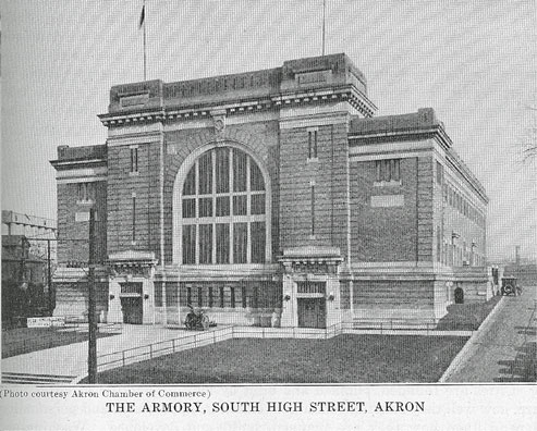
(Photo courtesy Akron Chamber of Commerce)
THE ARMORY, SOUTH HIGH STREET, AKRON
CHAPTER II
PLANNING AND DEVELOPMENT
By Charles F. Fisher, Planning Engineer
The City Plan
THE PLAN OF A CITY IS VARIABLE AND CHANGEABLE
A city's plan is one of the most interesting things about it and one of the most important. Its location largely determines its advantages for commerce, manufacturing or residential purposes and its probable future growth but, when once made, it cannot be changed. Its topography is a distinguishing characteristic and affects its development ; but topography is a permanent feature. It can be only slightly modified in making public improvements or in the process of preparing the land for the purposes for which it is to be used. If it is rugged, the hills cannot be leveled off entirely nor can the valleys be wholly filled up. Natural barriers have to be overcome by bridging the streams and valleys and by tunneling hills that are unsurmountable. Physical features are practically unalterable. The plan and development of a city, however, are variable factors and are susceptible of variation, control and revision.
IT DOES NOT NATURALLY GROW AND EXPAND WITH NEED
A city is not created by the power or forces of nature. It is not an organism and does not grow and function, true to species, in accordance with innate natural laws and processes, like a plant or tree. Its functions and utilities do not expand naturally or automatically with growth and need as do the functions and parts of a natural organism but remain as first established unless changed and adjusted by action of municipal authorities.
GOOD PLANNING BRINGS CITIES CHARM AND FAME
Cities are founded, planned and built by man. The kind of cities they are, how well they function, their conveniences, appearance and personality depend upon how they are planned, built, and developed. Washington, Paris and Vienna derive their charms and fame not so much from their location and topography but rather from their magnificent streets and boulevards, their splendid parks and public places, and their fine public buildings and other examples of civic art. London lost its chance to
- 64 -
66 - AKRON AND SUMMIT COUNTY
greatly profit by the great fire of 1666 when it failed to adopt and carry out either the Wren plan or the Evelyn plan for the 436 acres devastated and permitted the deformed and haphazard street system to be perpetuated.
THE CITY PLAN AFFECTS ALL ACTIVITIES AND ENTERPRISES
Under present day conditions, the plan of a city affects, one way or another, all the activities and enterprises in which its citizens are engaged as well as the public health, safety and welfare. The city plan has much the same relation to the functions and services of the city as the design of an industrial plant has to its efficiency and production. In the case of a building, the usual and accepted procedure is to so design and build the foundation that it will support the ultimate structure or, if this has not been done to redesign, reenforce and reconstruct it in part, if necessary, before enlarging the superstructure so that it will carry the proposed additional load. Likewise, if the plan of a city, which is the foundation and frame work upon which the city is built, has not been comprehensively and adequately 'prepared and all its parts coordinated in advance for its ultimate size, the reasonable and economic course is to revise and readjust it and correct its defects before it breaks down under the weight of a greater population and development than it is capable of sustaining safely, efficiently and economically.
EVERY TOWN AND CITY HAS A PLAN
Every town, city and region has a plan. Every municipality in Summit County, and the county itself, has a plan. These plans are not in the form of official maps but they are evident on the ground and are legally determined by county and municipal records. If delineated on maps, they would show the legal character of all lands, publicly or privately owned. A map representing the plan of Akron would show all public highways, parks and playgrounds, school sites, city, county, state and federal building sites, easements, and other public property or rights and the various zoning districts into which the city is divided by the Akron zoning ordinance. Even though there is no such official map, the plan does exist, nevertheless, as legally fixed on the ground.
THE GROWTH OF CITIES HAS BEEN SPASMODIC AND HAPHAZARD
American cities have grown, until a few years ago at least, in a spasmodic, haphazard way. From small beginnings in the shape of a subdivision or town plat of limited area, they have increased in population and expanded far beyond their original limits to an extent not foreseen by their founders. From time to time they have reached out and annexed other municipalities and contiguous territory that had been subdivided and more or less built up.
The plans of these annexed municipalities and territories had not been coordinated within themselves, with each other or with the original town
AKRON AND SUMMIT COUNTY - 67
sites. No general scheme or design had been followed and no authority had exercised supervision in the planning of the land subdivisions. Everyone who owned a parcel of land followed his own inclinations in laying out streets and creating building sites. As frontage and access were essential, streets were provided but only incidentally and grudgingly. The subdivision of land was regarded as a purely private commercial enterprise and handled on a commodity basis. That it was affected with a public interest was recognized only in the exceptional cases.
EFFECTS OF SELFISH INDIVIDUAL PLANNING AND USE OF LAND
The failure to plan intelligently and coordinate with existing and prospective street systems did not often result in greater profits, but frequently proved costly in the end and, in some cases, was disastrous. Some subdivisions were laid out in gridiron or checker board fashion on steep hillsides and others without any regard or attempt to conform to adjacent subdivisions. Subsequently it developed that the grades of the streets were impossible in some of these cases and that the property was practically inaccessible in others because all the streets were blocked or dead-ended as the result of their own or the adjacent owners' action. They were Chinese puzzles and hemmed in as if surrounded with a Chinese wall. There are instances of the above on record where property owners appealed to municipal authorities for relief from the situation in which they had become involved and conditions were corrected after many difficulties had been overcome and much time and effort had been spent in the process. In several cases, all lots were deeded to a trustee ; the plats were vacated ; new subdivision plats were made and recorded ; the property was reconveyed to original owners in accordance with the new plat ; and development followed. The topography and location were not changed but a proper and suitable plan changed potential values into actual values.
In the use and building up of the land, the failure in many instances to conform to the natural and existing development resulted in great economic and social losses. The tendency for uses to segregate and locate in natural residence, business and industrial districts was not strong enough in itself to prevent the scattering and intrusion of uses and buildings into localities where they were inappropriate and injurious.
Parks and other recreational areas, except in a few cities, were not secured according to a well considered plan designed to provide adequate recreational places in right locations for the various sections of the city but in a hit or miss way or only as they were donated by public-spirited citizens.
The economic and social advantages of order, system and beauty in urban communities were not fully appreciated, especially in those cities that experienced rapid industrial growth and development. The disorder, confusion and ugliness that prevailed in many cities spoiled their appearance, made them less attractive and less agreeable places in which to live and depreciated property values.
68 - AKRON AND SUMMIT COUNTY
PLANS ARE COMPOSITES OF IDEAS OF INDIVIDUALS
In some such fashion, most of our cities grew in population and increased their areas. As a result their plans are composites of the various divergent ideas of a great many different individuals most of whom had no unity of purpose, no realization of the import of their actions and often no sense of their responsibility to the community in the part they played in helping to make the city plan.
SPREAD OF MOVEMENT FOR COMPREHENSIVE, COORDINATED PLANNING
Many citizens and public officials perceived, more and more, the evil effects of this sort of planning and development. A movement for comprehensive, coordinated city planning started and spread rapidly. State laws were enacted and city charters were amended to provide for the creation by municipal authorities of city planning commissions to study and investigate the existing plans and make recommendations for the correction of their defects and for readjustments to meet modern requirements and conditions ; to study the need and make recommendations for the coordination of future public improvements ; to regulate the platting of land and prevent the repetition of past mistakes ; and to study and make recommendations respecting all matters pertaining to the convenience, health, safety and well-being of the community.
The Plan of Akron
AKRON HAS GROWN IN SAME WAY AS AVERAGE CITY
Akron was founded and planned and has grown and expanded in much the same way as the average American city. In its progress from a new town site to an important industrial community, it has paralleled the various steps taken by most other cities. First came the idea, then the town site plan, and after that the struggle and slow growth, followed by the subdivision of adjacent lands, then periods of more or less rapid growth and development and the extension from time to time of the city limits to include additional areas, until finally the city of today stands forth, surpassing the dreams of the founders and their immediate successors but still unfinished.
ITS GOOD FEATURES PLANNED BY FOUNDERS
The plan of Akron, like that of other cities, has some good features along with a number of defects and imperfections. Some of its deficiencies are due to its topography but most of its defects are the inevitable result of the way in which its plan, as it exists today, was made and laid down. Considering the number who helped to make it, that there was no general scheme to guide them and that each one who made a new subdivision could lay it out as he pleased, as there was no public supervision or control over the platting of land until a few years ago, the result as a whole is as good as could be expected. It is rather amazing, however, that
70 - AKRON AND SUMMIT COUNTY
the highway system which was largely laid out from 90 to 120 years ago should serve modern street transportation and traffic as well as it does. To the founders, who provided the streets in the downtown business district and the radial thoroughfares, Akron is indebted for most of the good features in its existing plan.
HOW AND WHY AKRON HAPPENED
The Ohio Canal furnished the occasion for a new town and the series of locks, which the topography made necessary, determined its location. When it became certain that the canal would be constructed, Gen. Simon Perkins, who had acquired a large tract of land on the summit between the valleys of the Cuyahoga and Tuscarawas rivers, conceived the idea that here would be a logical place to lay out a new town. In addition to the advantages of transportation and power which the canal would afford, he believed that the interruption of transportation and the time that would be required for boats to pass through the locks would result in a demand and patronage for various kinds of business enterprises. The land was surveyed, a plan was prepared and the plat was recorded in the records of Portage County on December 5, 1825. As the site of the proposed new town was on the summit between the two watersheds, General Perkins decided that "Akron" would be an appropriate name. The title of the plat as recorded was : "Map of the Town Plat of Akron in Portage County, Ohio, laid out on the Canal at Portage Summit."
THE SITE OF ORIGINAL AKRON
The town site of original Akron extended from what is now Center Street on the north to Harbor Street, south of Wooster Avenue, on the south, and from the alley east of Broadway on the east to Pine Street on the west. It was in the form of a square, being approximately one-half mile on each side, and contained an area of 172.20 acres, from which, however, twelve acres at the south end were excepted in the dedication. Its topography was somewhat irregular. A small stream flowed northerly through the center of it, on the south there was a marsh or swamp and on the east there was a low hill or ridge.
THE PLAN OF ORIGINAL AKRON
The blocks shown on the plat, with a few exceptions, due to topography, were rectangular in form and all of the streets were straight, except Water Street, which, in a general way, followed the course of the creek. Four of the six north and south streets and five of the six east and west streets were made 150 links, or ninety-nine feet wide. High Street and Chestnut Street were made one chain, or sixty-six feet wide, and Water Street varied in width from 66 feet to 82.5 feet. Alleys, twenty feet in width, were provided in all full blocks. One block, 330 feet by 330 feet, was dedicated as a "Public Square." This is the present Perkins Square on West Exchange Street between Bowery and Locust streets. One-half
AKRON AND SUMMIT COUNTY - 71
block, across the street from the "Public Square," was dedicated for "Public Buildings." This is now the site of Perkins School. A "Public Ground" was also shown and dedicated on the recorded plat. For some years this ground was used as a public market but it is not now in public use nor under public control.
Considering the location, the period, the conditions existing at that time and the prospects of growth, the plat of original Akron showed unusual vision and optimism and a fine public spirit. In the width of its streets, its provision for access to the rear of lots, which is a great advantage in the downtown business district, and its donation of land for public use, it probably has not been surpassed by any subdivision of land in or around Akron. The standard set by it was, unfortunately, not maintained in subsequent subdivisions. Except in the one case of Main Street, the 99 foot streets were reduced to 60, 50 or 40 feet when the adjacent and contiguous lands were subdivided and two of the 99 foot streets were narrowed a few years ago by vacation proceedings.
NORTH AKRON AND THE "GORE"
Following the laying out of original Akron, other lands were subdivided from time to time. Five years after, "Cascade," or "North Akron," was platted. It extended on both sides of what is now Main Street from Mill Street to North Street. In North Akron, Main Street was given a width of 189 links or 124.74 feet and Market Street 168 links or 110.88 feet. The width given Main Street was not due to far-sighted planning but to the fact that there happened to be a canal in the middle of it and a road had to be provided on each side of this canal. The area between Center Street and Mill Street was called the "Gore." When this was subdivided, Main Street in original Akron was "tapered up" from 99 feet to 124.74 in North Akron and Broadway was "tapered down" from 99 feet in original Akron to 66 feet in North Akron. Bowery Street was made only 66 feet wide, instead of 99 feet as in original Akron, and no land was dedicated for the widening of Center Street west of Main Street, which had been laid out as part of a street on the plat of original Akron. These are defects that are very apparent today and not now easily corrected.
THE MAIN HIGHWAYS
Akron's main highways in 1928, almost without exception, were laid out as country roads at a very early period and before the lands through which they passed had been subdivided. They were laid out, on petition, by the county surveyor and viewers appointed for that purpose between two designated points and so usually were direct and located with regard to topography. All of the surrounding towns and communities were connected up with county roads, a number of which passed through or led to the central part of Akron. Some of these county roads were established before original Akron was laid out and most of them by 1837. Outside of the present downtown business district, about the only evidence
72 - AKRON AND SUMMIT COUNTY
of intelligent, thoughtful planning in the first seventy-five years is found in the system of highways, laid out as county roads, which are the radial thoroughfares of today.*
Main Street, from Chestnut Street to South Street, was laid out eleven years after the recording of the plat of original Akron in which it was given a width of ninety-nine feet. Had this ninety-nine foot width been carried to South Street at that time, it would be a fine thing today.
It is also unfortunate that Exchange Street, when originally laid out in 1828 and 1834, was deflected towards, and its east and west termini placed on, Market Street. It now seems that it would have been better planning to have deflected West Exchange Street to the left at Portage Path and have given it the general direction of Copley Center and to have deflected East Exchange Street to the right, east of Grant Street, and carried it to Thomastown on Arlington Street and even to a connection with the Massillon Road near its intersection with Waterloo Road.
A SYSTEM OF CIRCUIT HIGHWAYS LACKING
At the time the county roads were being generally established, there was no need of a system of circuit or cross-town highways. All travel was to and from the center. There was no occasion to avoid it. Only a very few county roads can now be made to serve as links in a system of this kind. Where these circuit highways are now needed, the land was platted without any thought or provision for a system of traffic streets passing around the central part of the city and connecting up the radial highways. To the foresight of those who in that early period laid out the system of county highways is due the credit of having provided the present thoroughfare system, as no street that is now used as a thoroughfare was provided by dedication on a subdivision plat recorded previous to 1916.
PLAN IS COLLECTION OF DIFFERENT SUBDIVISIONS OR UNITS
After the downtown part of Akron had been platted, the adjacent lands were subdivided. Then additional subdivisions were laid out from time to time along and between the county roads. This process continued and land farther and farther out was platted. The climax came in 1920. Thus the plan of all of Akron's streets, except the main highways which had been laid out as county roads, is largely the collective plan of its differ-
* Portage Path, East Market Street, from Arlington Street east, and Diagonal Road were laid out in 1809; Case and Newton, in 1810; Arlington, East Buchtel and East Market, from Buchtel to Arlington, in 1811; South Main, south of South, and Coburn, in 1816; Maple and East South, in 1817; Brown, south of South, in 1818; Spicer, in 1822; Kent, in 1823; River, Wooster and Forge, from Union to Arlington, in 1826; West Exchange, and West Market, in 1828; East Market to Buchtel, Merriman Road, Bowery and a portion of Wooster, in 1832; East Exchange to Arlington and Copley Road, west of Perkins Park, in 1834; South Main, from Chestnut to South, in 1836; Carroll, Vine and Fountain, in 1837; North Street, east and west, and Furnace to Arlington, in 1842; Bowery, south of Wooster, in 1852; West Thornton, west of the Canal, in 1863; North Howard, north of Lads, in 1869; West South, in 1875; Aqueduct, in 1878; Locust, in 1881; and Hazel Street, in 1889.
AKRON AND SUMMIT COUNTY - 73
ent subdivisions. As anyone could plat streets and lots according to his own ideas and plans before 1916, it is not a unified whole, with all the parts fabricated to fit together, but rather a collection of separate units that are more or less disjointed and disconnected. The result is evident in the street plan today.
IMPROPER SUBDIVISION
In the early subdivisions that were platted prior to 1870, extra large blocks and lots were laid out. Land was cheap and large lots were desired at that time. During the period of rapid growth from 1915 to 1920, it became the practice to resubdivide these blocks and lots into extra small lots with narrow, and, in many cases, deadened courts ; to build two and even three houses, tandem fashion, on a frontage of fifty feet or less ; and to cut up the remaining unallotted parcels into so-called "unrecorded subdivisions," selling the lots by metes and bounds. In every instance the plans of these resubdivisions and unrecorded subdivisions were unsuitable and improper. The lots were usually inadequate both in frontage and depth and the streets, while providing frontage, were deficient in design and width. When built up, however, they became established and have thus also become a part of the existing plan.
The city plan also shows many dead-end streets where plats of allotments failed to extend or carry through the streets that had been provided in an adjacent allotment previously laid out ; very long blocks with no cross streets for over one-half mile ; and many other improper block and street layouts that indicate an inconsiderate, mistaken or selfish attitude on the part of the individual responsible.
EXPANSION BY ANNEXATIONS
The annexation map of Akron shows how from time to time the city limits have been extended and the area of the city increased by the annexation of additional territory. When any territory is annexed, the dedicated streets within that territory are accepted with all their defects and become a part of the city plan. Akron Village, when incorporated in 1836, was rectangular in shape with its four boundary lines located near Charles Street, Fir Street, South Street and Bell Street and included original Akron, Cascade, or North Akron, and Bartgestown. It had an area of three square miles. Annexations were made in 1864, 1872, 1883, 1899, 1902, 1916, 1920, 1923, 1926, 1927 and 1928. In this way the city's limits have been extended so that in 1928 it has an area of 27.46 square miles.
PREVAILING RESIDENTIAL DEVELOPMENT
Akron has been fortunate in the prevailing character of its residential development. It has a large percentage of home owners and the single family dwelling house has largely predominated. There is a marked absence of the three-decker and the row-house, built up solidly out to the street line, that is so prevalent in many of the eastern cities. It has always
74 - AKRON AND SUMMIT COUNTY
been the general practice in Akron to build detached houses and to provide both front and side yards in all residence sections.
TOPOGRAPHY AND BARRIERS
A large part of Akron has an irregular topography. The valleys of the Cuyahoga River and the Little Cuyahoga and its branches, with their generally steep hillsides, are natural barriers that separate the city physically into different parts. These parts cannot be united with highways of satisfactory grade and alignment except by the construction of bridges or viaducts. The North Hill Viaduct had to be built to join the main part of the city with North Akron and to give a better route to Cleveland on the east side of the Cuyahoga Valley. Other smaller but similar barriers, as the Glendale Valley, The Akron Rural Cemetery and the valley in which the bed of the Ohio Canal is located, are in the way of direct traffic routes. The three trunk railroads, passing near the downtown business district, are barriers to highway traffic and tend to restrict the extension of the business district.
PARKS AND RECREATION
Akron lists some thirty-five parcels of land, with a total area of about 536 acres, as city parks. A number of these are of the so-called "handkerchief" variety, being merely small open squares or small triangles at street intersections. Practically all the parks Akron has are gifts from a few public-spirited citizens by deed or by dedication on plats of allotments. Glendale Park was purchased and a small sum was paid toward acquiring McLean Park. Lane Field, Margaret Park and Manning Lake were acquired through purchase by the City of Akron Water Works. Only about $10,000.00 has been expended directly to acquire land for park purposes. The Perkins family donated Perkins Park, containing seventy-six acres, Grace Park and Union Park in addition to the three parcels dedicated to public use on the plat of original Akron. The largest single acreage presented to the city is the J. Edward Good Park of 172.25 acres, which has been improved as a municipal golf course.
The various parcels of land which make up Akron's park area do not constitute a park and recreational system. They are not located in accordance with any plan designed to adequately serve every section, but are where they are because the city was able to secure them without cost. The total park area in Akron is less than one-fourth that which a city of its population should have and the development and appearance of most of its parks are not a credit to the city. A few of the smaller ones were improved in appearance a few years ago, but others are in their original state or worse. Adequate funds have never been available to properly improve, beautify and maintain Akron's parks.
GROUPING OF PUBLIC BUILDINGS
The nearest approach to a grouping of public buildings is on High Street, between Bowery and Center streets, where the County Courthouse,
76 - AKRON AND SUMMIT COUNTY
the City Hall and the State Armory are located. In this respect, Akron is far behind many other cities that are designing and locating their public buildings in accordance with carefully prepared plans for the convenience of the people and the enhancement of the city's appearance.
It is probable that General Perkins intended and expected that the public square he provided in original Akron would be the central square of the future city. It is interesting to note that ninety-four years later, when Akron had become a city of 175,000 in population, this public square was made the central feature in a proposed grouping of public buildings.
OFFICIAL CITY PLANNING IN AKRON-THE BEGINNING OF SYSTEMATIC
PLANNING
The first official action for systematic city planning in Akron was taken when the council, as empowered by state law, passed an ordinance on March 13, 1916, establishing a City Planning Commission of seven members to be composed of the mayor, the director of public service, the president of the Board of Park Commissioners and four citizens to be appointed by the mayor. The City Planning Commission as constituted under this ordinance consisted of W. J. Laub, mayor ; C. F. Beck, director of public service; C. B. Raymond, president of the Board of Park Commissioners ; Julius Boenisch, Will Christy, James Shaw, E. E. Workman.
Under the statutes, the City Planning Commission had the powers of a platting commission and its approval of plats of new allotments within the city and for three miles outside, and outside of other municipalities, was required before such plats could be recorded. Platting rules were prepared and all new plats were checked and required to comply with the commission's regulation governing the platting of land. As funds had not been provided for planning studies and investigations, this commission's activities were largely limited to work connected with the platting of new allotments. It required that the plan of the streets and lots be proper and suitable, that correct surveys be made, that complete information as to dimensions of lots, angles, curves, etc., should be shown on the plat and that monuments be set at block corners so as to make it possible in the future to relocate any lot or street. Previous to the creation of the commission, such information as was given was often unreliable, the surveys were often inaccurate and the mapping of allotments was not properly done.
THE NOLEN SURVEY AND REPORT
In 1918, the Akron Chamber of Commerce, through its City Improvement Committee, retained Mr. John Nolen, city planner of Cambridge, Mass., to make a survey and study of the city, to formulate a suitable plan and make recommendations for its future development. Mr. Nolen prepared and submitted on April 25, 1919, his report, "City Plan for Akron," in which he gave the results of the civic survey he had made and presented plans and made recommendations for a general city plan, including a
AKRON AND SUMMIT COUNTY - 77
street system, a park system, public building sites, a plan for the downtown district and a zone plan. He pointed out in his report that Akron had grown to a population of over 175,000 without any thought of its proper development and showed how defects could be remedied and orderliness, convenience, attractiveness and efficiency could be secured. The influence of this study and report aided greatly in advancing the cause of city planning in Akron. Some of its recommendations have been accomplished and it will continue to be a source of information and a guide in making future public improvements. It was largely due to Mr. Frank B. Adams, chairman of the City Improvement Committee of the Chamber of Commerce and a member of the City Planning Commission at the same time, that the services of Mr. Nolen were engaged and his plan secured.
CITY PLANNING UNDER THE CITY CHARTER
The present city charter, which went into effect January 1, 1920, estab lished a City Planning Commission as a department of the city government and extended the scope of its duties and functions. The charter, as amended, provides that the mayor with five appointed members shall constitute the City Planning Commission and that the director of public service shall be, ex-officio, the chief engineer and secretary. The City Planning Commission's powers and functions do not interfere with the rights or prerogatives of the council or any other department but are largely limited to the making of studies, investigations and recommendations and the supervision of the platting of land.
The commission created under the new charter, held its first meeting on January 16, 1920, and was constituted as follows : H. S. Firestone, president; H. S. MacAyeall, vice president ; C. F. Beck, mayor; W. J. Laub, chief administrator ; F. G. Carnahan, D. C. Murphy, Jonathan Taylor, E. A. Zeisloft, ex-officio chief engineer and secretary.
The budget for 1920 provided sufficient funds for a staff organization contemplated by the charter, which says that "The council shall provide the commission with necessary funds for the carrying on of its work and shall provide for the employment by the commission of adequate clerical, engineering and other expert assistance." The commission engaged Charles F. Fisher as planning engineer, an assistant, five draftsmen and a field party. In addition to the work connected with examining, checking, revising and correcting the large number of allotment plats presented in 1920, a base map of the city and the region for more than three miles outside, at a scale of 800 feet to one inch, was prepared and various study maps and investigations, preparatory to the preparation of a zoning plan, were made.
PARK AND BOULEVARD PLAN
A general park and boulevard plan was also prepared in 1920 under the direction of Mr. A. S. De Forrest, landscape architect of Rochester, N. Y., who had been retained for this purpose from funds provided by the
78 - AKRON AND SUMMIT COUNTY
president of the City Planning Commission. This plan proposed areas for park and recreational purposes in various parts of the city, a large natural park in the Cuyahoga Valley and an outer boulevard encircling the city.
On the recommendation of the City Planning Commission, a proposed bond issue in the amount of $2,000,000, for the acquirement and improvement of lands for park and recreational purposes, was submitted to the voters at the election in November, 1920. The proposal had a majority of about 3,000 votes but as the state law, at that time, required a two-thirds majority of all the votes cast, it failed to carry. No action has been taken since to provide funds to acquire additional lands for park purposes or to improve existing undeveloped park areas. A number of small areas for recreational purposes have been obtained through dedication in allotment plats, and, in 1924, Mr. J. Edward Good gave to the city 172.25 acres of land, situated west of Hawkins Avenue and south of Mull Avenue, for recreational and educational purposes.
THE ZONING PLAN
The zoning ordinance is the only part of a general city plan for Akron that has been officially adopted. It was prepared by the staff of the City Planning Commission under its direction. It was then submitted in a tentative form to different civic and neighborhood organizations and groups for criticism and suggestions. After being revised, it was submitted to the council on June 20, 1922. The council on August 15, 1922, after public notice and hearing, passed it unanimously and it became effective on September 15, 1922.
Zoning is the application of good housekeeping principles to city development. It provides a place for everything and requires that something of the same order and system be observed in community building that the citizen observes in his individual home or business. With increased city growth and intensity of development, the use of city property becomes more and more a matter of community interest. Without municipal action to control and direct the use of land and buildings the majority of property owners are subject to the tyranny of the minority and are unable to protect themselves from the acts of the inconsiderate or the selfish. No useful trade or industry is in itself a nuisance but any business, trade or industry may be very objectionable and injurious in some locations. It is obviously necessary and reasonable to control the use of land and buildings by some arrangement that will provide for the harmonious development of the various localities of the city for the purpose for which they are most suitable and valuable. In every city some sections are specially adapted for residential use, some for business and some for industry. Zoning determines the purpose for which each part or neighborhood is most suitable and best adapted and, by the enactment of a zoning ordinance, divides the city into districts and prescribes the appropriate uses, appropriate building heights and the appropriate size of yards and density limitations for each district.
Under the zoning plan of city development there are industrial districts
AKRON AND SUMMIT COUNTY - 79
where manufacturing plants may locate; business districts at convenient points throughout the city where stores can group and form local centers instead of scattering throughout residential sections ; residence districts in which all kinds of residences including one and two family houses and apartments may be erected; and dwelling house districts for only one or two families. By the exclusion of the uses not permitted, all residence districts are protected from the intrusion of stores, filling stations, public garages, shops and industrial plants.
Zoning prevents the overcrowding of people in one locality and tends to spread the population over the less thickly populated areas ; assures the provision of yards and open spaces around all residence buildings; the maintenance of front yards; prevents the intrusion of injurious uses in the midst of uniformly built areas; gives a degree of permanency to the character of districts ; makes real estate a better investment and a safer security for loans ; stimulates good building development and encourages home ownership ; and so makes the city a more attractive and better place in which to live, work and do business.
The Akron Zoning Ordinance consists of the text or regulations, a zoning map showing the different districts into which the city is divided and the building line map showing the distance that buildings are required to set back from street lines. There are three classes of districts—use districts, height districts and area districts. The ordinance lists the uses and buildings permitted in each of the six use districts ; limits the height to which buildings may be erected in each of the five height districts; and fixes the size of the side and rear yards and the number of square feet required for each family for which a building is arranged in each of the five area districts.
The building line map provides definite front yard lines on all streets in dwelling house and apartment house districts and set-backs on many streets in business, commercial and industrial districts as well. It is a comprehensive plan to control the location of buildings on lots with respect to front lot lines or street lines just as the area district regulations control their location with respect to side and rear lot lines.
The Akron Zoning Ordinance has now been in effect about five and one-half years. It is impossible to determine with any degree of exactness the benefits conferred or even approximately estimate the damages that have been prevented throughout the city by the zoning regulations. It is certain, however, if unrestricted use of land and buildings had continued as immediately before the passage of the ordinance, that the total damages would have been much greater than anyone realizes. In every part of the city, property owners have been protected without being aware of the objectionable uses, like filling stations and projecting store buildings, that threatened them.
LAND SUBDIVISION
The plats of all new allotments, presented to the City Planning Commission for approval, have been carefully scrutinized by its staff. Most of
80 - AKRON AND SUMMIT COUNTY
them have been changed in some respects, many have been revised and some have been completely revamped. All allotment boundary lines have been checked on the ground and all computations and information on the plats have been checked and corrected before turning the plat over for recording. The commission has had building lines, or front yard lines, and side yard restrictions placed on all recorded plats. In new allotments along main highways, it has secured the dedication of additional land for their widening to eighty feet or more. In 1927, traffic highways for a length of 7,500 feet, counting one side only, were widened in this way. It has adopted a width of 110 feet as a minimum standard width for traffic streets in new local business centers at focal points and has pointed out the advantages of providing service courts for rear access and parking. In a number of recent allotments, such extra street widths and. service courts have been provided in proposed business centers. The commission prepared "A Design for a Local Business Center" at the intersection of thoroughfares in which are combined different features and advantages that, it is believed, will enhance the value of the property and facilitate the movement of traffic.
Tentative layouts for most of the unsubdivided lands within the city and for a part of the territory outside, within the commission's jurisdiction, have been prepared as a guide to subdividers and to the commission in passing upon proposed allotment plats when presented for approval. The platting of streets with regard to topography and the avoidance of standardized rectangular street plans, where the land is not uniformly level, has been encouraged.
TRAFFIC SURVEY IN 1927
A traffic survey was made by the staff of the City Planning Commission in 1927 as a basis in part for the preparation of a thorofare plan including recommendations for the regulation of traffic. The counts were made by men furnished by the larger industrial plants, the department of public service, the Boy Scouts and several other concerns. All traffic entering or leaving the city from 6 A. M. to 6 P. M. was counted on one day by stationing counters at nineteen "Gateways"—the points where the main traffic highways cross the city limits. Traffic was also counted at the intersections of thorofares inside of the city and at a number of downtown intersections. In all sixty-four stations were counted on three different days. The field sheets were tabulated, a final sheet for each intersection was developed showing the number of vehicles of each type passing through the intersection for each hour, the total of each for twelve hours, the total number of vehicles of all types for each hour and grand totals. The final sheet also showed on a diagram the total number of all vehicles passing through the intersection, the number of all types that passed straight through in each direction and the number of right and left hand turns for each corner of the intersection. The fluctuation of total traffic for each fifteen minute period was also shown by a graph. From the information on the final sheets, a Traffic Flow
AKRON AND SUMMIT COUNTY - 81
map was made which showed, by the width of strips on the map, the total and comparative volume of the traffic carried by the different traffic streets.
A comparison of the Traffic Flow map and a map showing the old county roads, shows in a striking way how generally motor vehicles today are using the roads laid out for ox carts and horse-drawn vehicles when Akron was a very small village.
A study of traffic accidents in 1926 and 1927 was also made and spot maps were prepared showing just where every traffic accident occurred.
CIVIC ART
The City Planning Commission has not submitted any plans or made any recommendation for the grouping of public buildings or the establishment of civic or community centers. No general plans have been developed for improving the appearance of the city. Any fast growing city has an unfinished appearance. There is apt to be much that is unattractive and unbeautiful. Akron has not given as much attention, however, to the improvement of its appearance, especially in the downtown business district, as its importance, from a civic and business standpoint, deserves.
In 1920, the commission recommended the planting of shade trees in city streets as part of street improvement proceedings. A plan was worked out whereby this could be done and, as a result, over 12,000 shade trees have been planted in the parking strips in the residential districts of the city.
SEPARATION OF RAILROAD GRADE CROSSINGS
After many years of negotiations, the city and the three trunk railroads passing through the city on adjacent rights of way, agreed upon terms and entered into arrangements for the separation of the railroad grade crossings from Center. Street to South Main Street, inclusive. A viaduct in East Exchange Street, 100 feet wide, has been completed,, plans have been prepared for a viaduct on Center Street, and it is proposed to proceed with the construction of five additional viaducts as fast as plans and finances can be provided. A number of other railroad grade crossings will have to be eliminated following the completion of the ones planned.
PLANNING PROJECTS ACCOMPLISHED
Akron has several examples of the benefit of accomplished city planning projects. The widening of West Market Street from Howard Street to Cherry Street in 1923, the construction of the North Hill viaduct in 1922, the opening and extension of North Main Street in 1922, and the completion of its improvement in 1924, from the north end of the North Hill viaduct to the High Level Bridge, have all proved their value
4-VOL. 1
82 - AKRON AND SUMMIT COUNTY
and are now indispensable for traffic purposes. The city widened North Main Street from the viaduct to Cuyahoga Falls Avenue to a width of ninety feet. Had the need for this not been foreseen and action taken, the completion of the North Hill viaduct would have dumped its traffic into a forty foot street. The widening of the existing fifty foot street (Camden Avenue), from Cuyahoga Falls Avenue to the High Level Bridge, to eighty-six feet in width is due almost entirely to the public spirit and determined efforts of Mr. H. G. Smith. The city supplied him with a dedication plat and he, after months of work, secured the signatures of the owners of eighty-six per cent of the total frontage of 9,562 feet, counting both sides of the street. With this showing, the city instituted proceedings to acquire the remaining frontage required to widen the entire street to eighty-six feet. The traffic count of 1927, showed that the traffic on this route is greater than on Cuyahoga Falls Avenue, the alternative route.
THOROUGHFARE PLANNING
The City Planning Commission for several years has realized the importance of thorof are planning for. Akron but has not been provided with sufficient funds to secure an adequate force to make the preliminary studies and investigations and work out a comprehensive Thorofare Plan. In its annual reports for the past three years, it discussed the need for a Thorofare Plan for the improvement of traffic and transportation facilities and urged that the preparation of such a plan be undertaken.
A comprehensive Thorofare Plan for Akron and the surrounding region should be worked out, submitted as a tentative plan to civic and neighborhood organizations and to the public generally for suggestions and constructive criticism. When revised and approved it should be adopted and carried out in accordance with a program, included in the plan, giving the sequence and year in which the various projects should be taken up and accomplished. This program of accomplishment would necessarily continue over a term of years. A comprehensive Thorofare Plan, or a physical improvement program, involving capital expenditures, cannot be successfully accomplished without provision for financing the different projects included in it. This requires a long term financial program to provide for the payment of the city's share of the cost of executing such a plan or program. Comprehensive planning requires comprehensive financing.
The advantages of taking stock of the situation with respect to all needed physical improvements for which the city has to pay a part or all and the estimated amount that will be available to pay for them at a given time and correlating the physical improvement program with the ability to pay are plainly apparent. All projects would be scrutinized more carefully and taken up in the order of their importance or urgency instead of preference being given to the petty schemes of certain individuals or groups ; the public funds would not be devoted almost entirely to one class of physical improvements to the exclusion of others
AKRON AND SUMMIT COUNTY - 83
of equal or greater importance for the welfare of the community ; and the tax payers would more readily support projects and vote funds for their execution if they knew just how and when certain projects, in which they are especially interested, could be and would be taken up and accomplished.
With traffic conditions as they are today and with prospects of a large growth in population in Akron and the surrounding region in the next fifteen or twenty years, it is unreasonable to expect that the thorofare system of 100 years ago will be adequate for the demands and needs of a continuously increasing volume of traffic. Organizations and property owners have been urging projects for the widening of certain traffic streets and the opening of new traffic routes in various parts of the city. Something will have to be done to readjust the thorofare system to modern conditions, enlarge its capacity and increase its efficiency.
SYSTEMATIC, COMPREHENSIVE PLANNING IS ESSENTIAL FOR A MODERN CITY
The citizens of a modern municipality are entitled to, and in a well-ordered city will have, those physical improvements, facilities and services that will provide safe, convenient and economic highway transportation, promote healthful and comfortable living conditions, furnish adequate recreational advantages, and contribute to the improvement of the appearance and aesthetic character of the community. These physical improvements, facilities and services are parts of, or are dependent upon, the city plan. It is evident from the nature of city growth, and experience has demonstrated, that a proper and suitable city plan does not result from the incidental acts or casual efforts of individuals or from the spasmodic, inconsiderate action of municipal authorities but can only be secured through the consistent, scientific control and direction of all the parts or elements of the city plan and their revision, adjustment and correction in a systematic, comprehensive way so that they will form a coordinated, unified system.
PERSONNEL OF THE CITY PLANNING COMMISSION
As Chief Administrators, H. C. Campbell and M. C. Tucker served as ex-officio members of the City Planning Commission in 1922. D. C. Rybolt as Mayor and as Mayor-Administrator was a member of the commission from January 1, 1922, to December 31, 1927.
The City Planning Commission in 1928 is constituted as follows;
D. C. Murphy, President
C. A. Strobel, Vice President
G. Lloyd Weil, (Mayor)
C. A. Myers
A. W. Sweeny
W. E. Wright
Fred E. Swineford, Ex-officio, Chief Engineer and Secretary. Charles F. Fisher, Planning Engineer.
CHAPTER III
AKRON'S NEIGHBORS—SUMMIT CITIES AND VILLAGES
Outside of Akron in Summit County are many progressive and prosperous political subdivisions. Included are Barberton, Kenmore and Cuyahoga Falls, really a part of the Greater Akron district, and at the time this is written a movement is under way to bring about a merger of Akron and these three municipalities to be operated under one government.
BARBERTON
The possibilities of the present site of Barberton were not new when discovered by the eventual promoters and founders. As early as 1781 the advantages and possibilities of this site were pointed out by no less a personage than Thomas Jefferson in his "Notes on the State of Virginia." At that time this locality was known as a part of the Western Reserve and part of the great State of Virginia, which was bounded on the west by the Mississippi River. In these notes Jefferson had attempted to encourage settlement of the Western Reserve, and in explaining the advantages offered in this part of the country mentions the portage at this point being the best and shortest route from the Great Lakes to the Gulf of Mexico.
CANAL WAS PROPOSED
These notes by Jefferson say that the portage was from the Tuscarawas River (then known as the Little Muskingum) to what is now known as Summit Lake. This lake was then connected with the Cuyahoga River, thus making a direct waterway to Lake Erie. He remarks about the fertile lands between this portage and the Ohio River. It was proposed at that time (1781) to build a canal connecting the two waterways, but it involved too much expense for a country so young.
It must be remembered in those days the Tuscarawas (according to the Jeff erson-Huchins report) was 600 feet wide at the portage and could accommodate such boats as were then in use. With the coming of the settler and his ax and sawmills, the forests were soon thinned out and the moisture for the rivers was materially reduced. Then with the coming of the Ohio Canal in 1825-27 the drainage was complete and nothing was left to supply the Tuscarawas but the present source—the overflow from the Portage lakes.
Thirty years after this report was presented by Jefferson came the
- 84 -
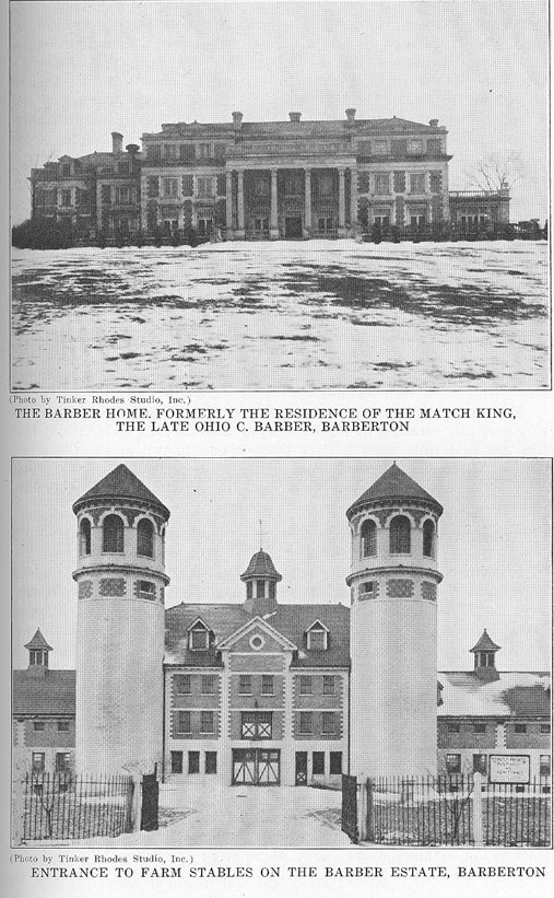
86 - AKRON AND SUMMIT COUNTY
first settlement that can be discovered as being made by white men on the site of Barberton. In 1811 a man by the name of George Laird established a trading store a short distance north of the present site of Young's Crossing. He carried on a great and thriving business both with Indians and whites. He built the boats that carried the freight to the gulf and accepted shipments in much the same manner that the express companies do now. His establishment was, as nearly as can be discovered, at the point where the Belt Line Railroad crosses the river today.
WAS SETTLED EARLY
It seems rather strange that the country all around the site of Barberton was settled and thriving many years before the city was thought of, but such was the case. As early as 1814 places now known as crossroads were thriving settlements ; in 1821 what is now known as Portage was the site of the first factory in the district—the Palmer Glass Company, manufacturers of glass tableware. Copley, Loyal Oak, Norton Center, Western Star and New Portage were all established trading places seventy-five years before the building of the Magic City.
After the building of the Ohio Canal, settlements sprang up at every lock. Wolf Creek lock was nearest the site of Barberton.
Forty years and more of canal transportation through this section was very seriously retarded by the building of the railroads in 1852. At that time the first rails were laid for what is now known as the Cleveland, Akron & Columbus Railroad Company. Twelve years later the laying of rails of the Atlantic & Great Western Railroad, the present Erie System, was an event celebrated with great ceremony in Summit County.
LAND IS ACQUIRED
In January, 1890, a partnership composed of Ohio C. Barber, Charles Baird, A. T. Paige and J. K. Robinson, through several purchases acquired a section of land (640 acres) located between the two railroads running south and west from Akron. Reuben Tate, Akron liveryman, took options. The territory extended from the Erie Railroad on the south, and from the intersection of Hopocan Avenue and Bolivar Road, on the east, to Wolf Creek on the west.
The company of capitalists whom Mr. Tate represented was incorporated under the name of the Barberton Land & Improvement Company, and William A. Johnston of Philadelphia, Pa. (now of Akron), was employed as civil engineer to survey and plat the town. Residence and business districts were laid out, and factory sites were provided for the new industries to come.
M. J. Alexander of Pittsburgh and George W. Crouse of Akron were later taken into the firm of the land company. With the additional capital stock of Col. William Moore and A. M. Sloan of Greensburg, Pa., the company was subscribed $100,000. O. C. Barber was elected president; G
AKRON AND SUMMIT COUNTY - 87
W. Crouse, vice president ; Charles Baird, attorney, secretary and treasurer; and M. J. Alexander, manager. The promoters entered the plats of the proposed town in the Summit County Courthouse on March 23, 1891. Two months later these men incorporated for $240,000. There were twenty-one acres of section alloted as park grounds.
FEW BUILDINGS
The only buildings on the tract of land at the time the town was incorporated was a little one-story, five-room frame house occupied by a family named Carney. It was located on the northwest corner of the lake—then called "Way's" or "Davis" Lake, now Lake Anna, after Mr. Barber's only daughter, Anna, the wife of Dr. A. D. Bevan of Chicago.
The original name of the lake was given in honor of Joseph Way, who settled in 1817.
The first industry to locate in Barberton was the National Sewer Pipe Company, now the American Vitrified Products Compahy. In November, 1891, there were eight thriving industries, including the American Strawboard Company, now fallen into ruins and the site offered again for another industry. The Strawboard mill was the pioneer of all industries, erected in 1882, when North Barberton was known as New Portage, a flourishing village of 500 inhabitants.
PLANT CHANGES HANDS
The building now occupied by the Domestic Rubber Co., formerly the Electric Rubber Reclaiming Co., was originally the property of the American Alumin Company, that manufactured industrial alum. The Carrara Paint Company took possession of the building after the Alumin Company, manufacturing white lead, and later a firm took possession of the building that manufactured burial caskets, moving later to Cincinnati, and the plant was bought by the Electric Rubber Reclaiming Company.
Another early industry was the Akron Heating & Ventilating Company, which manufactured hot air heating apparatus. West Central grade school building, is equipped with this company's apparatus. The plant was sold to the Diamond Match Company, the Diamond Machine Company now occupying the building for the most perfect match machines made in the world furnished for the factories in England, Europe and South America and the United States of America.
DESTROYED BY FIRE
One of the almost forgotten industries in Barberton was the Kirkham Art Tile & Pottery Company, located on what is now the Stuver field. This company erected buildings at a cost of $400,000, its products being art tile and decorative chinaware. The building and all contents was destroyed by fire in 1896 and never rebuilt.
88 - AKRON AND SUMMIT COUNTY
Soon after the Art Tile disaster, the Barberton Pottery plant was built. After a few years' operation in the manufacture of dishes, it failed, and the Ohio Insulator Company purchased the plant. The Ohio Insulator Company has the largest output of any high tension insulator company in the world. The high powered testing sets that this company has are, in effect, lightning generators, being capable of striking an arc through a distance of eighteen to twenty feet. Besides manufacturing high tensioned insulators and transformers, this company also designs and manufactures much of the high tensioned radio insulation used in this country and abroad. Its general manager, Arthur O. Austin, is at this time abroad, and delivered an address this month in Paris at the International Engineers' Association meeting.
ANNA DEAN FARM
It was in 1898 that O. C. Barber purchased 200 acres of land lying southeast of the city from Houston Kepler. This was the beginning of what developed Mr. Barber's pride, and the city's show place, the Anna Dean Farm. It is recognized as one of the finest show places in the United States, comprising several thousand acres.
Mr. Barber retired from active participation in the affairs of the Diamond Match Company, of which he had been president for many years, and spent the next fifteen years in developing the large tract of land and erecting a palatial home, several large brick and stone barns, a chicken ranch, squab and pigeon farm, slaughter house, flour and feed mill and hotel for his employes.
The perennial gardens are in glass buildings now owned by M. S. and I. D. Yoder, and produce annually seventy-five tons of tomatoes, sixty tons of lettuce, fifty tons of cucumbers, several varieties of flowers and many pounds of mushrooms. Yoder Bros. purchased the greenhouses from the Barber estate in 1919, shortly after Mr. Barber's death. The large garden house occupies a space of about eleven acres, or 450,000 square feet, and a smaller one occupies three acres or 150,000 square feet, making altogether an area of 600,000 or fourteen acres. Covering this area are 800,000 square feet of glass, the outside dimensions of the large greenhouse measuring 816x560 feet.
CITY IN WARS
Barberton sent large numbers of soldiers, sailors and marines to the Spanish-American War and the World War. There were over 600 young men from the Magic City who served in the World War. The American Legion post, named for Helen Thesing, who gave her life at Camp Sherman in combating the influenza epidemic in 1918, has established club rooms in the top floor of the Central Savings & Trust Company bank building, and it is the aim of the post to purchase a home in the not far distant future.
AKRON AND SUMMIT COUNTY - 89
In addition to the Masons, Knights of Pythias, I. O. O. F., Knights of Columbus, B. P. 0. Elks, Eagles, Moose, Woodmen, Oaks, A. I. U., K. O. T. M., Owls, Jr. O. U. A. M., and the respective auxiliaries of the fraternal organizations, Barberton has a Y. M. C. A. organization and the first unit of the building was erected this summer at the corner of First Street and Paige Avenue.
EARLY SETTLERS
A list of the early settlers of Barberton includes :
Arthur A. Moore, first postmaster ; Frank Cully, first editor ; John R. Davis, first superintendent of school ; William E. Snyder, first schoolteacher ; Dr. C. D. Carr, first physician ; Patrick Duffy, first policeman ; William Higgins and George Koser, first marshals ; B. F. Tracy, who built the first business block of three stories ; Edward Karshner, first minister, and his wife, Rev. Ellen Runkle, who was later Rev. Ellen Runkle Kin ; Noda Knoch, daughter of Oliver Hoch and Minnie Irene Purcell, was the first girl born in Constable ; Elmer Boden, the first mail carrier ; Paul Welker, the first station agent ; William Brotzman and Frank Haws, owners of the first contractor ; Greenbaum, S. A. Decker and Tom Childs, first lawyers ; Milton Royston, first dry goods merchant ; William Webb, Miss Duffy and Miss Ault, now Mrs. 0. D. Everhard, early teachers ; Ross McDouglass, first shoemaker ; Daniel Ellison, first colored man ; Sam Sing, first Chinaman ; Jacob Mast, first five and ten cent store ; M. L. Shook, Herman Baughman and William Haver, first painters; E. A. Huene Frase, Dr. William Steadman and Doctor Herman and M. Richberger had the first clothing stores ; Miss Clara Dandrige was the first Hawaiian ; Mrs. II. K. Wannenhower, Hawaiian, first undertakers.
MORE PIONEERS
Byron Williams, James Courson, Mr. Parmalee, John Edwards, first photographers ; Dr. Benjamin Catter Changler, the first merchants ; Tom Daily, Hal Eby, George Burt, Wilson Berlin, Harry Houser, Jimmy Fox, William Haver, J. Baxendale and Clifton Miller ; Eli Boerstler was the first street car conductor ; Jimmie McMast, first landlord of National Hotel ; Mr. Miller, of Chicago, first manager of Barberton ; David Kessler, first tailor ; Lee Amby Lee, T. J. Davies and George and Al Cos, first grocers, and Gene Wright and George Sisler, first professional ball players.
The first social club, the Tuscarawas Club, was organized in 1892 with clubrooms in the National Sewer Pipe Company's office. The members were Park and Henry A. Robison, E. L. Ty, Jay W. Tracy, B. F. Tracy, Joseph Costigan, Charles Worthen, Ed and Philo Buel, William Hunt, A. P. Turner, A. C. Carpenter, Mulford Wade, Will Baird and William A. Johnston.
90 - AKRON AND SUMMIT COUNTY
CHURCH DIRECTORY
Baptist
First Baptist Church, 534 N. Sixth, Rev. H. K. Freeman, pastor.
Trinity Baptist Church, 1015 Cornell, Rev. John Betlem, pastor.
Friendship Baptist Church, 133 Huston, Rev. Abraham Thomas, pastor.
Thankful Baptist Church, 19 Amanda Avenue, Rev. F. M. Mize, pastor.
Galilee Baptist Church, 325 1st, Rev. I. M. Yancy, pastor.
Congregational
Columbia Congregational Church, 1104 Wooster Avenue, Rev. J. W. Quinton, pastor.
Disciples of Christ
First Church of Christ, corner Hopocan Avenue and Newell, Rev. C. H. Holcomb, pastor.
Episcopal
St. Andrew's Episcopal Church, 603 N. Fifth, Rev. R. J. Duer, pastor.
Hebrew
Ohaiv-Sholon Congregation, 313 W. Baird, Benj. Ettenberg, rabbi.
Lutheran
First English Evangelical Lutheran Church, cor. 2d and Hopocan Avenue, Rev. E. H. Courter, pastor.
Slavonic Lutheran Church, 717 Cornell.
Methodist
First M. E. Church, cor. 3d and Lake, Rev. W. A. Rutledge, pastor.
High Street M. E. Church, 265 High, Rev. J. J. McAlpine, pastor.
Epworth M. E. Church, Elm Street.
Wesleyan Methodist Church, 17 Moore, Rev. F. J. Davis, pastor.
Allen's Chapel A. M. E. Church, rear 513 N. Bolivar Road
Johnson M. E. Church, Wooster Avenue ext.
Presbyterian
First Presbyterian Church, 216 N. 6th, Rev. C. A. Hunter, pastor.
Reformed
First Reformed Church, cor. 1st and Hopocan Avenue, Rev. C. A. Lang, pastor.
Roman Catholic
St. Augustine Roman Catholic Church, cor. N. 7th and Lake Avenue, Rev. J. W. Schmitz, pastor, Rev. L. J. Ahern, assistant.
Holy Trinity Roman Catholic Church, 344 1st, Rev. Lawrence Biro, pastor.
Saints Cyrill and Methodius, 307 Center, Rev. E. J. Stanko, pastor.
Sacred Heart Slavonic Church, W. Hopocan Avenue cor. Center, Rev. A. L. Bombacher, pastor.
St. Mary's Polish Church, 185 Betz, Rev. P. P. Michalek, pastor.
Greek Catholic
St. Nicholas Greek Catholic Church, cor. 1st and E. Lake Avenue, Rev. Anthony
Knapik, pastor.
United Brethren
Moore Memorial U. B. Church, cor. Paige Avenue and 3d, Rev. W. E. Roush, pastor.
Church of God
Church of God in Christ, 508 Bolivar Road.
Latter Day Saints
Reorganized Church of Latter Day Saints, cor. W. State and Hiram.
Nazarene
First Church of The Nazarene, 412 N. 2d.
Nazarene Congregation (Servian), 130 Huston.
Seventh Day Adventists (Foreign)
Meets every Saturday afternoon, 316 E. Tuscarawas Avenue.
International Bible Students of America
316 E. Tuscarawas Avenue.
Missions
Unity Chapel, 129 Sylvester.
Salvation Army Salvation Army,
214 E. Park Avenue.
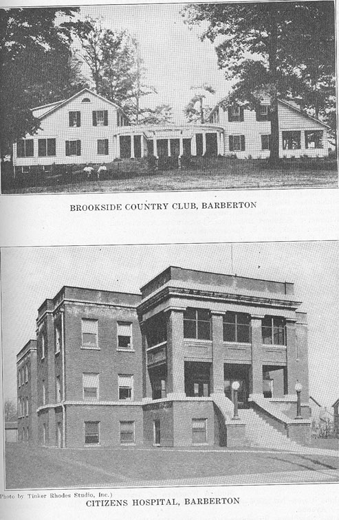
92 - AKRON AND SUMMIT COUNTY
PUBLIC BUILDINGS, ETC.
Central Savings & Trust Building, Tuscarawas Avenue and 3d.
Citizens Hospital, 710 Cornell.
City Building, 133 W. Tuscarawas Avenue.
Davis Block, 316 E. Tuscarawas Avenue.
Damovina Hall, 148 Mulberry.
Fowler Flat, 331 W. Tuscarawas Avenue.
Elks' Home, 102 E. Park Avenue.
Gonder Block, 345 N. 2d.
Great Northern B. & L. Building, 210 N. 2d.
Heckman Block, 745 Cornell.
Johnson Block, 436 N. 2d.
Johnston Building, cor. N. 3d and Park.
Karshner Flats, 411-27 W. 8th.
McKenna Block, 1051/2 E. Tuscarawas Avenue.
Masonic Temple Building, cor. W. Park Avenue and 5th.
Meehan Block, 400 W. Tuscarawas Avenue.
Moore Block, cor. Tuscarawas Avenue and 3d.
Richberger Block, 118 E. Tuscarawas Avenue.
Servian Home, 618 Cornell.
Sprankle Block, 222 1/2 E. Tuscarawas Avenue.
St. Augustine Hall, 427 N. 7th.
Stuhldreher Block, 302 E. Tuscarawas Avenue.
Tracy Block, 104 W. Tuscarawas Avenue.
Whigam & Schubert Block, cor. Tuscarawas Avenue and 4th.
Worthen Block, 218 E. Tuscarawas Avenue.
Y. M. C. A. Building, 315 E. Paige Avenue.
SECRET SOCIETIES
Masonic
National Lodge No. 568, F. & A. M.—Meets 1st and 3d Tuesdays of each month in Masonic Temple.
Jeannette Chapter, Order Eastern Star, No. 212—Meets 2d and 4th Mondays in Masonic Temple.
Portage Chapter No. 202, R. A. M.—Meets 3d Thursday evening in each month in Masonic Temple.
Masonic (Colored) Queen of Sheba Lodge—Meets every Tuesday evening, 302 E. Tuscarawas Avenue.
Odd Fellows
Pharos Lodge No. 863—Meets every Thursday evening in McKenna Block. Summit Encampment No. 319—Meets every Monday evening in McKenna Block.
Summit Lodge, D. of R., No. 603—Meets 1st and 3d Tuesday evening in McKenna
Block.
Knights of Pythias
Barberton Lodge No. 486—Meets every Friday evening in McKenna Block. Barberton Company No. 63, Uniform Rank—Meets 2d and 4th Wednesday evenings in McKenna Block.
Martha Temple No. 393, P. S.—Meets 1st and 3d Wednesday evenings in McKenna Block.
G. A. R.
Dickerson Post—Meets at call of members.
Modern Woodmen of America
Alpha Camp No. 3206—Meets alternate Monday evenings at 100 E. Tuscarawas Avenue.
Royal Neighbors, Wilmington Camp No. 4890—Meets alternate Monday evenings at 100 E. Tuscarawas Avenue.
The Maccabees
Barberton Tent No. 114—Meets every Monday evening in Tracy Block.
AKRON AND SUMMIT COUNTY - 93
Women's Benefit Association of The Maccabees
Lake Anna Review No. 104—Meets 1st and 3d Wednesday evenings at 100 E. Tuscarawas Avenue.
Woodmen of the World
Magic City Camp No. 136—Meets at call of members.
Independent Order of Foresters
Lodge No. 4054—Meets at call of members.
Ladies' Catholic Benefit Association
Meets 1st and 3d Monday evenings in Meehan Block.
B. P. O. Elks
Barberton Lodge No. 982—Meets 2d and 4th Thursday evenings of each month at 100 1/2 E. Tuscarawas Avenue. Elks' Home, 102 E. Park Avenue.
Fraternal Order of Eagles
Barberton Aerie No. 562—Meets 1st and 3d Tuesday evenings of each month at 310 E. Park Avenue.
Loyal Order of Moose
Barberton Lodge No. 759—Meets every Thursday evening at 345 N. 2d.
Ladies of Loyal Order of Moose—Meets every Friday evening at 345 N. 2d.
Ancient Order of Hibernians
Barberton Branch—Meets at call of members in St. Augustine Hall.
American Legion
Helen Thesing Post No. 271—Meets 1st and 3d Monday evenings of each month in Central S. & T. Building.
Ladies' Auxiliary—Meets 2d and 4th Monday evenings of each month in Central S. & T. Building.
Ohio National Guard
Hospital Company No. 134—Meets at 413 E. Hopocan Avenue.
Troop F, One Hundred Seventh Cavalry—Meets every Tuesday evening at Anna Dean Farm,
Robinson Avenue.
Junior Order United American Mechanics
Daniel Webster Council No. 161—Meets every Friday evening at 100 E. Tuscarawas Avenue.
Daughters of America, No. 116—Meets every Tuesday evening at 100 E. Tuscarawas. Avenue.
Knights and Ladies of Security
No. 1738—Meets every Tuesday evening in Tracy Block.
Knights of Columbus
Barberton Council No. 1617—Meets 1st and 3d Thursday evenings in Meehan Block.
Slovenian National Benefit Society
Triglav Lodge No. 48—Meets 1st Sunday of each month at 148 Mulberry.
German Beneficial Union
District No. 361—Meets 2d and 4th Sunday afternoons at 312 E. Tuscarawas Avenue.
Sons of Herman
Barberton Lodge No. 8—Meets 1st Sunday afternoon of each month at 316 E. Tuscarawas Avenue.
Grand United Order of Odd Fellows
Mount Tabor Lodge No. 10501—Meets every Wednesday evening at 316 E. Tuscarawas Avenue.
Mosaic Templars of America
Chatfield Chapter No. 4922—Meets every Thursday evening at 316 E. Tuscarawas Avenue.
Croatian League of Illinois
Ben Work Lodge No. 100—Meets 2d Sunday afternoon of each month at 316 E. Tuscarawas Avenue.
CUYAHOGA FALLS AND SILVER LAKE
The tale of the founding of the City of Cuyahoga Falls and of its struggles is replete with thrills, successes and failures.
Today the city, which lies just over the Akron boundary line, to the
94 - AKRON AND SUMMIT COUNTY
northeast, is experiencing another climax in its history that seems to bid fair a bright future.
Homes are springing up almost overnight and the population has shown a steady gain until now it is claimed to be well past the 15,000 mark.
Building programs running well into the millions are being undertaken by various real estate companies and the city is quickly broadening out, much new territory being developed.
THRIVING INDUSTRIAL CENTER
Cuyahoga Falls, too, is thriving as an industrial center, perhaps not as great as her early founders had dreamed, but her endeavors bring her well up in the line of industrial progress.
The visitor today in Cuyahoga Falls finds a modern city-owned water works plant, a city light plant, beautiful shady streets, good schools, and a few quaint structures of another day ; and, in fact, the visitor is given the impression immediately that Cuyahoga Falls is a thriving center and one of the finest home sections in Summit County.
The early settlements of Cuyahoga Falls, and of what is now Silver Lake, are closely allied.
In 1804, Joshua Stow, who had acquired title to the Township of Stow through the Connecticut Land Company, entered into a contract with one William Wetmore to come from Connecticut to Stow Township, and to act as Agent of Stow. Wetmore was to have the township surveyed into lots one-half mile square, and was to act as Stow's agent in selling lands, for which he was to receive a commission. Wetmore was also to purchase 1,000 acres of land from Stow, to be selected by Wetmore anywhere in the township, for which land he was to pay Stow $1.25 per acre. Wetmore came to Stow Township and settled on what is now the Moore Farm, adjoining Silver Lake on the east.
In 1810, Wetmore made a selection of his 1,000 acres of land. He took what is now the Moore farm, and the other parcels lying north of Silver Lake, including the old Graham farm. The lots, which he selected, fell short two acres of making the 1,000; and a memorandum was put on the back of the contract, and signed by Wetmore and Stow, showing the lots selected, and the shortage of two acres, for which a credit of $2.50 was given Wetmore. This original contract was in the writer's possession, and was turned over to The Summit County Historical Association several years ago.
Wetmore, in connection with Joshua Stow, immediately began improvements on the Cuyahoga River, building a dam just above the river bridge at Gaylord's Grove. A sawmill and grist mill were constructed and operated under the name of Stow & Wetmore.
William Wetmore had three sons : William, Ogden and Henry. After the death of the elder William Wetmore, the firm of Stow & Wetmore was continued, being then composed of Joshua Stow and Henry Wet-
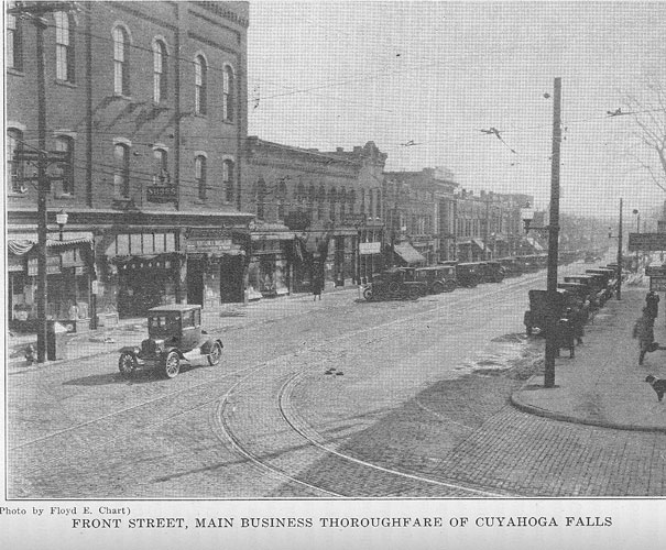
96 - AKRON AND SUMMIT COUNTY
more. In addition to the mills, they established a store, which was operated for several years.
Henry Wetmore continued to reside in Cuyahoga Falls until his death in 1890, and he told the writer several interesting stories about the early life at Silver Lake and Cuyahoga Falls.
When the Wetmore boys were twelve to sixteen years of age, there was a large Indian village at Silver Lake. These Indians were very friendly, and frequently came to the Wetmore home. There was one Indian girl, in particular, who was a frequent visitor at Wetmore's home. These Indians, during the summer season, wore little, if any, clothes. Mrs. William Wetmore undertook to teach the Indian girls to wear clothes ; and one day when this Indian girl was visiting at Wetmore's house, Mrs. Wetmore fixed up some sort of a "Mother Hubbard" dress, made of red calico, and put it on the girl. She wore this dress back to the Indian village, and the Indians were wonderfully taken with it. The next day a delegation of Indian women and girls came over to see Mrs. Wetmore, to find out how they could get some clothes to wear. Mrs. Wetmore told them that if they would get some furs and pelts, she would go down to the store with them and trade these for calico, and show them how to make dresses. They did this and Mrs. Wetmore gave the Indian women their first lesson in dressmaking. The Indians knew nothing about sewing, and it was quite a job to teach them to use the needle. After that time, none of the Indian girls or women were seen without dresses.
While the Wetmores and Joshua Stow were running their mills and store, in about 1829, the first strike, which ever occurred in Cuyahoga Falls, took place. Whisky, in those days, was very cheap and very plentiful. About 25 cents per gallon was the regular price, and everybody drank whisky. Stow and Henry Wetmore, in their mills, employed about forty men ; and they paid off every Saturday afternoon, at which time they opened a barrel of whisky, and gave each man a bonus of a gallon of whisky. Cuyahoga Falls, at that time, was in Portage County and the doctors in this county had a convention at Ravenna in 1829, at which time they discussed the practice of drinking so much whisky, and decided to do what they could to get the people away from this practice.
Dr. Orlando Wilcox, then a young physician, was located at Cuyahoga Falls, and attended this convention. When he came home, he talked about this resolution to Henry Wetmore, who became interested in the subject, and after communicating with his partner, Joshua Stow, they decided to stop the practice of giving whisky to the men. On the next Saturday they paid off their men, but gave them no whisky. The men all went on strike, saying "No whisky, no work." On Monday morning Wetmore told the men that those who wanted to could go back to work, but that there would be no more whisky. About one-half the men returned to work, and the other half quit and their places were supplied by other men. This was probably the first strike that ever occurred
AKRON AND SUMMIT COUNTY - 97
in Cuyahoga Falls. A temperance organization was started about the same time, which was taken up in other parts of the state.
Henry Wetmore, in connection with the Hanfords built a paper mill at Cuyahoga Falls in about 1830 ; and the first paper ever made west of the Allegheny Mountains, was made in this mill. Henry Wetmore was married about this time, and gave his wife, as a wedding present, a bundle of this newly made paper, some of which, yellowed with age, is still in existence.
By reason of its splendid water-power, Cuyahoga Falls developed as a manufacturing town. Nearby, in the Township of Tallmadge, coal mines were opened ; and a narrow gauge railway was built from these coal mines to the Falls for transportation of coal. This track was also used for the transportation of clay for the sewer pipe manufacturers later.
The Pennsylvania & Ohio Canal extended from Pittsburgh through Cuyahoga Falls to Akron, and this canal business was extensive in the early days.
After the development of the paper industry, one of the next important industries was the making of sewer pipe. This was started by the Cooks, with whom H. B. Camp was later associated. The firm name was Camp, Cook & Company, later H. B. Camp, then Camp & Thompson, and finally the sewer pipe plants were taken over by Harry Thompson, who became a party to the sewer pipe combination known as The American Sewer Pipe Company, and this company took over the Falls plants and abandoned them.
During the Civil War an extensive industry grew up in Cuyahoga Falls in the rolling mill, operated by Israel James, who made car axles. This old rolling mill was later converted into what is known now as the Falls Hollow Staybolt Company, owned by C. M. Walsh, which is largely devoted to making staybolts for locomotive boilers.
During the Civil War there also grew up a factory and business of working hemp and tow into products for army use. This plant was located about where The Marathon Tire & Rubber plant now is.
From a small start in making rivets, under the management of E. L. Babcock, a business was built up which was known as The Falls Rivet Company, and is now known as The Falls Clutch & Machinery Company. The rivet part of the business was transferred, a number of years ago, to Kent.
About 1875, the manufacture of wire was started, and this was developed by Seelah Reeve into an extensive business. The company became involved in litigation and the business was abandoned. Several years later the wire business was again revived and operated, for some time, under two or three different names, but the company was not sufficiently financed to carry on the work, and it failed.
The rubber industry got its first start in Cuyahoga Falls by the organization of what is now The Falls Rubber Company, which, at the present time, has a large factory, and is doing a prosperous business.
98 - AKRON AND SUMMIT COUNTY
A little later The Marathon Tire & Rubber Company was organized, and was operated until within the past year, when it was taken over by The Goodyear Tire & Rubber Company.
One of the early industries of Cuyahoga Falls was originally known as Turner, Parks & Company, and later Turner, Vaughn & Taylor Company. It is now known as The Vaughn Machinery Company. This concern is devoted largely to the construction of clay-working and wiredrawing machinery.
At one time a large chain factory was operated at Cuyahoga Falls. For several years a factory was operated by Thomas Bros., making crocks, jugs and earthenware of various kinds. This factory burned down.
In the early '80s a large planing mill and lumber yard was operated by Harvey Snyder, south of Broad Street. This factory was equipped with a large quantity of machinery and they produced and manufactured sash, blinds, doors and other wood products. This factory also afterwards burned down.
The flour mill industry, first started by Stow and Wetmore in th early days, has continued under different owners and management, an is now owned by C. M. Walsh, who also operates a lumber yard an planing mill in connection with it.
Just previous to the World War, a hardwood lumber business, whit had been operated by T. A. Steele and associates, under the name of th Steele Bros. Hardwood Lumber Company, was reorganized into a com pany known as the Steele-Alderfer Company, and a large and wel equipped plant was constructed. During the World War, this compan did an extensive business in getting out black walnut lumber for th government for gun stocks and aeroplane propellers. At the close o the war, the plant was very largely expanded and took on, for a tim the operations of a general lumber yard. After the financial depressio in 1920, the retail lumber business was abandoned, and the business wa reorganized under the name of the Silver Lake Hardwood Company This company is now doing a large business.
A foundry business was started, just prior to the World War, at th north end of Cuyahoga Falls. It was first known as the Nute Foundry The buildings of this company were destroyed by fire, and were rebuilt by another company, but have never been operated.
Prior to and during the Civil War, there was a distillery located o the east side of the river which did an extensive business. This w owned largely by T. M. Cornell and it is said that during the Civil War after the high revenue taxes were put upon whisky, that large quantiti of whisky were spirited away from Cuyahoga Falls to Cleveland, in th night season, to avoid the payment of taxes.
In the early '30s a scheme was evolved, to utilize the water of th Cuyahoga River for an elaborate water power system, which was t supply a city to be located on what is now Cuyahoga Street, in Akron The city was to be known as "Summit City." A dam was built near th
AKRON AND SUMMIT COUNTY - 99
Marathon Tire & Rubber Company dam, and a race was constructed along the southerly side of the Cuyahoga River, to take the water down, below where the High Level bridge is now located, and to carry it around the hill to the proposed site of "Summit City." This race was completed, and water turned into it, but in those days they had not learned the use of cement in construction of walls, and there was so much leakage, that the transportation of the water was not a success. About this time the panic of 1837 struck this country, and this hydraulic race was abandoned. This race and manufacturing scheme were owned and operated by the Portage Canal & Manufacturing Company. They had purchased a large tract of land along the river, and had given mortgages aggregating about $150,000. These mortgages were foreclosed in 1850 and the property sold at sheriff's sale, but the remains of the old race are still visible, and the Northern Ohio Traction & Light Company have a switch track, from their power house down the river, located in this old race way.
In about 1880, L. W. Loomis and Harvey Parks started a pleasure resort, known as the "High Bridge Glens." Their buildings, located on Front Street, just south of Prospect, consisted of a large pavilion, roller coaster, and other buildings, with paths down into the gorge. A foot bridge was constructed across the river, and the old race way was used as a path over which excursionists walked down the river. This resort became very popular, and it was not unusual for sixty car loads of excursionists to come to the Glens in a day. The resort at Silver Lake was operating at the same time, and during the picnic season, a large number of hacks and busses carried passengers back and forth between the two places with the dust from six to eight inches deep. This roller coaster, built at the "High Bridge Glens," was the first roller coaster built, so far as is known ; and it is said that the first day it operated, the receipts taken in were $2,500. This resort was finally taken over by a corporation known as the High Bridge Glens Company, but it had become unpopular, because of the sale of liquor, and was abandoned.
During the panic of 1837, above referred to, money was very scarce and a scheme was promoted at Cuyahoga Falls known as "The Cuyahoga Falls Real Estate Association" which might be denominated "High Finance." This young manufacturing town was greatly in need of money. Its paper mills were making paper, and someone conceived the idea of converting some of this paper into money, by the use of a printing press. In April, 1838, one Robert McCaughy and others formed a voluntary association, known as "The Cuyahoga Falls Real Estate Association," for the purpose of creating a circulating medium, consisting of orders of various denominations. The members gave mortgages on their real estate to William Turner, Birdsey Booth and Grant B. Turner as trustees, for which mortgages this script was issued, and turned over to the mortgagors, who used it as money. The whole scheme was illegal and in the early '40s some of the holders of the money undertook to enforce the mortgages, and they were held illegal. Ten thousand dol-